Finding bibliographic resources
|
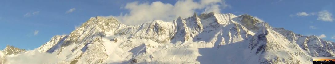
No authors (-)
Satellite image of Arolla - unknown date  Show on map |
|
|
A. Bezinge (-)
Tsijiore Nouve, unknown date 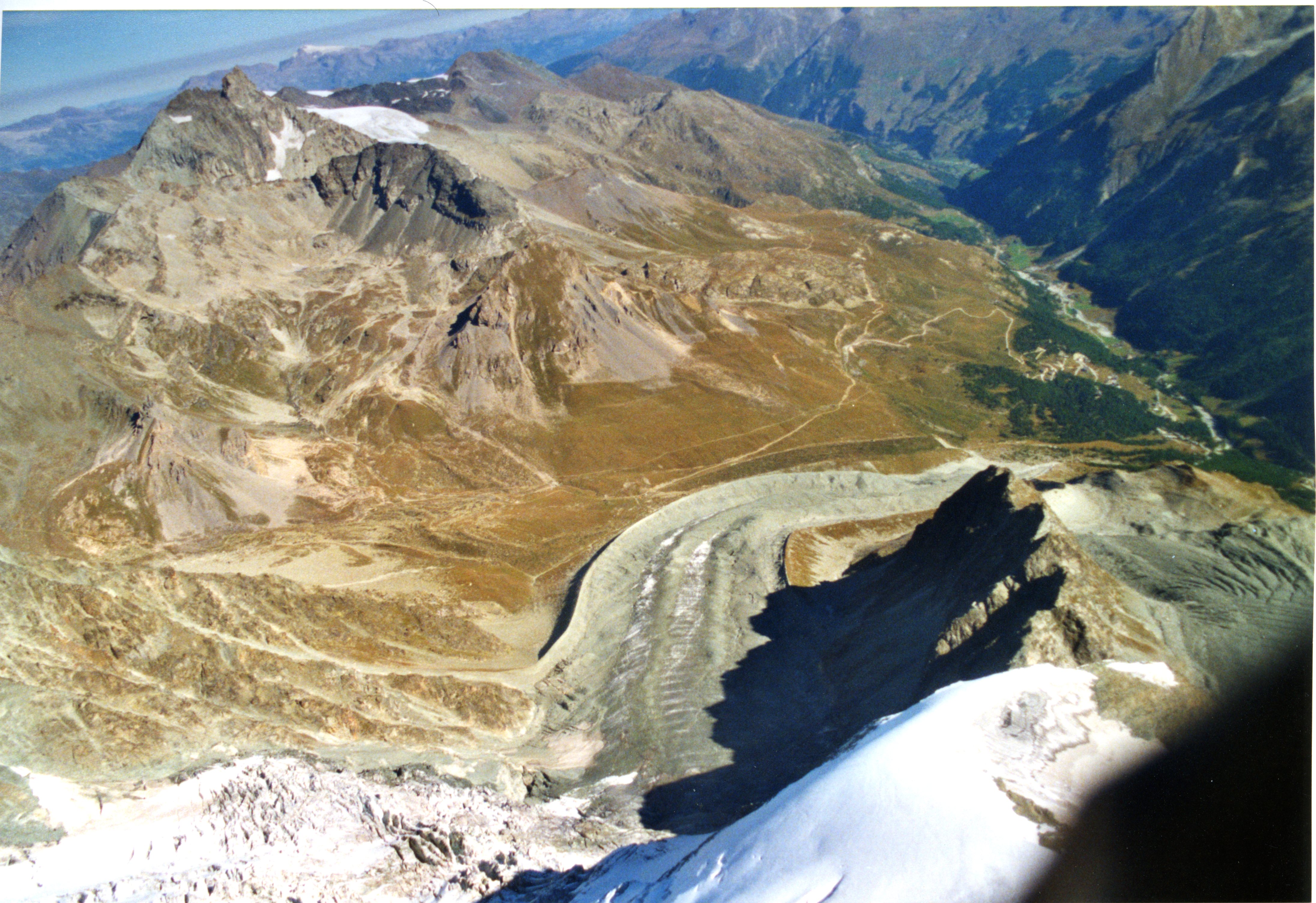 Show on map |
|
|
A. Bezinge (-)
Satellite image of Arolla and Ferpècle - unknown date  Show on map |
|
|
A. Bezinge (-)
Mont Miné Glacier, 1990's? 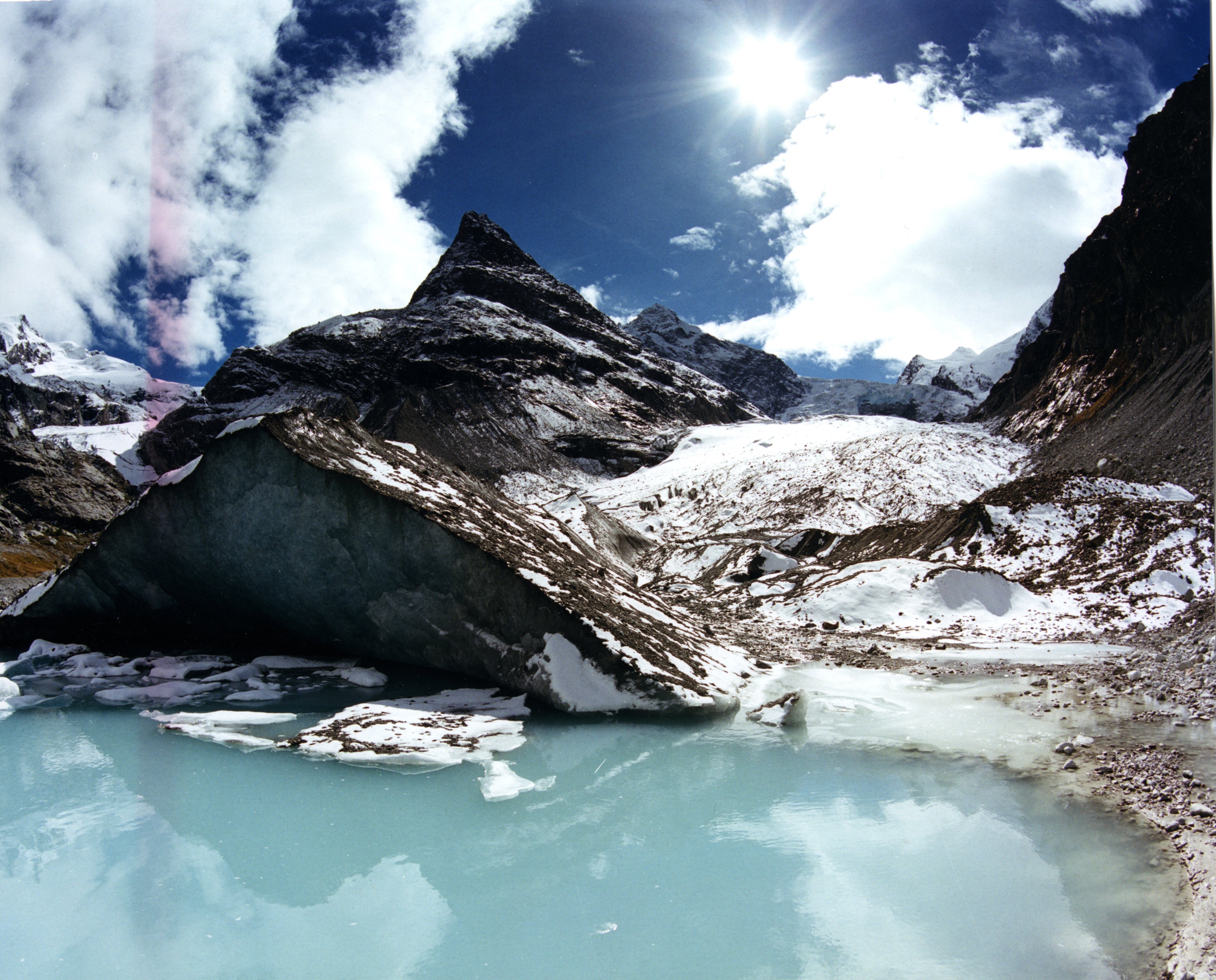 Show on map |
|
|
A. Bezinge (-)
Tsijiore Nouve, unknown date 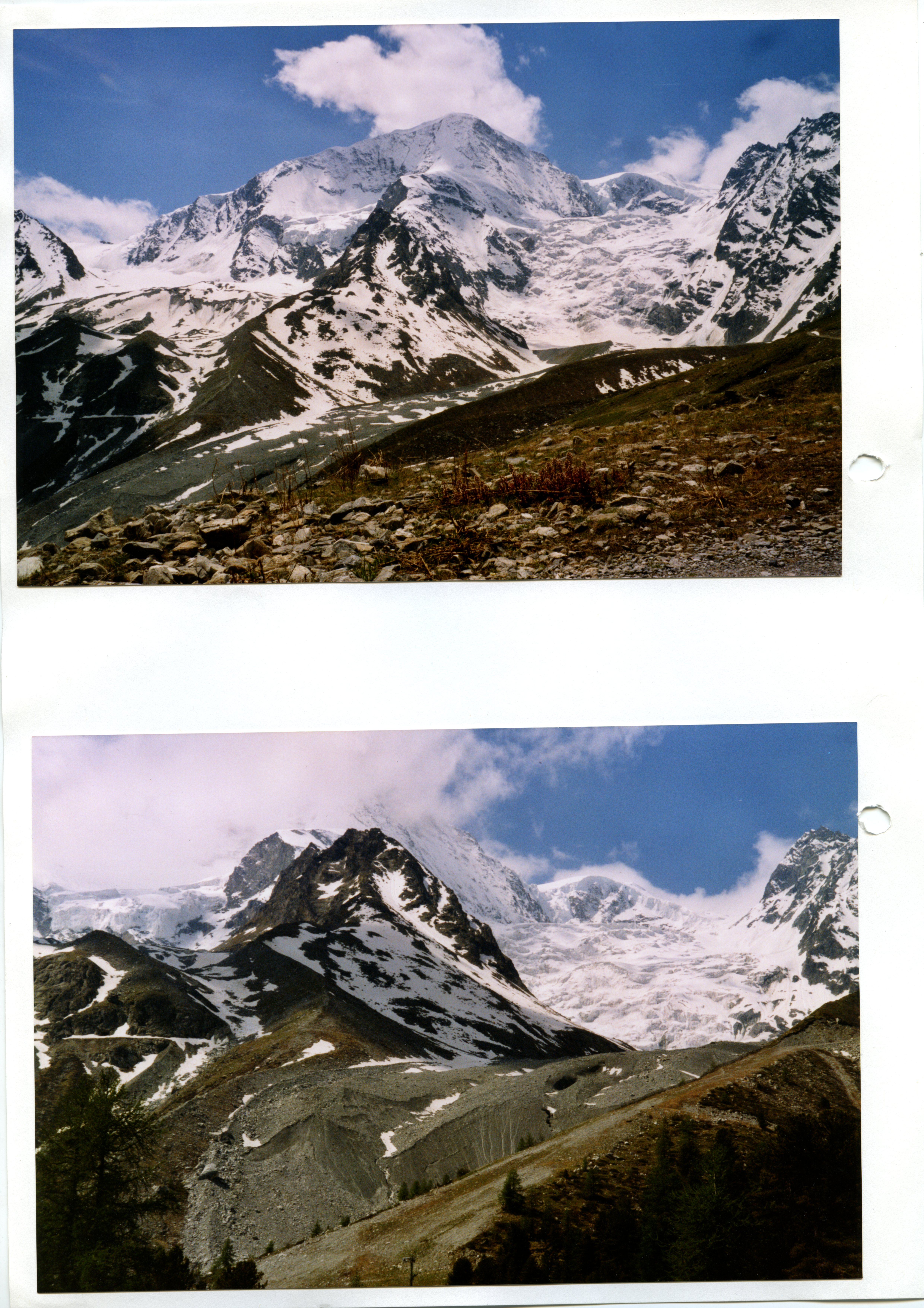 Show on map |
|
|
A. Bezinge (-)
Haut Glacier d'Arolla, unknown date 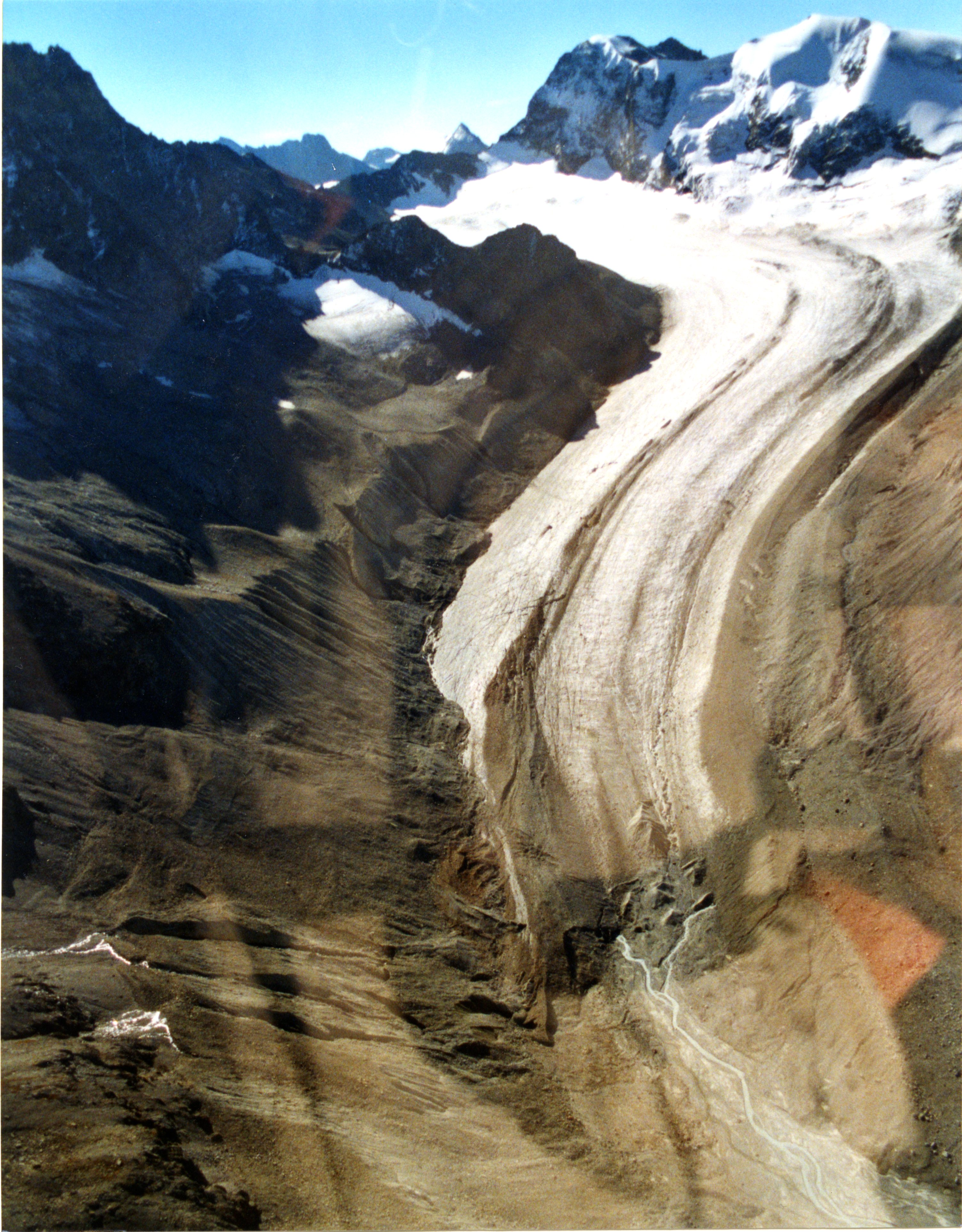 Show on map |
|
|
Association Valaisanne des Producteurs d'Energie Electrique (-)
Vidéos des prise de l'eau pendant une purge Show on map |
|
|
Corbaz et Cie (-)
Arolla with Dent de Vesivi and Col Torrent 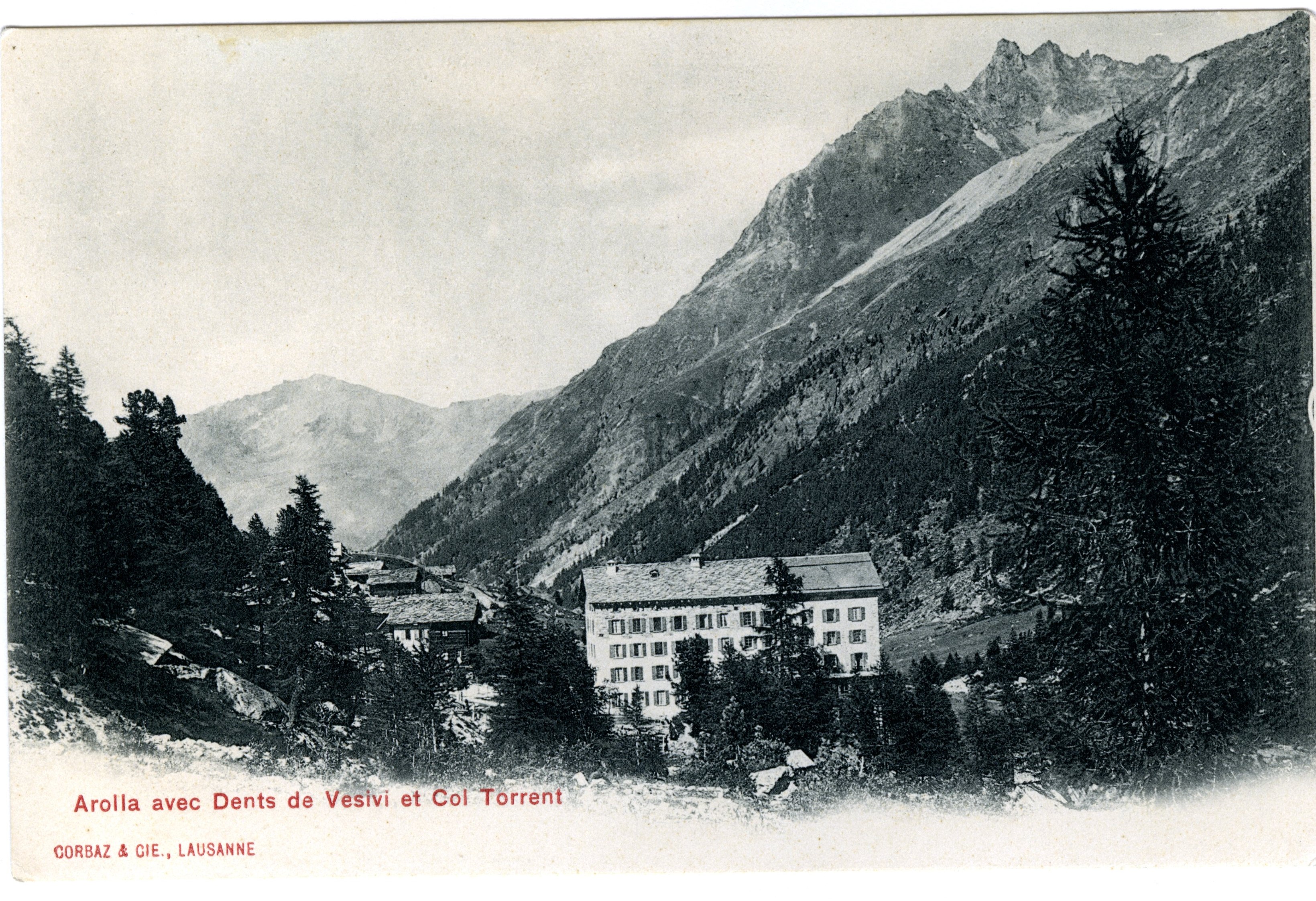 Show on map |
|
|
Corbaz et Cie (-)
Arolla and Tsijiore Nouve glacier 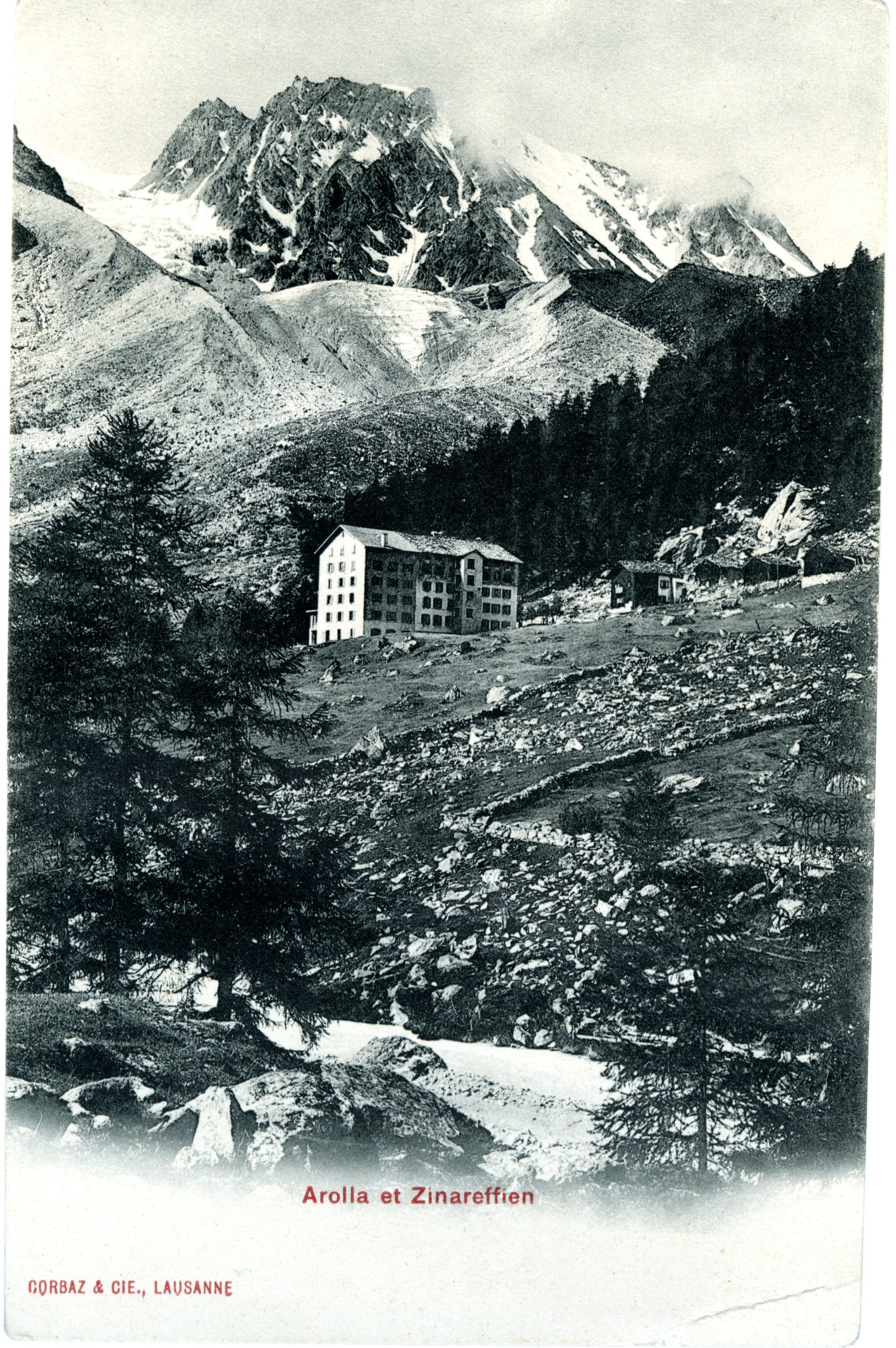 Show on map |
|
|
Haefeli, Lewis and Clark, Grande Dixence SA (-)
Diagram of absolute movement, rotational movement and tunnel in Bas Glacier d'Arolla Show on map |
|
|
Stuart Lane (with open access meteosuisse data) (-)
Arolla, climatologie mensuelle, 1864-2019 Show on map |
|
|
Unknown author (-)
Haut Glacier d'Arolla, unknown date 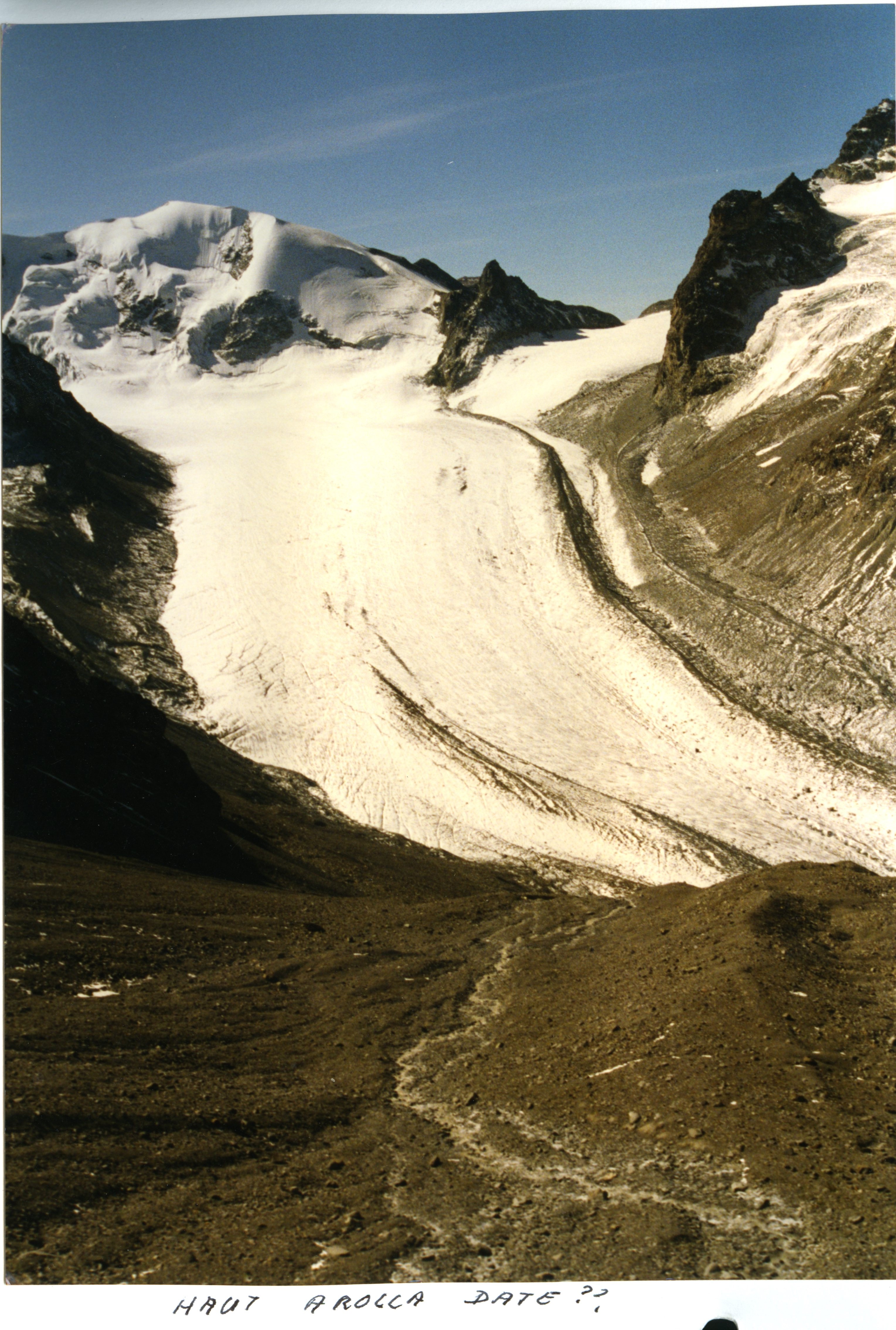 Show on map |
|
|
Unknown author (-)
Mont Collon and Bas Glacier d'Arolla 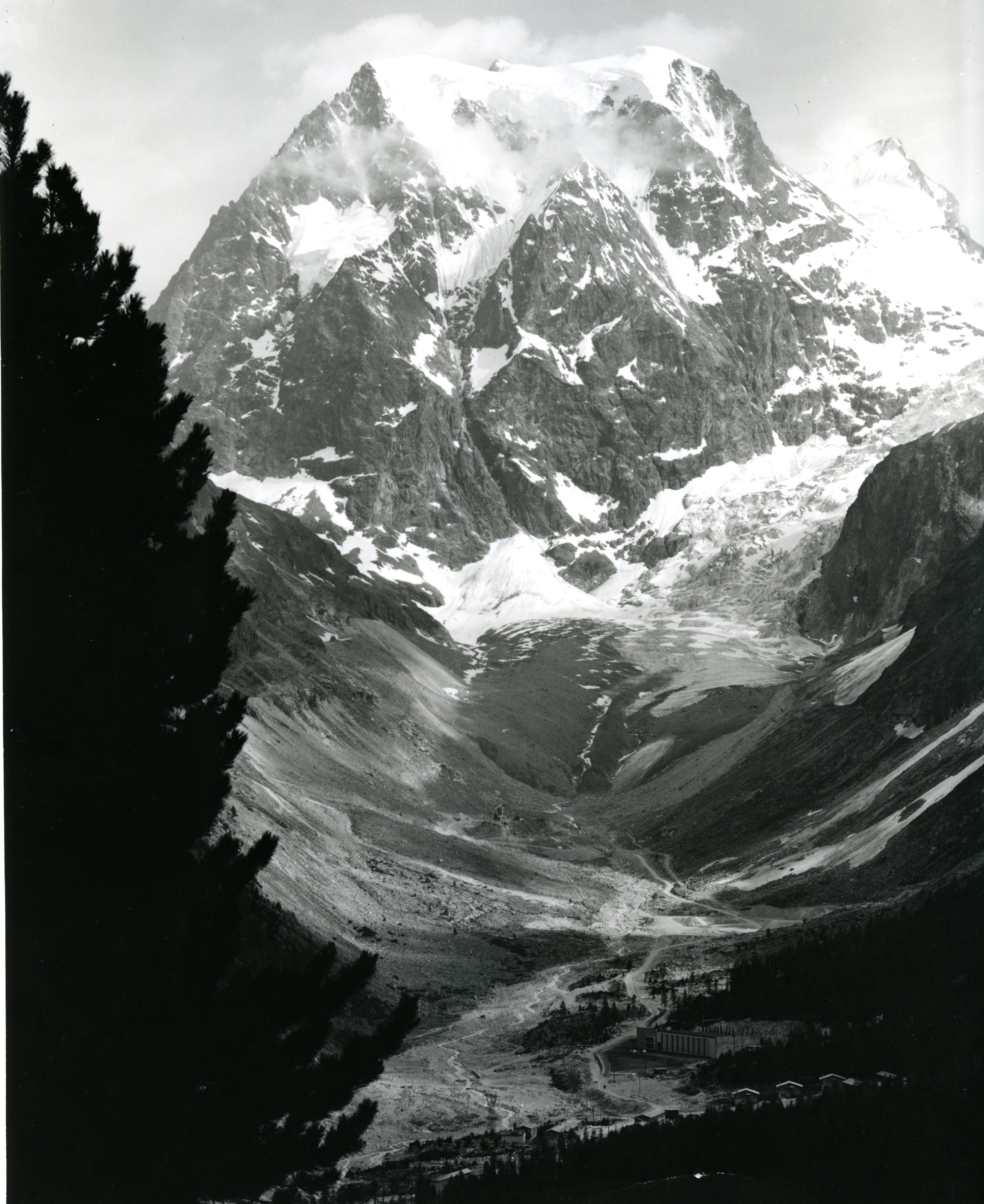 Show on map |
|
|
Unknown author (-)
Bas Glacier d'Arolla and Mont Collon - Sometime during the little ice age  Show on map |
|
|
Unknown author (-)
Haut Glacier d'Arolla, unknown date  Show on map |
|
|
Unknown author (-)
Glacier du Mont Miné (unknown date and author) 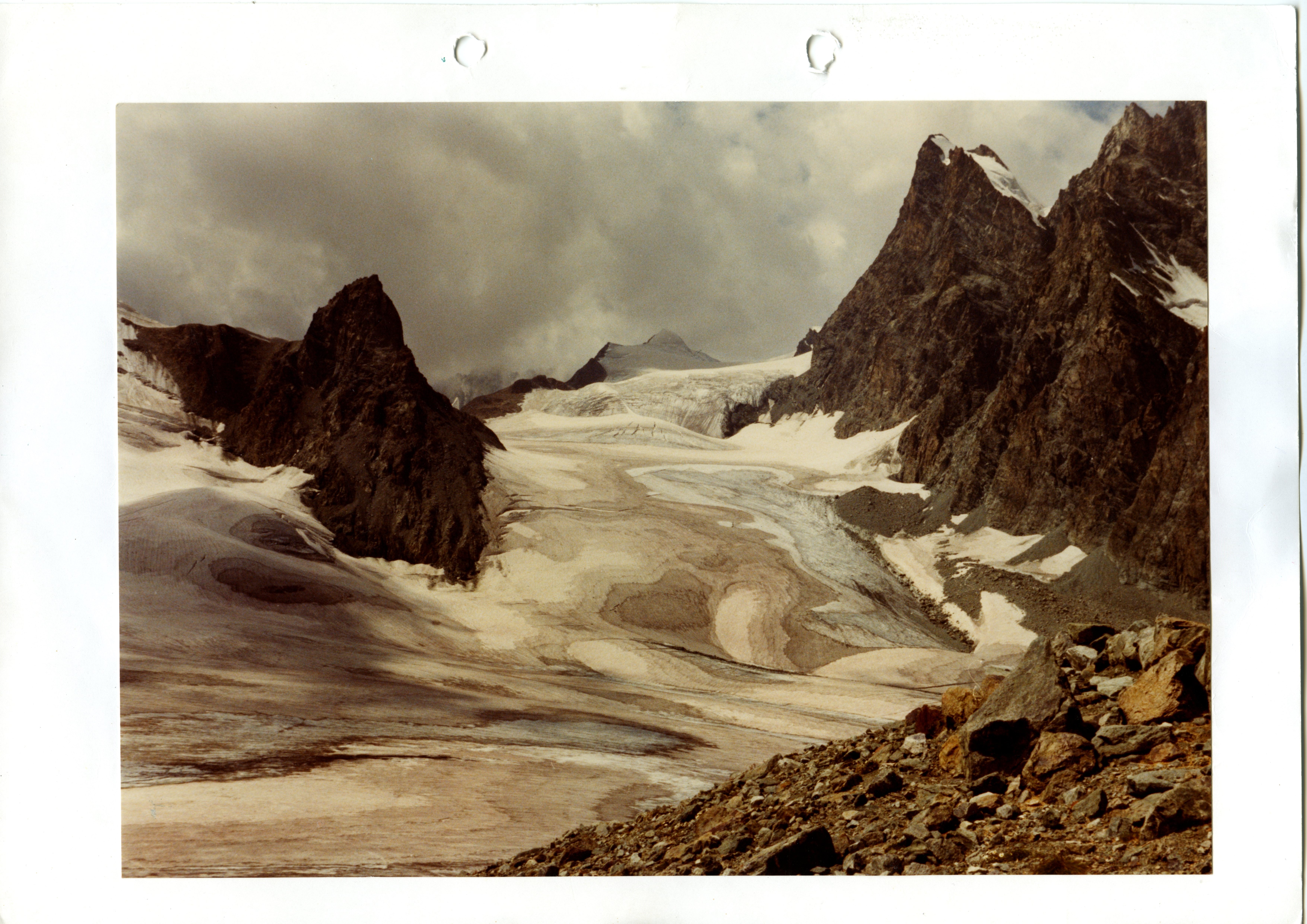 Show on map |
|
|
VAW ETH Zürich (-)
Histoire du recul du Bas Glacier d'Arolla Show on map |
|
|
Antoniazza, G., Bakker, M. and Lane, S.N. (2019)
Revisiting the morphological method in two-dimensions to quantify bed material transport in braided rivers Show on map |
|
|
Bakker, M and Lane SN (2019)
Borgne Volume changes 1959 to 2014 Show on map |
|
|
Bakker, M., Antoniazza, G., Odermatt, E. and Lane, S.N. (2019)
Morphological response of an Alpine braided reach to sediment-laden flow events Show on map |
|
|
Chrystelle Gabbud and Stuart Lane (2019)
Gabbud et al. (2019), data Show on map |
|
|
Chrystelle Gabbud and Stuart Lane (2019)
Raw macroinvertebrate data, 2016 and 2017, for the Borgne d'Arolla Show on map |
|
|
Gabbud, C., Bakker, M., Clemençon, M. and Lane, S.N. (2019)
Causes of the severe loss of macrozoobenthos in Alpine streams subject to repeat hydropower flushing events Show on map |
|
|
Gabbud, C., Robinson, C. and Lane, S.N. (2019)
Sub-basin and temporal variability of macroinvertebrate assemblages in Alpine streams: when and where to sample? Show on map |
|
|
Gabbud, C., Robinson, C., Lane, S.N. (2019)
Summer is in winter: disturbance-driven shifts in macroinvertebrate communities following hydroelectric power exploitation Show on map |
|
|
Lane, S.N. and Nienow, P.W. (2019)
Hydrology: Decadal-scale climate forcing of Alpine glacial hydrological systems: discharge data Show on map |
|
|
Lane, S.N. and Nienow, P.W. (2019)
Decadal-scale forcing of Alpine glacial hydrological systems Show on map |
|
|
Lane, S.N., Bakker, M., Costa, A., Girardclos, S. Loizeau, J-L., Molnar, P., Silva, T., Stutenbecker, L., and Schlunegger, F. (2019)
Making stratigraphy in the Anthropocene: climate change impacts and economic conditions controlling the supply of sediment to Lake Geneva Show on map |
|
|
Maarten Bakker and Stuart Lane (2019)
Daily DEMs and hydrodynamic variables (depth, velocity) for a braided stream Show on map |
|
|
Stutenbecker, L., Costa, A., Bakker, M., Anghileri, D., Molnar, P., Lane, S.N. and Schlunegger, F. (2019)
Disentangling human impact from natural controls of sediment dynamics in an Alpine catchment Show on map |
|
|
Bakker, M. Costa, A., Silva, T. A. Stutenbecker, L., Girarclos, S., Loizeau, J.-L., Molnar, P., Schlunegger, F. and Lane, S. N., 2018 (2018)
Combined flow abstraction and climate change impacts on an aggrading Alpine river Show on map |
|
|
Bakker M. et al. (2018)
Reconstructed sediment yield from the Tsijiore Nouve and Lower Bertol intakes Show on map |
|
|
Gabbud, C. Bakker, M., Lane, S.N. (2018)
L’environnement Alpin face au changement climatique : glaciers, rivières et paysages, quels enjeux Show on map |
|
|
Maarten Bakker and Stuart Lane (2018)
Erosion and Deposition in the Borgne d'Arolla from 1959 to 2014 based on archival photogrammetry Show on map |
|
|
Bakker M and Lane SN (2017)
Archival photogrammetric analysis of river-floodplain systems using Structure from Motion (SfM) methods Show on map |
|
|
Lane, S.N., Bakker, M., Gabbud, C., Micheletti, N. and Saugy, J-N (2017)
Sediment export, transient landscape response and catchment-scale connectivity following rapid climate warming and Alpine glacier recession Show on map |
|
|
Micheletti, N., Tonini, M. and Lane, S.N., 2017 (2017)
Geomorphological activity at a rock glacier front detected with a 3D density-based clustering algorithm Show on map |
|
|
Gabbud, C. and Lane, S.N., 2016 (2016)
Impacts des prises d’eau alpines sur les écosystèmes – le rôle-clé de la gestion sédimentaire Show on map |
|
|
Gabbud, C. and Lane, S.N., 2016 (2016)
Ecosystem impacts of Alpine water intakes for hydropower: the challenge of sediment management Show on map |
|
|
Gabbud, C. and Micheletti, N. and Lane, S. N. (2016)
Response of a temperate alpine valley glacier to climate change at the decadal scale Show on map |
|
|
Micheletti, N. and Lane, S. N. (2016)
Water yield and sediment export in small, partially glaciated Alpine watersheds in a warming climate Show on map |
|
|
Gabbud, C.and Lane, S.N. (2015)
Ecosystem impacts of Alpine water intakes for hydropower: the challenge of sediment management Show on map |
|
|
Gérard Stampfli (2015)
Large collapse on the Glacier de Ferpècle - Sept. 2015 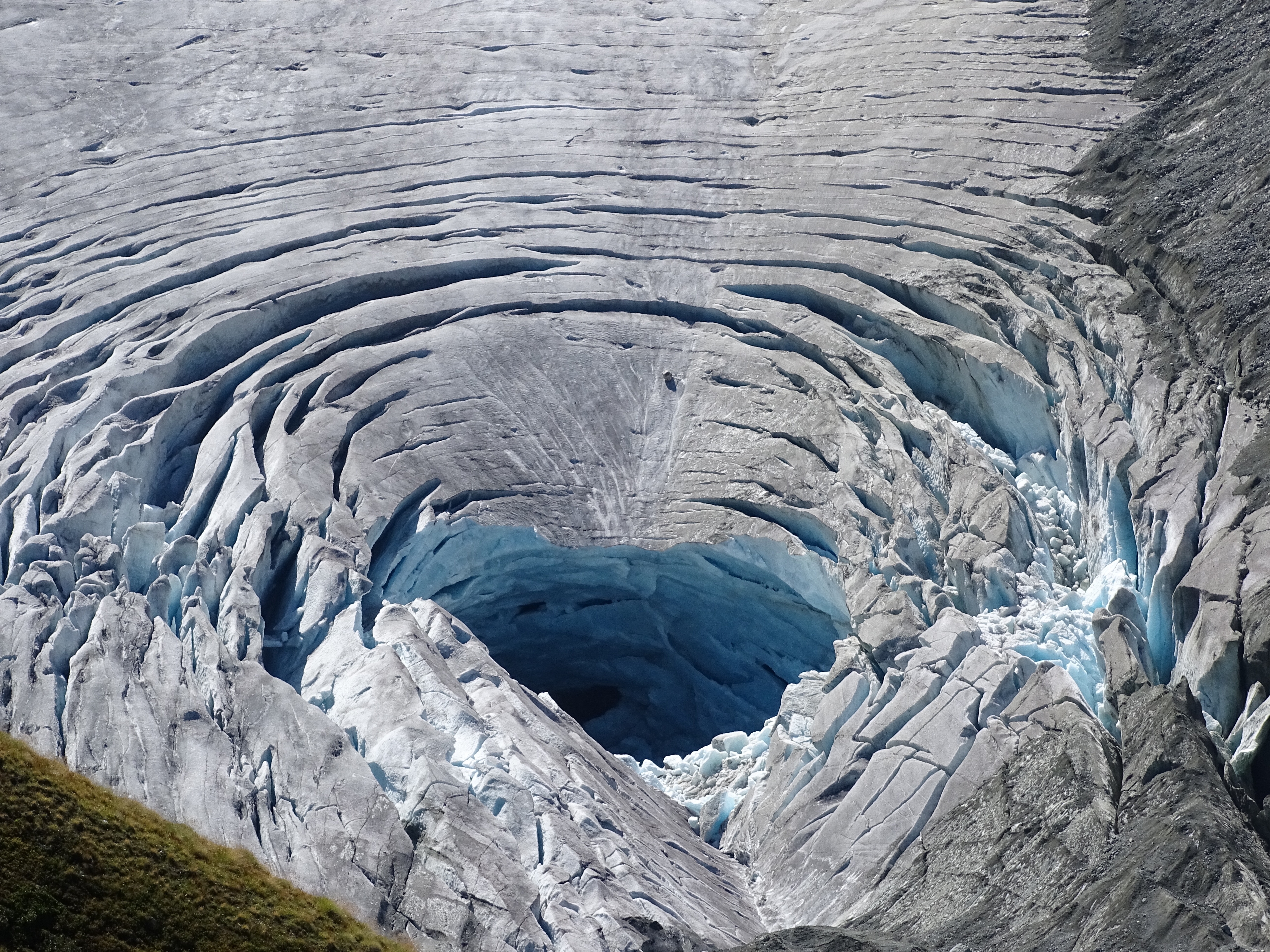 Show on map |
|
|
Gérard Stampfli (2015)
Large collapse on the Glacier de Ferpècle - Sept. 2015 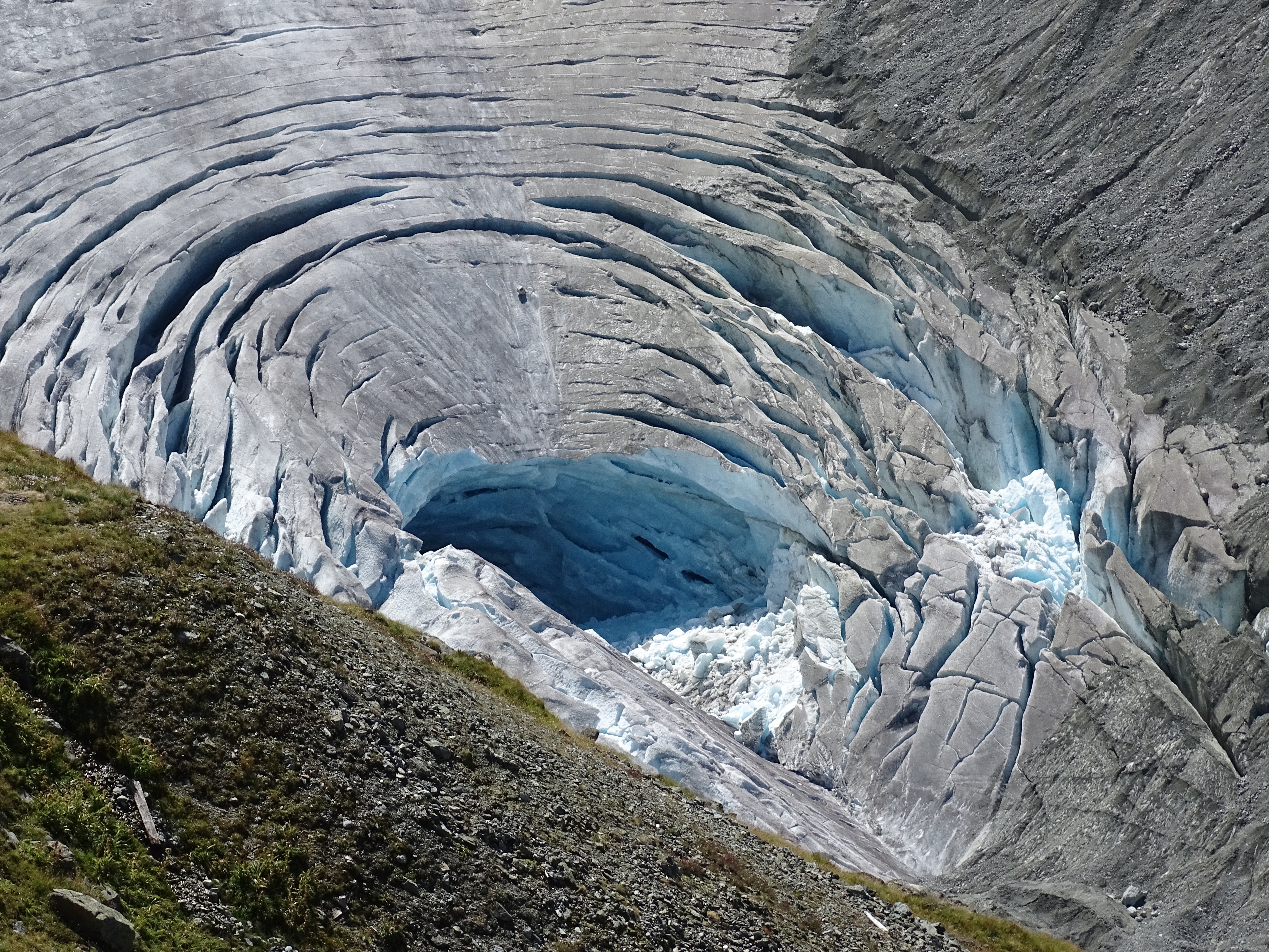 Show on map |
|
|
Gérard Stampfli (2015)
Large collapse on the Glacier de Ferpècle - Sept. 2015 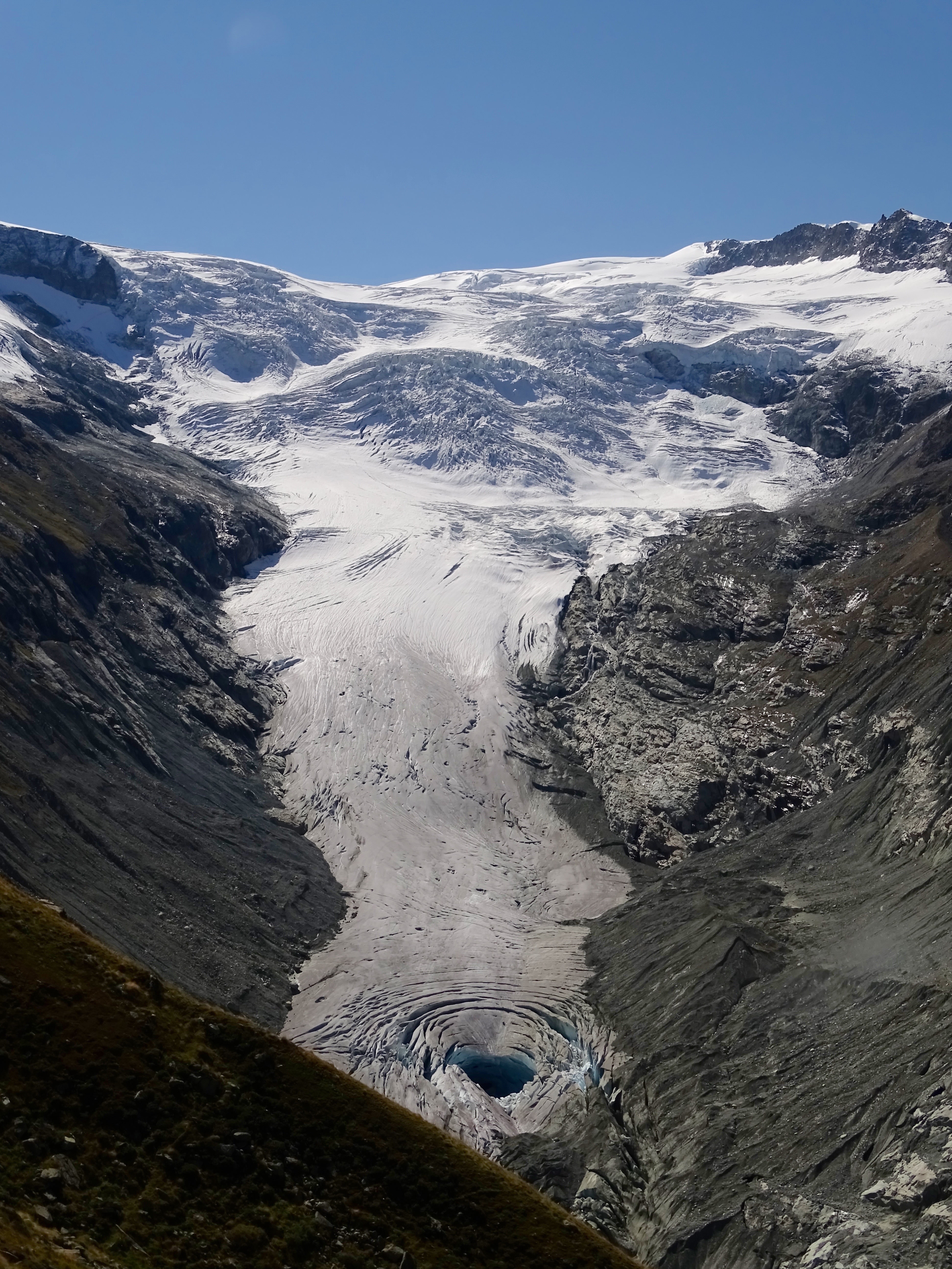 Show on map |
|
|
Gérard Stampfli et Sébastien Ruttimann (2015)
GéoGuide Val d'Hérens 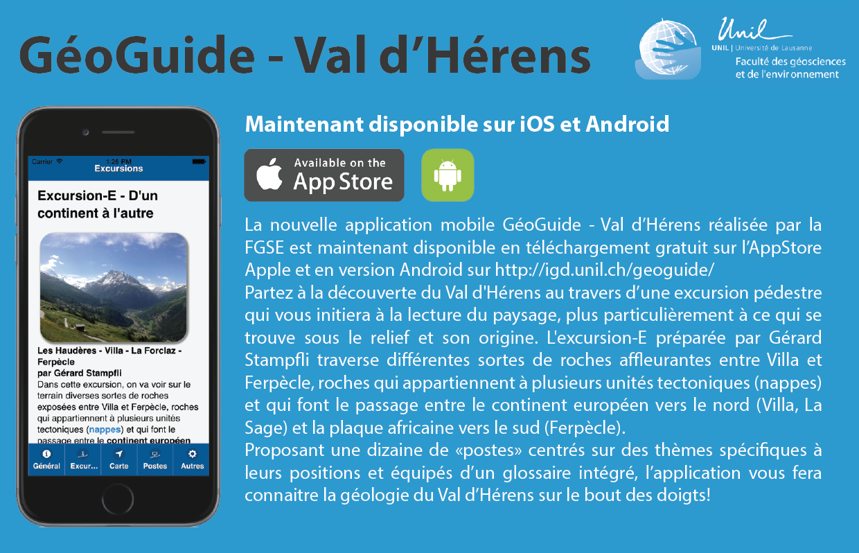 Show on map |
|
|
Lidar measurement of surface melt for a temperate Alpine glacier at the seasonal and hourly scales (2015)
Gabbud, C. and Micheletti, N. and Lane, S.N. Show on map |
|
|
Micheletti, N. (2015)
Snow depth in Arolla using the SOCONT model: used in Micheletti et al 2015 (JGR-ES) and Lane and Nienow 2019 (WRR) Show on map |
|
|
Micheletti, N. and Chandler, J.H. and Lane S.N. (2015)
Investigating the geomorphological potential of freely available and accessible structure-from-motion photogrammetry using a smartphone Show on map |
|
|
Micheletti, N. and Chandler, J.H. and Lane, S.N. (2015)
Structure from Motion (SfM) Photogrammetry Show on map |
|
|
Micheletti, N. and Lambiel, C. and Lane, S.N. (2015)
Investigating decadal scale geomorphic dynamics in an Alpine mountain setting Show on map |
|
|
Micheletti, N. and Lane S.N. and Chandler, J.H. (2015)
Application of archival aerial photogrammetry to quantify climate forcing of Alpine landscapes Show on map |
|
|
SCNAT (2015)
Evolène: 2000 mètres cubes de roches s'abattent dans la vallée Show on map |
|
|
Gabbud, C. (2014)
Historical Digital Elevation of Models of the Haut Glacier d'Arolla Show on map |
|
|
Lane, S.N., Bakker, M., Balin D., Lovis, B. and Regamey, B. (2014)
Climate and human forcing of Alpine river flow Show on map |
|
|
Sébastien Ruttimann (2014)
Purge at Bertol inférieur water intake (dessableur) - August 2014  Show on map |
|
|
Sébastien Ruttimann (2014)
Borgne d'Arolla - Purge passing by in the river (video) - July 2014 Show on map |
|
|
Sébastien Ruttimann (2014)
Tsijiore Nouve flyover with a drone (video) - October 2014 Show on map |
|
|
Sébastien Ruttimann (2014)
Footage of Bertol inférieur dessableur purging, August 2014 Show on map |
|
|
Sébastien Ruttimann (2014)
Footage of the Torrent de Tsijiore Nouve during a purge - August 2014 Show on map |
|
|
Sébastien Ruttimann (2014)
A DEM of Tsijiore Nouve's proglacial margin. 0.5cm resolution Show on map |
|
|
Sébastien Ruttimann (2014)
Haut Glacier d'Arolla, aerial picture from a drone - August 2014  Show on map |
|
|
Sébastien Ruttimann (2014)
Ferpècle: sandur (aerial footage) - July 2014 Show on map |
|
|
Sébastien Ruttimann (2014)
Haut Glacier d'Arolla and sandur - flyover with a drone (video) - August 2014 Show on map |
|
|
Sébastien Ruttimann (2014)
Borgne d'Arolla - Aerial footage between Pramousse and Satarma - July 2014 Show on map |
|
|
Sébastien Ruttimann (2014)
Haut Glacier d'Arolla melt waters, July 2014  Show on map |
|
|
Sébastien Ruttimann (2014)
Differential melting under a boulder on the Haut Glacier d'Arolla, July 2014  Show on map |
|
|
Sébastien Ruttimann (2014)
Mont Collon and moraines from the Haut Glacier d'Arolla, July 2014  Show on map |
|
|
Sébastien Ruttimann (2014)
Front of the Haut Glacier d'Arolla, July 2014  Show on map |
|
|
Sébastien Ruttimann (2014)
Ferpècle dam lake  Show on map |
|
|
Sébastien Ruttimann (2014)
Ferpècle dam  Show on map |
|
|
Sébastien Ruttimann (2014)
Ferpècle Sandur and Mont Miné Glacier, June 2014  Show on map |
|
|
Sébastien Ruttimann (2014)
Interior of Bertol inférieur water intake (dessableur) - August 2014 Show on map |
|
|
Sébastien Ruttimann (2014)
Interior of Bertol inférieur water intake (dessableur) - August 2014 Show on map |
|
|
Sébastien Ruttimann (2014)
Inside of an ancient subglacial channel - Haut Glacier d'Arolla - August 2014  Show on map |
|
|
Sébastien Ruttimann (2014)
Aiguille de la Tsa and moraines complex and La Roussette Rock Glacier- october 2014  Show on map |
|
|
Sébastien Ruttimann (2014)
Tsijiore Nouve glacier in October 2014  Show on map |
|
|
Sébastien Ruttimann (2014)
Tsijiore Nouve glacier in October 2014  Show on map |
|
|
Sébastien Ruttimann (2014)
La Borgne d'Arolla near Satarma - June 2014  Show on map |
|
|
Sébastien Ruttimann (2014)
Vegetation in La Borgne d'Arolla near Satarma - June 2014  Show on map |
|
|
Sébastien Ruttimann (2014)
Protective embankments at Pramousse - June 2014  Show on map |
|
|
Sébastien Ruttimann (2014)
Borgne d'Arolla near La Monta - June 2014  Show on map |
|
|
Sébastien Ruttimann (2014)
Borgne d'Arolla - Les Haudères - Dye-tracing 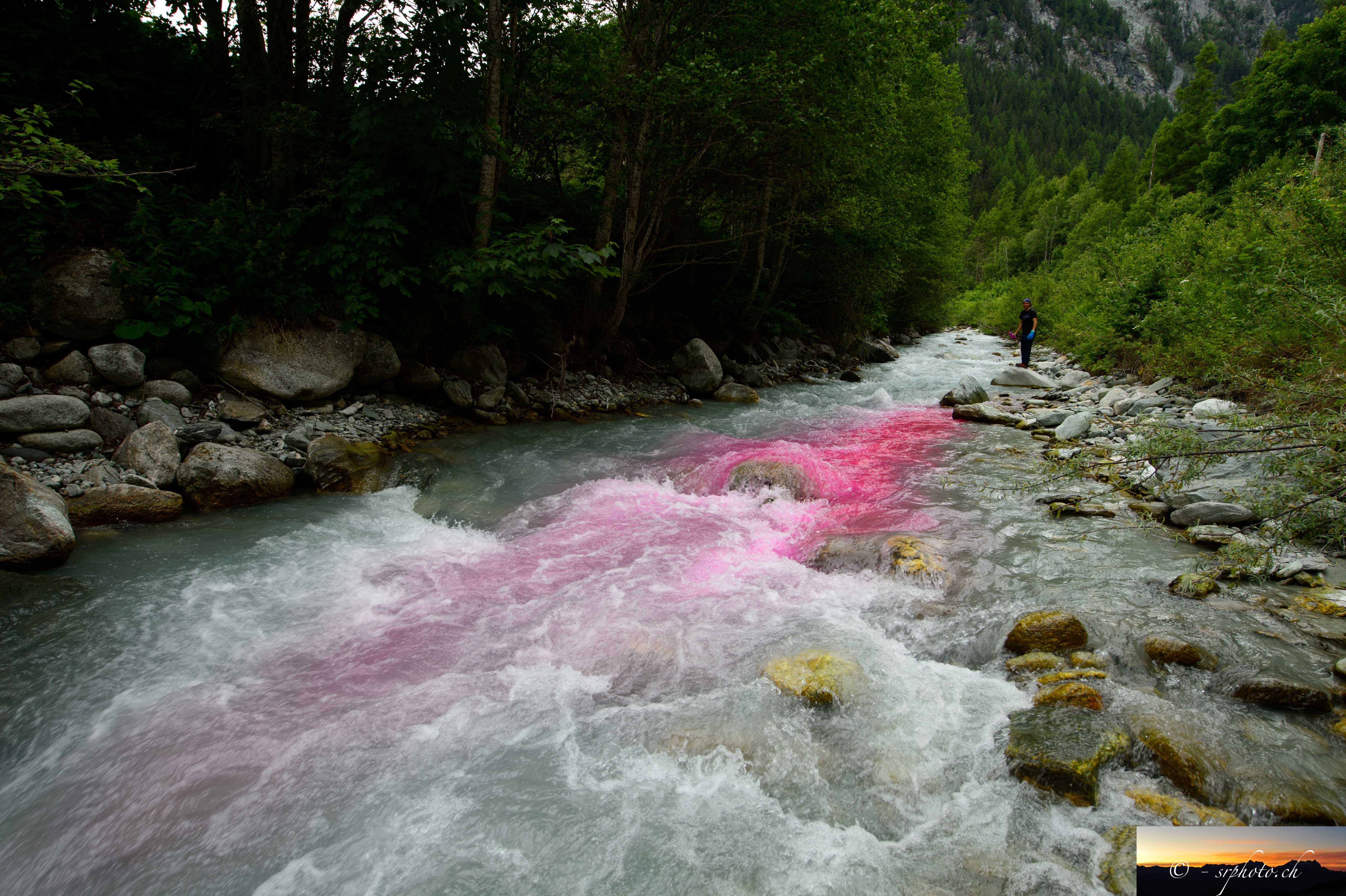 Show on map |
|
|
Sébastien Ruttimann (2014)
Les Fontanesses water intake  Show on map |
|
|
Sébastien Ruttimann (2014)
Helicopter view of Bertol supérieur water intake - August 2014  Show on map |
|
|
Sébastien Ruttimann (2014)
Torrent de Tsijiore Nouve during a purge - August 2014  Show on map |
|
|
Sébastien Ruttimann (2014)
Borgne d'Arolla - helicopter view - August 2014  Show on map |
|
|
Sébastien Ruttimann (2014)
Ancient subglacial channel exit - Haut Glacier d'Arolla -- August 2014  Show on map |
|
|
Sébastien Ruttimann (2014)
Tsijiore Nouve water intake - October 2014 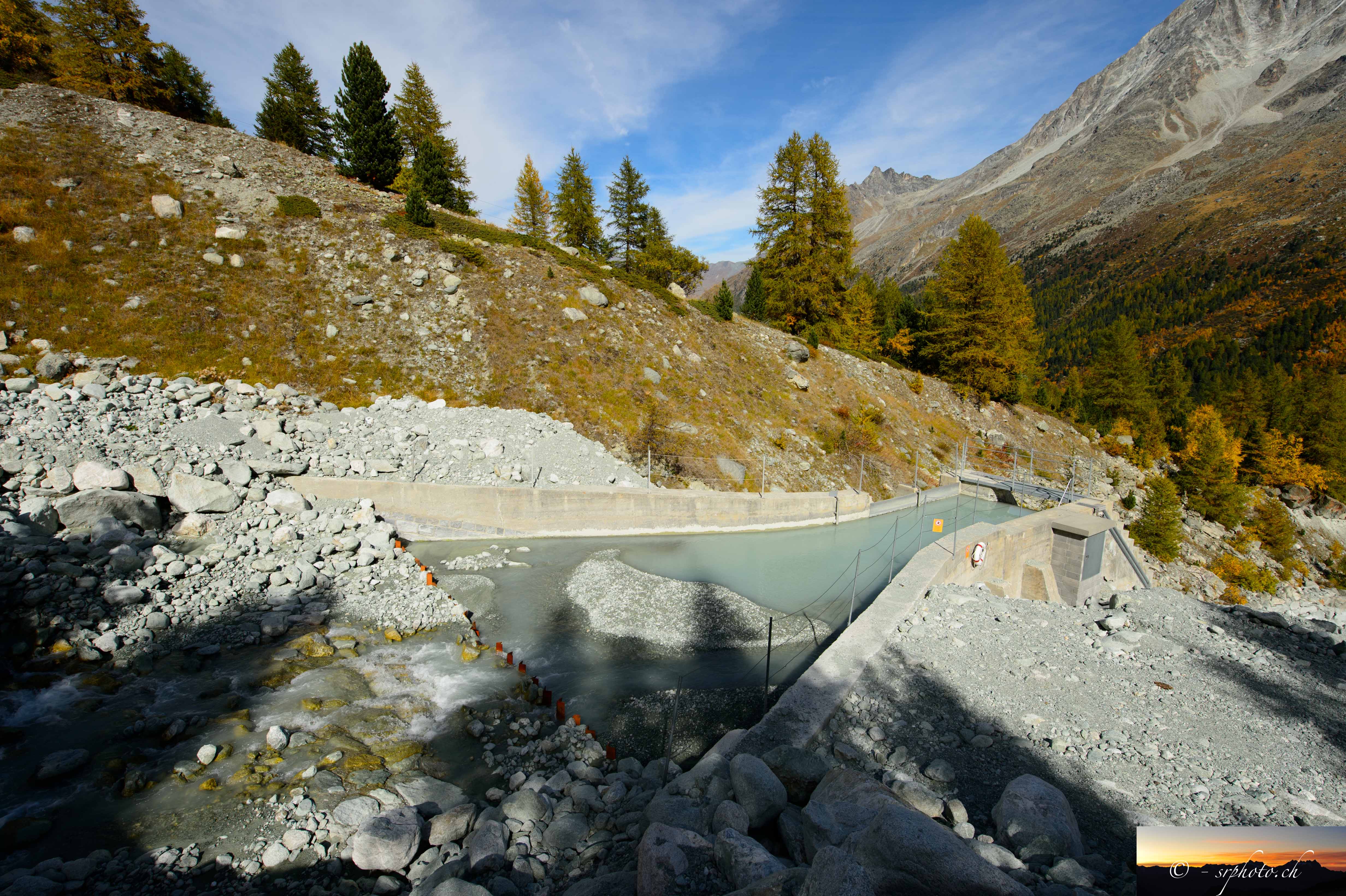 Show on map |
|
|
Sébastien Ruttimann (2014)
Information panel on Grande dixence installations at Ferpècle dam. Panel 3 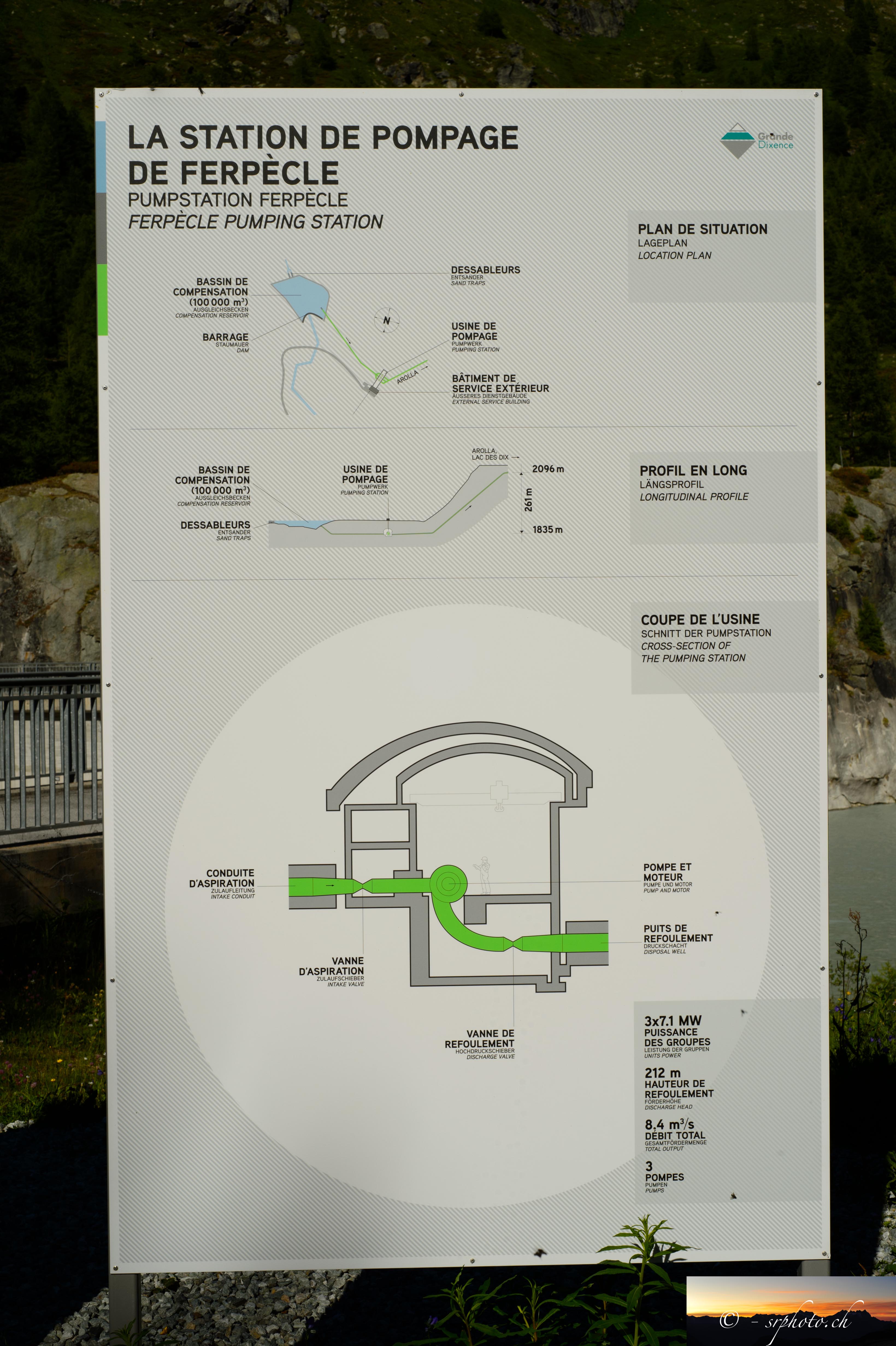 Show on map |
|
|
Sébastien Ruttimann (2014)
Front of the Tsijiore-Nouve in october 2014 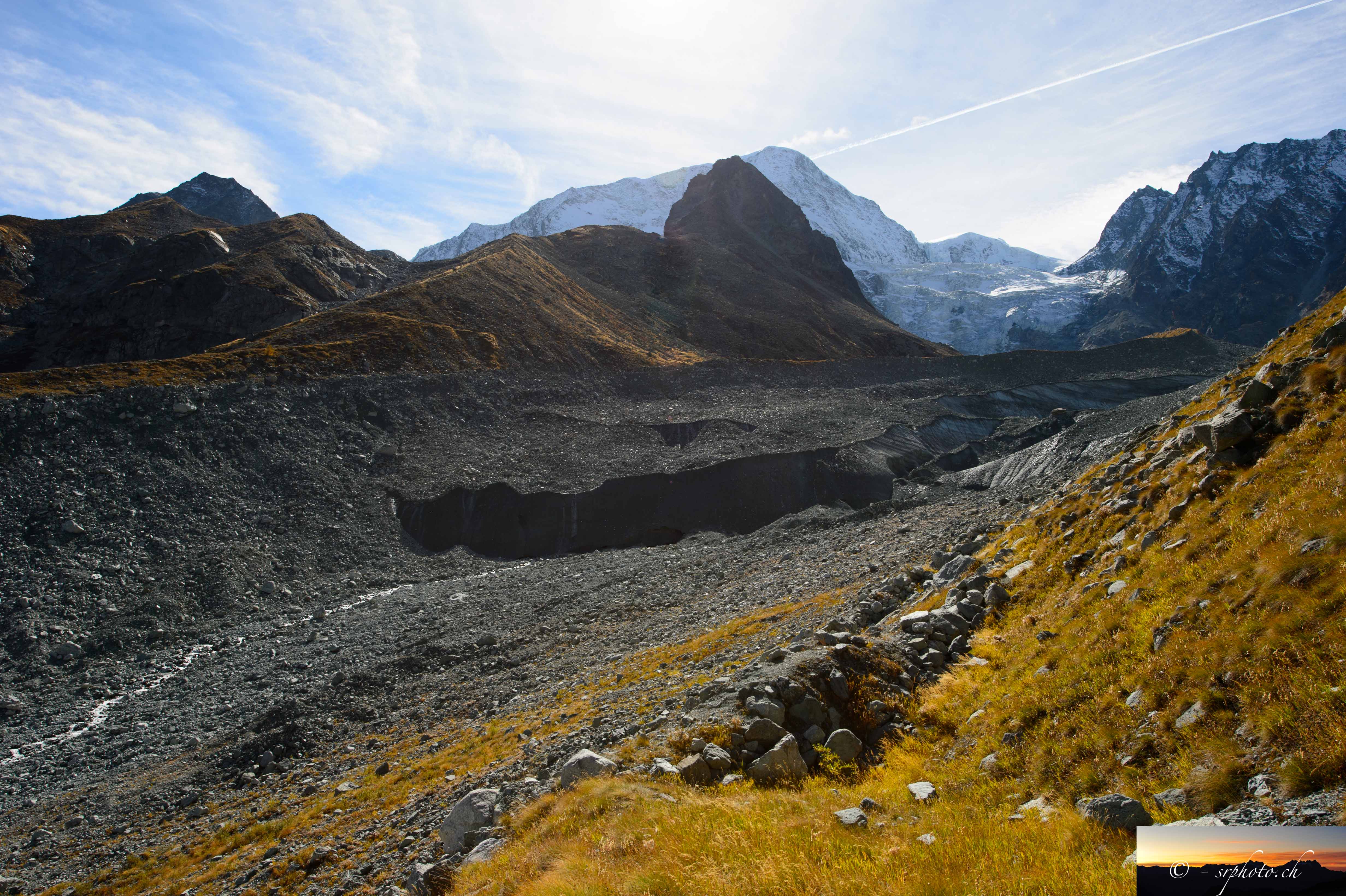 Show on map |
|
|
Sébastien Ruttimann (2014)
Information panel on Grande dixence installations at Ferpècle dam. Panel 2 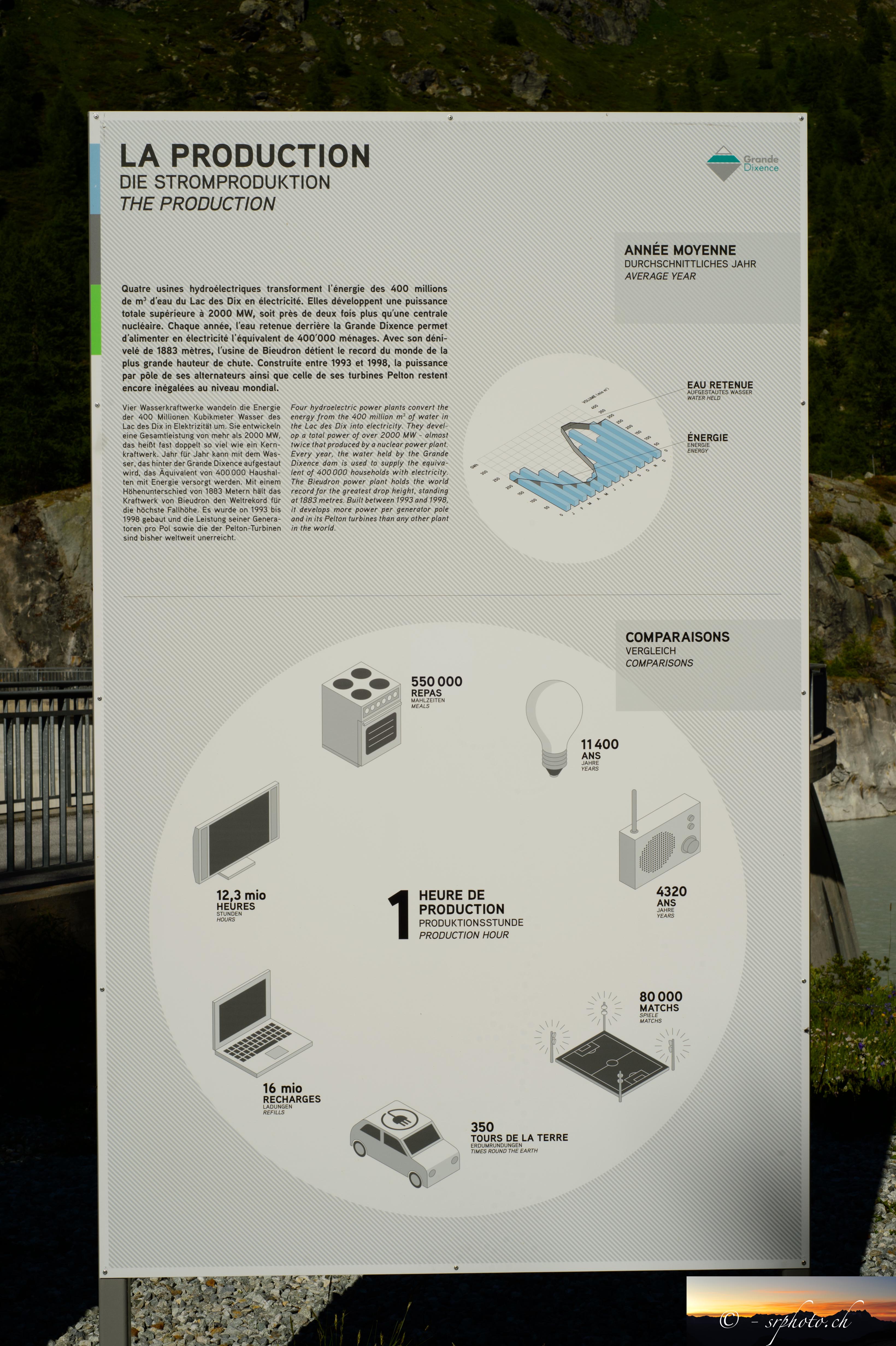 Show on map |
|
|
Sébastien Ruttimann (2014)
Information panel on Grande dixence installations at Ferpècle dam. Panel 1 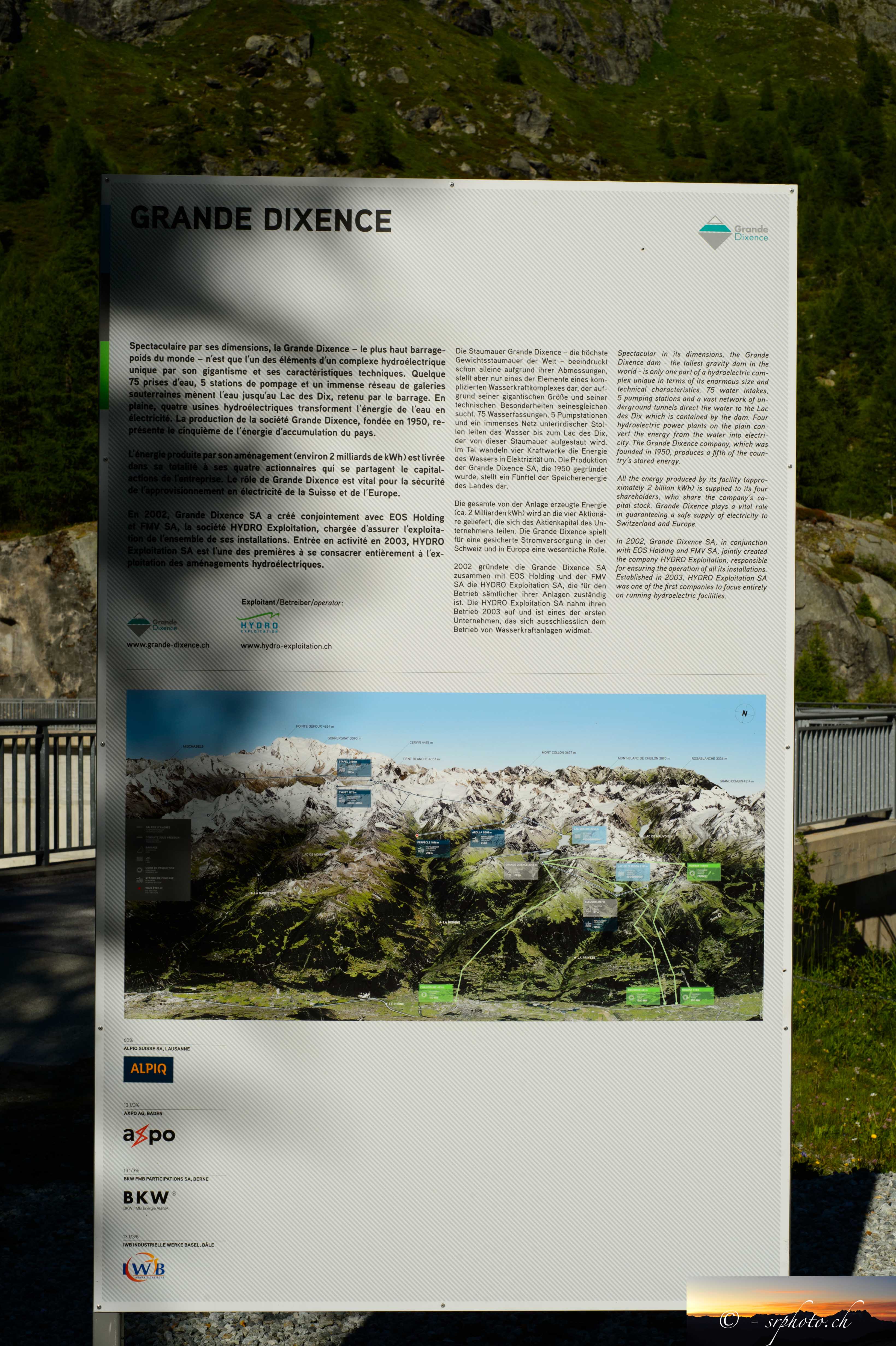 Show on map |
|
|
Sébastien Ruttimann (2014)
Helicopter view of the Bas Glacier d'Arolla - August 2014  Show on map |
|
|
Sébastien Ruttimann (2014)
Proglacial zone of the Tsijiore Nouve with 1980's moraine - October 2014  Show on map |
|
|
Sébastien Ruttimann (2014)
Ferpècle - Sandur - July 2014  Show on map |
|
|
Sébastien Ruttimann (2014)
Confluence of La Borgne d'Arolla and La Borgne de Ferpècle during a purge - July 2014  Show on map |
|
|
Sébastien Ruttimann (2014)
Protective embankments at Pramousse - June 2014  Show on map |
|
|
Sébastien Ruttimann (2014)
Torrent de Bertol below the water intake - August 2014  Show on map |
|
|
Sébastien Ruttimann (2014)
La Borgne d'Arolla near Pramousse - June 2014  Show on map |
|
|
Sébastien Ruttimann (2014)
Bas Glacier d'Arolla and Mont Collon Glacier, August 2014 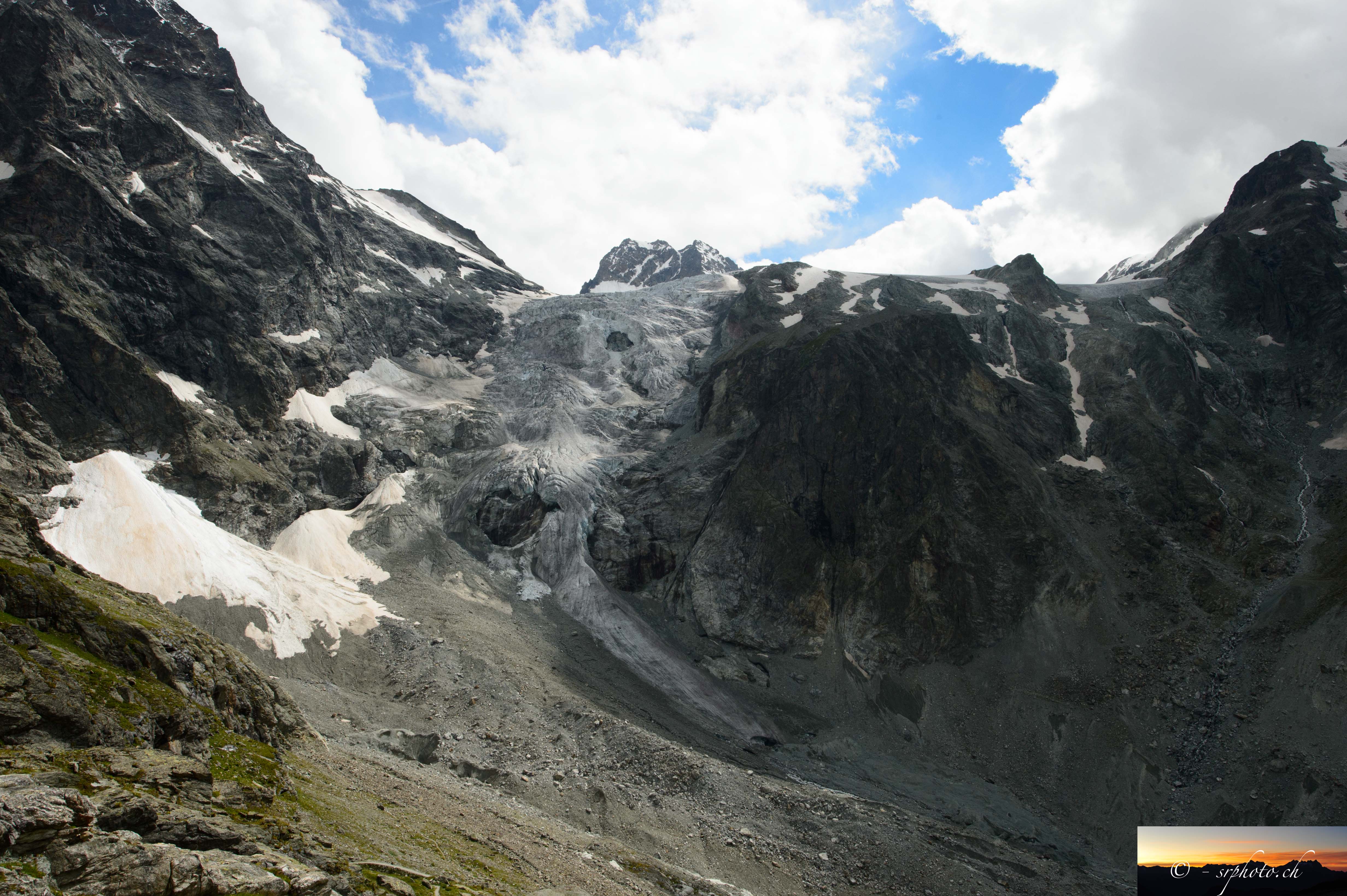 Show on map |
|
|
Sébastien Ruttimann (2014)
Pouring dye-tracer in a moulin at Haut Glacier d'Arolla - August 2014 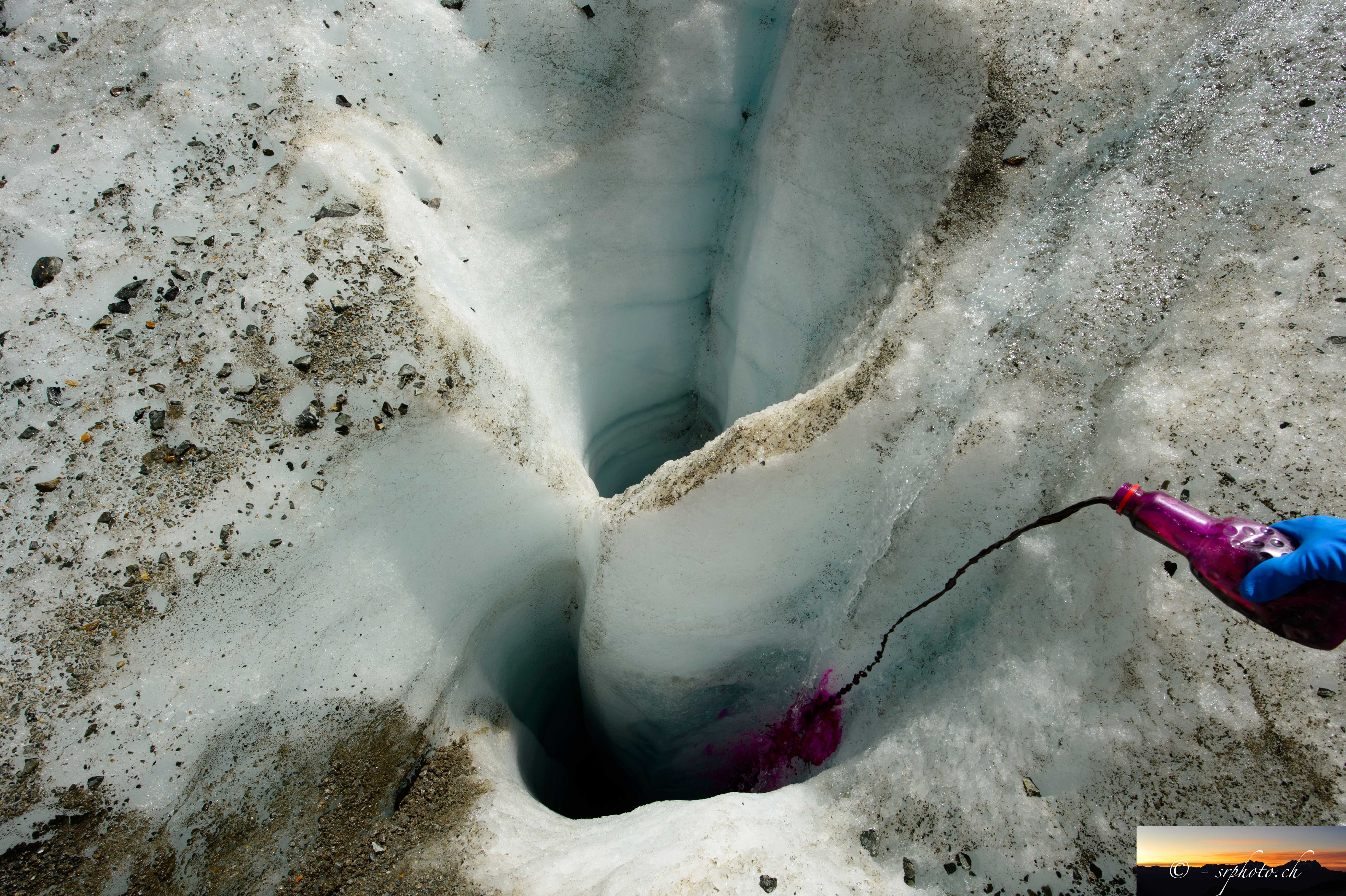 Show on map |
|
|
Sébastien Ruttimann (2014)
Helicopter view of the proglacial zone of the Haut Glacier d'Arolla - August 2014  Show on map |
|
|
Sébastien Ruttimann (2014)
Picture of a moulin on the Haut Glacier d'Arolla - August 2014 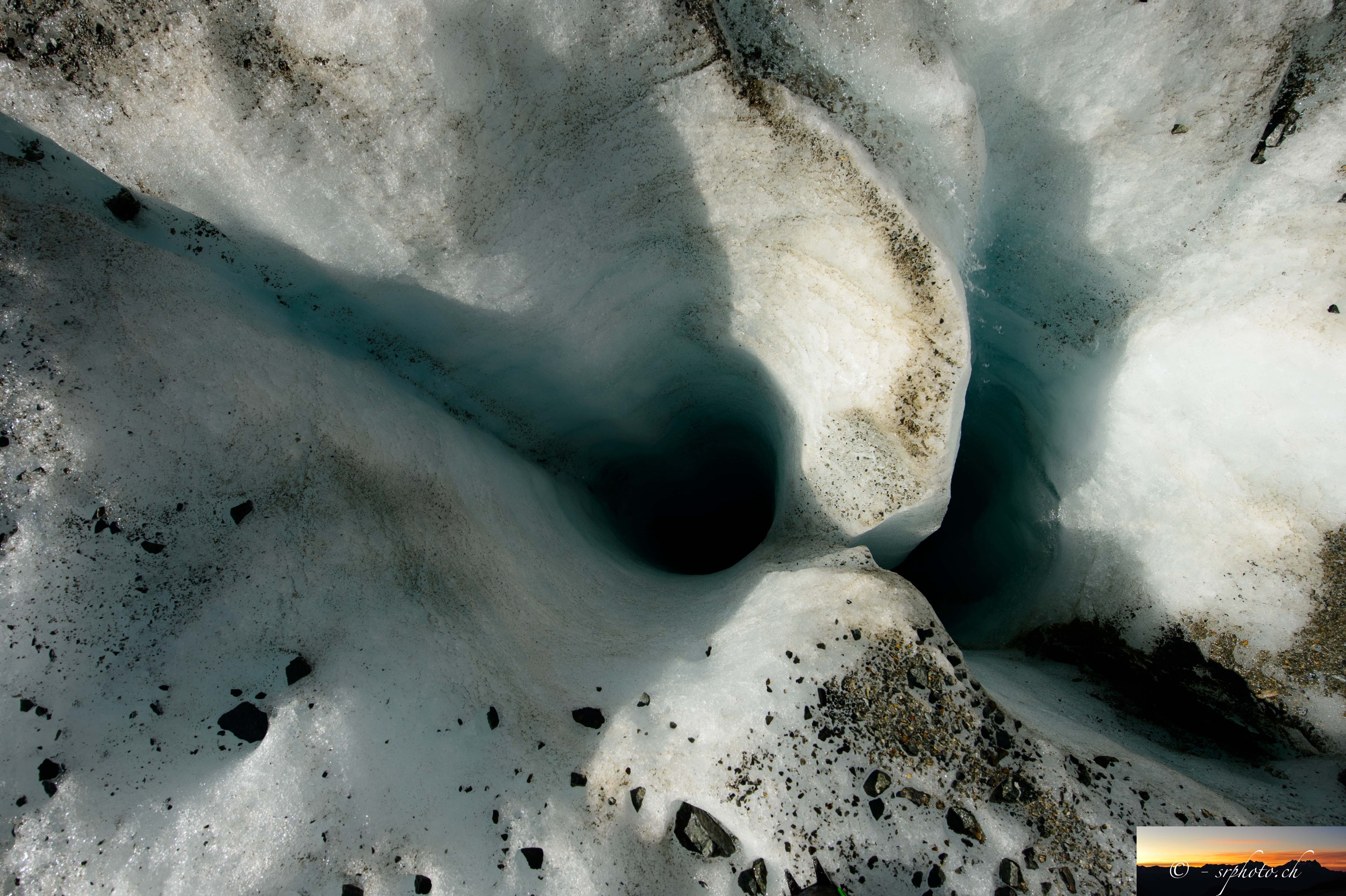 Show on map |
|
|
Sébastien Ruttimann (2014)
Haut Glacier d'Arolla - helicopter view - August 2014 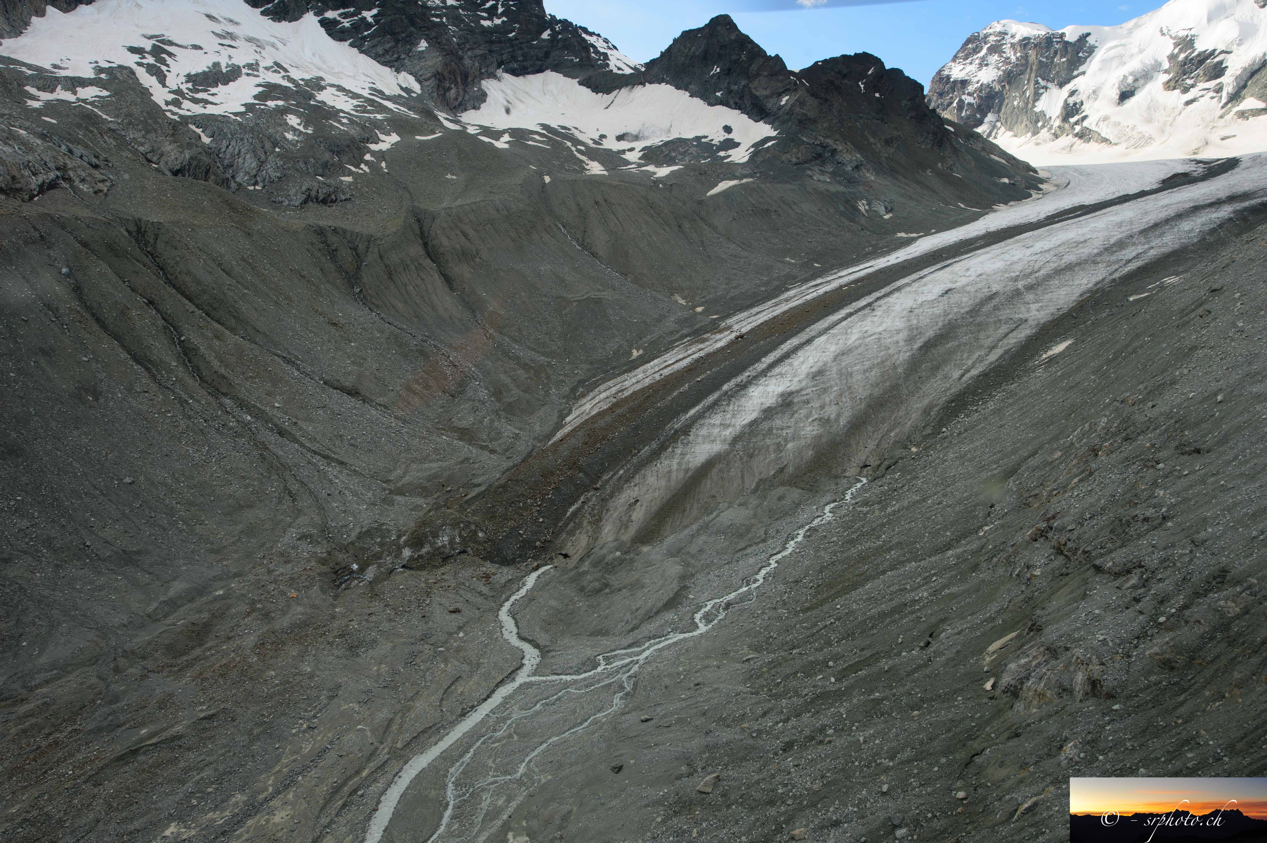 Show on map |
|
|
Sébastien Ruttimann (2014)
Haut Glacier d'Arolla - helicopter view - August 2014 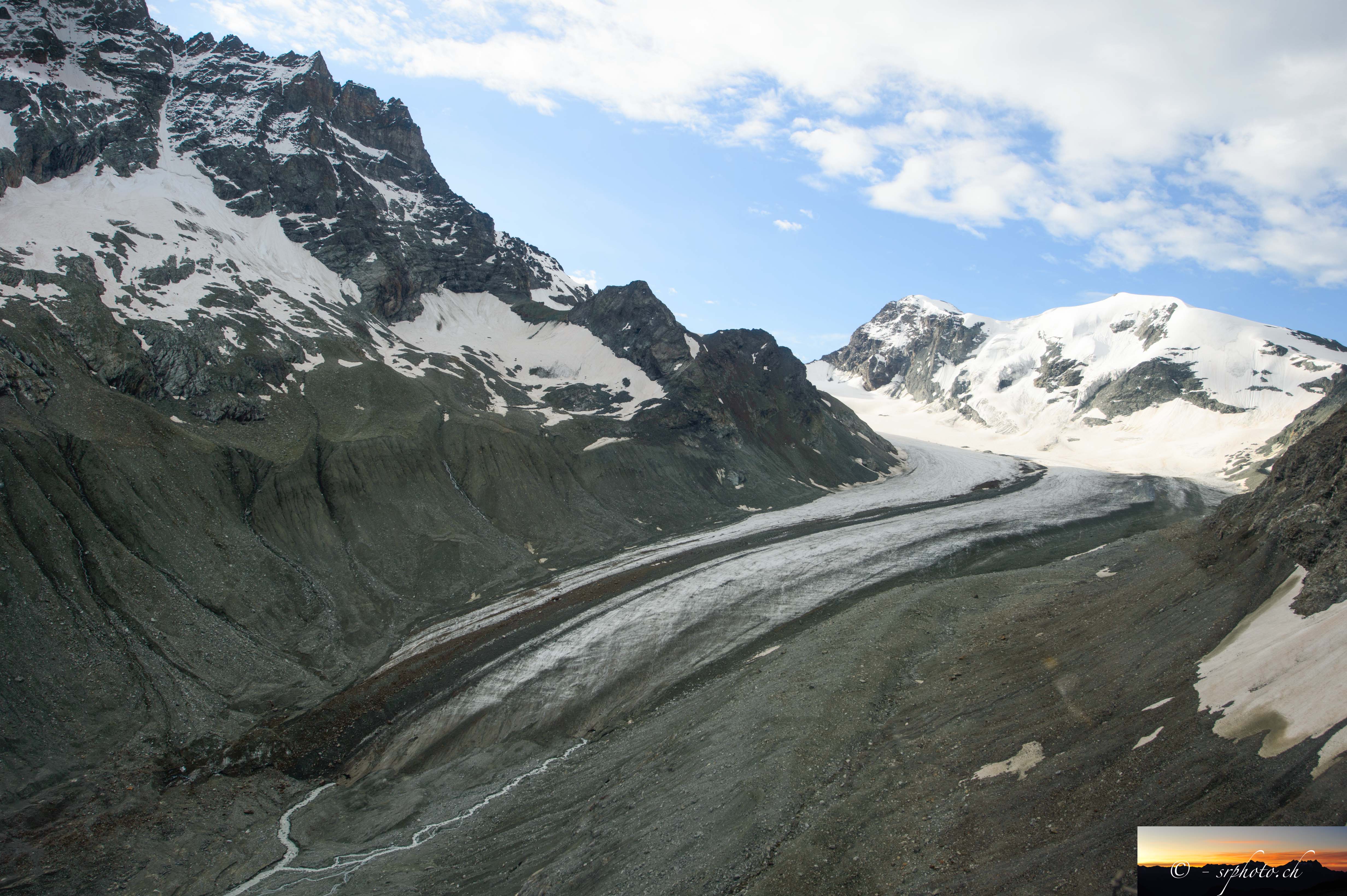 Show on map |
|
|
Sébastien Ruttimann (2014)
Petit Mont Collon - helicopter view - August 2014  Show on map |
|
|
Sébastien Ruttimann (2014)
Bas Glacier d'Arolla and moraines - helicopter view - August 2014 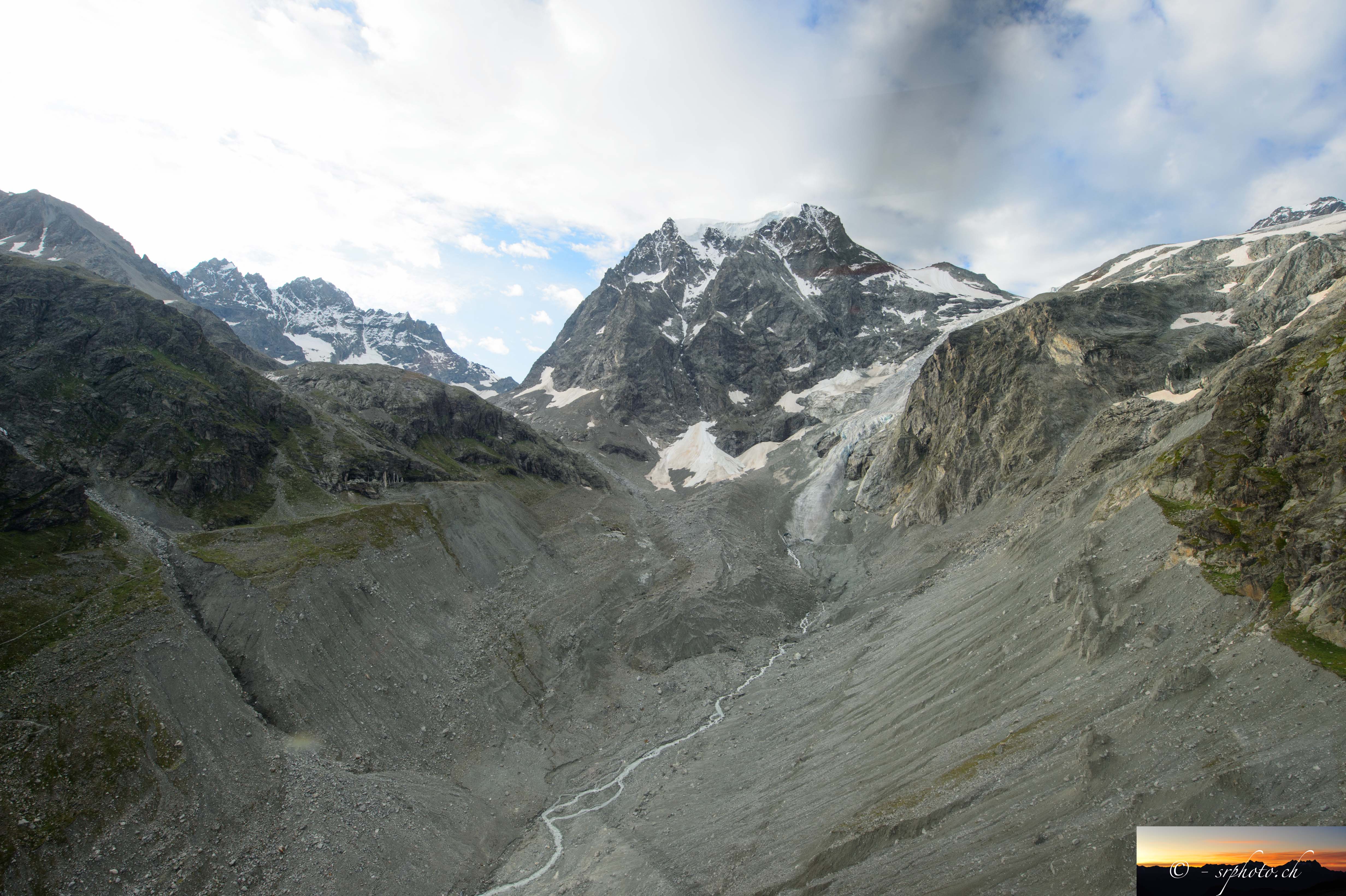 Show on map |
|
|
Sébastien Ruttimann (2014)
Borgne d'Arolla - helicopter view - August 2014  Show on map |
|
|
Sébastien Ruttimann (2014)
Ancient subglacial channel exit - Haut Glacier d'Arolla - August 2014 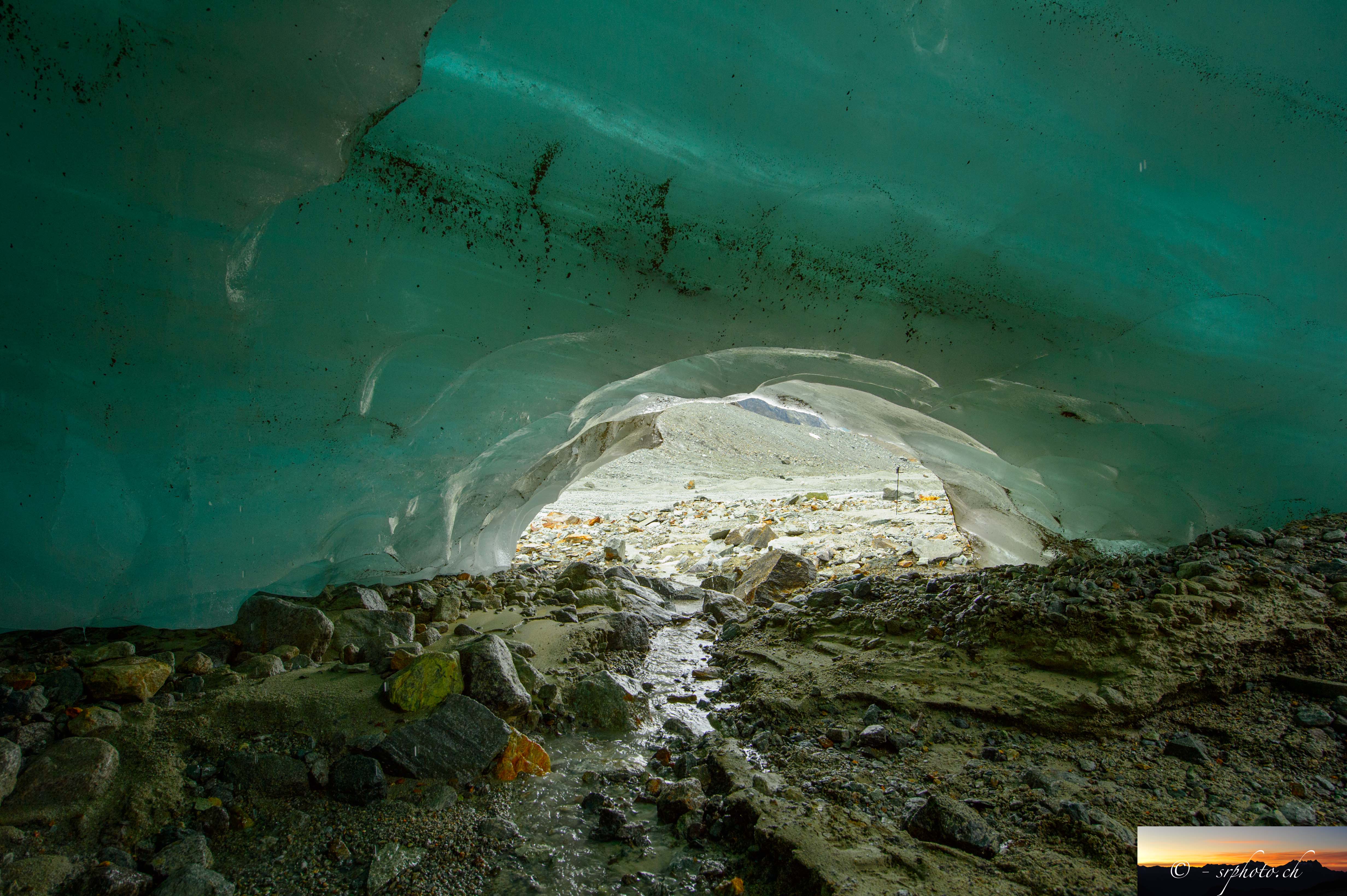 Show on map |
|
|
Sébastien Ruttimann (2014)
Subglacial channel exit at Haut Glacier d'Arolla - August 2014 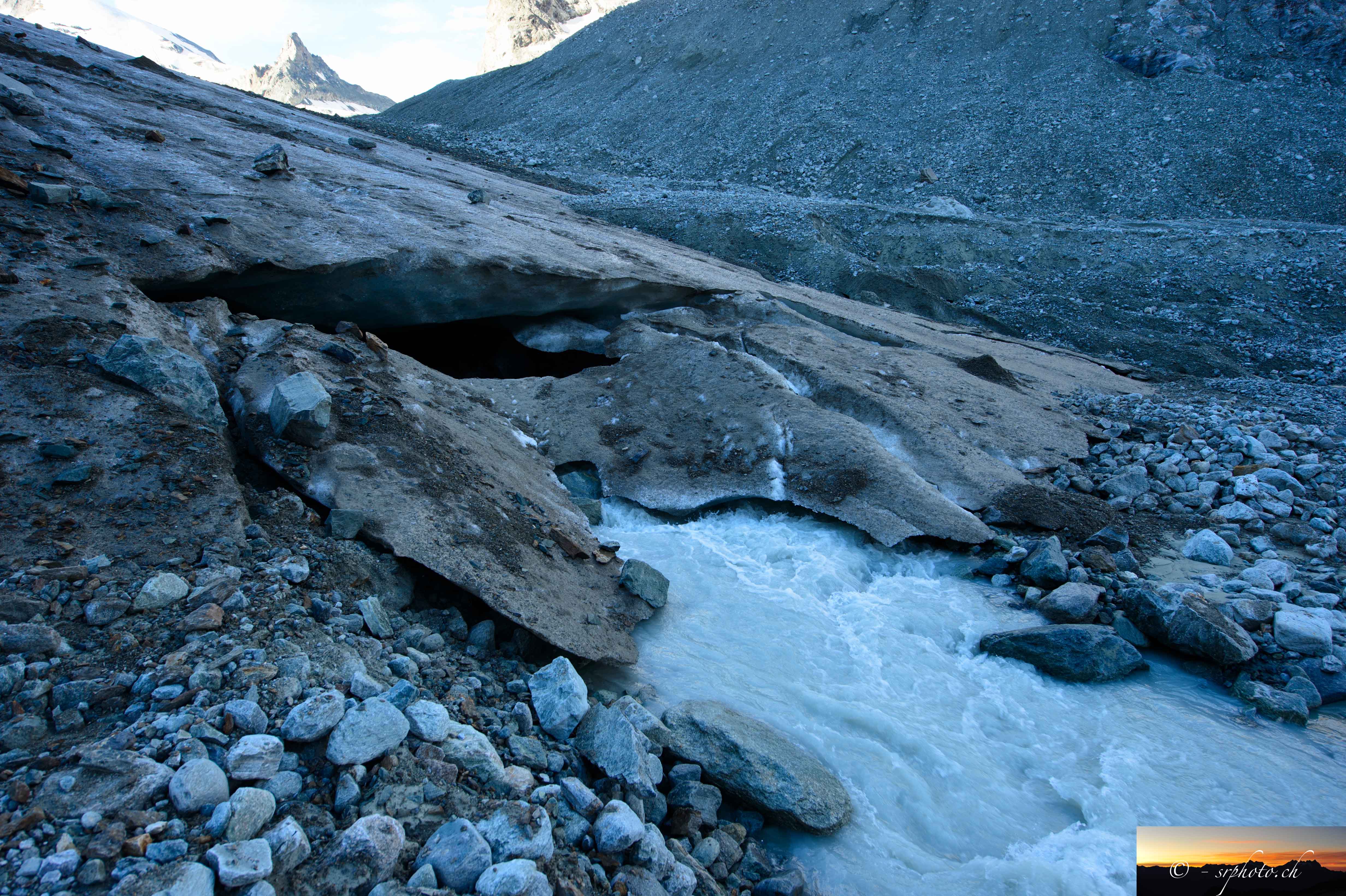 Show on map |
|
|
Sébastien Ruttimann (2014)
La Borgne d'Arolla and Mont Collon - June 2014  Show on map |
|
|
Sébastien Ruttimann (2014)
Tsijiore Nouve water intake - October 2014  Show on map |
|
|
Sébastien Ruttimann (2014)
Torrent de Tsijiore Nouve below water intake - October 2014  Show on map |
|
|
Sébastien Ruttimann (2014)
Tsijiore Nouve water intake - October 2014  Show on map |
|
|
Sébastien Ruttimann (2014)
Empty Borgne d'Arolla in October 2014  Show on map |
|
|
Sébastien Ruttimann (2014)
Possibly an ancient subglacial channel on Haut Glacier d'Arolla revealed by melting- August 2014  Show on map |
|
|
Sébastien Ruttimann (2014)
High resolution aerial mosaic of Tsijiore Nouve's proglacial margin. Show on map |
|
|
Sébastien Ruttimann (2013)
Tsijiore Nouve's moraine, May 2013  Show on map |
|
|
Sébastien Ruttimann (2013)
Grande Dixence dam  Show on map |
|
|
Sébastien Ruttimann (2013)
Avalanche deposits, May 2013  Show on map |
|
|
Sébastien Ruttimann (2013)
Tsijiore Nouve upper part, May 2013  Show on map |
|
|
Sébastien Ruttimann (2013)
Little ice age moraines of the Glacier des Aiguilles Rouges d'Arolla - September 2013  Show on map |
|
|
Sébastien Ruttimann (2013)
Grande Dixence dam info panel - September 2013 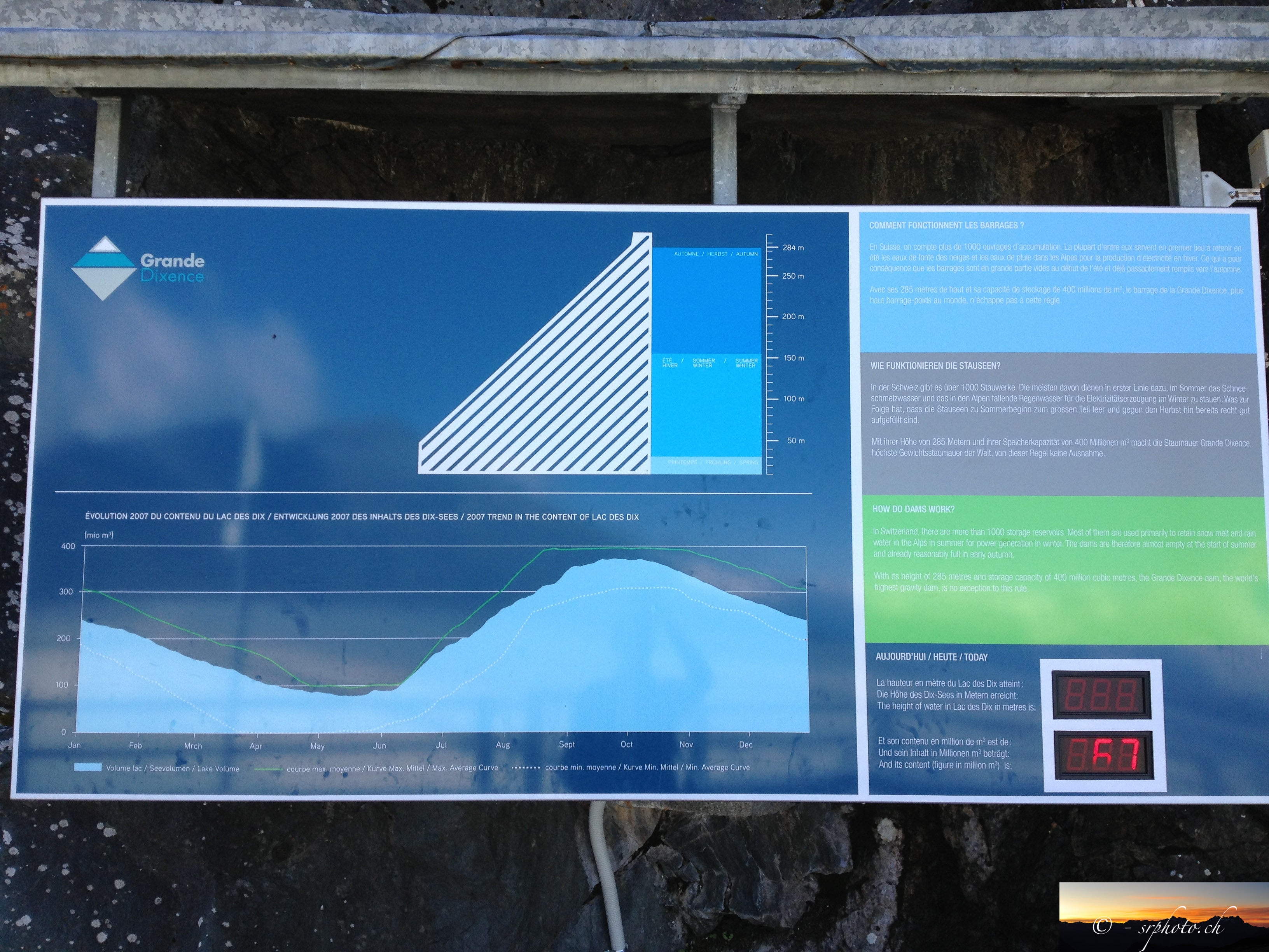 Show on map |
|
|
Sébastien Ruttimann (2013)
Tsijiore Nouve's moraine, May 2013  Show on map |
|
|
Stuart Lane using ETHZ VAW data (2013)
Estimated X Y (CH1903 and WGS84) position of Bas Glacier Show on map |
|
|
Hydroexploitation SA (2012)
Untitled Show on map |
|
|
Scapozza, C. (2012)
Stratigraphie, morphodynamique, paléoenvironnements des terrains sédimentaires meubles à forte déclivité du domaine périglaciaire alpin. Show on map |
|
|
Sébastien Ruttimann (2012)
Tsarmine, Torrent de Perroc debris cone, La Borgne d'Arolla and Satarma, June 2012  Show on map |
|
|
Sébastien Ruttimann (2012)
Tsijiore Nouve Glacier seen from Tsarmine, October 2012  Show on map |
|
|
Sébastien Ruttimann (2012)
Front of Tsarmine Rock Glacier, October 2012  Show on map |
|
|
Sébastien Ruttimann (2012)
Glacier de la Tsa and moraines, September 2012  Show on map |
|
|
Sébastien Ruttimann (2012)
Tsarmine Glacier and little rock glacier on the right, September 2012  Show on map |
|
|
Sébastien Ruttimann (2012)
Little ice age moraines of the Glacier des Aiguilles Rouges d'Arolla - September 2012  Show on map |
|
|
Sébastien Ruttimann (2012)
Torrent de Perroc, upper part with debris flow marks, September 2012  Show on map |
|
|
Sébastien Ruttimann (2012)
Glacier de Pièces - September 2012  Show on map |
|
|
Sébastien Ruttimann (2012)
Doigt de Satarma, June 2012  Show on map |
|
|
Sébastien Ruttimann (2012)
Fixed GPS on Tsarmine Rock Glacier, October 2012 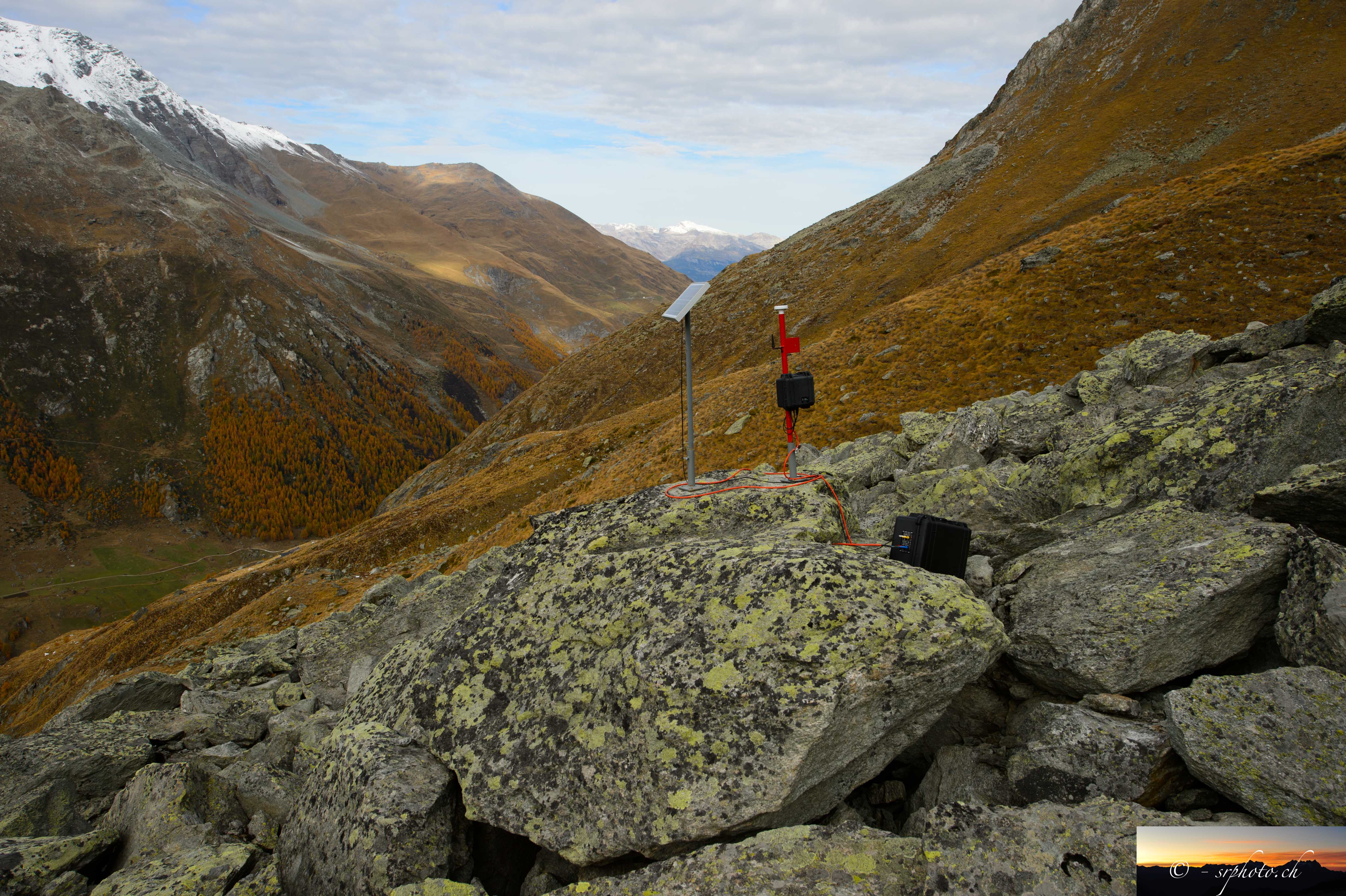 Show on map |
|
|
Sébastien Ruttimann (2012)
Glacier de Pièces - September 2012 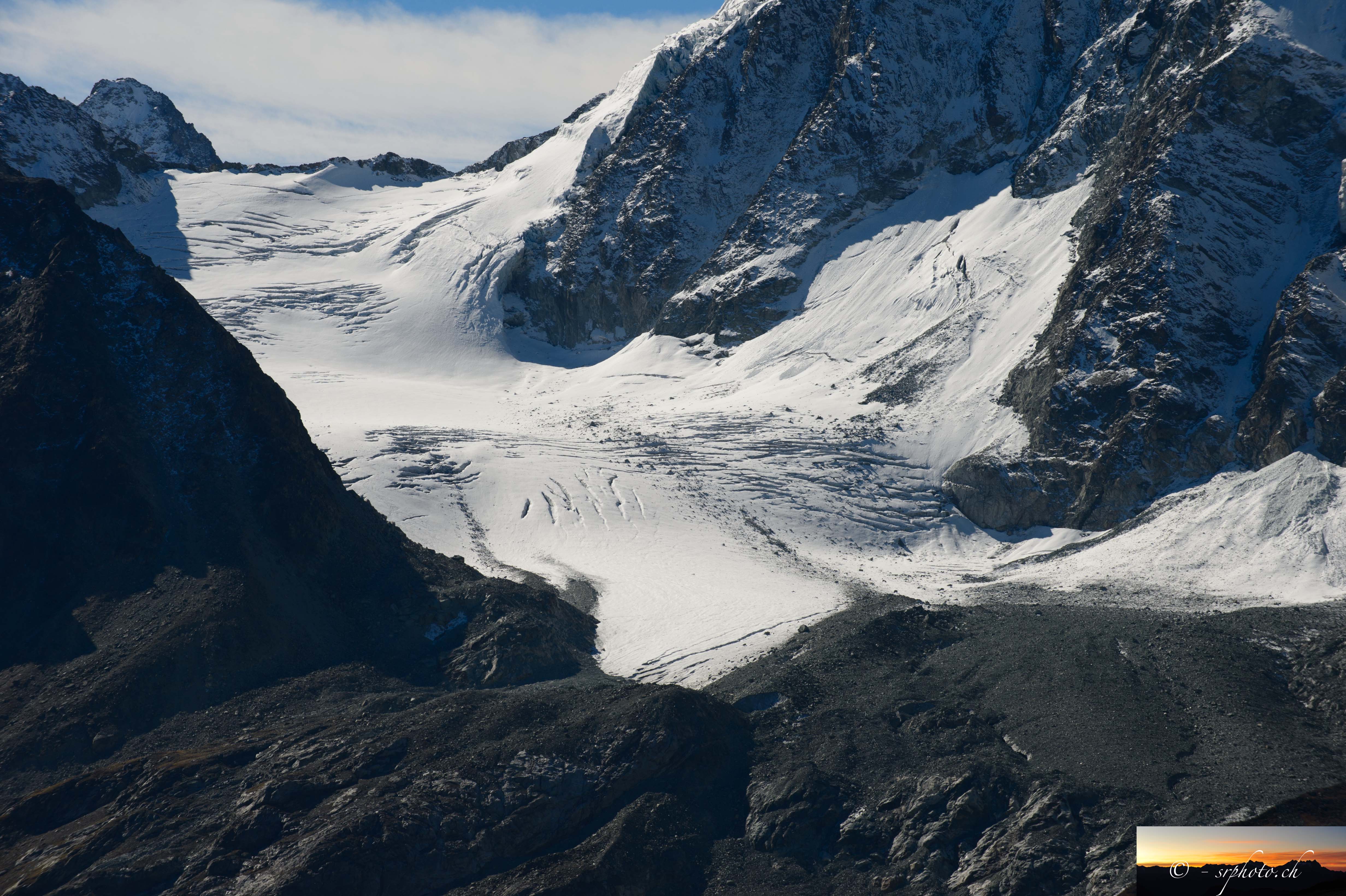 Show on map |
|
|
Sébastien Ruttimann (2012)
Dent de Perroc, Tsarmine Rock Glacier, June 2012  Show on map |
|
|
Sébastien Ruttimann (2012)
Tsarmine Rock glacier, October 2012  Show on map |
|
|
Sébastien Ruttimann (2012)
Webcam observing Tsarmine Rock Glacier, October 2012  Show on map |
|
|
Sébastien Ruttimann (2012)
Aiguilles Rouges d'Arolla, Satarma, Pra Gra from Tsarmine, October 2012  Show on map |
|
|
Sébastien Ruttimann (2012)
Glacier rocheux de Tsarmine, animation des mouvements à partir d'images webcam. Show on map |
|
|
Sébastien Ruttimann (2012)
Tsarmine Rock glacier from above, October 2012  Show on map |
|
|
Sébastien Ruttimann (2012)
Tsarmine Glacier, October 2012  Show on map |
|
|
Sébastien Ruttimann (2012)
Glacier rocheux de Tsarmine, vitesses horizontales octobre 2004 à octobre 2012 Show on map |
|
|
Sébastien Ruttimann (2012)
Tsarmine Rock glacier front, October 2012  Show on map |
|
|
Sébastien Ruttimann (2012)
Glacier rocheux de Tsarmine, vitesses horizontales moyennes par zones d'octobre 2004 à octobre 2012 et comparaison avec la température du sol Show on map |
|
|
Sébastien Ruttimann (2012)
Rocks falling from Tsarmine Rock Glacier, October 2012  Show on map |
|
|
Sébastien Ruttimann (2012)
Tsarmine Glacier and Rock Glacier seen from the opposite side of the valley, September 2012  Show on map |
|
|
Sébastien Ruttimann (2012)
La Roussette Rock Glacier, September 2012  Show on map |
|
|
Stuart Lane (2012)
Flooding, 2nd July 2012 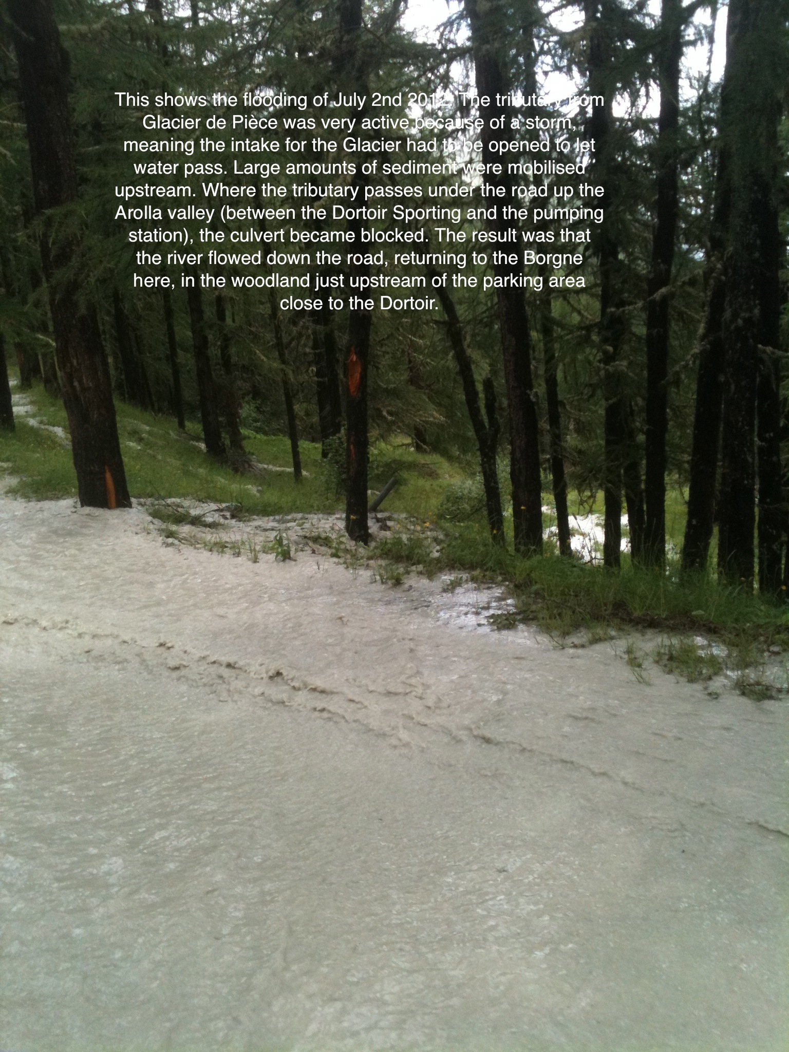 Show on map |
|
|
Stuart Lane (2012)
Flooding, 2nd July 2012 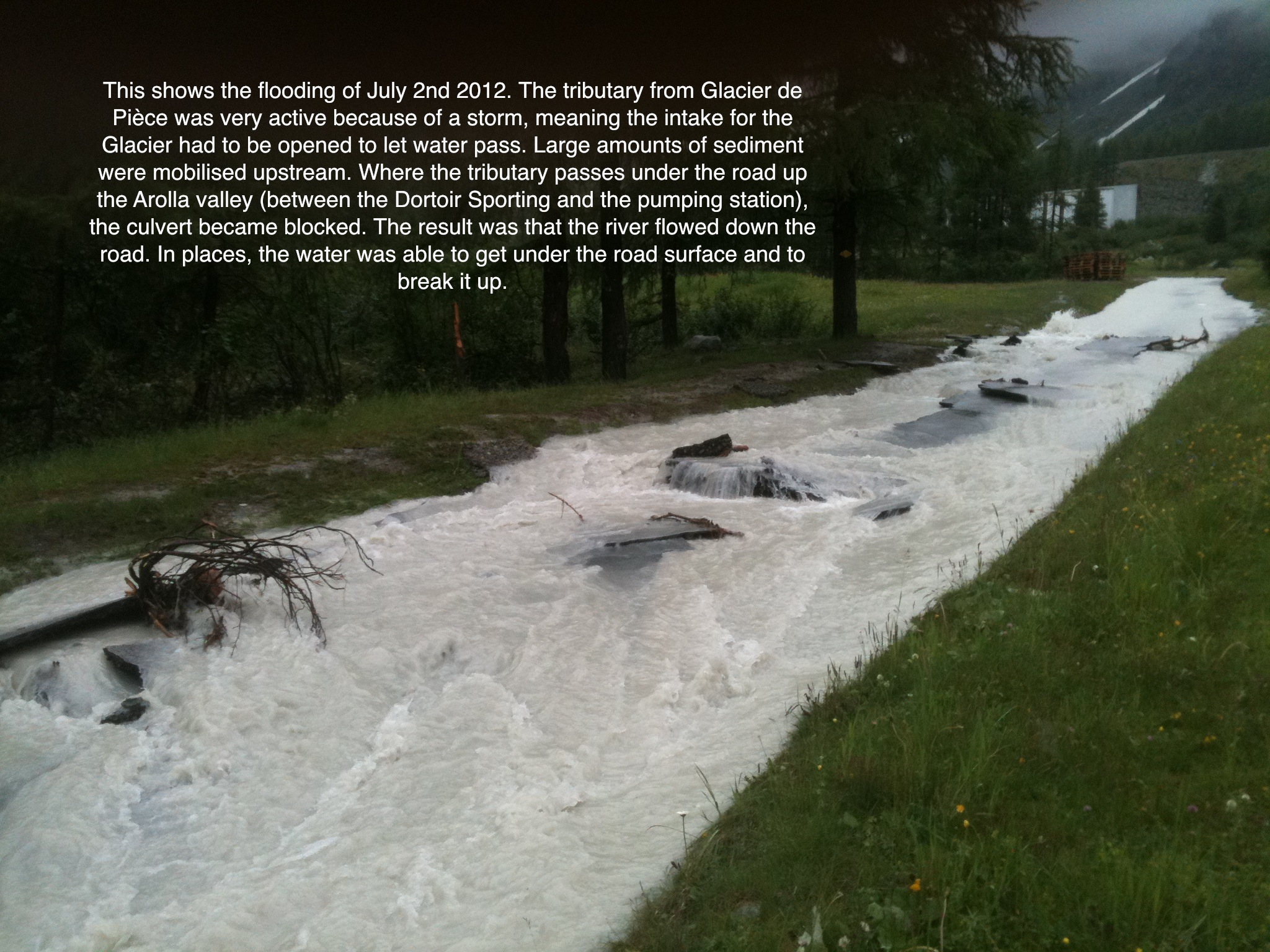 Show on map |
|
|
Stuart Lane (2012)
Flooding, 2nd July 2012 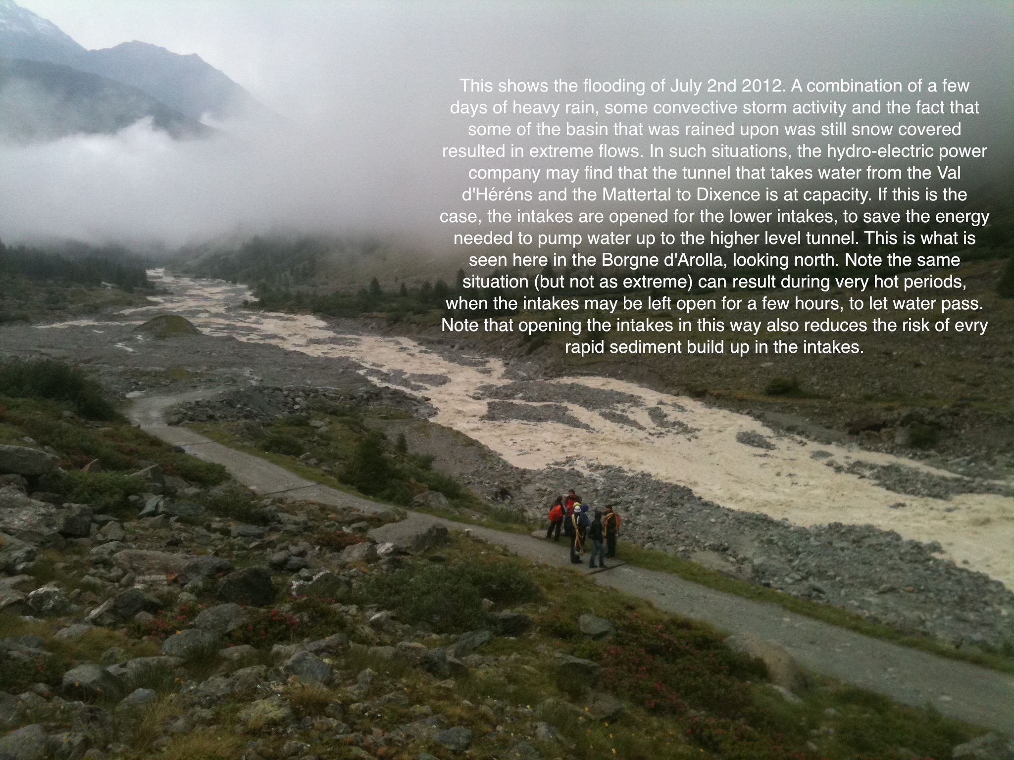 Show on map |
|
|
Stuart Lane (2012)
Laser scanner data for the Tsijiore Nouve glacier Show on map |
|
|
Stuart Lane (2012)
Flooding, 2nd July 2012 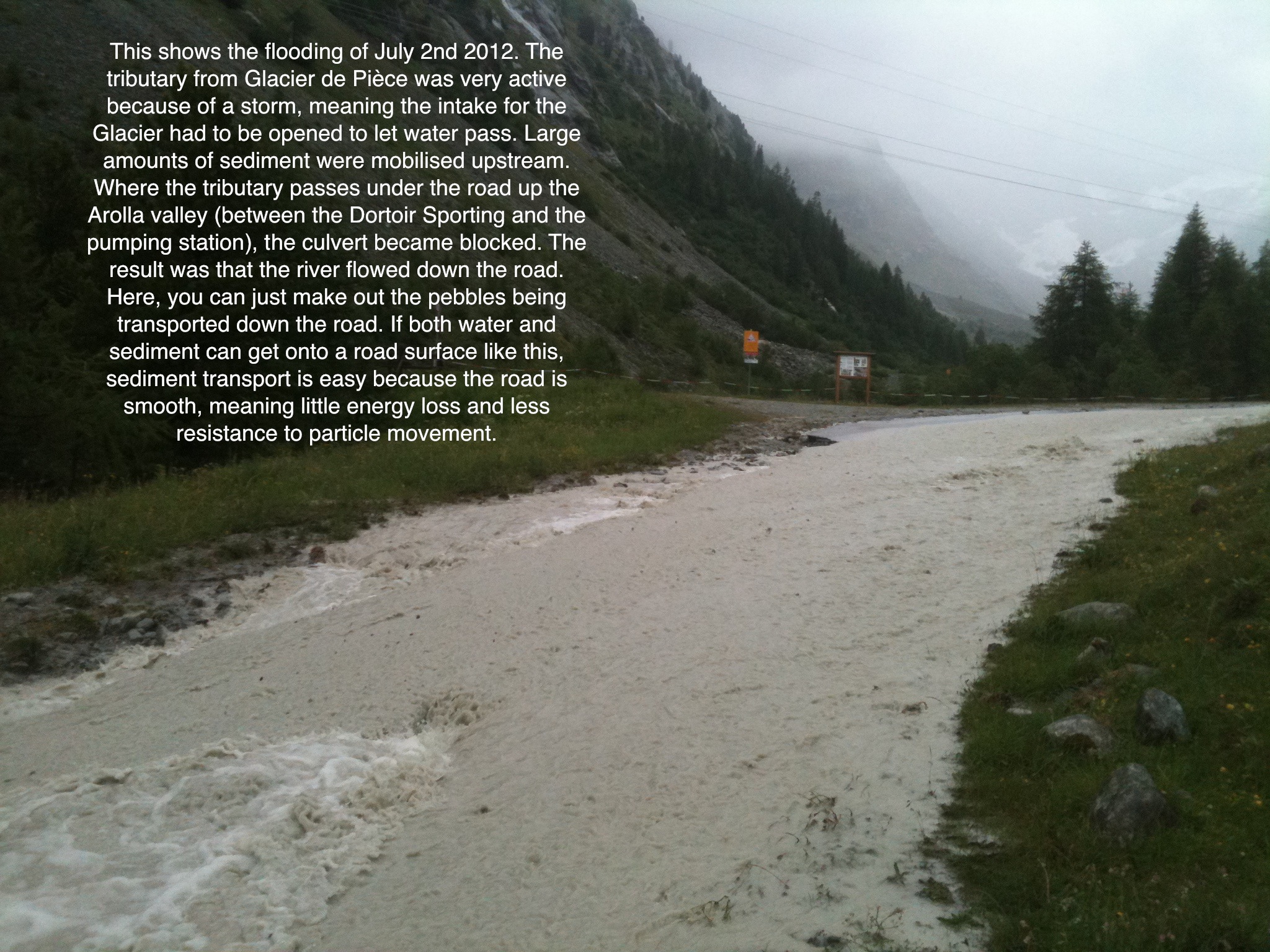 Show on map |
|
|
Stuart Lane (2012)
Flooding, 2nd July 2012 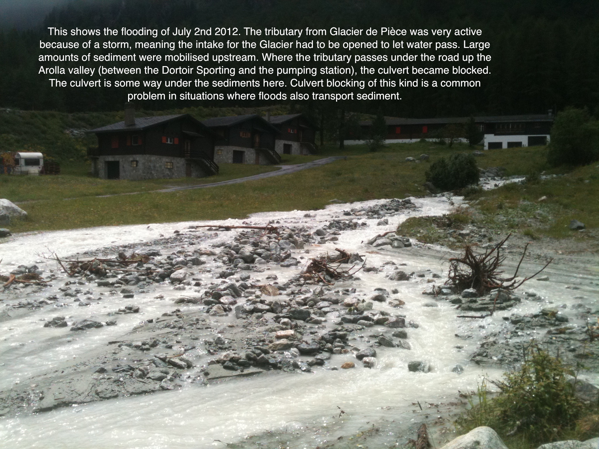 Show on map |
|
|
Stuart Lane (2012)
Long profiles for the Borgne d'Arolla, Satarma, 2005 and 2012 Show on map |
|
|
Stuart Lane (2012)
Pebble cluster in the Borgne d'Arolla 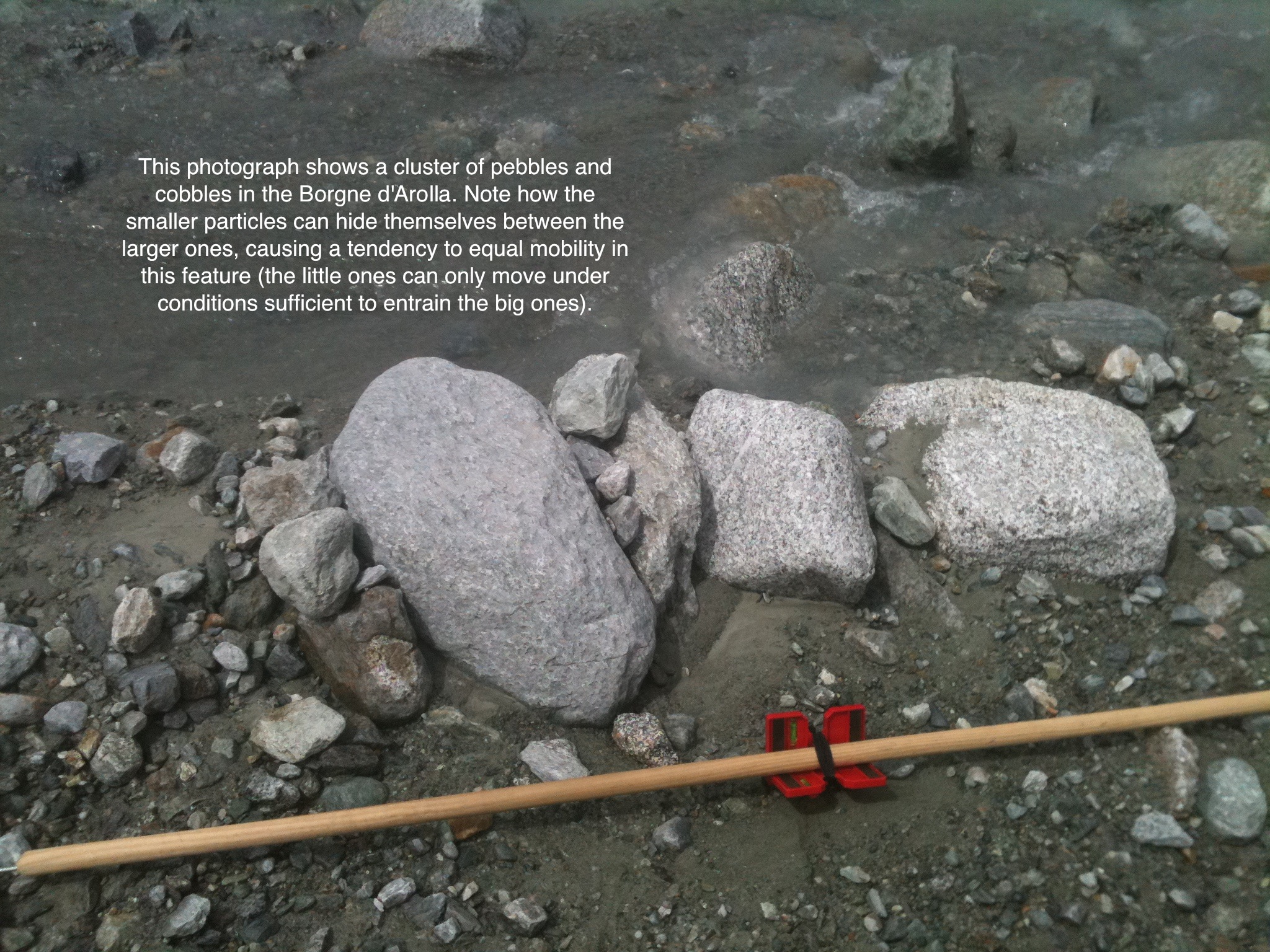 Show on map |
|
|
Stuart Lane (2012)
Flooding, 2nd July 2012 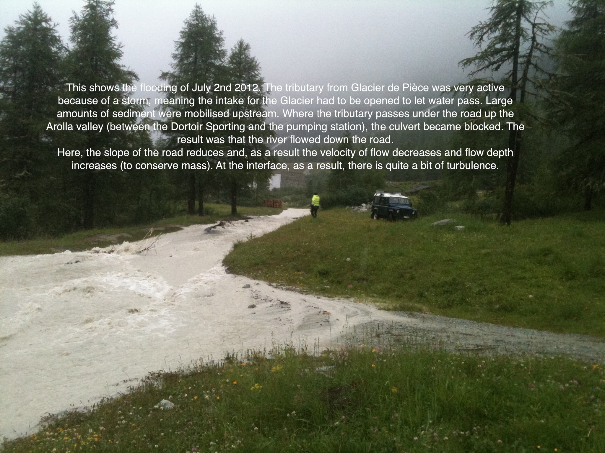 Show on map |
|
|
Stuart Lane (2012)
Infilling of the Satarma fishing pond 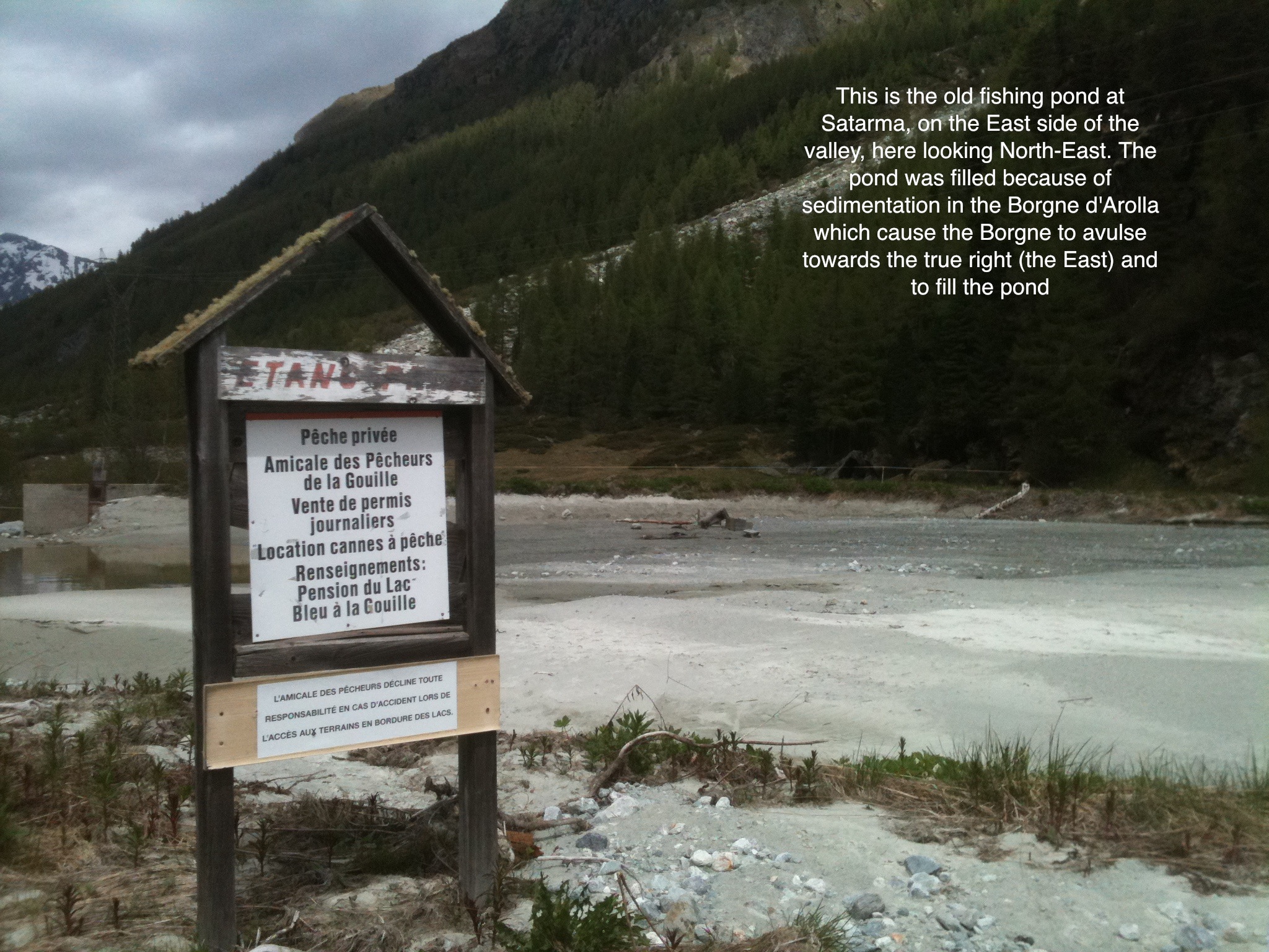 Show on map |
|
|
Stuart Lane (2012)
Trees and the Little Ice Age 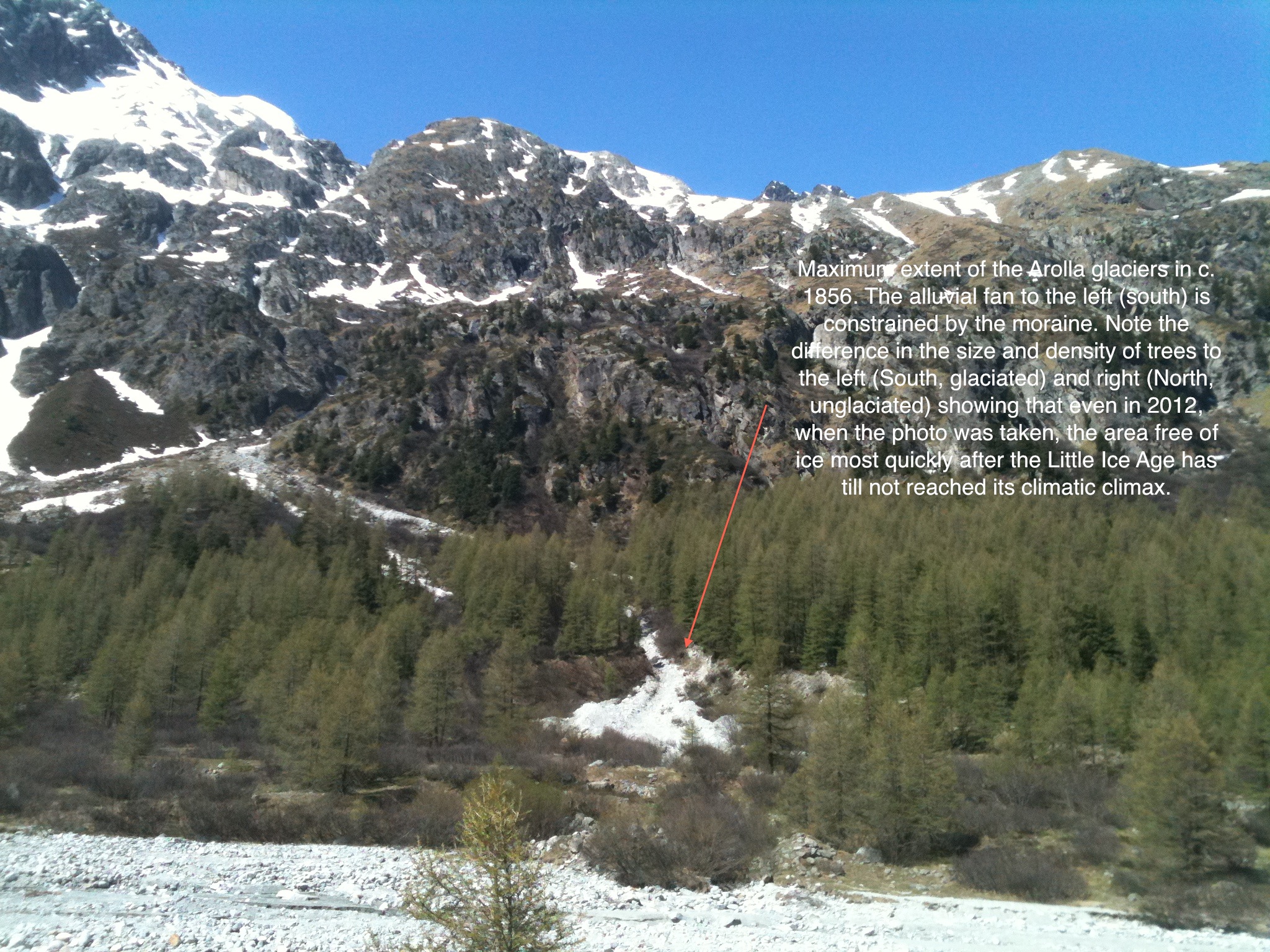 Show on map |
|
|
Stuart Lane (2012)
Flooding, 2nd July 2012 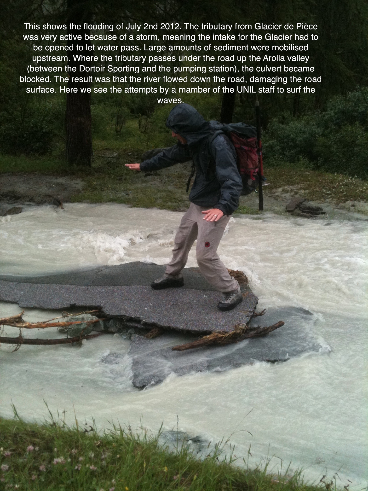 Show on map |
|
|
Stuart Lane (2012)
Sedimentation Zones in the Borgne d'Arolla 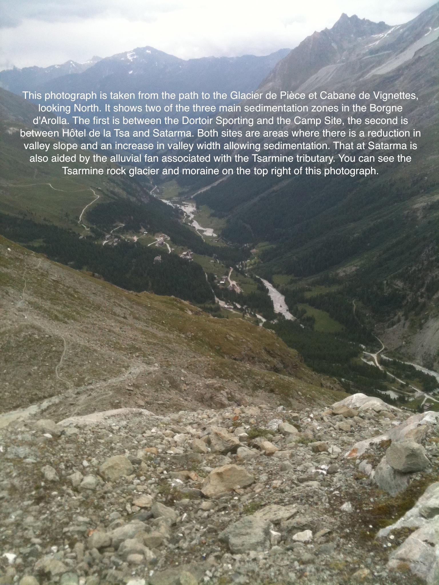 Show on map |
|
|
Stuart Lane (2012)
Flooding, 2nd July 2012 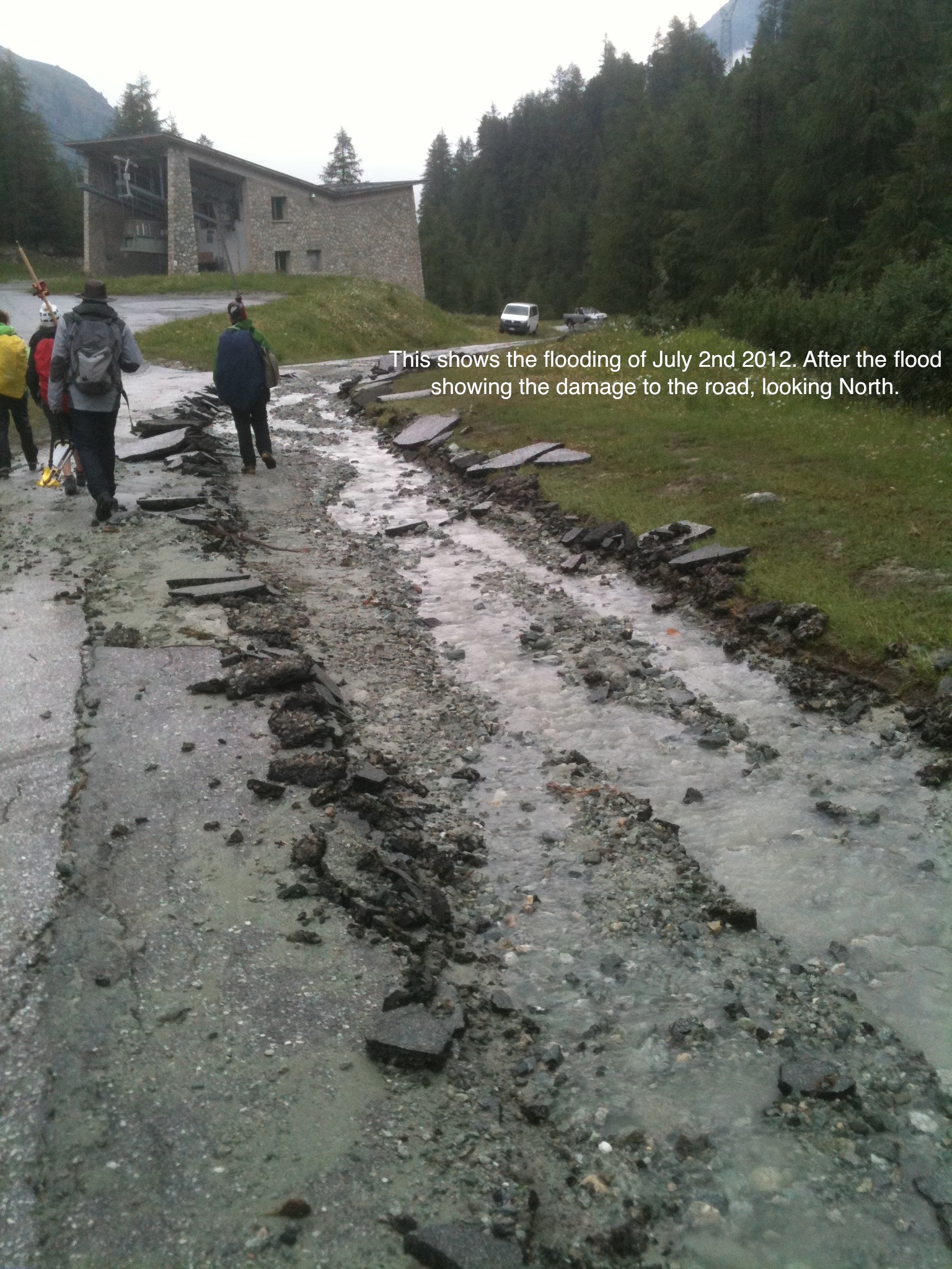 Show on map |
|
|
Stuart Lane (2012)
High river flow, with prises open, July 2nd 2012 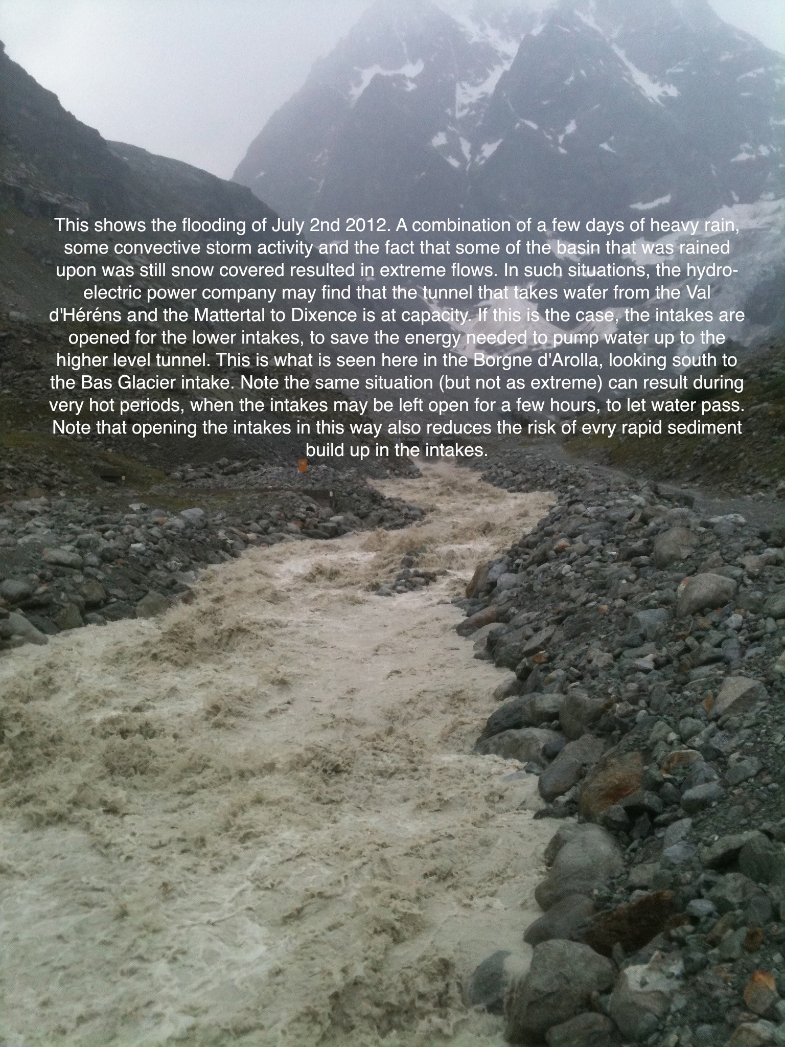 Show on map |
|
|
Stuart Lane (2012)
Accelerated vegetation colonisation post Little Ice Age 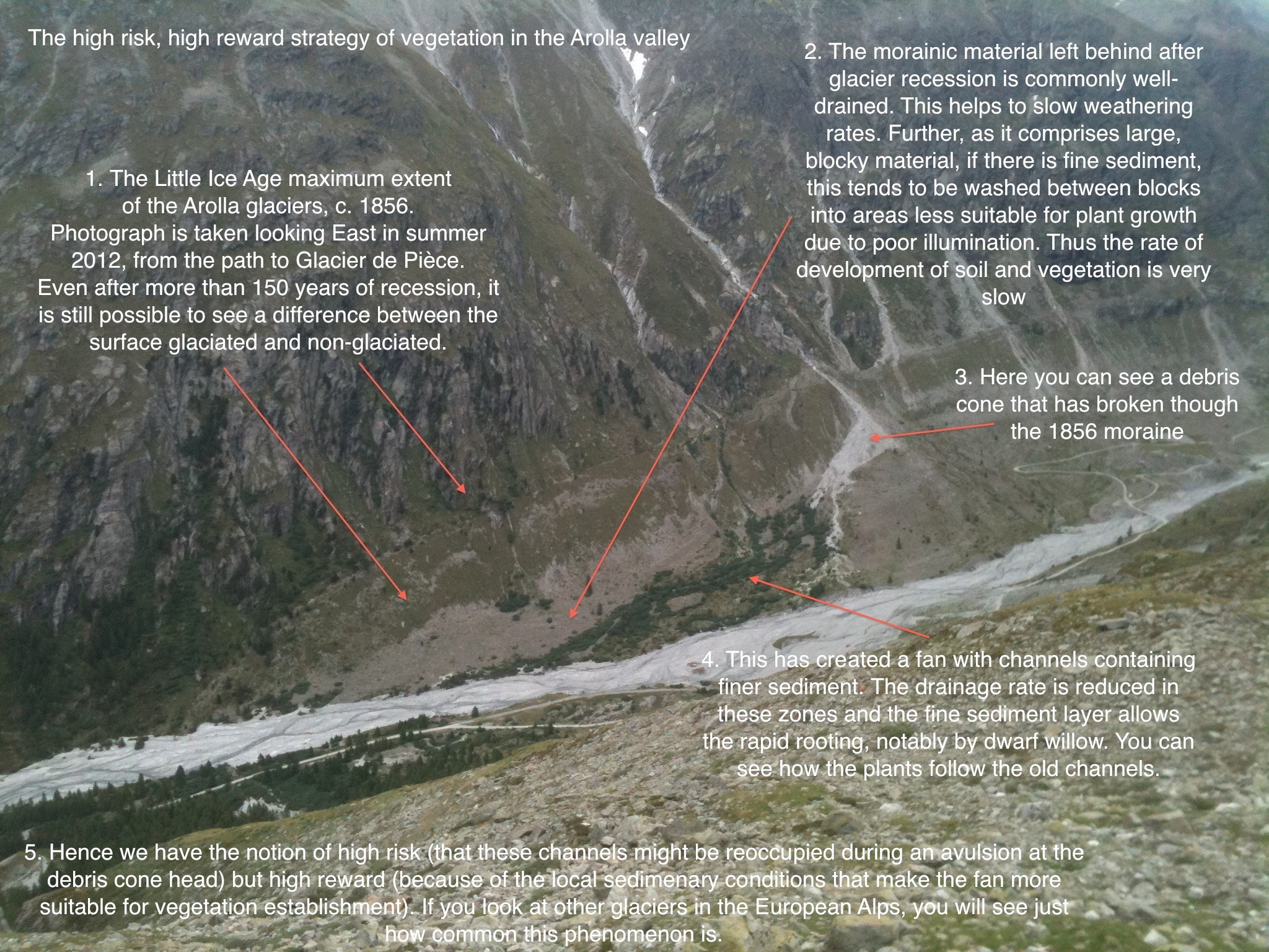 Show on map |
|
|
Stuart Lane (2012)
Debris fan at Satarma 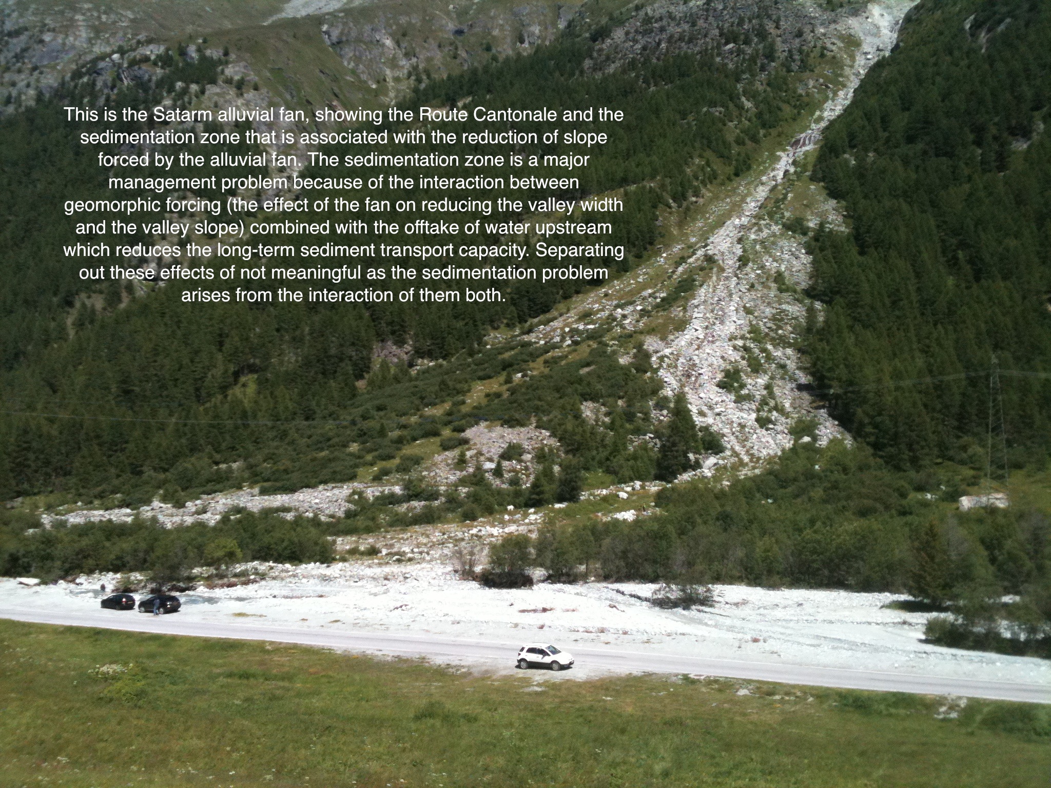 Show on map |
|
|
Stuart Lane (2012)
Sedimentation, La Monta, Borgne d'Arolla 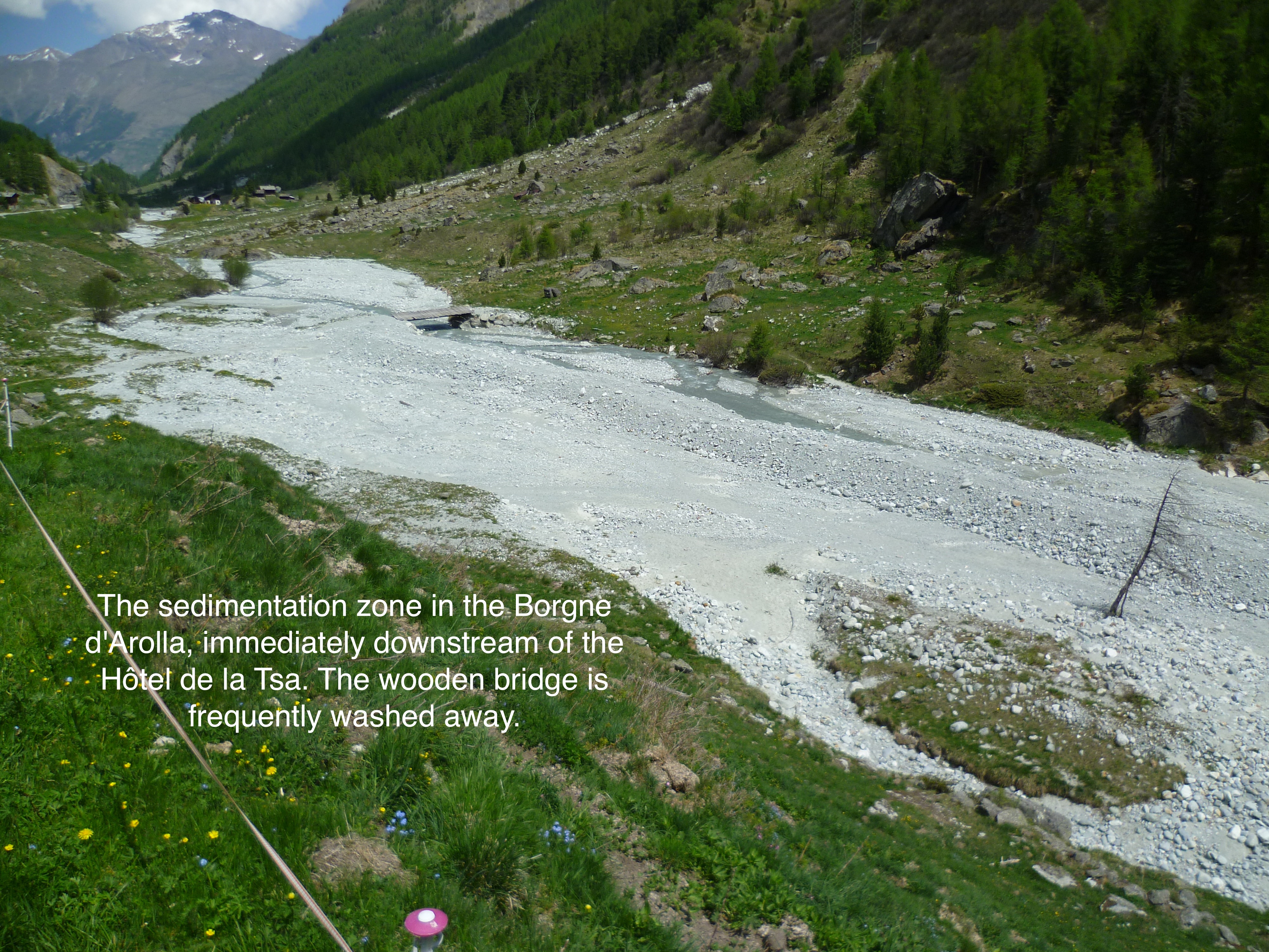 Show on map |
|
|
No authors (2011)
Confluence of the Tsijiore Nouve tributary with the Borgne d'Arolla 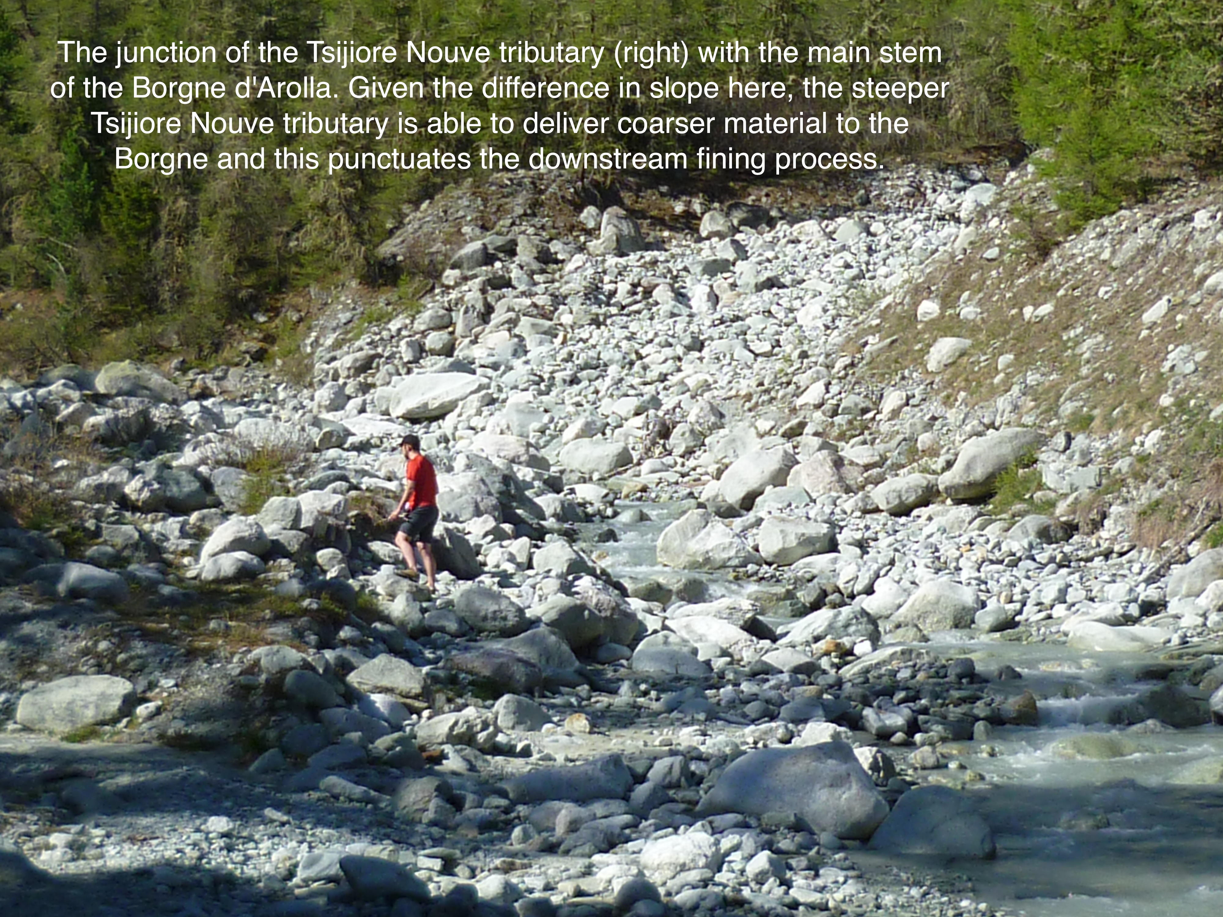 Show on map |
|
|
Fischer, U.H. and Mair, D.and Kavanaugh, J.F. and Willis, I. and Nienow, P. and Hubbard, B. (2011)
Modelling ice-bed coupling during a glacier speed-up event: Haut Glacier d'Arolla, Switzerland Show on map |
|
|
Pellicciotti, F. and Raschle, T. and Huerlimann, T. and Carenzo, M. and Burlando, P. (2011)
Transmission of solar radiation through clouds on melting glaciers: a comparison of parametrizations and their impact on melt modelling Show on map |
|
|
Stuart Lane (2011)
The braid plain of the Haut Glacier d'Arolla 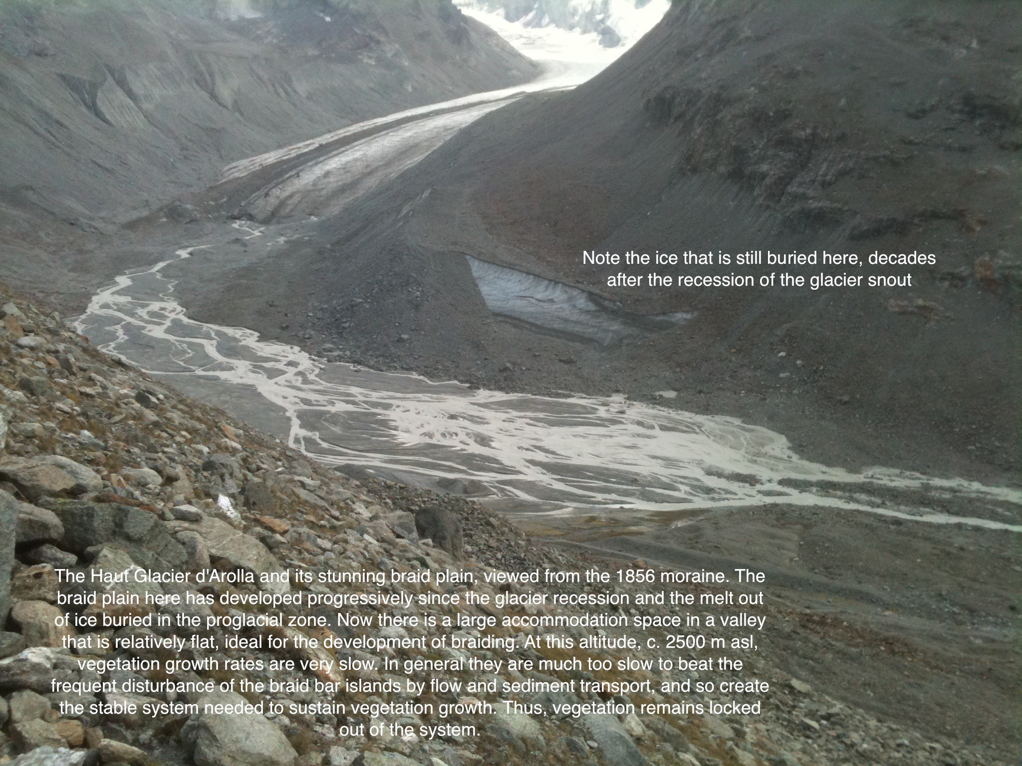 Show on map |
|
|
Stuart Lane (2011)
HEP Intake, Tsijiore Nouve, August 2011  Show on map |
|
|
Stuart Lane (2011)
HEP Intake, Tsijiore Nouve, August 2011  Show on map |
|
|
Stuart Lane (2011)
Sedimentation, Borgne d'Arolla 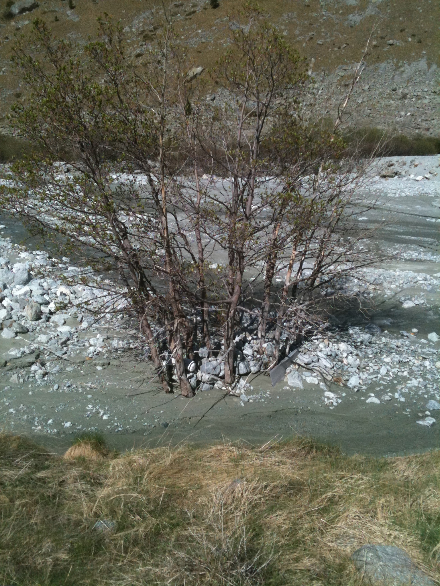 Show on map |
|
|
Stuart Lane (2011)
Video of the opening of the gates of the Bas Glacier d'Arolla Show on map |
|
|
Stuart Lane (2011)
Intakes above Remointse d'Arolla, mainly to capture snow melt 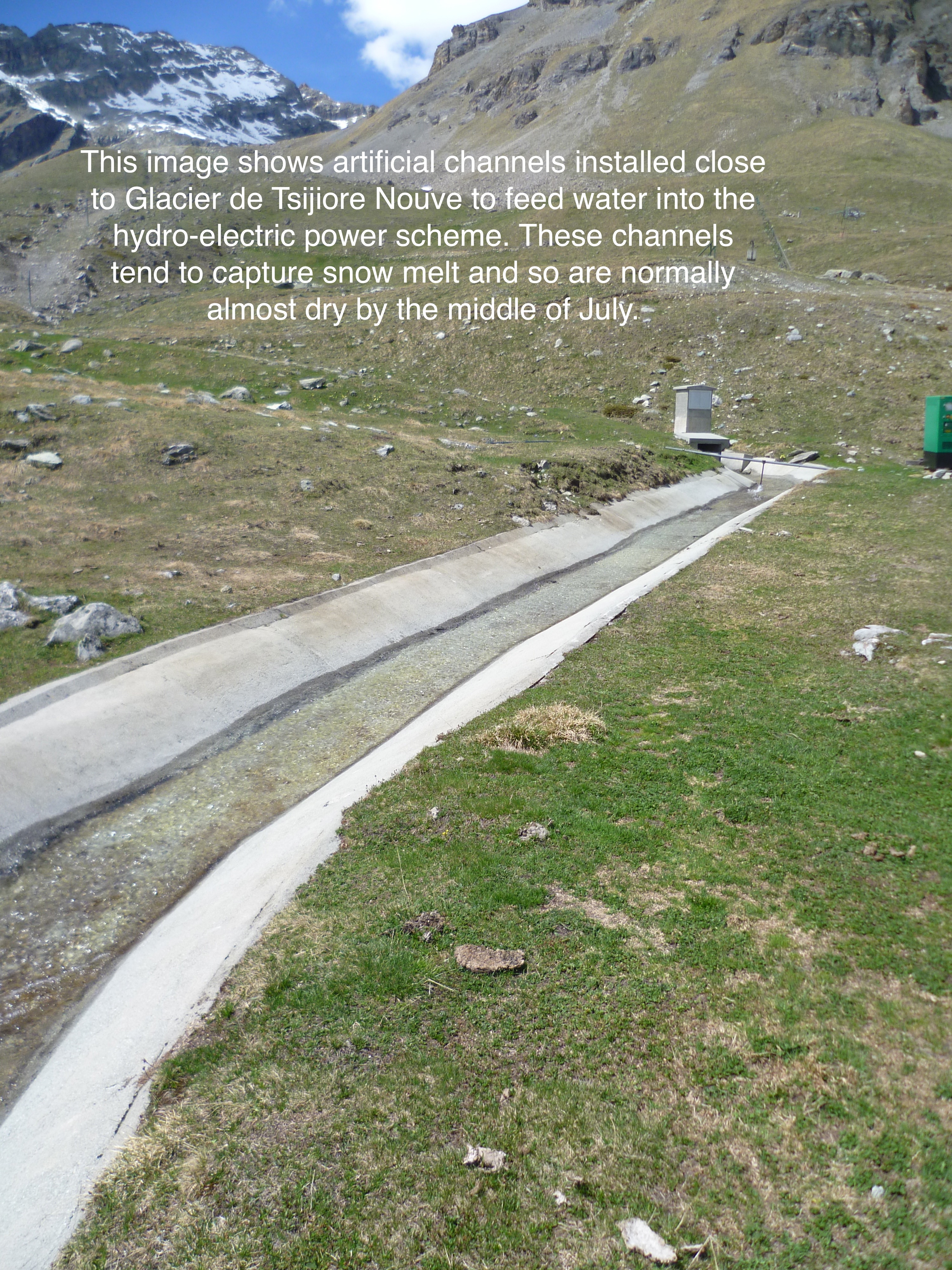 Show on map |
|
|
Stuart Lane (2011)
Sedimentation between Tsijiore Nouve and the Camping Site, in the Borgne d'Arolla 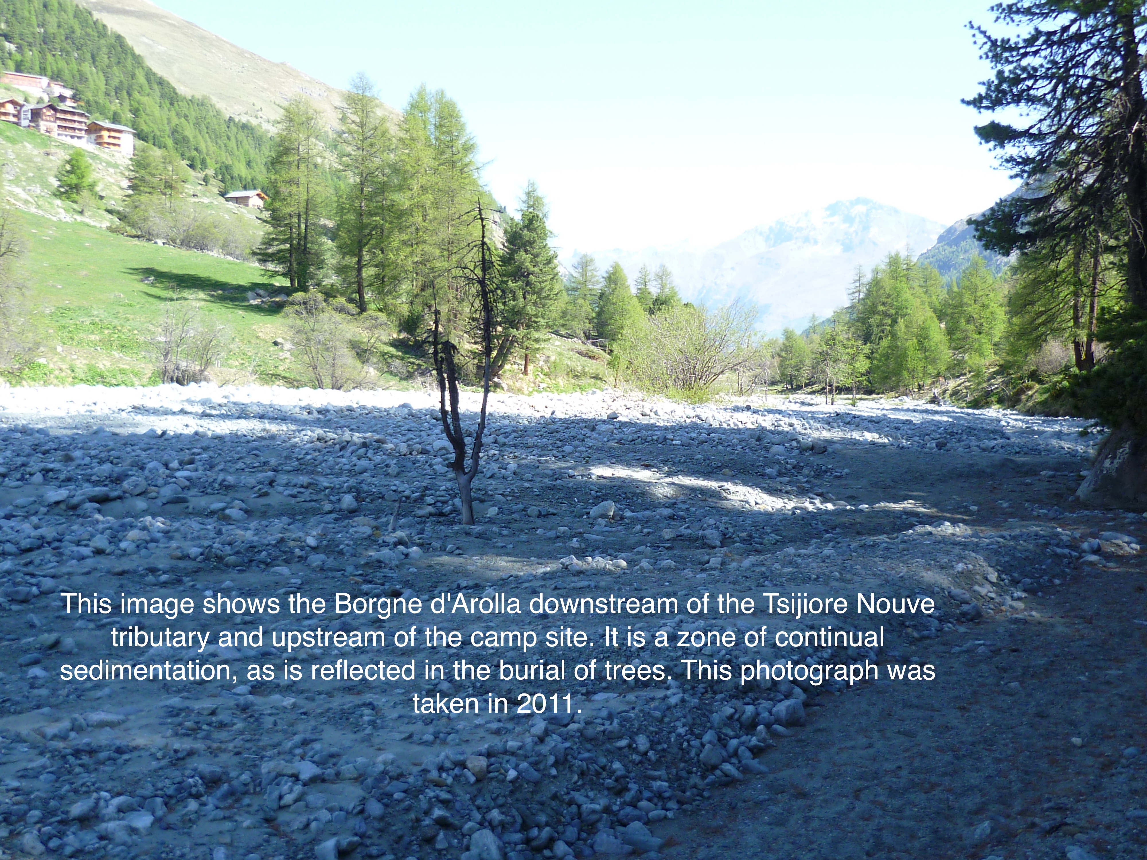 Show on map |
|
|
Stuart Lane (2011)
Intakes above Remointse d'Arolla, mainly to capture snow melt 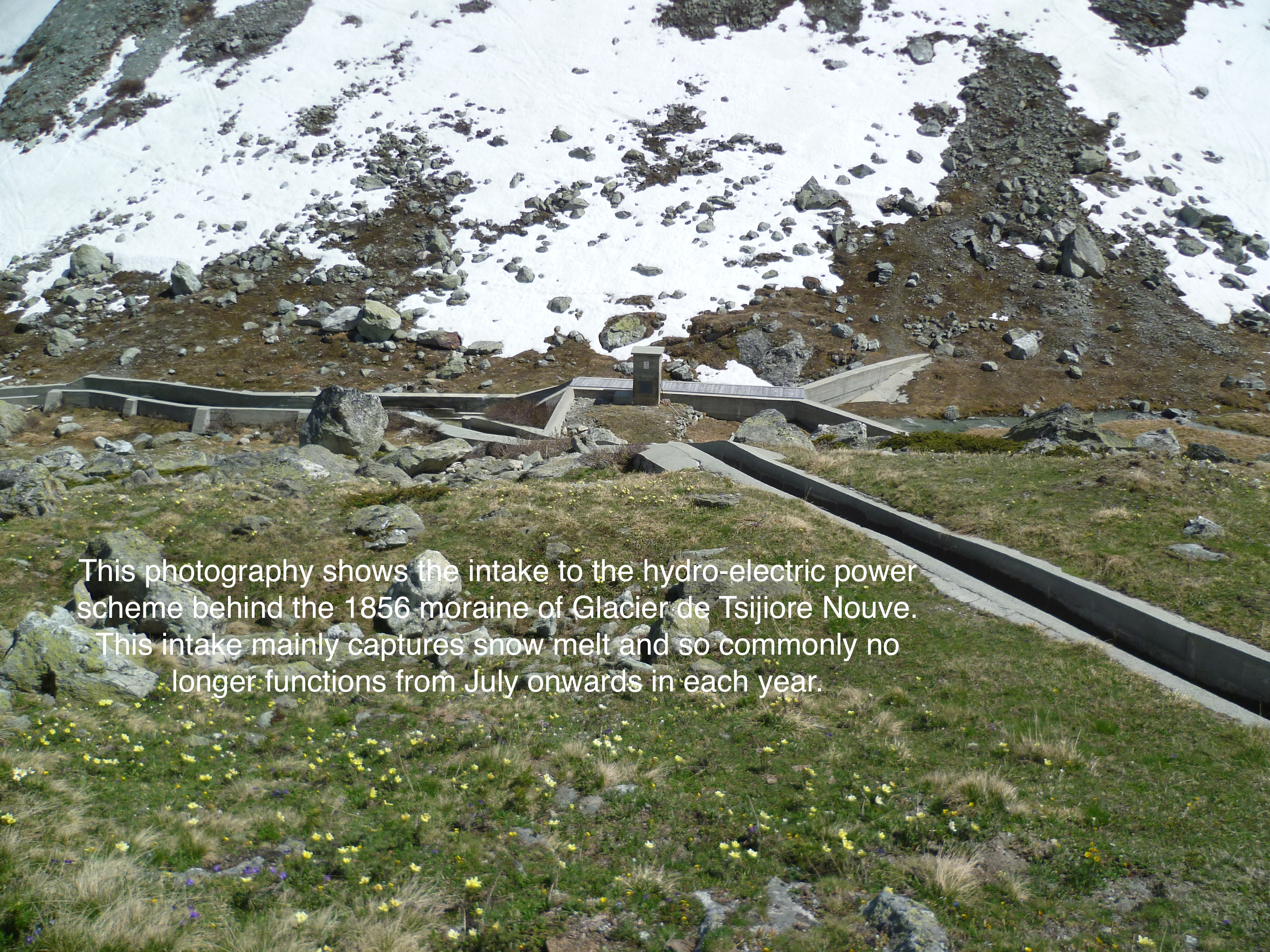 Show on map |
|
|
Stuart Lane (2011)
Close up photo of the Bad Glacier Intake 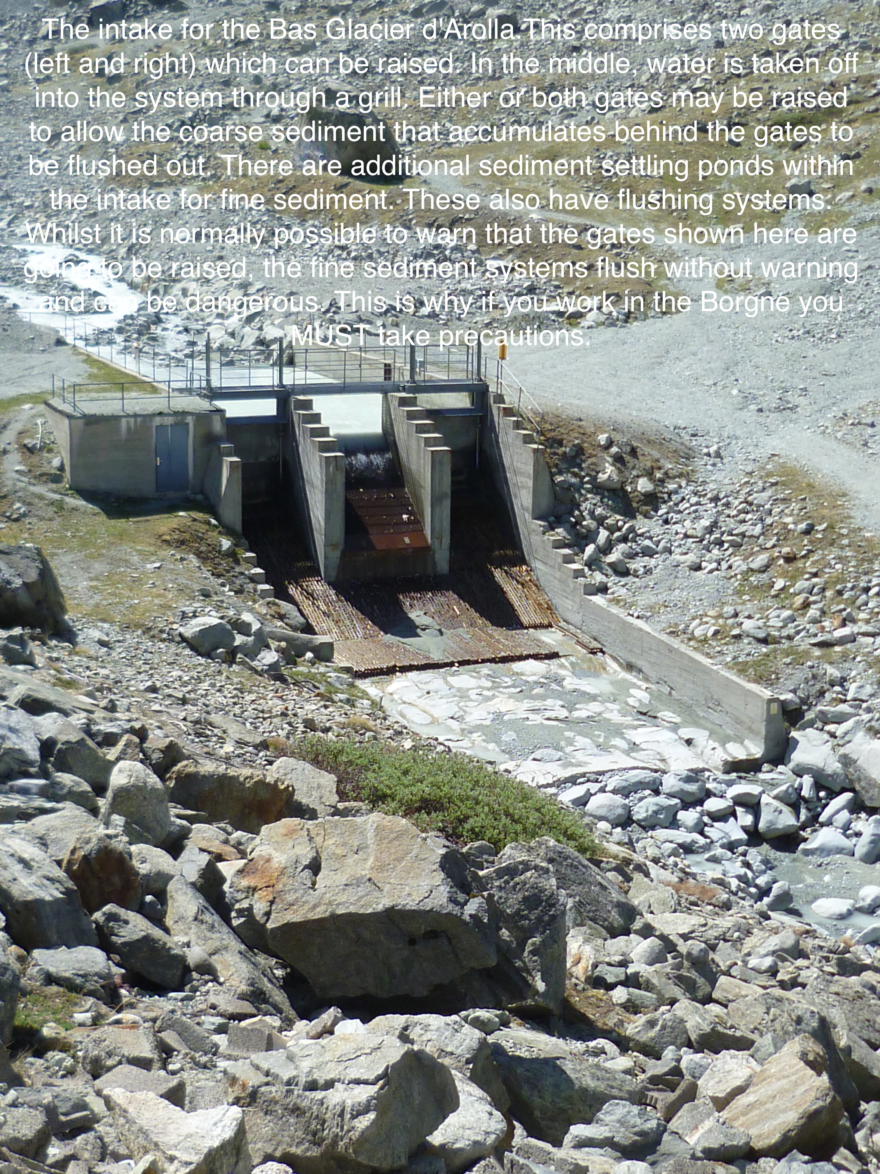 Show on map |
|
|
Swift, D. A. and Sanderson, D. C. W. and Nienow, P. W. and Bingham, R. G. and Cochrane, I. C. (2011)
Anomalous luminescence of subglacial sediment at Haut Glacier d'Arolla, Switzerland - a consequence of resetting at the glacier bed? Show on map |
|
|
Dadic, R. and Mott, R. and Lehning, M. and Burlando, P. (2010)
Wind influence on snow depth distribution and accumulation over glacier Show on map |
|
|
No authors (2009)
Bas Glacier, 2009 Show on map |
|
|
Carenzo, M. and Pellicciotti, F. and Rimkus, S. and Burlando, P. (2009)
Assessing the transferability and robustness of an enhanced temperature-index glacier melt model Show on map |
|
|
Chrystelle Gabbud (2009)
A DEM of Haut Glacier d'Arolla. 1m resolution. Show on map |
|
|
Pellicciotti, F. and Carenzo, M. and Helbing, J. and Rimkus, S. and Burlando, P. (2009)
On the role of subsurface heat conduction in glacier energy-balance modelling Show on map |
|
|
Sébastien Ruttimann (2009)
Glacier de Cheilon, september 2009  Show on map |
|
|
Sébastien Ruttimann (2009)
Grande Dixence dam  Show on map |
|
|
Sébastien Ruttimann (2009)
Grande Dixence dam  Show on map |
|
|
Sébastien Ruttimann (2009)
Aiguilles Rouges d'Arolla from eastern side, october 2009  Show on map |
|
|
Sébastien Ruttimann (2009)
Aiguille de la Tsa and moraines complex - october 2009  Show on map |
|
|
Sébastien Ruttimann (2009)
Glacier de Cheilon, september 2009  Show on map |
|
|
Sébastien Ruttimann (2009)
Interior of the Grande Dixence dam  Show on map |
|
|
Sébastien Ruttimann (2009)
Interior of the Grande Dixence dam 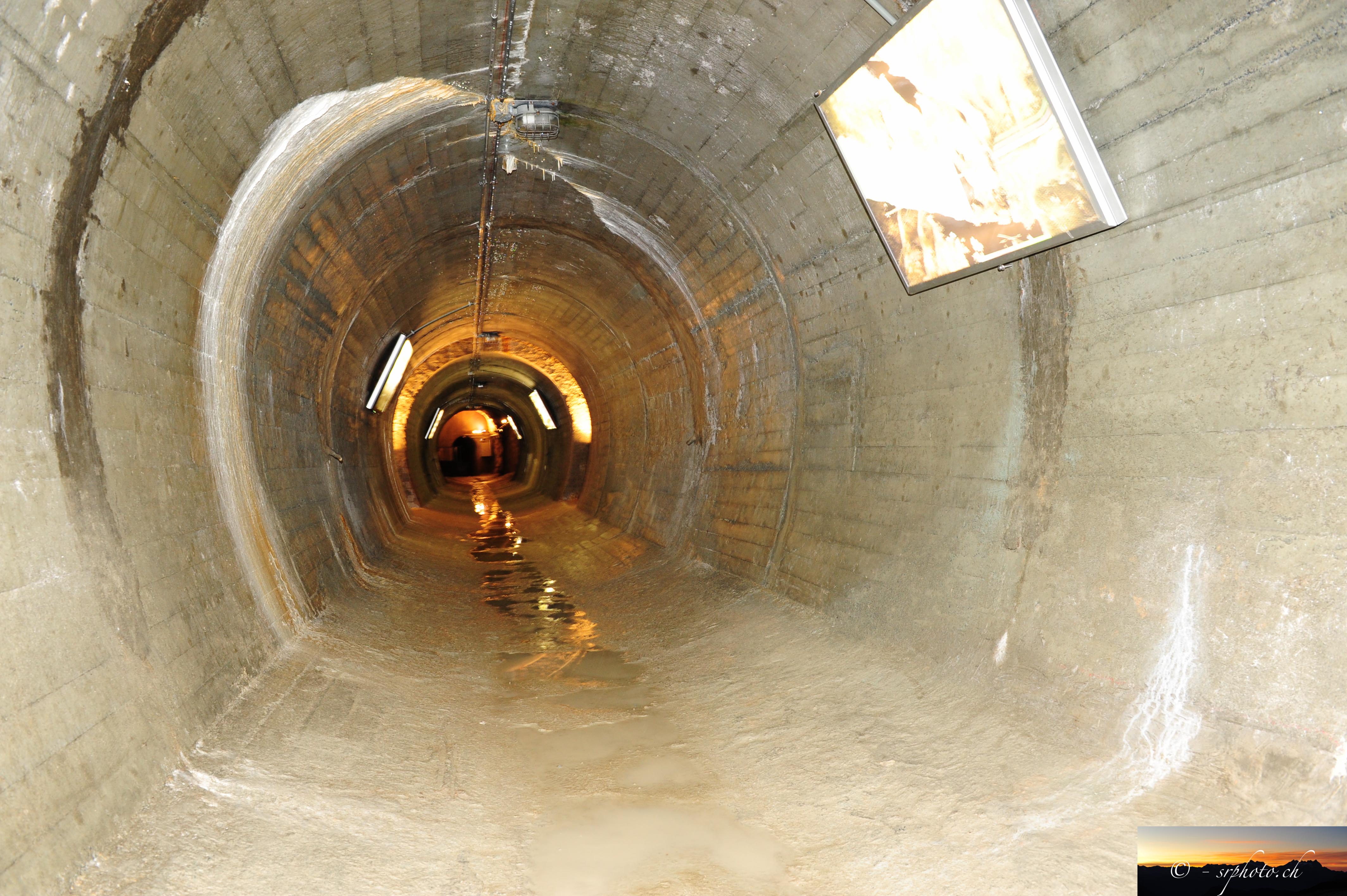 Show on map |
|
|
Sébastien Ruttimann (2009)
Interior of the Grande Dixence dam 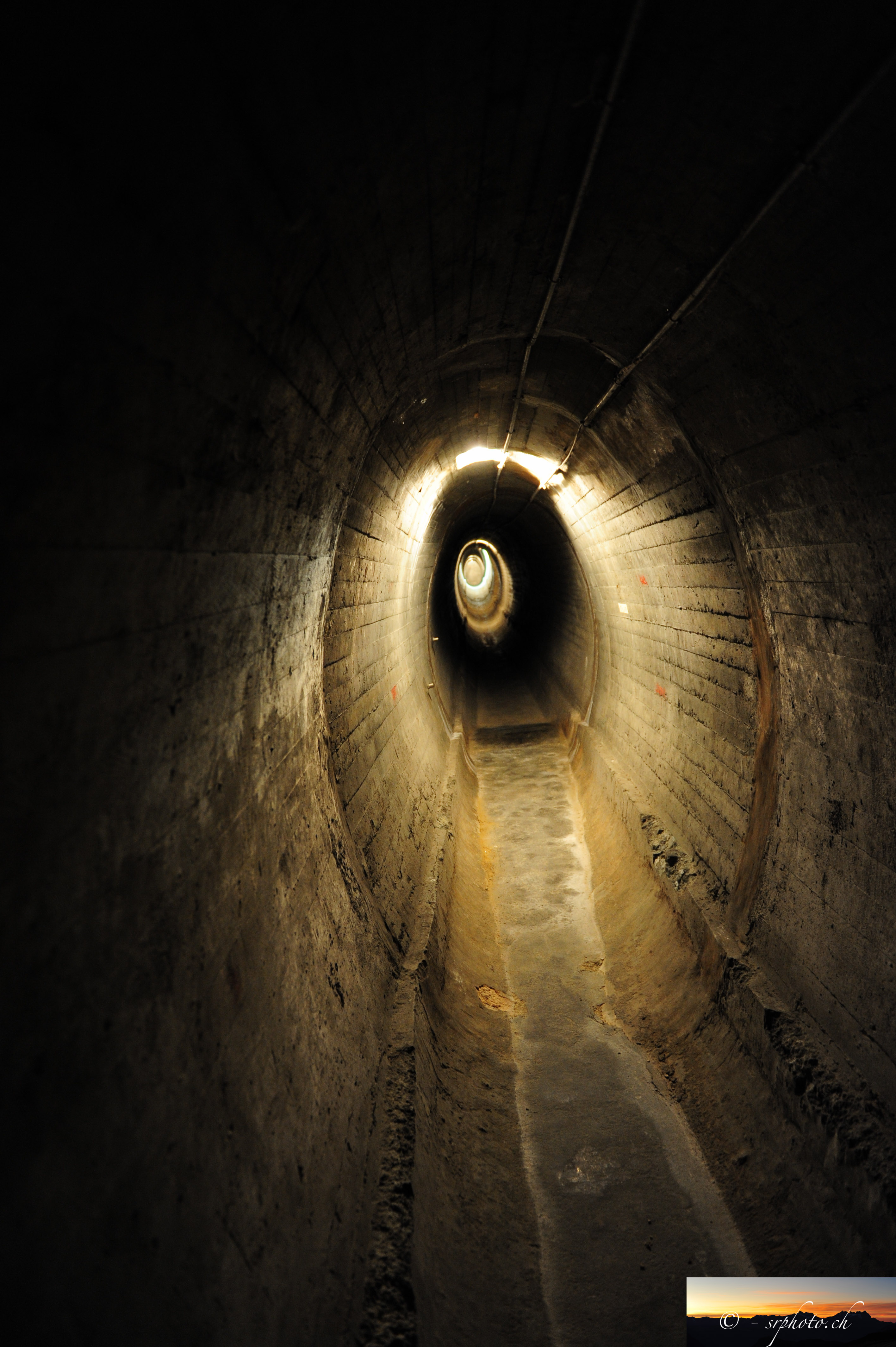 Show on map |
|
|
Sébastien Ruttimann (2009)
Interior of the Grande Dixence dam 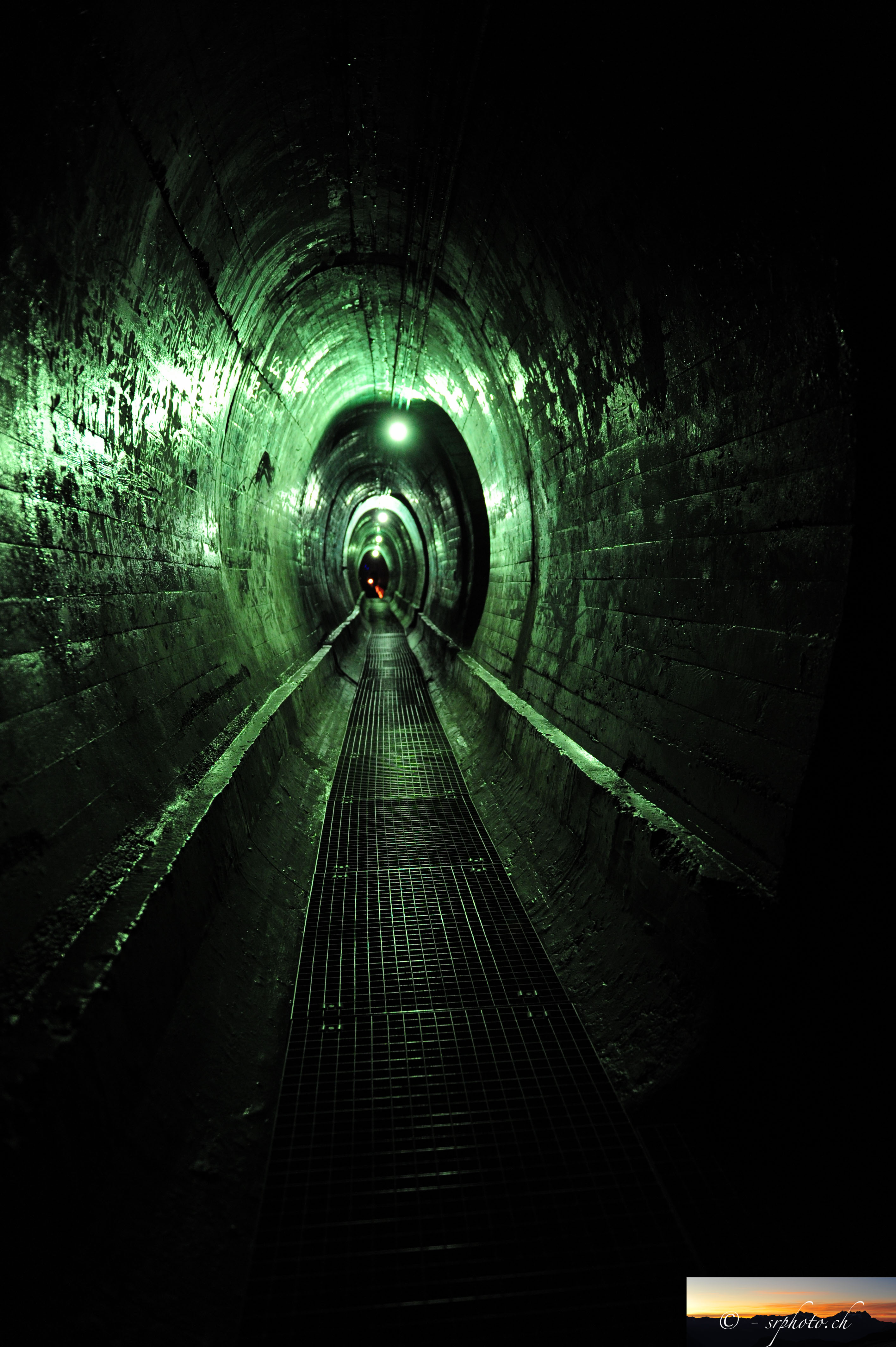 Show on map |
|
|
Sébastien Ruttimann (2009)
Glacier de Pièces - August 2009 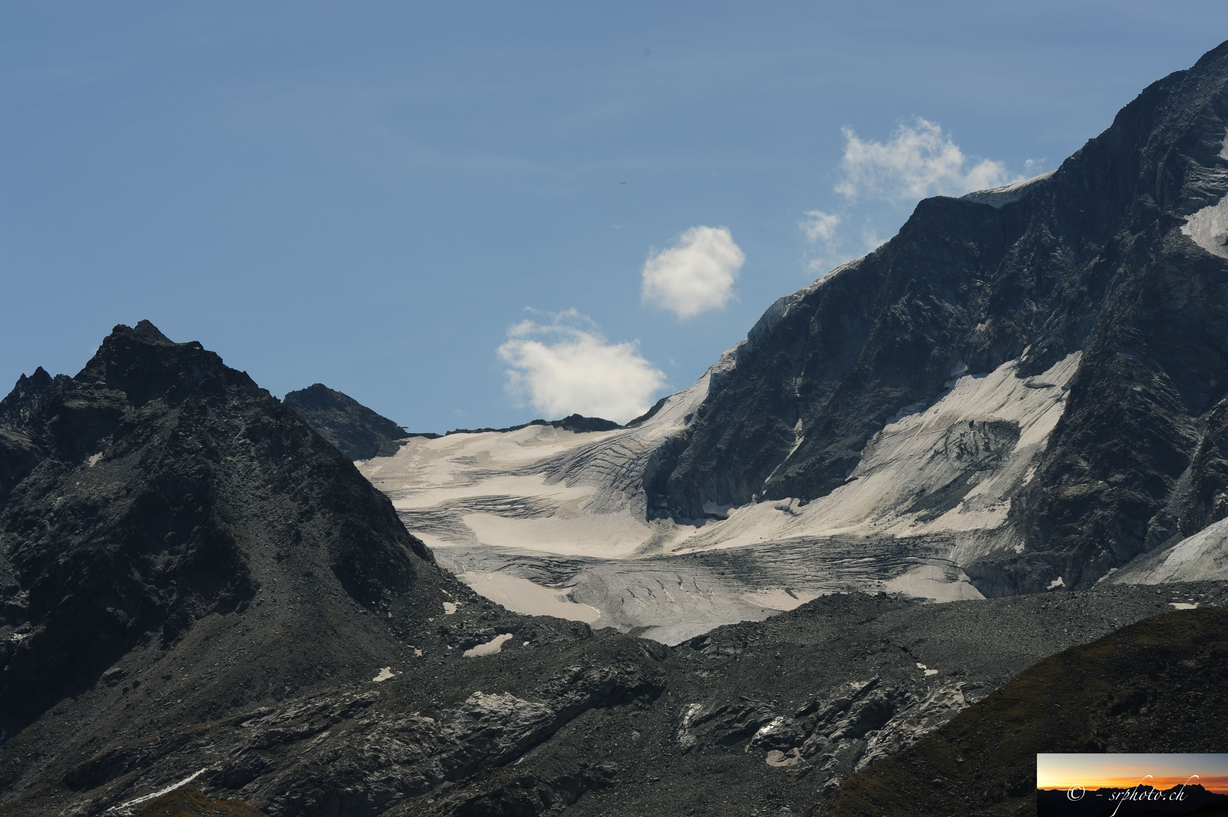 Show on map |
|
|
Sébastien Ruttimann (2009)
Tsijiore Nouve glacier in August 2009  Show on map |
|
|
Bohorquez, P. and Darby, S. E. (2008)
The use of one- and two-dimensional hydraulic modelling to reconstruct a glacial outbust flood in a steep Alpine valley Show on map |
|
|
Dadic, R. and Corripio, J. G. and Burlando, P. (2008)
Mass-balance estimates for Haut Glacier d'Arolla, Switzerland, from 2000 to 2006 using DEMs and distributed mass-balance modeling Show on map |
|
|
Delaloye, R. and Perruchoud, E. and Avian, M. and Kaufmann, V. and Bodin, X. and Hausmann, H. and Ikeda, A. and Kääb, A. and Kellerer-Pirklbauer, A. and Krainer, K. and Lambiel, C. and Mihajlovic, D. and Staub, B. and Roer, I. and Thibert, E. (2008)
Recent interannual variations of rockglaciers creep in the European Alps Show on map |
|
|
Delaloye, R. and Strozzi, T. and Lambiel, C. and Perruchoud, E. (2008)
Landslide-like development of rockglaciers detected with ERS-1/2 SAR interferometry Show on map |
|
|
Fox, A.M. and Willis I.C. and Arnold N.S. (2008)
Modification and testing of a one-dimensional energy and mass balance model for supraglacial snowpacks Show on map |
|
|
Lambiel, C. and Delaloye, R. and Strozzi, T. and Lugon, R. and Raetzo, H. (2008)
ERS InSAR for assessing rock glacier activity Show on map |
|
|
Mair, D. and Hubbard, B. and Nienow, P. and Willis, I. and Fischer, U.H. (2008)
Diurnal fluctuations in glacier ice deformation: Haut Glacier d'Arolla, Switzerland Show on map |
|
|
Mitchell, A. C. and Brown, G. H. (2008)
Modeling geochemical and biogeochemical reactions in subglacial environments Show on map |
|
|
Delaloye, R. and Lambiel, C. and Lugon, R. and Raetzo, H. and Strozzi, T. (2007)
ERS InSAR for Detecting Slope Movement in a Periglacial Mountain Environment (Western Valais Alps, Switzerland) Show on map |
|
|
Milan D.J. and Heritage G. and Hetherington D. (2007)
Application of a 3D laser scanner in the assessment of erosion and deposition volumes and channel change in a proglacial river Show on map |
|
|
Mitchell, A. C. and Brown, G. H. (2007)
Diurnal hydrological - physicochemical controls and sampling mehods for minor and trace elements in an Alpine glacial hydrological system Show on map |
|
|
Brock, B.W. and Willis, I.C. and Sharp, M.J. (2006)
Measurement and parameterization of aerodynamic roughness length variations at Haut Glacier d'Arolla, Switzerlan Show on map |
|
|
Campbell, F. M. A. and Nienow P. W. and Purves, R. S. (2006)
Role of supracglacial snowpack in mediating meltwater delivery to the glacier system as inferred from dye tracer investigations Show on map |
|
|
Kulessa, B. and Hubbard, B. and Brown, G. H. (2006)
Time-lapse imaging of subglacial drainage conditions using three-dimensional inversion of borehole electrical resistivity data Show on map |
|
|
Lambiel, C (2006)
Le pergélisol dans les terrains sédimentaires à forte déclivité: distribution, régime thermique et instabilités Show on map |
|
|
Mitchell, A. C. and Brown, G. H. and Fuge, R. (2006)
Minor and trace elements as indicators of solute provenance and flow routing in a subglacial hydrological system Show on map |
|
|
A. Bezinge (2005)
Front of the Tsijiore Nouve in may 2005  Show on map |
|
|
A. Bezinge (2005)
Tsijiore Nouve - Front in september 2005  Show on map |
|
|
A. Bezinge (2005)
Bas Glacier d'Arolla august 2005  Show on map |
|
|
A. Bezinge (2005)
Bas Glacier d'Arolla mai 2005  Show on map |
|
|
Arnold, N. (2005)
Investigating the sensitivity of glacier mass-balance/elevation profiles to changing meteorological conditions: Model experiments for haut glacier D'Arolla, Valais, Switzerland Show on map |
|
|
Chrystelle Gabbud (2005)
DEM 1m Haut Glacier d'Arolla 2005 Show on map |
|
|
Delaloye, R. and Lambiel, C. (2005)
Evidences of winter ascending air circulation in talus slopes situated near the lower limit of alpine discontinuous permafrost (Swiss Alps). Show on map |
|
|
Goodsell, B. and Hambrey, M. J. and Glasser, N. F. (2005)
Debris transport in a temperate valley glacier: Haut Glacier d'Arolla, Valais, Switzerland Show on map |
|
|
Goodsell, B. and Hambrey, M. J. and Glasser, N. F. and Nienow, P. and Mair, D. (2005)
The structural glaciology of a temperate valley glacier: Haut Glacier d'Arolla, Valais, Switzerland Show on map |
|
|
Kulessa, B. and Hubbard, B. and Williamson, M. et al. (2005)
Hydrogeological analysis of slug tests in glacier boreholes Show on map |
|
|
Nienow, P. W. and Hubbard, A. L. and Hubbard, B. P. and Chandler, D. M. and Mair, D. W. F. and Sharp, M. J. and Willis, I. C. (2005)
Hydrological controls on diurnal ice flow variability in valley glaciers Show on map |
|
|
Pellicciotti, F. and Brock, B. and Strasser, U. and Burlando, P. and Funk, M. and Corripio, J. G. (2005)
An enhanced Temperature Index Glacier Melt Model Including the Shortwave Radiation Balance: Development and Testing for Haut Glacier d'Arolla, Switzerland Show on map |
|
|
Swift, D.A. and Nienow, P.W. and Hoey, T.B. (2005)
Basal sediment evacuation by subglacial meltwater: suspended sediment transport from Haut Glacier d'Arolla, Switzerland Show on map |
|
|
Swift, D.A. and Nienow, P.W. and Hoey, T.B. and Mair, D. W. F. (2005)
Seasonal evolution of runoff from Haut Glacierd'Arolla, Switzerland and implications for glacial geomorphic processes Show on map |
|
|
Swisstopo (2005)
Carte tectonique 1:500000 - région Arolla, géoréférencée Show on map |
|
|
Swisstopo (2005)
Carte géologique 1:500000 - région Arolla, géoréférencée Show on map |
|
|
A. Bezinge (2004)
Bas Glacier d'Arolla spring 2004  Show on map |
|
|
Brock, B.W. (2004)
An analysis of short-term albedo variations at Haut Glacier d'Arolla, Switzerland Show on map |
|
|
Strasser, U. and Corripio, J. and Pellicciotti, F. and Burlando, P. and Brock, B. and Funk, M. (2004)
Spatial and temporal variability of meteorological variables at Haut Glacier d'Arolla (Switzerland) during the ablation season 2001: Measurements and simulations Show on map |
|
|
No authors (2003)
Bas Glacier, 2003 Show on map |
|
|
A. Bezinge (2003)
Bas Glacier d'Arolla. Two pictures at unknown date, probably around 2003  Show on map |
|
|
Cudden, J.R. and Hoey, T.B. (2003)
The causes of bedload pulses in a gravel channel: The implications of bedload grain-size distributions Show on map |
|
|
Kulessa, B. and Hubbard, B. and Brown, G. H. (2003)
Cross-coupled flow modeling of coincident streaming and electrochemical potentials and application to subglacial self-potential data Show on map |
|
|
Kulessa, B. and Hubbard, B. and Brown, G. H. et al. (2003)
Earth tide forcing of glacier drainage Show on map |
|
|
Mair, D. and Willis, I. and Fischer, U. H. and Hubbard, B. and Nienow, P. and Hubbard, A. (2003)
Hydrological controls on patterns of surface, internal and basal motion during three "spring events": Haut Glacier d'Arolla, Switzerland Show on map |
|
|
Willis, I. and Mair, D. and Hubbard, B. and Nienow P. and Fischer, U. and Hubbard, A. (2003)
Seasonal variations in ice deformation and basal motion across the tongue of Haut Glacier d'Arolla, Switzerland Show on map |
|
|
A. Bezinge (2002)
Front of the Tsijiore-Nouve in 2002  Show on map |
|
|
Bottrell, S. H. and Tranter, M. (2002)
Sulphide oxidation under partially anoxic conditions at the bed of the Haut Glacier d'Arolla, Switzerland Show on map |
|
|
Goodsell, B. and Hambrey, M.J. and Glasser, N.F. (2002)
Formation of band ogives and associated structures at Bas Glacier d'Arolla, Valais, Switzerland Show on map |
|
|
Mair, D. and Nienow, P. and Sharp, M. and Wohlleben, T. and Willis, I. (2002)
Influence of subglacial drainage system evolution on glacier surface motion: Haut Glacier d'Arolla, Switzerland Show on map |
|
|
Mair, D.W.F. and Sharp, M.J. and Willis, I.C. (2002)
Evidence for basal cavity opening from analysis of surface uplift during a high-velocity event: Haut Glacier d'Arolla, Switzerland Show on map |
|
|
Swift, D.A. and Nienow, P.W. and Spedding, N. and Hoey, B.H. (2002)
Geomorphic implications of subglacial drainage configuration: rates of basal sediment evacuation controlled by seasonal drainage system evolution Show on map |
|
|
Tranter, M. and Sharp, M.J. and Lamb, H.R. and Brown, G. H. and Hubbard, B. P. and Willis, I. C. (2002)
Geochemical weathering at the bed of Haut Glacier d’Arolla, Switzerland—a new model Show on map |
|
|
Willis, I.C. and Arnold, N.S. and Brock, B.W. (2002)
Effect of snowpack removal on energy balance, melt and runoff in a small supraglacial catchment Show on map |
|
|
A. Bezinge (2001)
Glaciers de Ferpècle: historique et phénomènes récents Show on map |
|
|
Brown, G. H. and Hubbard, B. and Seagren, A.G. (2001)
Modelled solute acquisition from suspended sediment in a theoretical 4-cell subglacial hydrological system Show on map |
|
|
Brown, G. H. and Hubbard, B. and Seagren, A.G. (2001)
Kinetics of solute acquisition from the dissolution of suspended sediment in subglacial channels Show on map |
|
|
Gordon, S. and Sharp, M. and Hubbard, B. and Willis, I. and Smart, C. and Copland, C. and Harbor, J. and Ketterling, B. (2001)
Borehole drainage and its implications for the investigation of glacier hydrology: experiences from Haut Glacier d'Arolla, Switzerland Show on map |
|
|
Mair, D. and Nienow, P. and Willis, I. and Sharp, M. (2001)
Spatial patterns of glacier motion during a high-velocity event: Haut Glacier d'Arolla, Switzerland Show on map |
|
|
Mitchell, A. C. and Brown, G. H. and Fuge, R. (2001)
Temporal Variations in the Minor and Trace Element Chemistry of Meltwaters Draining Haut Glacier d’Arolla, Switzerland: Implications for Downstream Water Quality Show on map |
|
|
Mitchell, A. C. and Brown, G. H. and Fuge, R. (2001)
Minor and trace elements export from a glacierized Alpine headwater catchment (Haut Glacier d'Arolla, Switzerland) Show on map |
|
|
A. Bezinge (2000)
Ferpècle Lake, october 2000 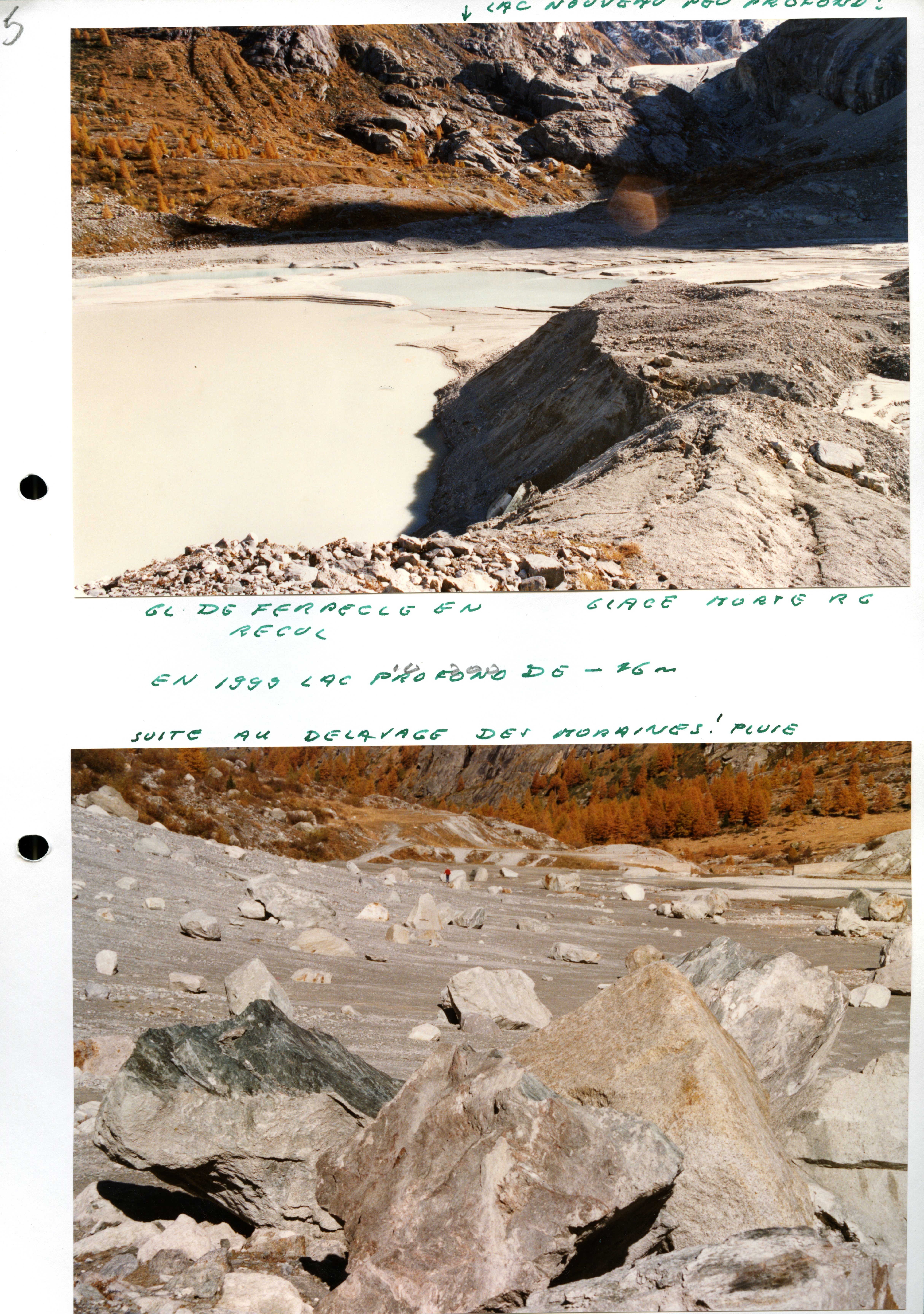 Show on map |
|
|
A. Bezinge (2000)
Glaciers de Ferpècle: historique et phénomènes récents Show on map |
|
|
A. Bezinge (2000)
Frontal moraine of Ferpècle Glacier and pioneer vegetation, october 2000 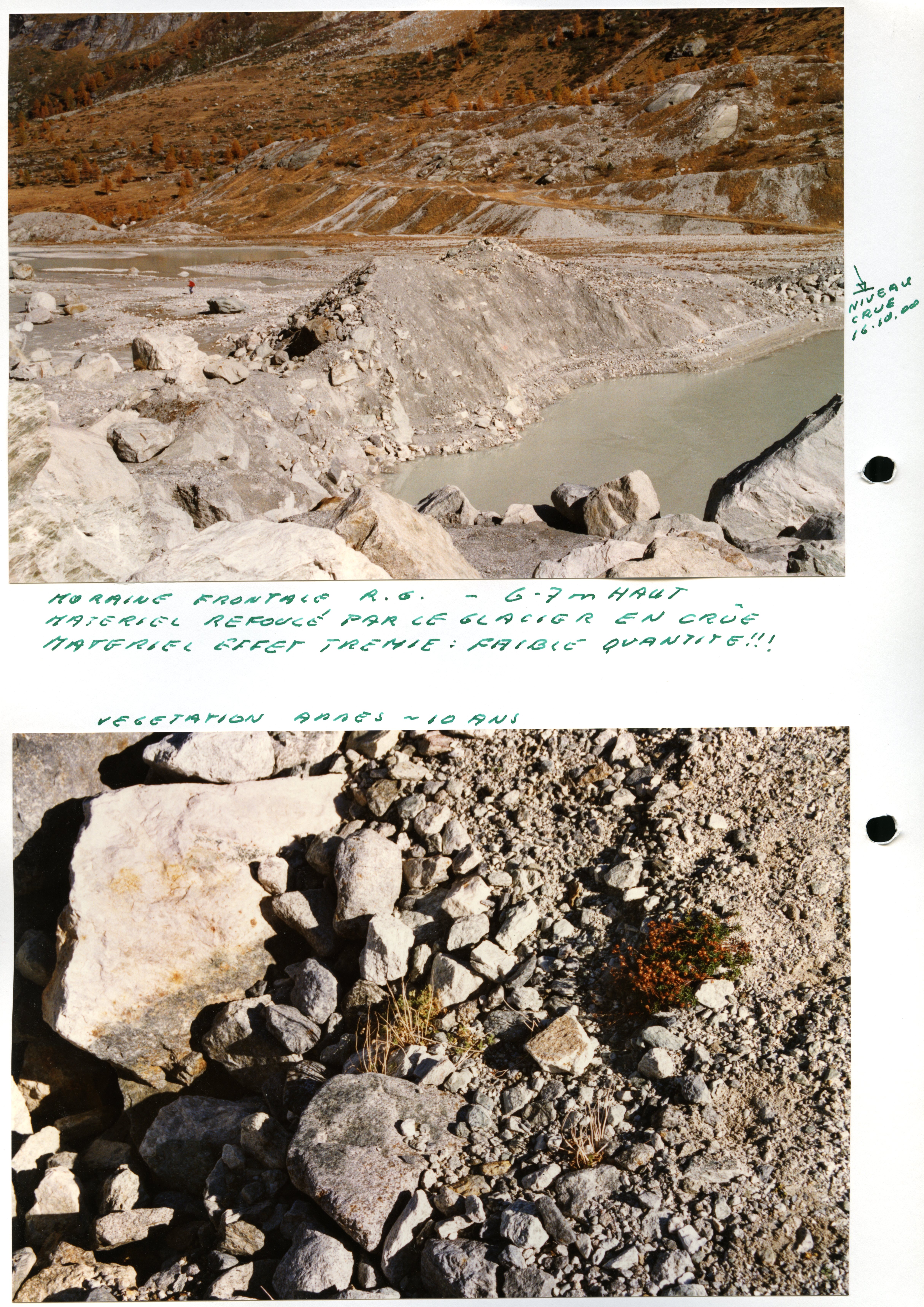 Show on map |
|
|
A. Bezinge (2000)
Mont Miné Glacier 1840's moraines  Show on map |
|
|
Brock, B.W. and Arnold, N.S. (2000)
A spreadsheet-based (Microsoft Excel) point surface energy balance model for glacier and snow melt studies Show on map |
|
|
Brock, B.W. and Willis, I.C. and Sharp, M.J. (2000)
Measurement and parameterization of albedo variations at Haut Glacier d'Arolla, Switzerland Show on map |
|
|
Brock, B.W. and Willis ,I.C. and Sharp, M.J. and Arnold, N.S. (2000)
Modelling seasonal and spatial variations in the surface energy balance of Haut Glacier d'Arolla, Switzerland Show on map |
|
|
Hubbard, A. (2000)
The verification and significance of three approaches to longitudinal stresses in high-resolution models of glacier flow Show on map |
|
|
Hubbard, A. and Willis, I. and Sharp, M. and Mair, D. and Nienow, P. and Hubbard, B. and Blatter, H. (2000)
Glacier mass-balance determination by remote sensing and high-resolution modelling Show on map |
|
|
Norbert Wicky (2000)
Sérac dynamité Show on map |
|
|
A. Bezinge (1999)
Seracs of Ferpècle Glacier, november 1999  Show on map |
|
|
A. Bezinge (1999)
Mont Miné Glacier lake and frontal moraines, november 1999 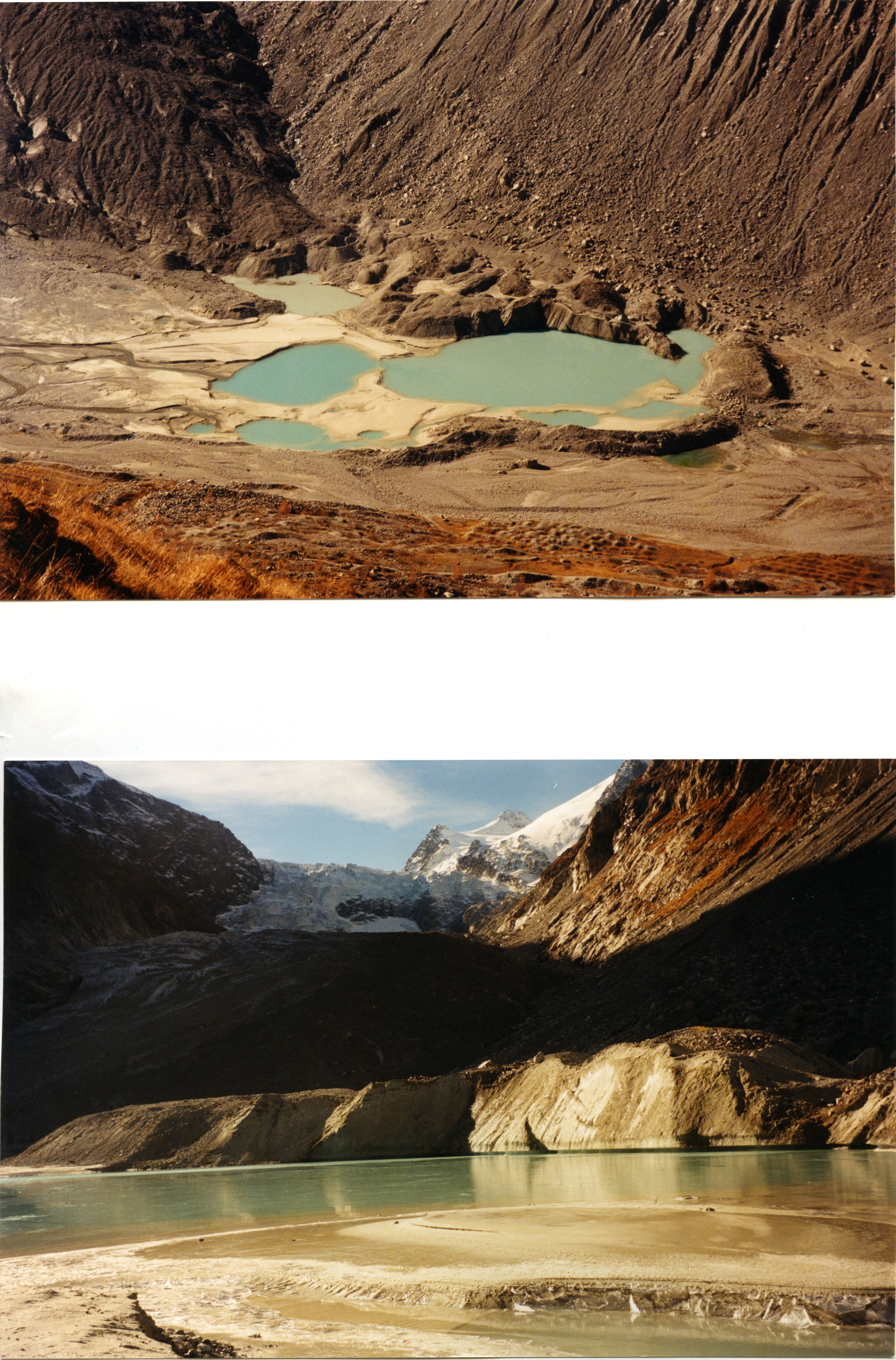 Show on map |
|
|
A. Bezinge (1999)
Mont Miné Glacier lake and frontal moraines, november 1999 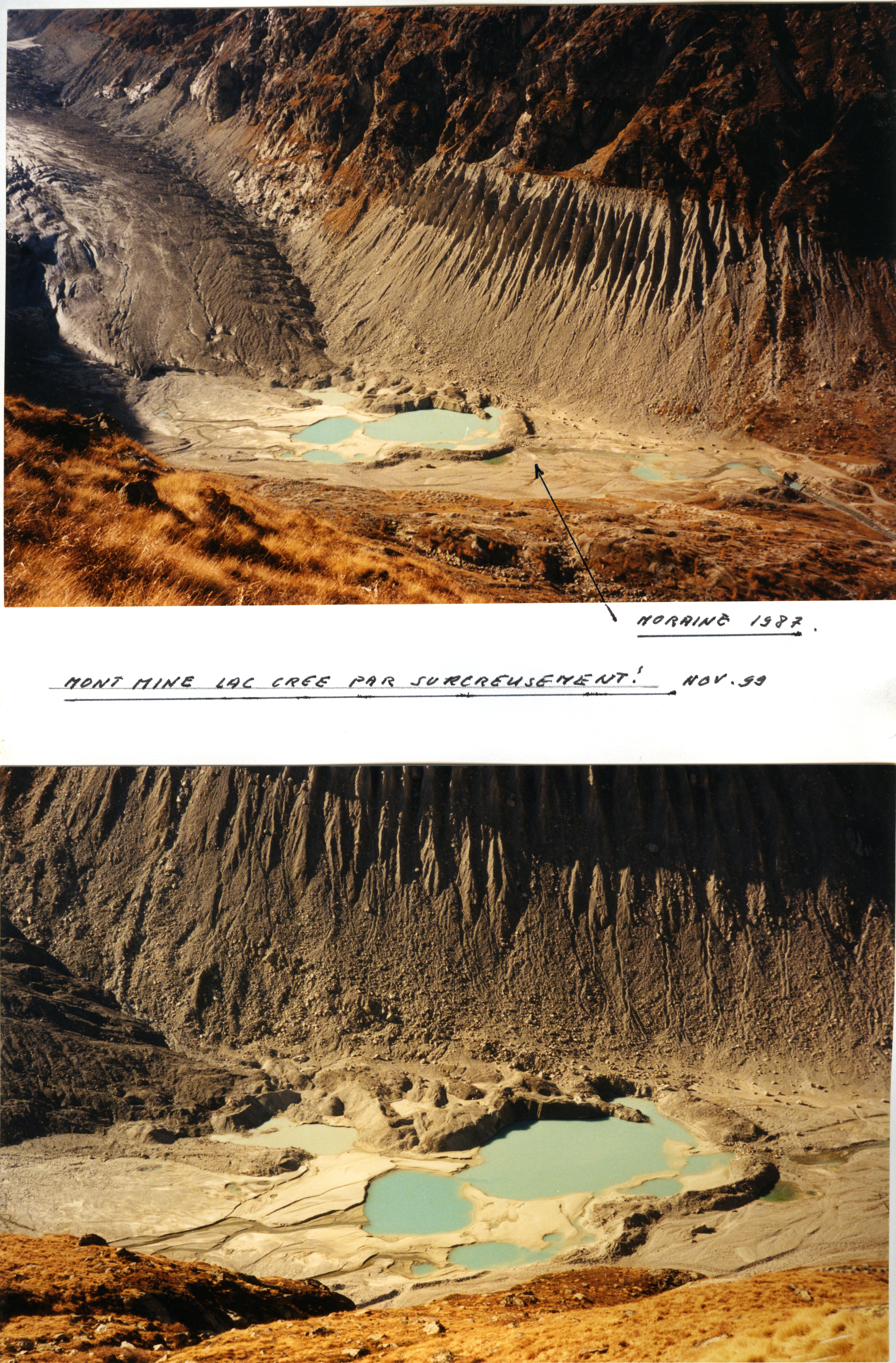 Show on map |
|
|
A. Bezinge (1999)
Mouvements du glacier du Mt Miné de 1976 à 1999 Show on map |
|
|
A. Bezinge (1999)
1840's and 1920's moraine, Ferpècle valley 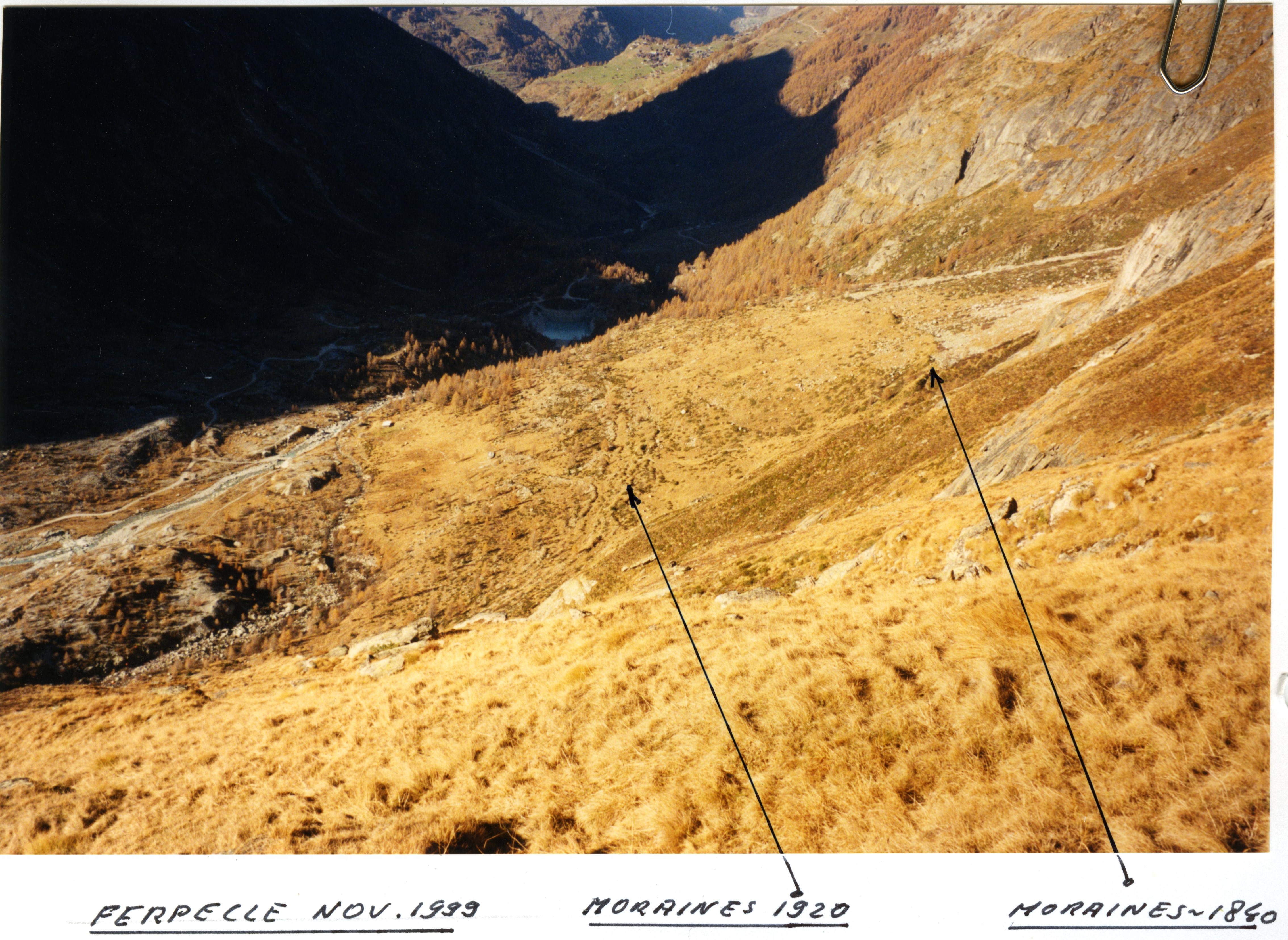 Show on map |
|
|
A. Bezinge M.J. Clark, A.M. Gurnell and J. Warburton (1999)
The management of sediment transported by glacial meltwater streams and its significance for the estimation of sediment yield Show on map |
|
|
Fischer, U.H. and Hubbard, B. (1999)
Subglacial sediment textures: character and evolution at Haut Glacier d'Arolla, Switzerland Show on map |
|
|
Knap, W.H. and Brock, B.W. and Oerlemans, J and Willis, I.C. (1999)
Comparison of Landsat TM-derived and ground-based albedos of Haut Glacier d'Arolla, Switzerland Show on map |
|
|
M. Baltasar et A. Pahud (1999)
Lac proglaciaire de Ferpècle. Etat novembre 1999 Show on map |
|
|
Monique Baltasar et André Pahud (1999)
Glacier du Mont Miné. Etat novembre 1999 Show on map |
|
|
A. Bezinge (1998)
Bas Glacier d'Arolla august 1998  Show on map |
|
|
A. Bezinge (1998)
Bas Glacier d'Arolla mai 1998 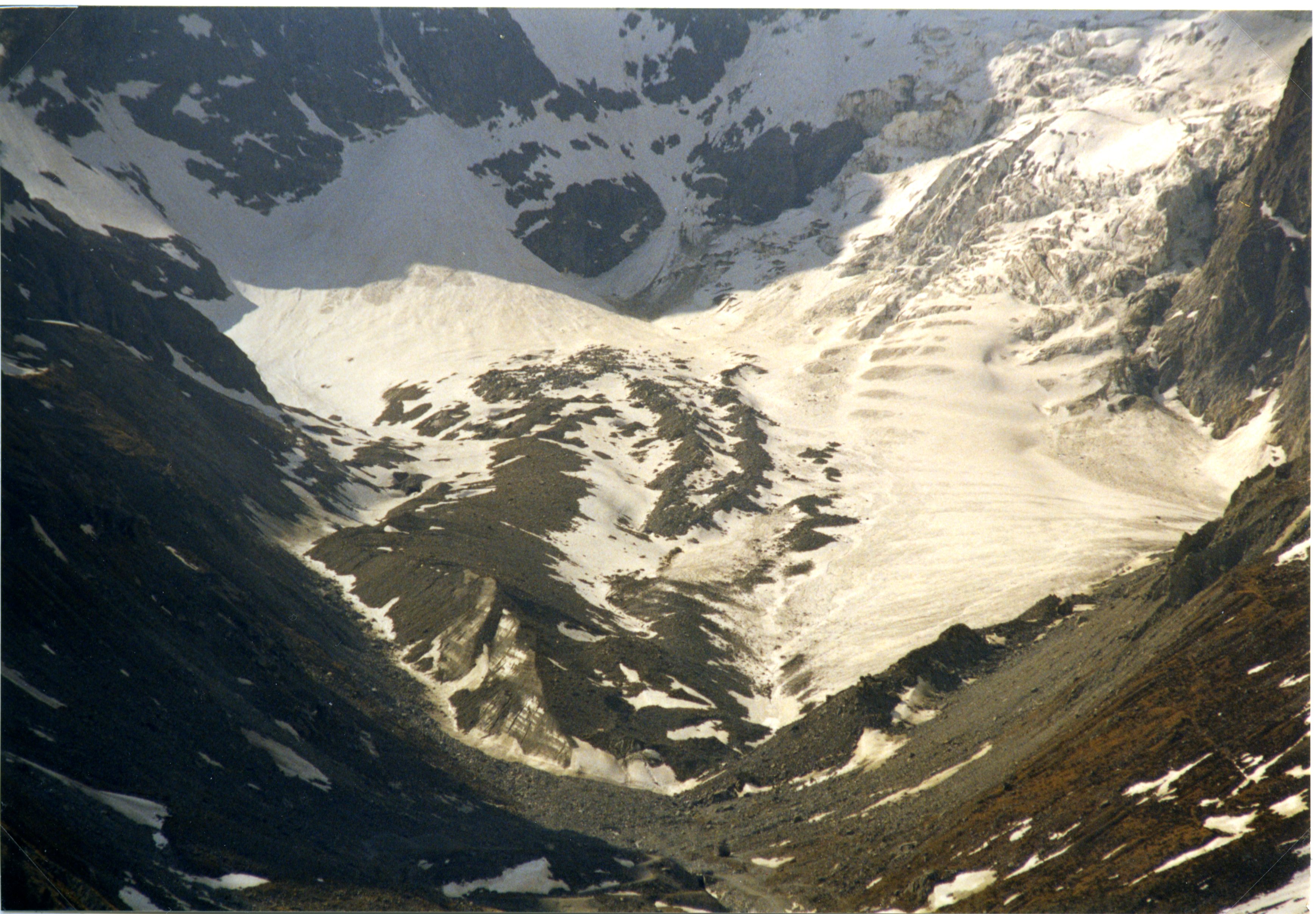 Show on map |
|
|
Arnold, N. and Richards, K. and Willis, I. and Sharp, M. (1998)
Initial results from a distributed, physically based model of glacier hydrology Show on map |
|
|
Biron, P.M. and Lane, S.N. and Roy, A.G. and Bradbrook, K.F. and Richards, K.S. (1998)
Sensitivity of bed shear stress estimated from vertical velocity profiles: the problem of sampling resolution Show on map |
|
|
Gordon, S. and Sharp, M. and Hubbard, B. and Willis, I. and Smart, C. and Ketterling, B. and Willis, I. (1998)
Seasonal reorganization of subglacial drainage inferred from measurements in boreholes Show on map |
|
|
Hubbard, A., Blatter, H., Nienow, P. Mair, D. and Hubbard, B. (1998)
Comparison of a three-dimensional model for glacier flow with field data from Haut Glacier d'Arolla, Switzerland Show on map |
|
|
Lane, S.N. and Biron, P.M. and Bradbrook, K.F. and Butler, J.B. and Chandler, J.H. and Crowell, M.D. and McLelland, S.J. and Richards, K.S. and Roy, A.G. (1998)
Three-dimensional measurements of river channel flow processes using acoustic doppler velocimetry Show on map |
|
|
Lane, S.N. and Richards, K.S. (1998)
High resolution, two-dimensional spatial modelling of flow processes in a multi-thread channel Show on map |
|
|
Nienow, P. W. and Sharp, M. and Willis, I. C. (1998)
Seasonal changes in the morphology of the subglacial drainage system, Haut Glacier d'Arolla, Switzerland Show on map |
|
|
No authors (1997)
Bas Glacier, 1997 Show on map |
|
|
A. Bezinge (1997)
Mont Miné Glacier, 1997 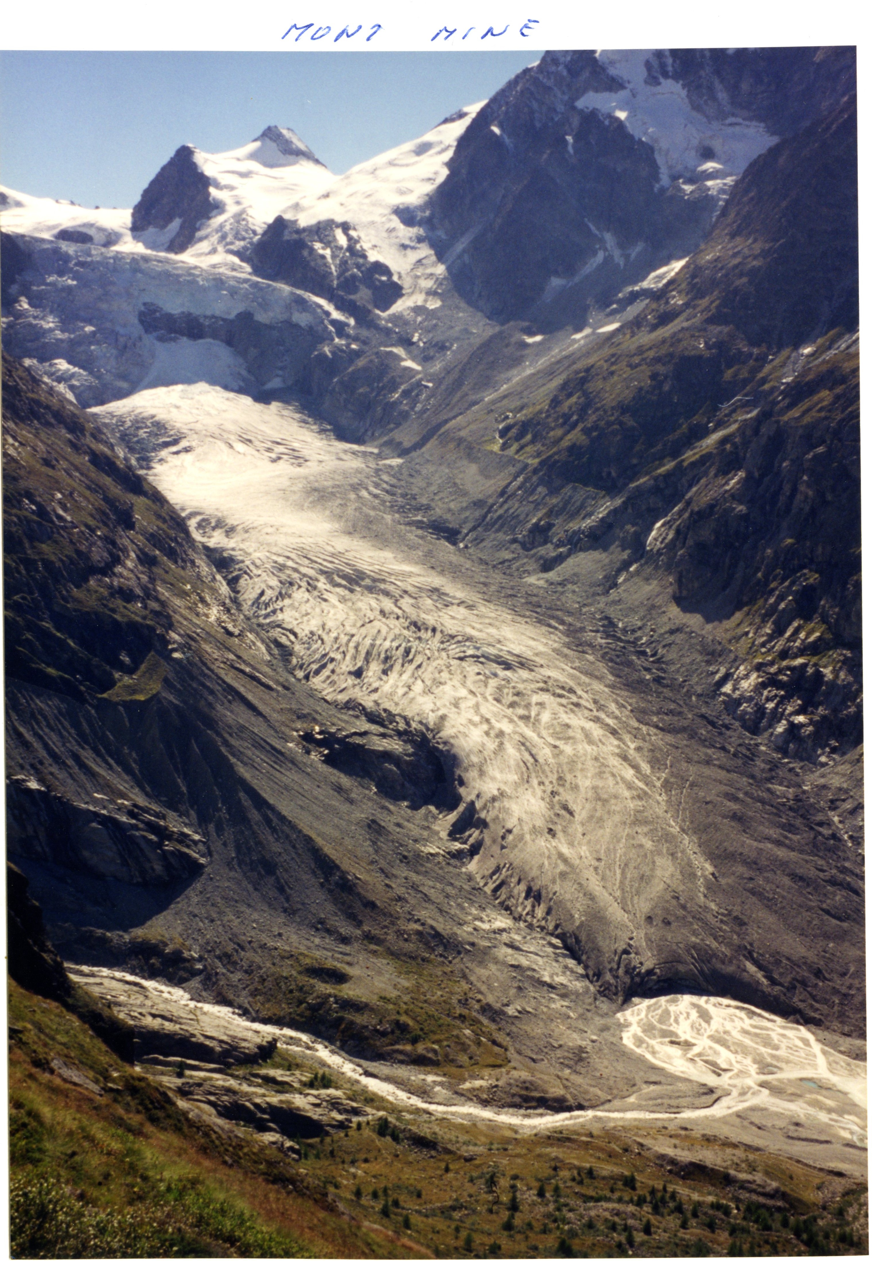 Show on map |
|
|
A. Bezinge (1997)
Bas Glacier d'Arolla 1997  Show on map |
|
|
Copland, L. and Harbor, J. and Gordon, S. and Sharp, M. (1997)
The use of borehole video in investigating the hydrology of a temperate glacier Show on map |
|
|
Copland, L. and Harbor, J. and Sharp, M. (1997)
Borehole video investigations of englacial and basal ice conditions in a temperate valley glacier Show on map |
|
|
Harbor, J. and Sharp, M. and Copland, L. and Hubbard, B. and Nienow, P. and Mair, D. (1997)
Influence of subglacial drainage conditions on the velocity distribution within a glacier cross section Show on map |
|
|
Hubbard, B. and Nienow, P. (1997)
Alpine subglacial hydrology Show on map |
|
|
Kulessa, B. and Hubbard, B. (1997)
Interpretation of borehole impulse tests at Haut Glacier d'Arolla, Switzerland Show on map |
|
|
Lane, S.N. (1997)
The reconstruction of bed material yield and supply histories in gravel-bed streams Show on map |
|
|
Lane, S.N. and Richards, K.S. (1997)
Linking river channel form and process: time, space and causality revisited Show on map |
|
|
Tranter, M. and Sharp, M. J. and Brown, G. H. and Willis, I. C. and Hubbard, B. P. and Nielsen, M. K. and Smart, C. C. and Gordon, S. and Tulley, M. and Lamb, H. R (1997)
Variability in the chemical composition of in situ subglacial meltwaters Show on map |
|
|
A. Bezinge (1996)
Ferpècle Glacier, july 1996  Show on map |
|
|
Arnold, N.S. and Willis, I.C. and Sharp, M.J. and Richards, K.S. and Lawson, W.J. (1996)
A distributed surface energy-balance model for a small valley glacier .1. Development and testing for Haut Glacier d'Arolla, Valais Switzerland Show on map |
|
|
Brown, G. H. and Tranter, M. and Sharp, M.J. (1996)
Experimental investigations of the weathering of suspended sediment by Alpine glacial meltwater Show on map |
|
|
Chandler, J.H. and Lane, S.N. and Richards, K.S. (1996)
The determination of water surface morphology at river channel confluences using automated digital photogrammetry and their consequent use in numerical flow modelling Show on map |
|
|
Lane, S.N. and Richards, K.S. and Chandler, J.H. (1996)
Discharge and sediment supply controls on erosion and deposition in a dynamic alluvial channel Show on map |
|
|
Nienow, P.W. and Sharp, M. and Willis, I. (1996)
Velocity-discharge relationships derived from dye-tracer experiments in glacial meltwaters: implications for subglacial flow conditions Show on map |
|
|
Nienow, P. W. and Sharp, M. and Willis, I. C. (1996)
Sampling-rate effects on the properties of dye breakthrough curves from glaciers Show on map |
|
|
Nienow, P. W. and Sharp, M. and Willis, I. C. (1996)
Temporal switching between englacial and subglacial drainage pathways: Dye tracer evidence from the Haut Glacier d'Arolla, Switzerland Show on map |
|
|
Richards, K. and Sharp, M. and Arnold, N. and Gurnell, A. and Clark, M. and Tranter, M and Nienow, P and Brown, G. and Willis, I. and Lawson, W. (1996)
An integrated approach to modelling hydrology and water quality in glacierized catchments Show on map |
|
|
Tranter, M. and Brown, G. H. and Hodson, A. J. and Gurnell, A. M. (1996)
Hydrochemistry as an indicator of subglacial drainage system structure: A comparison of Alpine and sub-polar environments Show on map |
|
|
Clifford, N.J. and Richards, K.S. and Brown, R.A. and Lane, S.N. (1995)
Scales of Variation of Suspended Sediment Concentration and Turbidity in a Glacial Meltwater Stream Show on map |
|
|
Clifford, N.J. and Richards, K.S. and Brown, R.A. and Lane, S.N. (1995)
Laboratory and field assessment of an infrared turbidity probe and its response to particle size and variation in suspended sediment concentration Show on map |
|
|
HUBBARD, B.P. and SHARP, M.J. and WILLIS, I.C. and NIELSEN, M.K. and SMART, C.C. (1995)
Borehole water-level variations and the structure of the subglacial hydrological system of Haut Glacier d'Arolla, Valais, Switzerland Show on map |
|
|
Lane, S.N. (1995)
The dynamics of dynamic alluvial channels Show on map |
|
|
Lane, S.N. and Richards, K.S. and Chandler, J.H. (1995)
Morphological estimation of the time-integrated bedload transport rate Show on map |
|
|
McGregor, R. and Petts, G. E. and Gurnell, A. M. and Milner, A. M. (1995)
Sensitivity of alpine stream ecosystems to climate-change and human impacts Show on map |
|
|
Richards, K.S. and Arold, N. and Lane, S.N. and Chandler, J.H. Chandra, S. and Mattikalli, I. (1995)
Numerical landscapes: 'static' and 'dynamic' form-process relationships Show on map |
|
|
Sharp, M. and Brown, G. H. and Tranter, M. (1995)
Comments on the use of chemically based mixing models in glacier hydrology Show on map |
|
|
WIllis, I. and Bonvin, J.M. (1995)
Climate-change in mountain environments - hydrological and water resource implications Show on map |
|
|
A. Bezinge (1994)
Aerial picture of Ferpècle valley with Glacier du Mont Miné and Glacier de Ferpècle, 1994  Show on map |
|
|
Brown, G. H. and Sharp, M. J. and Tranter, M. and Gurnell, A. M. and Nienow, P. W. (1994)
Impact of post-mixing chemical-reactions on the major ion chemistry of bulk meltwaters draining the Haut Glacier D'Arolla, Valais, Switzerland Show on map |
|
|
Brown, G. H. and Tranter, M. and Sharp, M. J. and Davies, T. D. and Tsiouris, S. (1994)
Dissolved-oxygen variations in Alpine glacial meltwaters Show on map |
|
|
Gurnell, A. M. and Brown, G. H. and Tranter, M. (1994)
Sampling strategy to describe the temporal hydrochemical characteristics of an Alpine proglacial system Show on map |
|
|
Lane, S.N. and Chandler, J.H. and Richards, K.S. (1994)
Developments in monitoring and modelling small-scale river bed topography Show on map |
|
|
Petts, G.E. and Bickerton, M.A. (1994)
Influence of water abstraction on the macroinvertebrate community gradient within a glacial stream system: La Borgne d'Arolla, Valais, Switzerland Show on map |
|
|
Warburton, J. and Fenn, C. R. (1994)
Unusual flood events from an alpine glacier - observations and deductions on generating mechanisms Show on map |
|
|
A. Bezinge (1993)
Picture of the Bas Glacier d'Arolla and Bertol inférieur water intake in june 1993 Show on map |
|
|
A. Bezinge (1993)
Bas Glacier d'Arolla and Mont Collon, June 1993  Show on map |
|
|
A. Bezinge (1993)
Mont Miné Glacier, june 1993  Show on map |
|
|
A. Bezinge (1993)
Nye channels, Ferpècle Glacier, june 1993  Show on map |
|
|
A. Bezinge (1993)
Picture of the Bas Glacier d'Arolla in june 1993 Show on map |
|
|
A. Bezinge (1993)
Bas Glacier d'Arolla and Mont Collon, June 1993  Show on map |
|
|
A. Bezinge (1993)
Picture of La Borgne d'Arolla near Bertol inférieur water intake  Show on map |
|
|
A. Bezinge (1993)
Bas Glacier d'Arolla june 1993 - Front  Show on map |
|
|
A. Bezinge (1993)
Aerial picture of Arolla 1993  Show on map |
|
|
A. Bezinge et P. Curdy (1993)
Les Alpes pennines au temps d'hibernatus - 5350 BP Show on map |
|
|
Albert Bezinge (1993)
Bas Glacier d'Arolla, june 1993  Show on map |
|
|
Brown, G.H. and Sharp, M.J. (1993)
The use of sulfate as a tracer for the delayed flow component of alpine glacial runoff Show on map |
|
|
Energie - Environnement - Sécurité (1993)
Le projet Cleuson-Dixence Show on map |
|
|
Gurnell, A. M. (1993)
How many reservoirs - An analysis of flow recessions from a glacier basin Show on map |
|
|
Harbor, J. and Warburton, J. (1993)
Relative rates of glacial and nonglacial erosion in alpine environments Show on map |
|
|
Sharp, M. and Richards, K. and Willis, I. and Arnold, N. and Nienow, P. (1993)
Geometry, bed topography and drainage system structure of the Haut Glacier d'Arolla, Switzerland Show on map |
|
|
Tranter, M. and Brown, G. and Raiswell, R. and Sharp, M. and Gurnell, A. (1993)
A CONCEPTUAL-MODEL OF SOLUTE ACQUISITION BY ALPINE GLACIAL MELTWATERS Show on map |
|
|
Warburton, J. (1993)
Energenetics of Alpine proglacial geomorphic processes Show on map |
|
|
Warburton, J. and Beecroft, I. (1993)
Use of meltwater stream material loads in the estimation of glacial erosion rates Show on map |
|
|
A. Bezinge (1992)
Bas Glacier d'Arolla august 1992  Show on map |
|
|
A. Bezinge (1992)
Borgne d'Arolla and Bas Glacier d'Arolla october 1992  Show on map |
|
|
A. Bezinge (1992)
Evolution des fronts des glaciers de Rotfirn, Chelen, Mont Miné, Ferpècle, Turtmann, Brunegg, Tschierva et Roseg entre 1890 et 1992 Show on map |
|
|
A. Bezinge (1992)
Front of the Tsijiore-Nouve in august 1992  Show on map |
|
|
A. Bezinge (1992)
Tsijior Nouve and water intake, october 1992 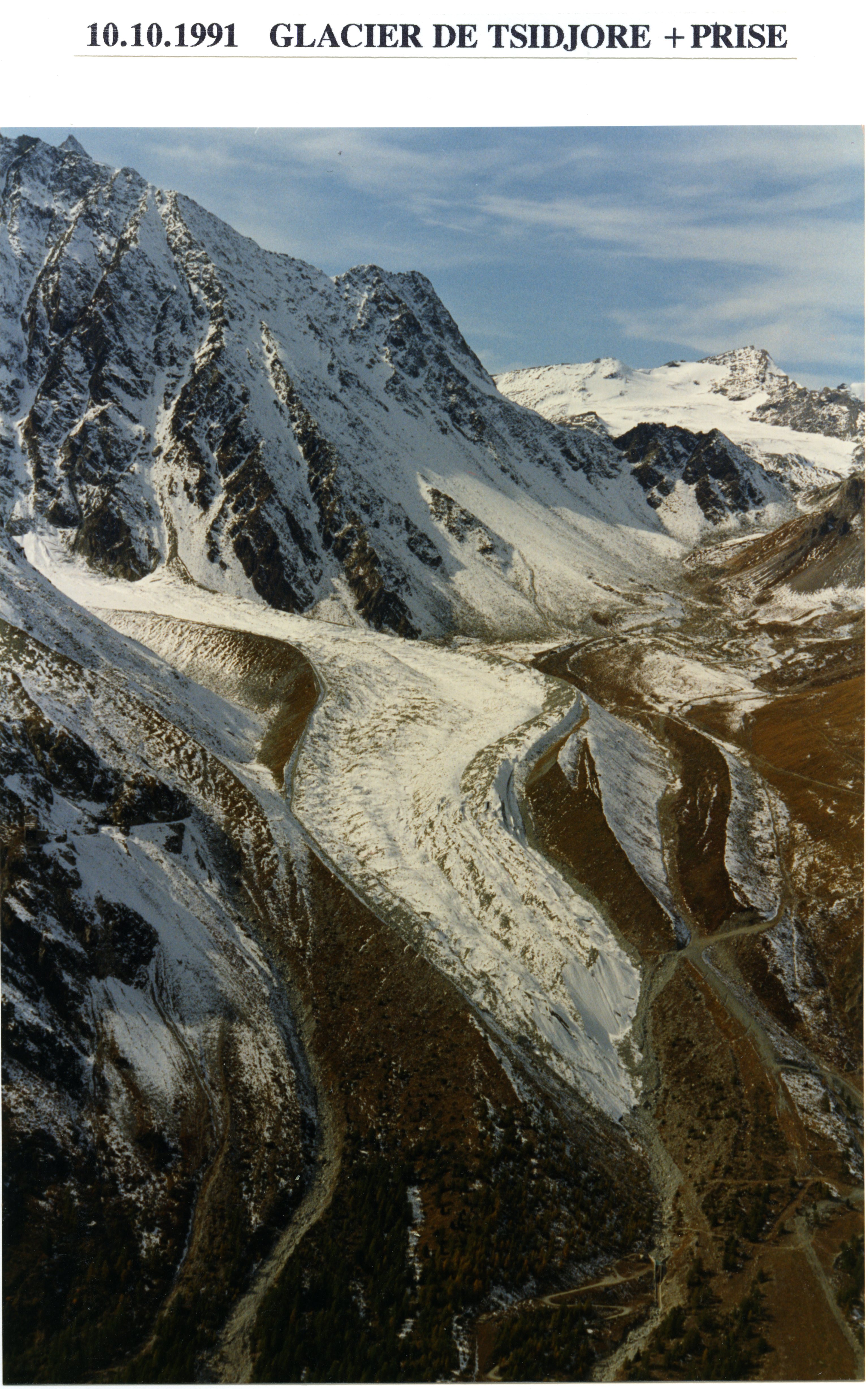 Show on map |
|
|
A. Bezinge (1992)
Glacier de type V: glaciers à séparation. Evolution des fronts Show on map |
|
|
A. Bezinge (1992)
Bas Glacier d'Arolla october 1992 - Front  Show on map |
|
|
A. Bezinge (1992)
Bertol inférieur water intake, august 1992  Show on map |
|
|
A. Bezinge (1992)
Bas Glacier d'Arolla and water intake, august 1992  Show on map |
|
|
Albert Bezinge (1992)
Subglacial channel exit 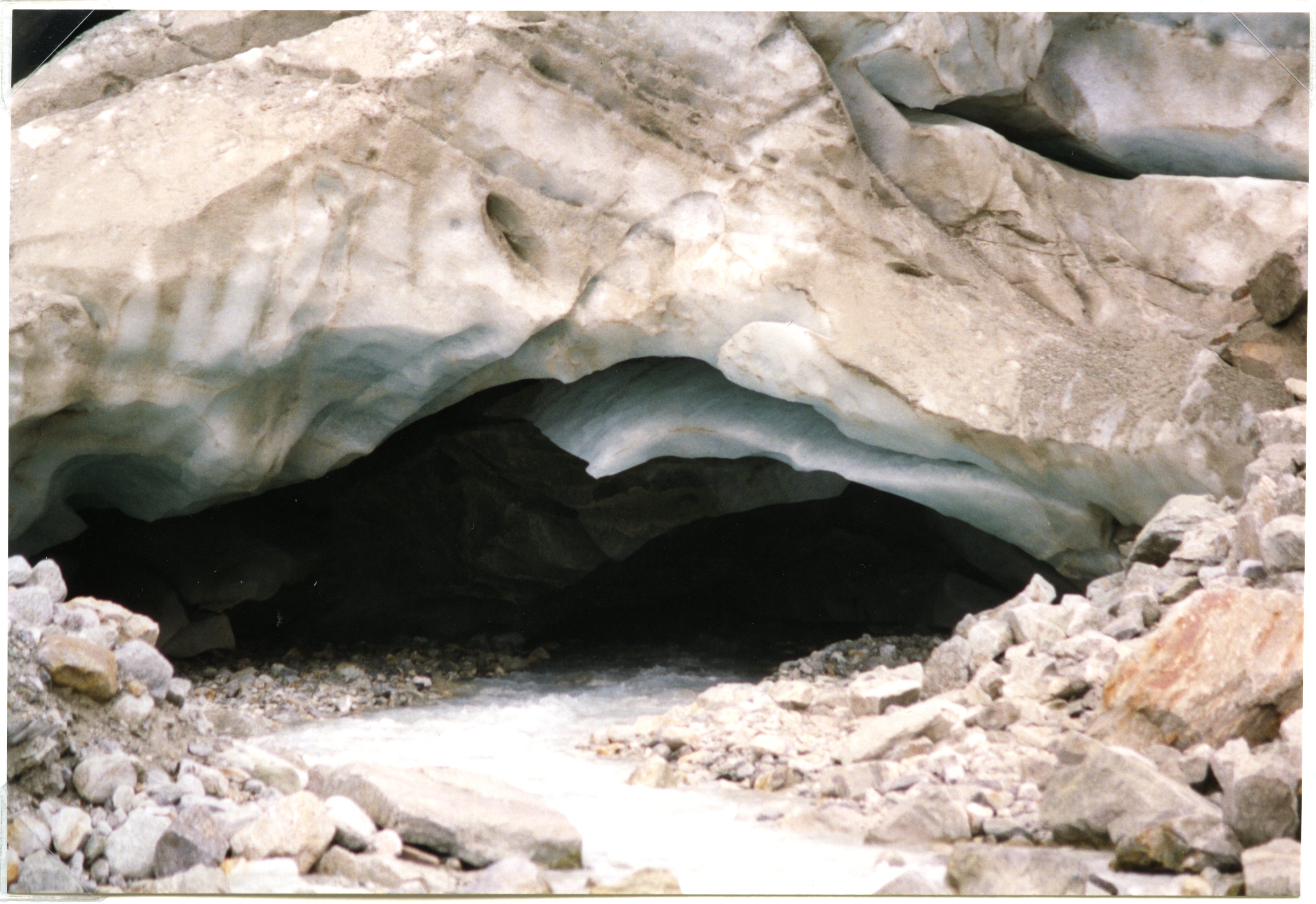 Show on map |
|
|
Albert Bezinge (1992)
Bas Glacier d'Arolla, october 1992  Show on map |
|
|
Albert Bezinge (1992)
Bas Glacier d'Arolla, august 1992  Show on map |
|
|
Emmanuelle Lathion (1992)
L'homme qui dialogue avec les glaciers. Albert Bezinge les observe depuis 40 ans. Show on map |
|
|
Gurnell, A. M. and Clark, M. J. and Hill, C. T. (1992)
Analysis and interpretation of patterns within and between hydroclimatological time-series in an alpine glacier basin Show on map |
|
|
Jean-Pierre Bommer (1992)
Menace sur la force hydraulique. L'interminable controverse sur les débits minimaux Show on map |
|
|
Michel Zangger (1992)
Cleuson-Dixence: le grand projet valaisan pour le 21e siècle Show on map |
|
|
Warburton, J. (1992)
Observations of Bed Load Transport and Channel Bed Changes in a Proglacial Mountain Stream Show on map |
|
|
A. Bezinge (1991)
Sommet du Glacier de Ferpècle et Cervin, octobre 1991  Show on map |
|
|
A. Bezinge (1991)
Douves Blanches Glacier, october 1991  Show on map |
|
|
A. Bezinge (1991)
Tsijiore Nouve in october 1991  Show on map |
|
|
A. Bezinge (1991)
Aerial picture of Tsijiore Nouve's front in july 1991  Show on map |
|
|
A. Bezinge (1991)
Tsijiore Nouve - Front in september 1991  Show on map |
|
|
A. Bezinge (1991)
Ignes water intake, july 1991 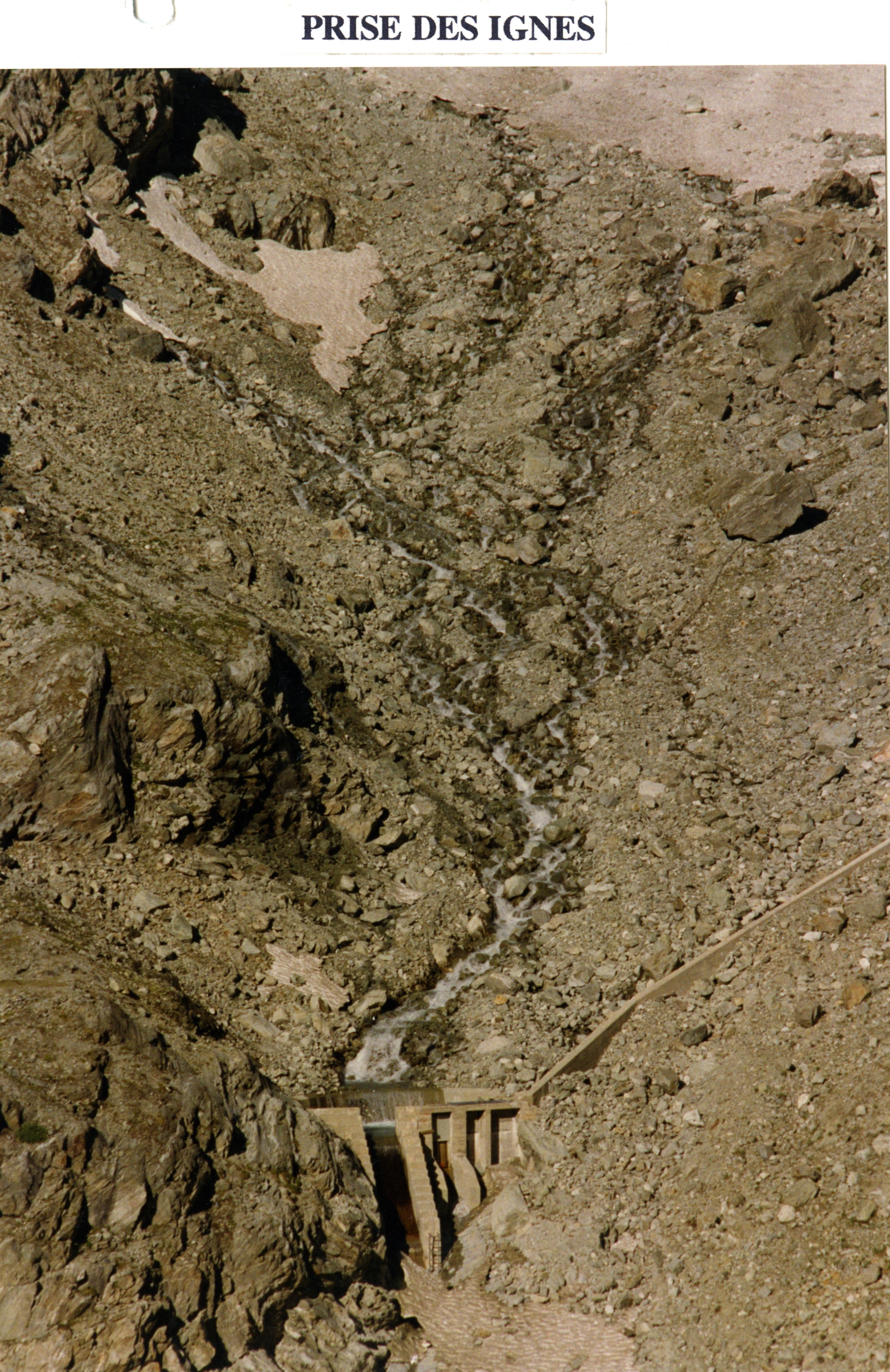 Show on map |
|
|
A. Bezinge (1991)
Arolla pumping station 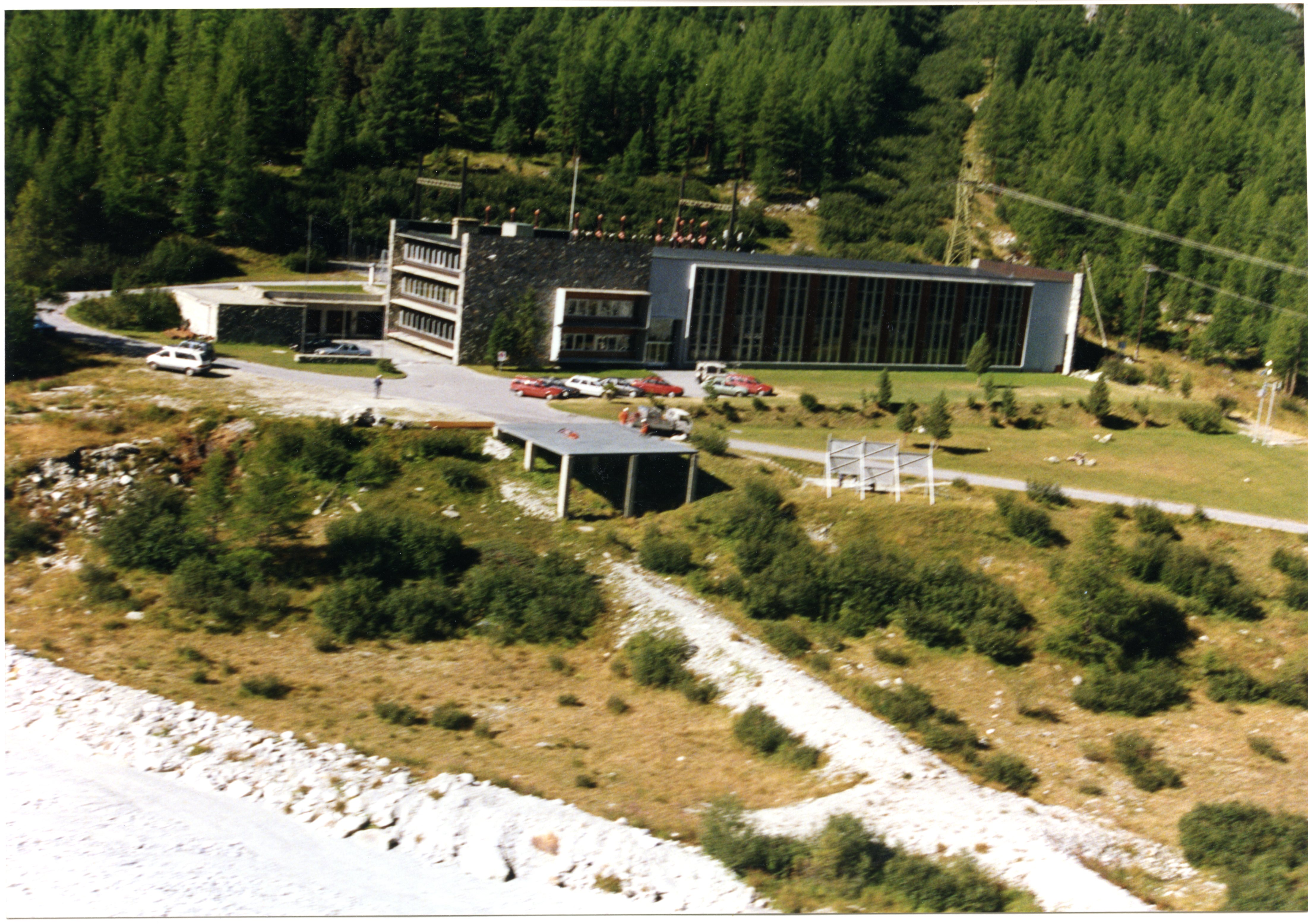 Show on map |
|
|
A. Bezinge (1991)
Bas Glacier d'Arolla august 1991 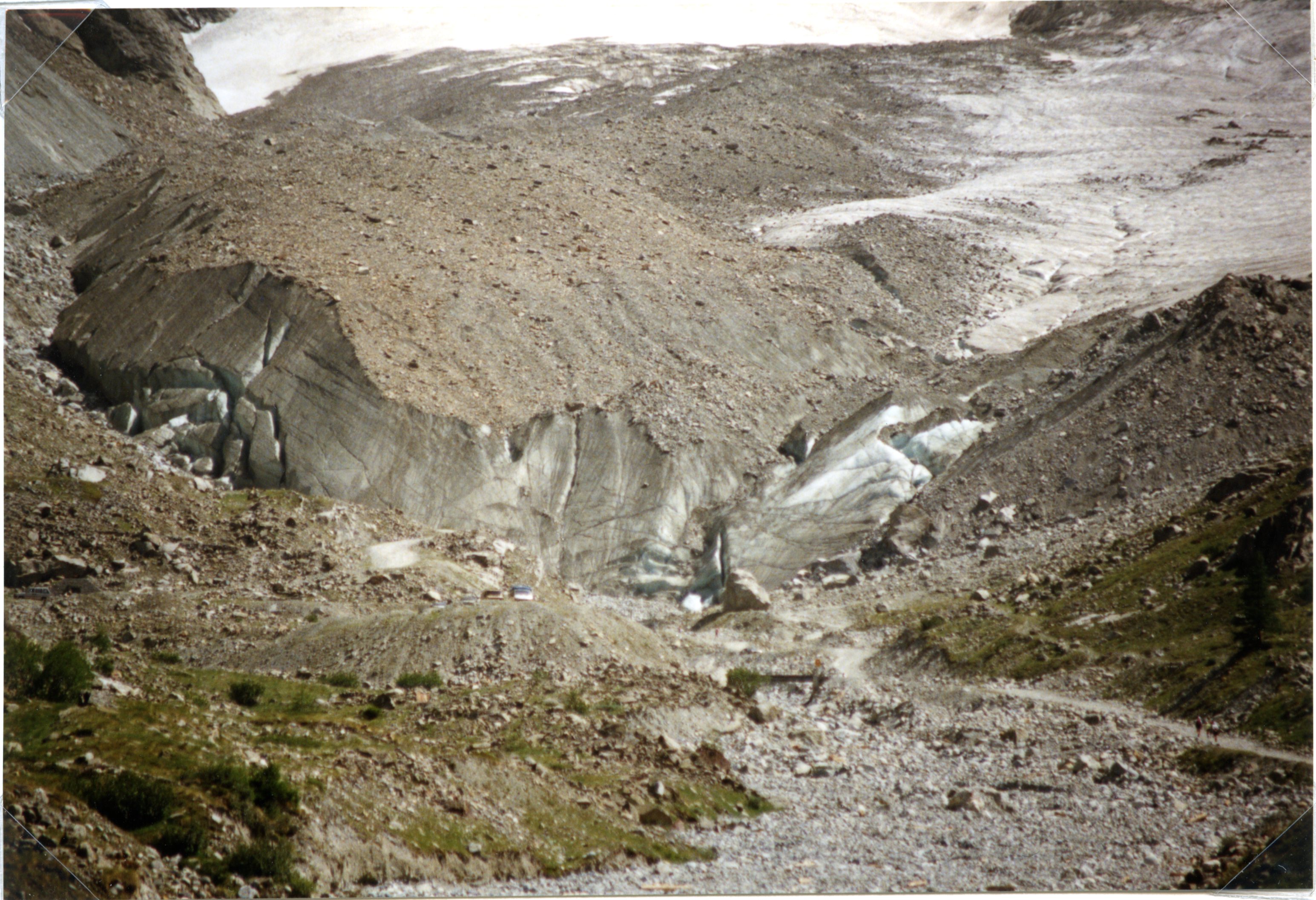 Show on map |
|
|
A. Bezinge (1991)
Bas Glacier d'Arolla august 1991 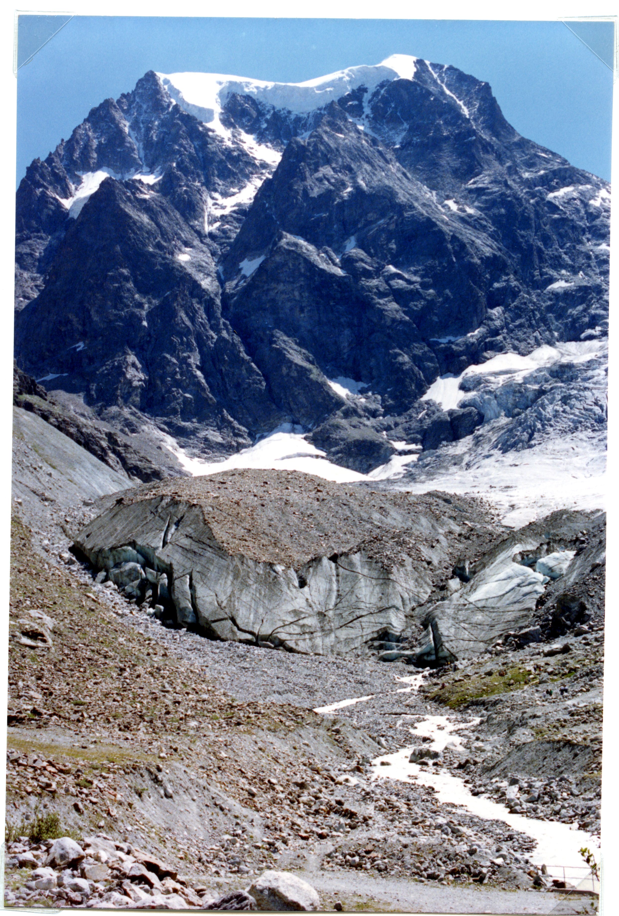 Show on map |
|
|
A. Bezinge (1991)
Bas Glacier d'Arolla august 1991 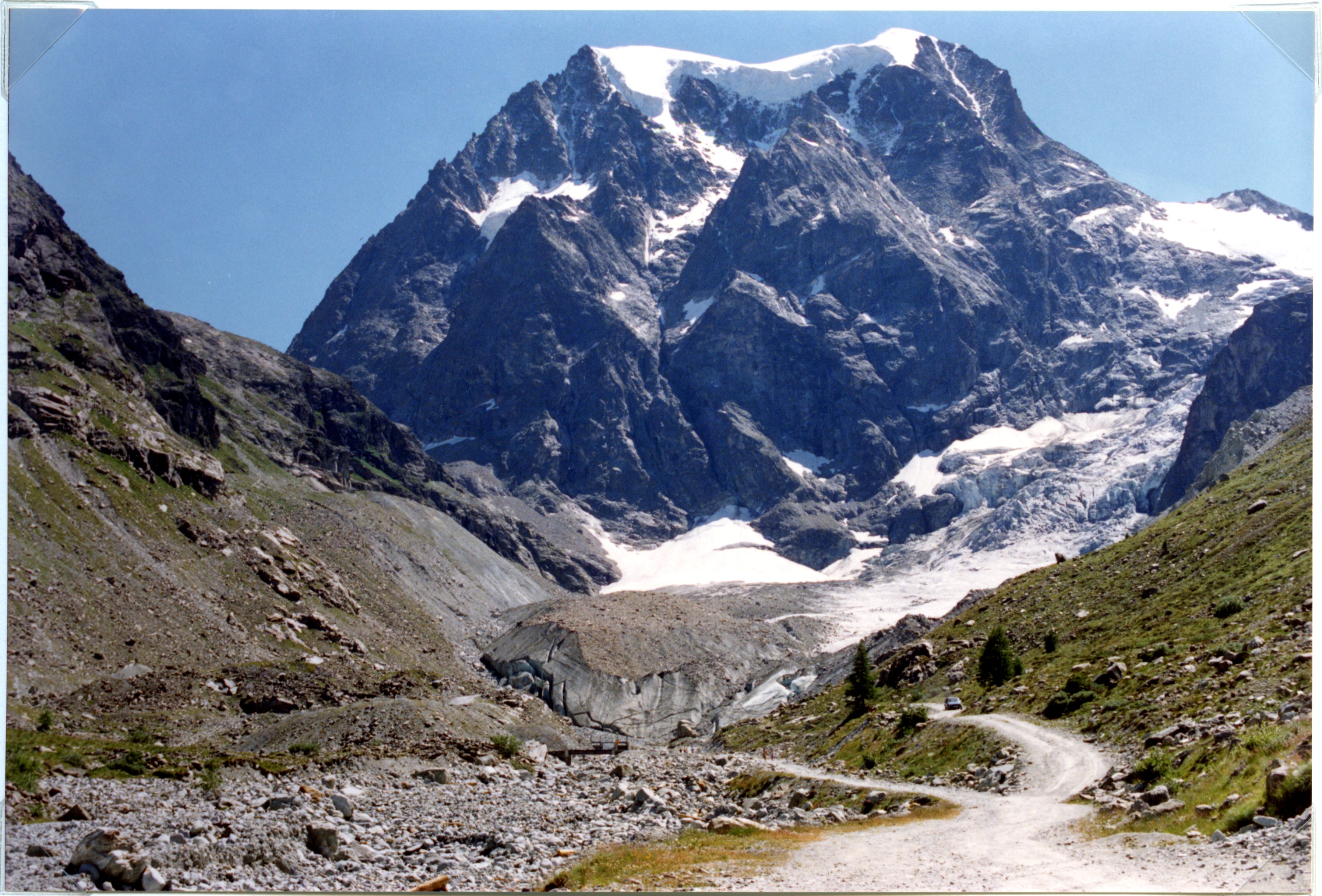 Show on map |
|
|
A. Bezinge (1991)
Les réserves d'eau solides: Alpes suisses Show on map |
|
|
A. Bezinge (1991)
Bertol supérieur water intake, october 1991 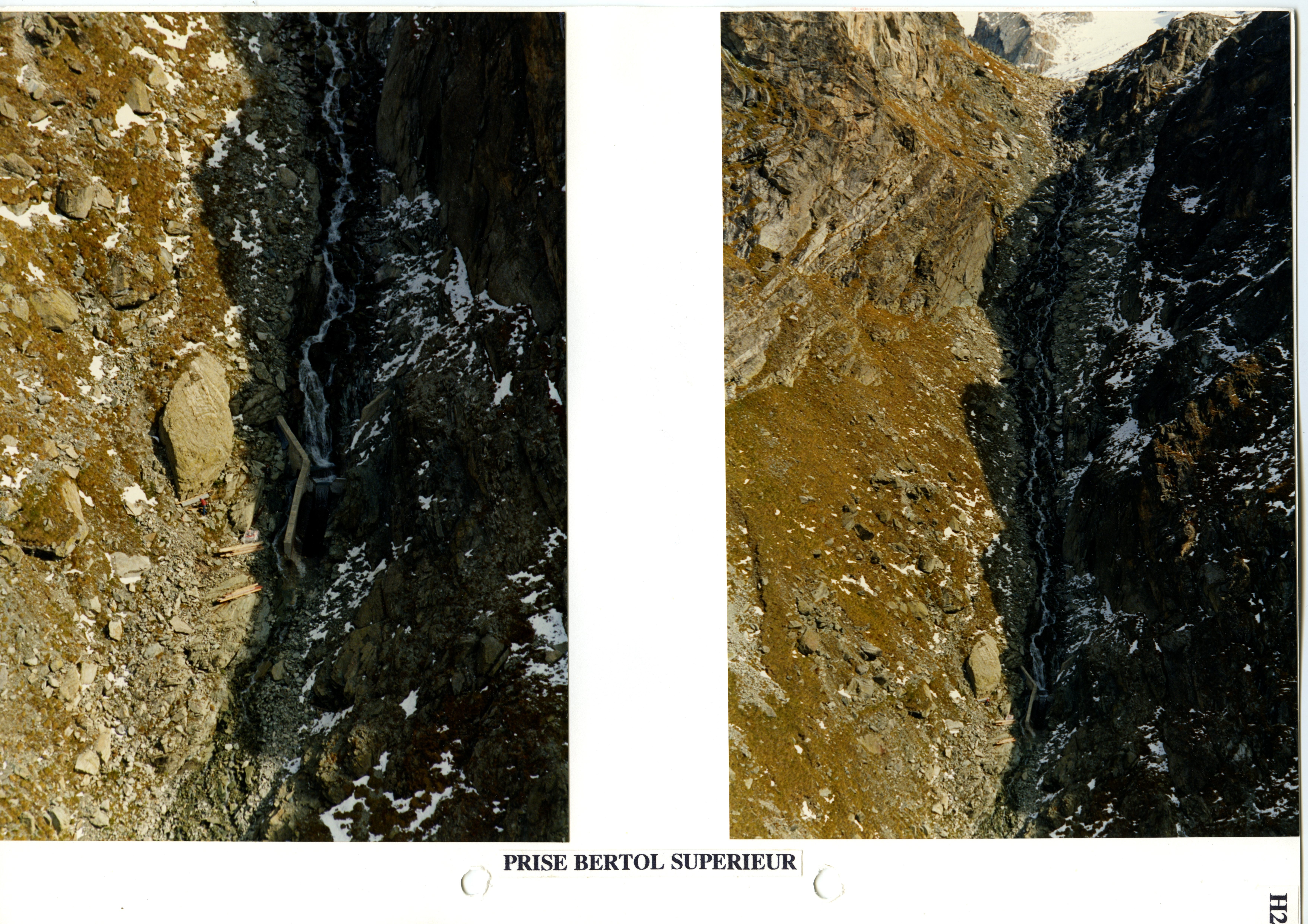 Show on map |
|
|
A. Bezinge (1991)
Picture of the Bas Glacier d'Arolla and Bertol inférieur water intake in october 1991 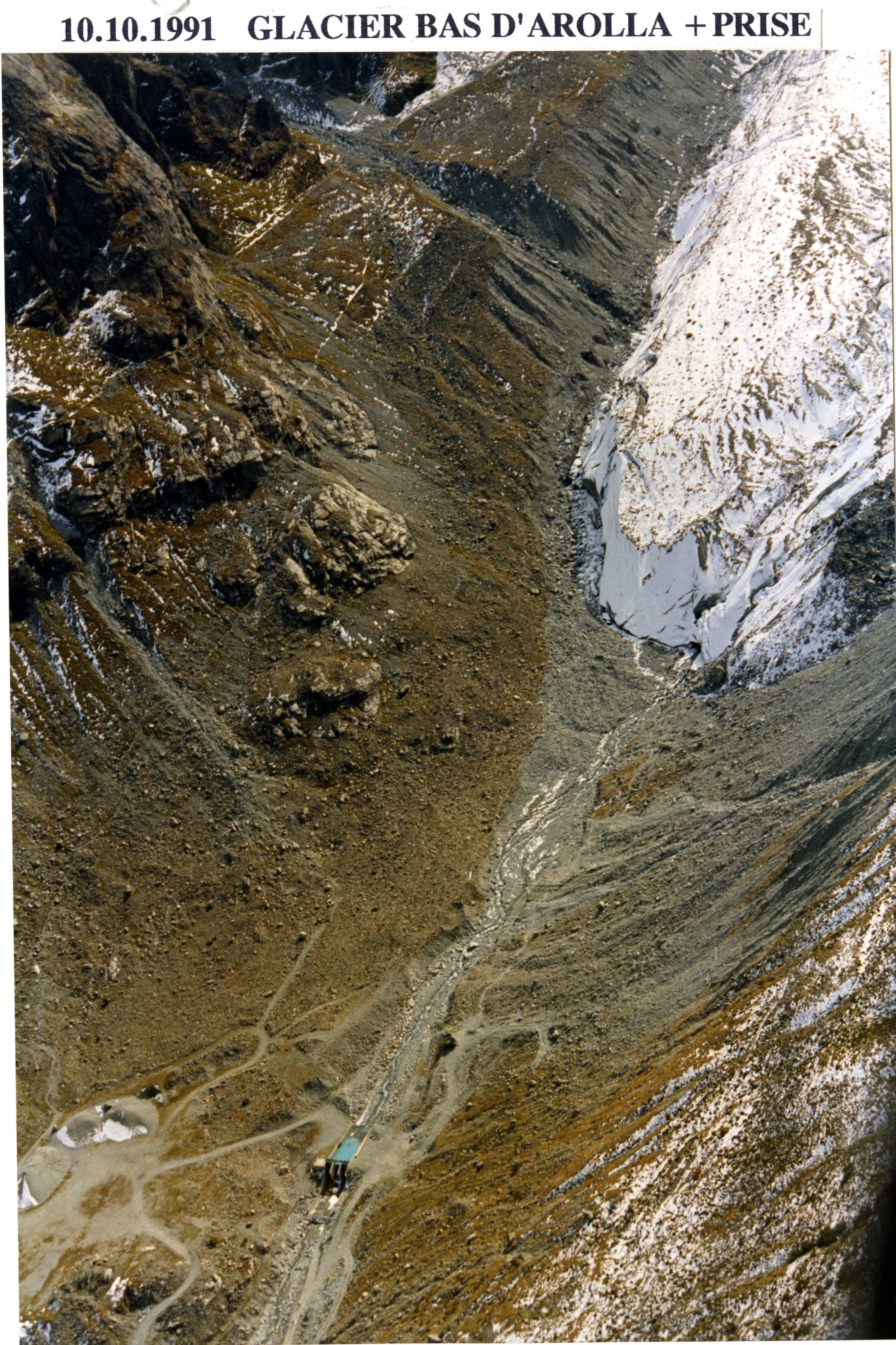 Show on map |
|
|
A. Bezinge (1991)
Bas Glacier d'Arolla august 1991 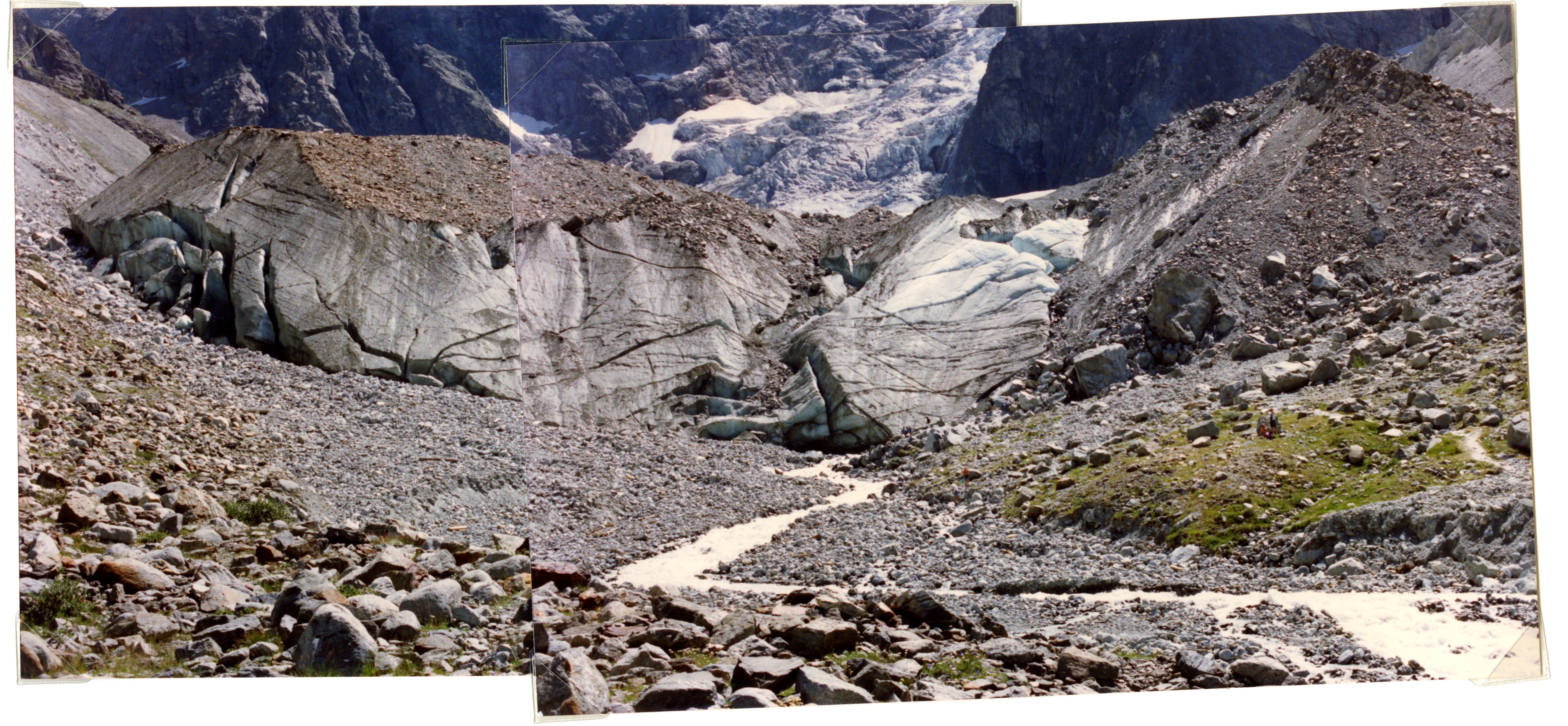 Show on map |
|
|
A. Bezinge (1991)
Bas Glacier d'Arolla, 1840's moraines  Show on map |
|
|
A. Bezinge (1991)
Pièces water intake, july 1991  Show on map |
|
|
A. Bezinge (1991)
Haut Glacier d'Arolla and 1840's moraines, october 1991 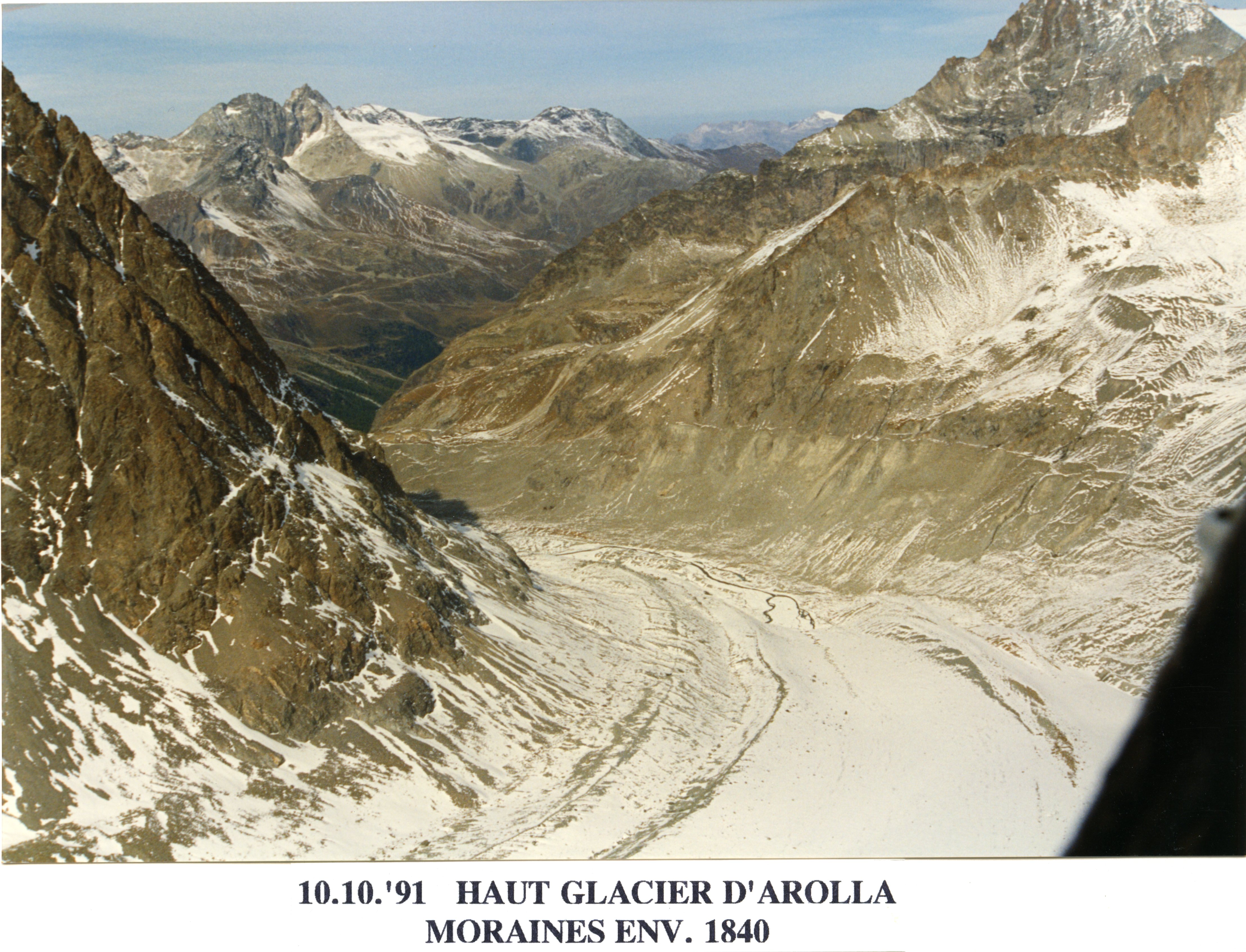 Show on map |
|
|
A. Bezinge (1991)
Tsijiore Nouve in july 1991  Show on map |
|
|
A. Bezinge, J.M. Bonvin et G. Dayer (1991)
Glaciologie et production hydroélectrique en Suisse Show on map |
|
|
Albert Bezinge (1991)
Bas Glacier d'Arolla, Mont Collon and Borgne d'Arolla, august 1991  Show on map |
|
|
A. Bezinge (1990)
Variations of glacier fronts from 1890 to 1989: Arolla glacier, tsijiorenouve, cheilon, desert mont fort, tsanfleron, otemma, gietro, valsoret, saleina, trient, mt mine, aletsch Show on map |
|
|
A. Bezinge (1990)
Bas Glacier d'Arolla june 1990 - Three pictures mosaic  Show on map |
|
|
A. Bezinge (1990)
Bas Glacier d'Arolla june 1990  Show on map |
|
|
A. Bezinge (1990)
Bas Glacier d'Arolla june 1990  Show on map |
|
|
A. Bezinge (1990)
Bas Glacier d'Arolla june 1990  Show on map |
|
|
A. Bezinge (1990)
Bas Glacier d'Arolla june 1990  Show on map |
|
|
A. Bezinge (1990)
Bas Glacier d'Arolla june 1990  Show on map |
|
|
A. Bezinge (1990)
Bas Glacier d'Arolla june 1990 - Front  Show on map |
|
|
A. Bezinge (1990)
Bas Glacier d'Arolla june 1990 - moraine erosion  Show on map |
|
|
A. Bezinge (1990)
Bas Glacier d'Arolla june 1990 - Two pictures mosaic 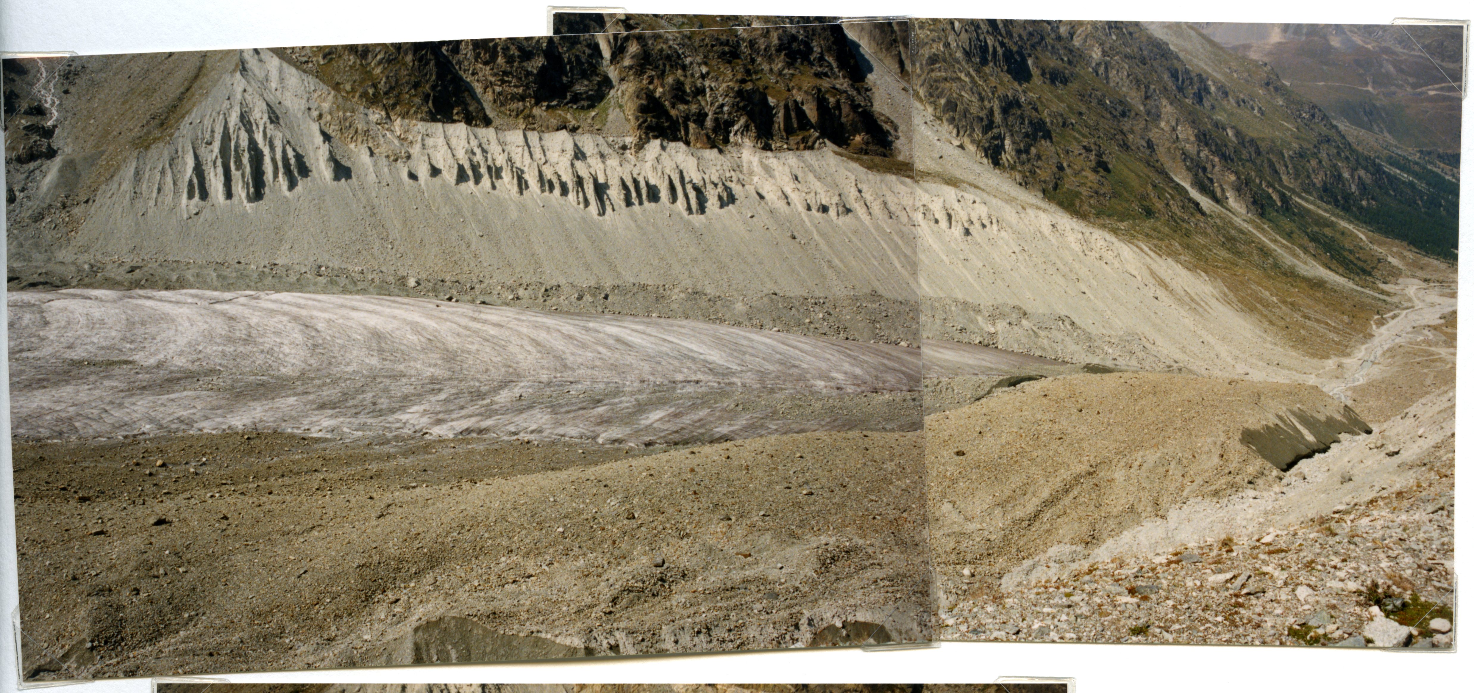 Show on map |
|
|
A. Bezinge (1990)
Bas Glacier d'Arolla june 1990 - Two pictures mosaic 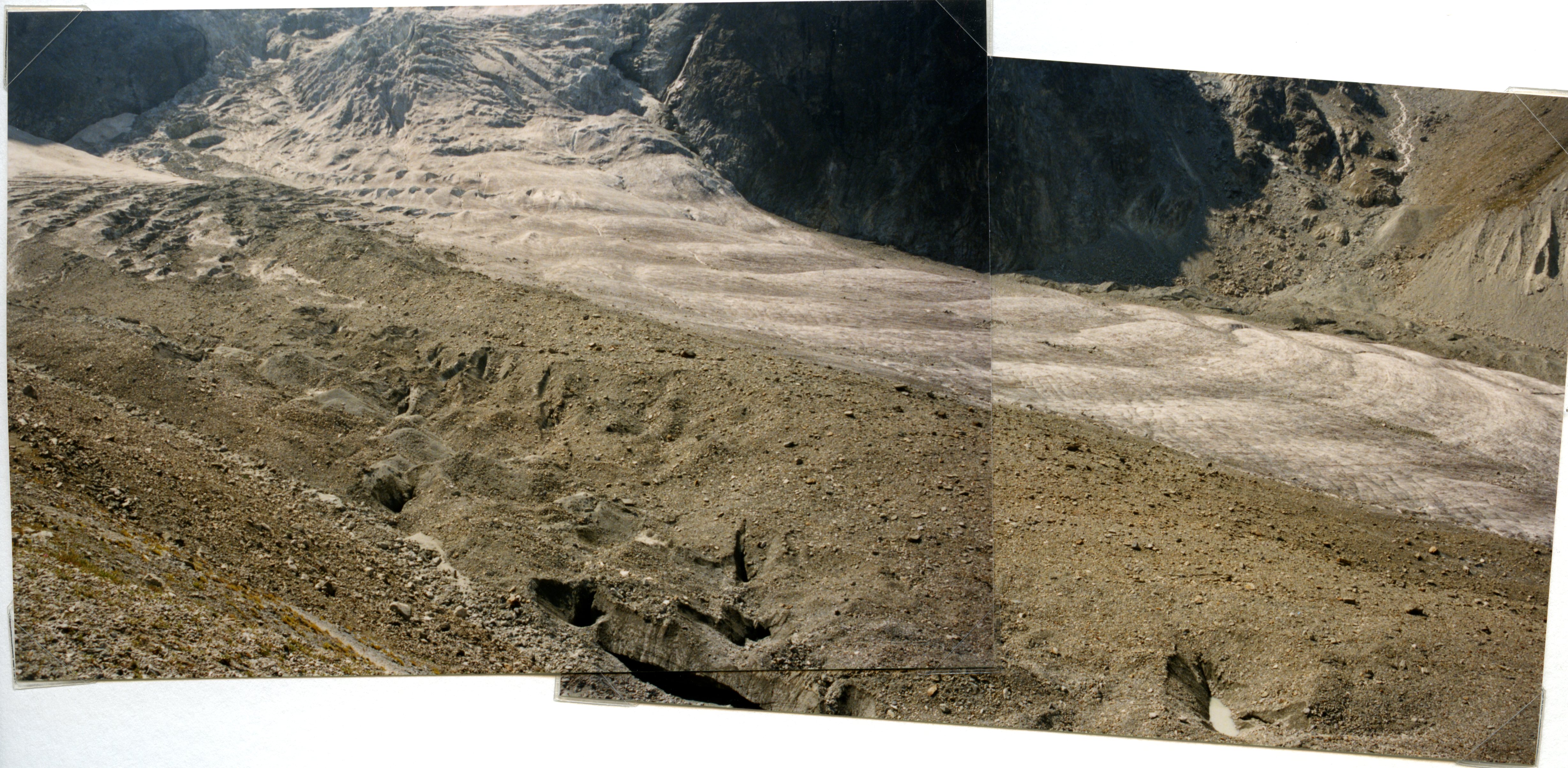 Show on map |
|
|
A. Bezinge (1990)
Bas Glacier d'Arolla june 1990 - Forbes bands  Show on map |
|
|
A. Bezinge (1990)
Graphique des variations des fronts glaciaires 1890-1989: Ferpècle, Arolla, Tsijiore-Nouve, Cheilon Show on map |
|
|
Albert Bezinge (1990)
Glacier de Vuibé, june 1990 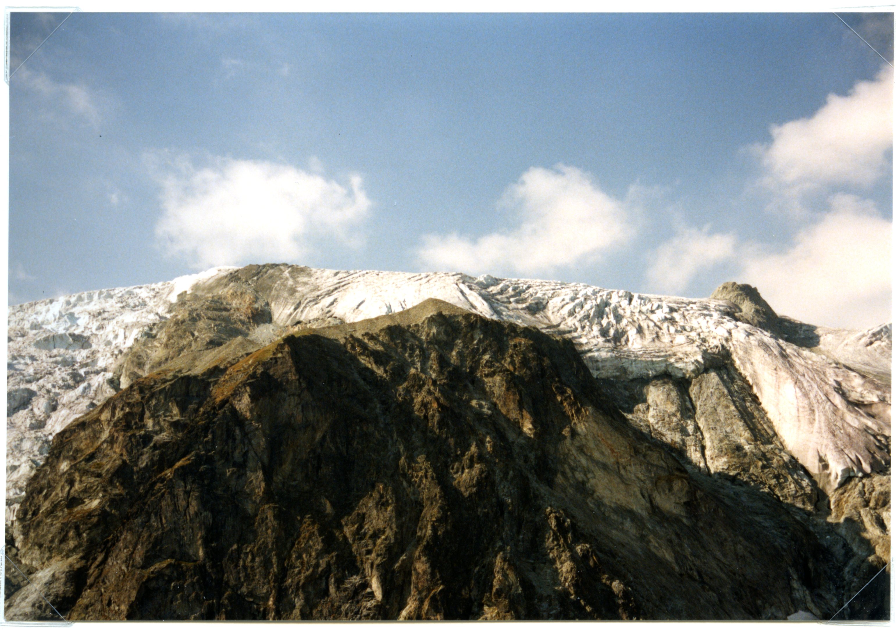 Show on map |
|
|
Albert Bezinge (1990)
Pigne d'Arolla 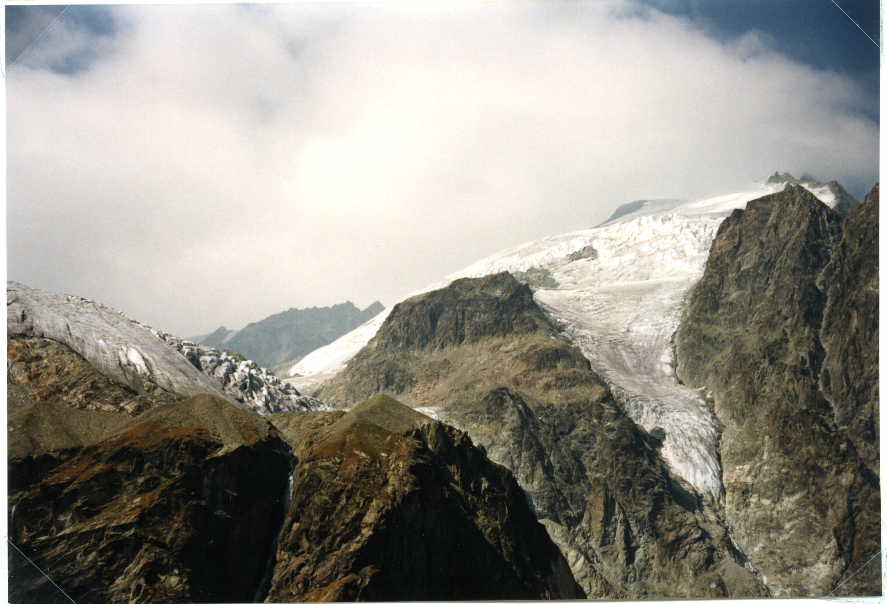 Show on map |
|
|
Albert Bezinge (1990)
Bas Glacier d'Arolla, june 1990  Show on map |
|
|
M. Baltasar et A. Pahud (1990)
Mont Miné Glacier, july 1990 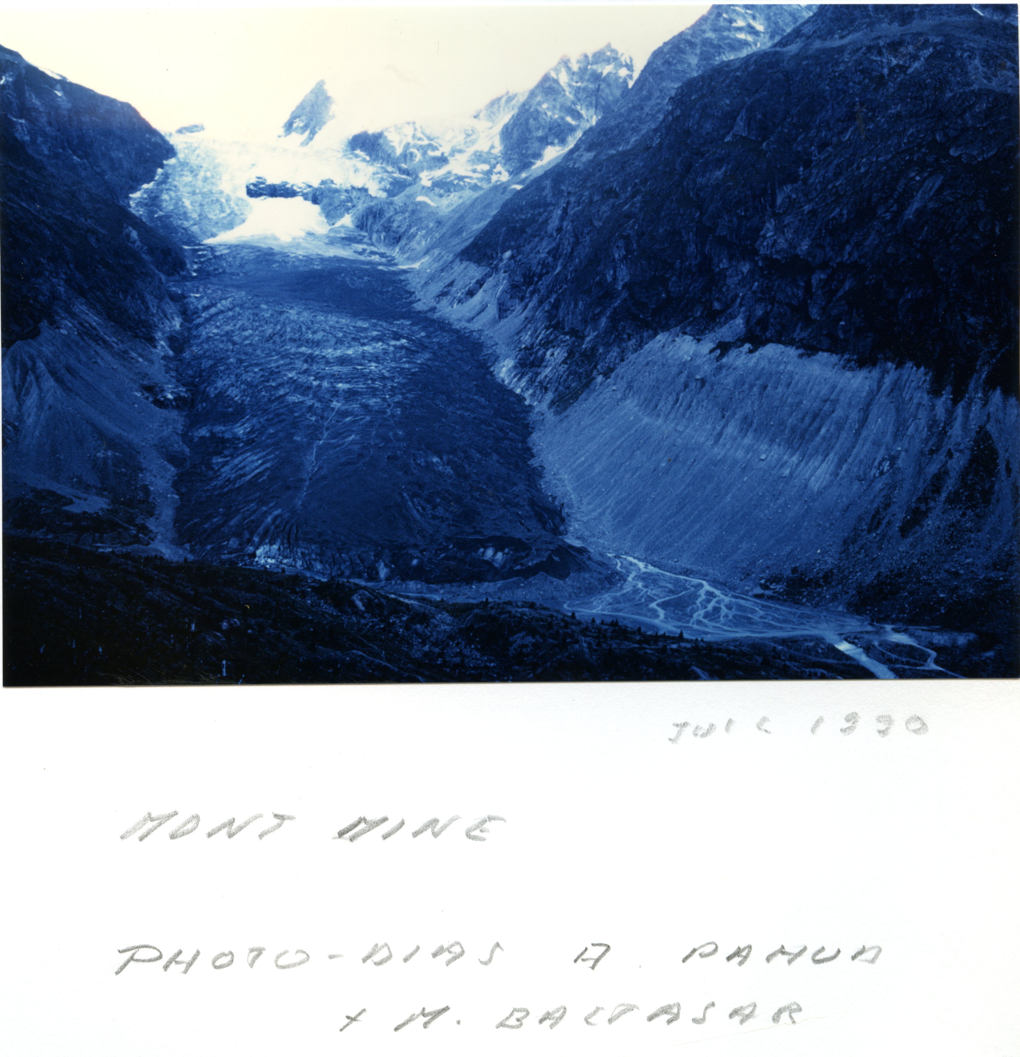 Show on map |
|
|
Rey, Y. et Dayer, G. (1990)
Crues de l'été 1987 dans les bassins versants glaciaires des Alpes Pennines Show on map |
|
|
Warburton J. (1990)
An Alpine Proglacial Fluvial Sediment Budget Show on map |
|
|
Warburton, J. (1990)
Comparison of bed load yield estimates for a glacial meltwater stream Show on map |
|
|
A. Bezinge (1989)
Front of the Tsijiore-Nouve in 1989  Show on map |
|
|
A. Bezinge (1989)
La Borgne d'Arolla during a purge  Show on map |
|
|
A. Bezinge (1989)
Bas Glacier d'Arolla and Mont Collon 1989  Show on map |
|
|
A. Bezinge (1989)
Bas Glacier d'Arolla august 1989  Show on map |
|
|
A. Bezinge (1989)
Front of the Tsijiore-Nouve and river in 1989  Show on map |
|
|
A. Bezinge (1989)
Front of the Tsijiore-Nouve, 1989  Show on map |
|
|
A. Bezinge (1989)
Bas Glacier d'Arolla and Mont Collon august 1989  Show on map |
|
|
A. Bezinge (1989)
Bas Glacier d'Arolla september 1989 - Glacier Front  Show on map |
|
|
A. Bezinge (1989)
Tsijiore-Nouve in 1989 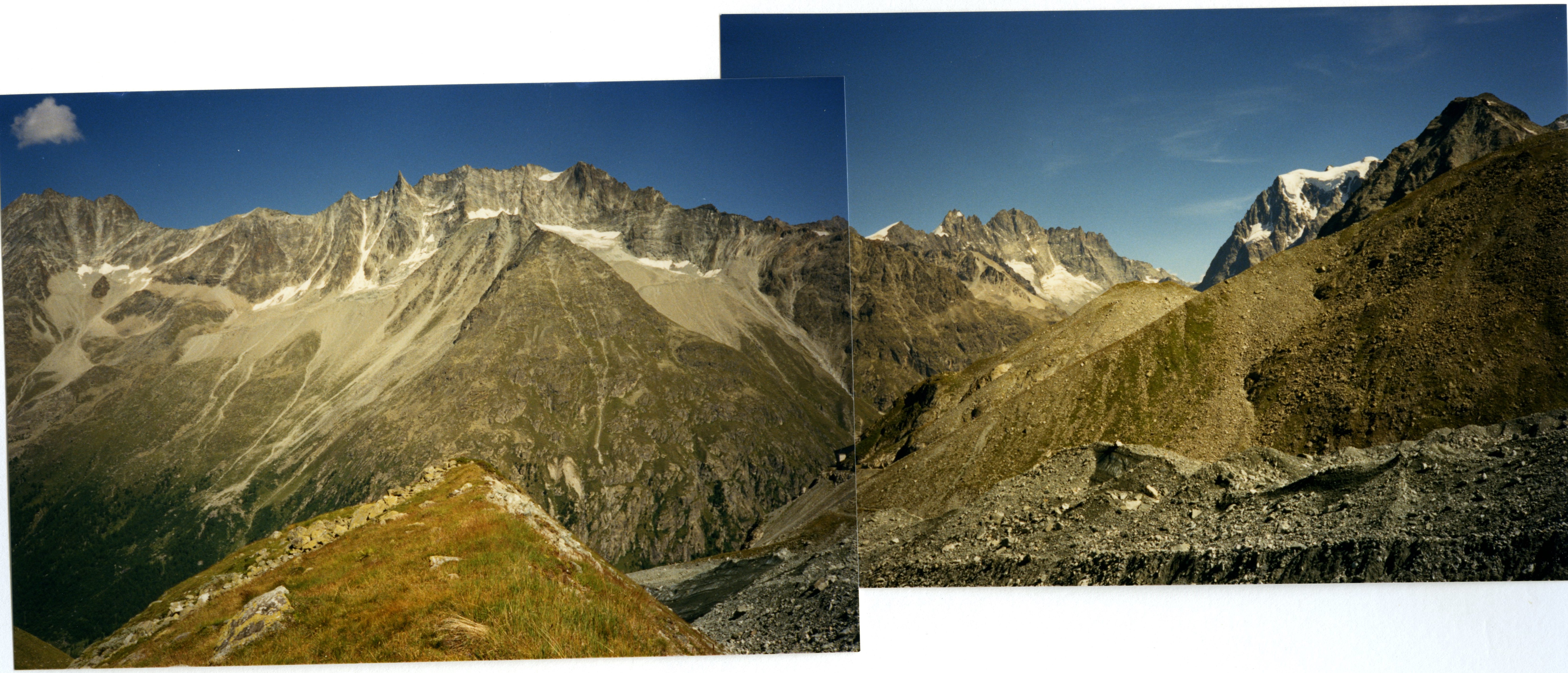 Show on map |
|
|
A. Bezinge (1989)
Front of the Tsijiore-Nouve in 1989 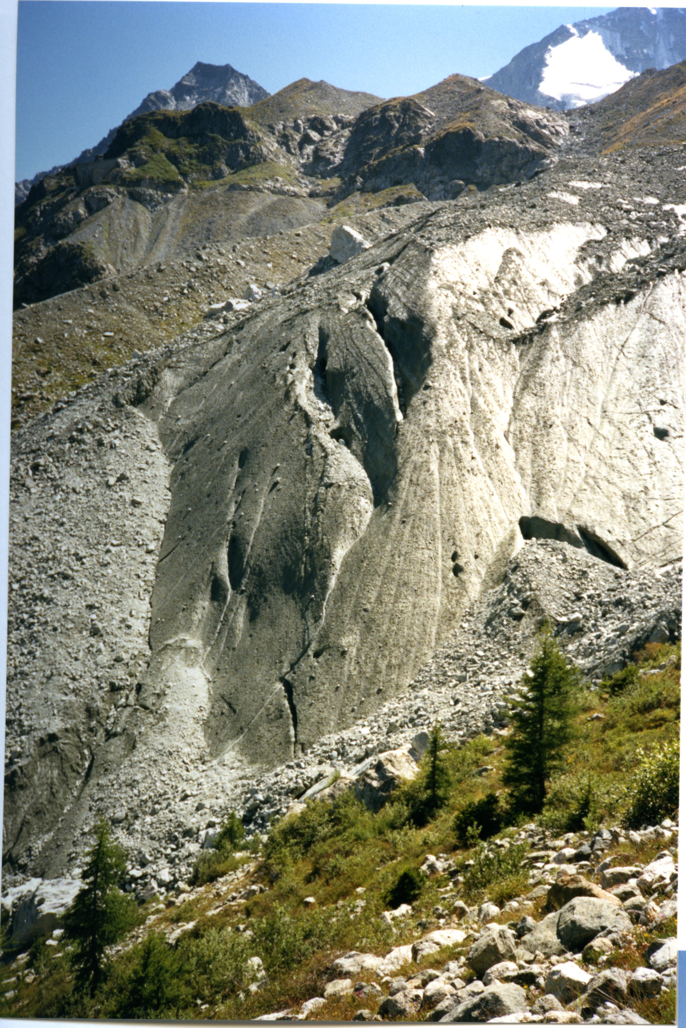 Show on map |
|
|
A. Bezinge (1989)
Tsijiore-Nouve and Pigne d'Arolla in july 1989 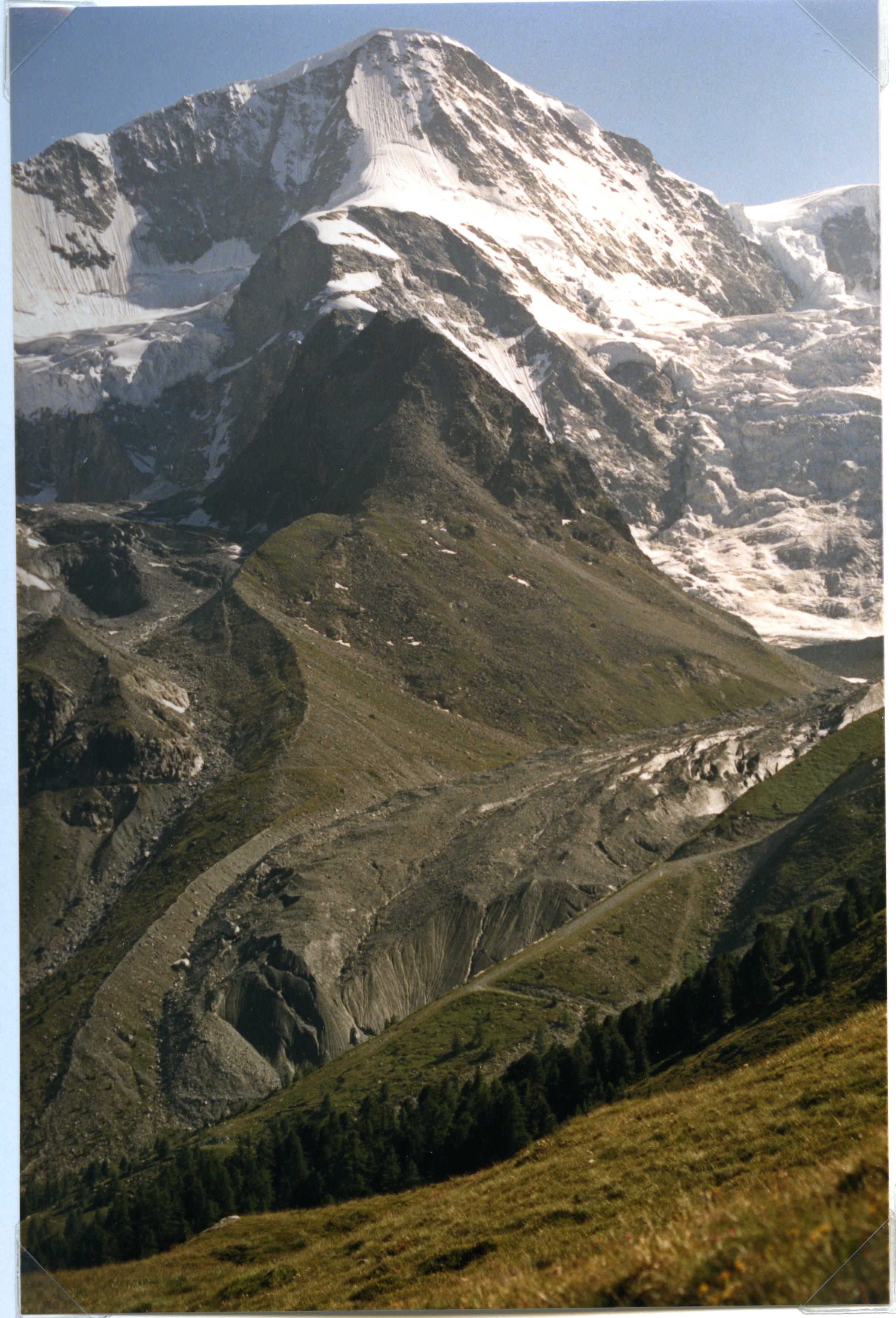 Show on map |
|
|
Fenn, C.R. and Gomez, B. (1989)
Particle size analysis of the sediment suspended in a proglacial stream: Glacier de Tsidjoire Nouve, Switzerland Show on map |
|
|
Gurnell, A.M. and Warburton, J. and Clark, M.J. (1988)
A comparison of the sediment yield characteristics of two adjacent glacier basins, Val d'Hérens, Switzerland Show on map |
|
|
A. Bezinge (1987)
Bas Glacier d'Arolla 24-25 août 1987 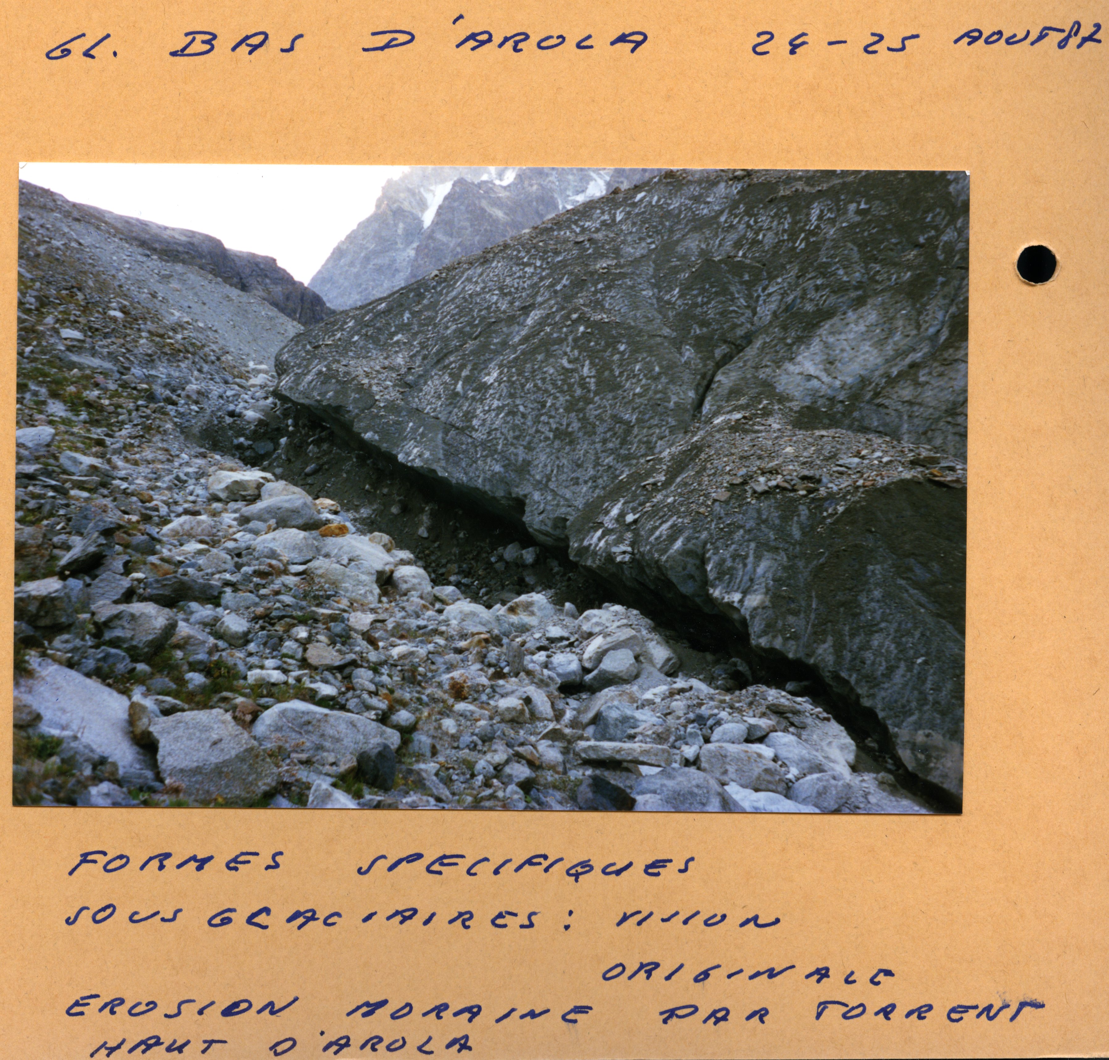 Show on map |
|
|
A. Bezinge (1987)
Bas Glacier d'Arolla 1987 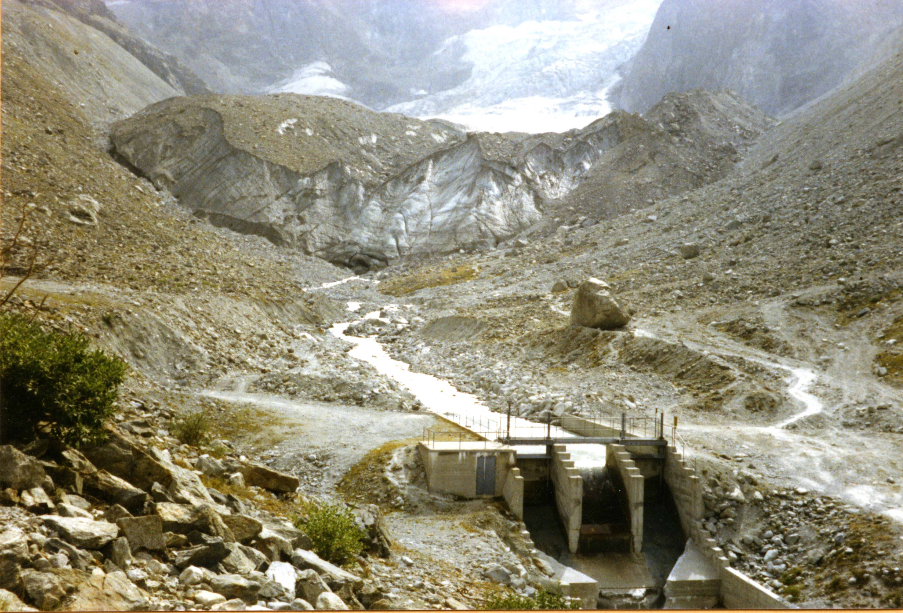 Show on map |
|
|
A. Bezinge (1987)
Destroyed bridge after august 24-25 1987's flood at Les Haudères 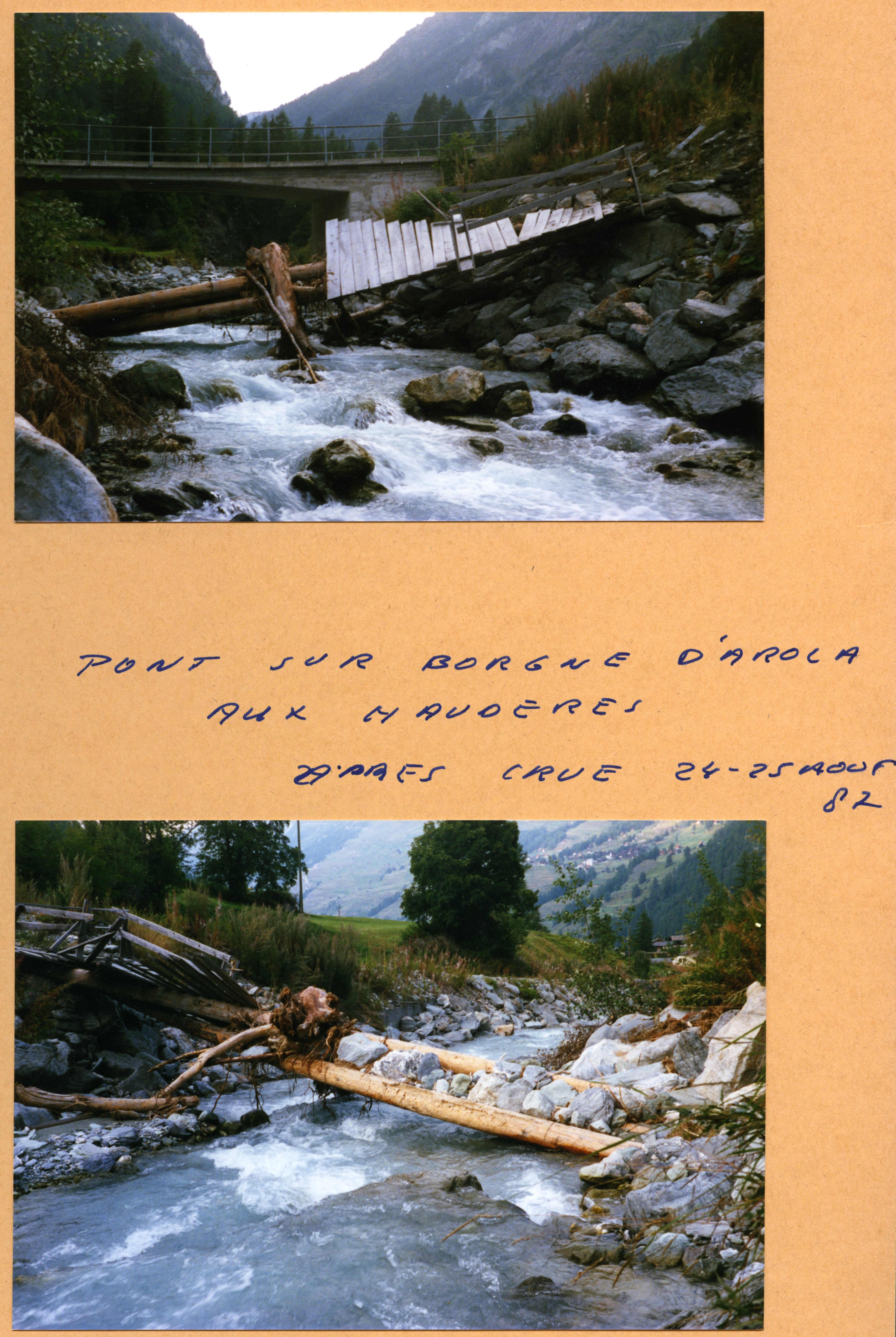 Show on map |
|
|
A. Bezinge (1987)
Mont Miné Glacier, lateral flow 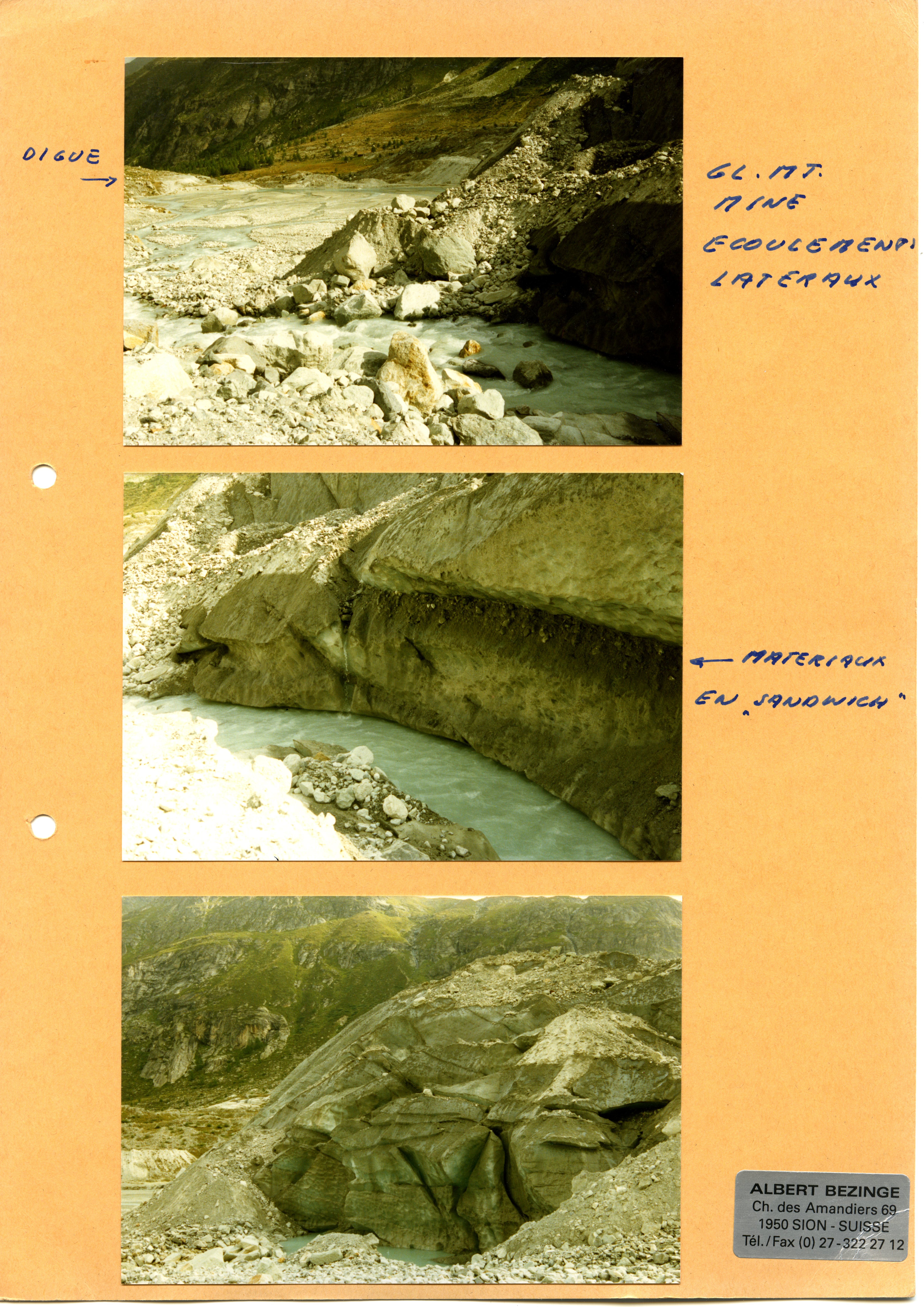 Show on map |
|
|
A. Bezinge (1987)
Surging Mont Miné Glacier in september 1987 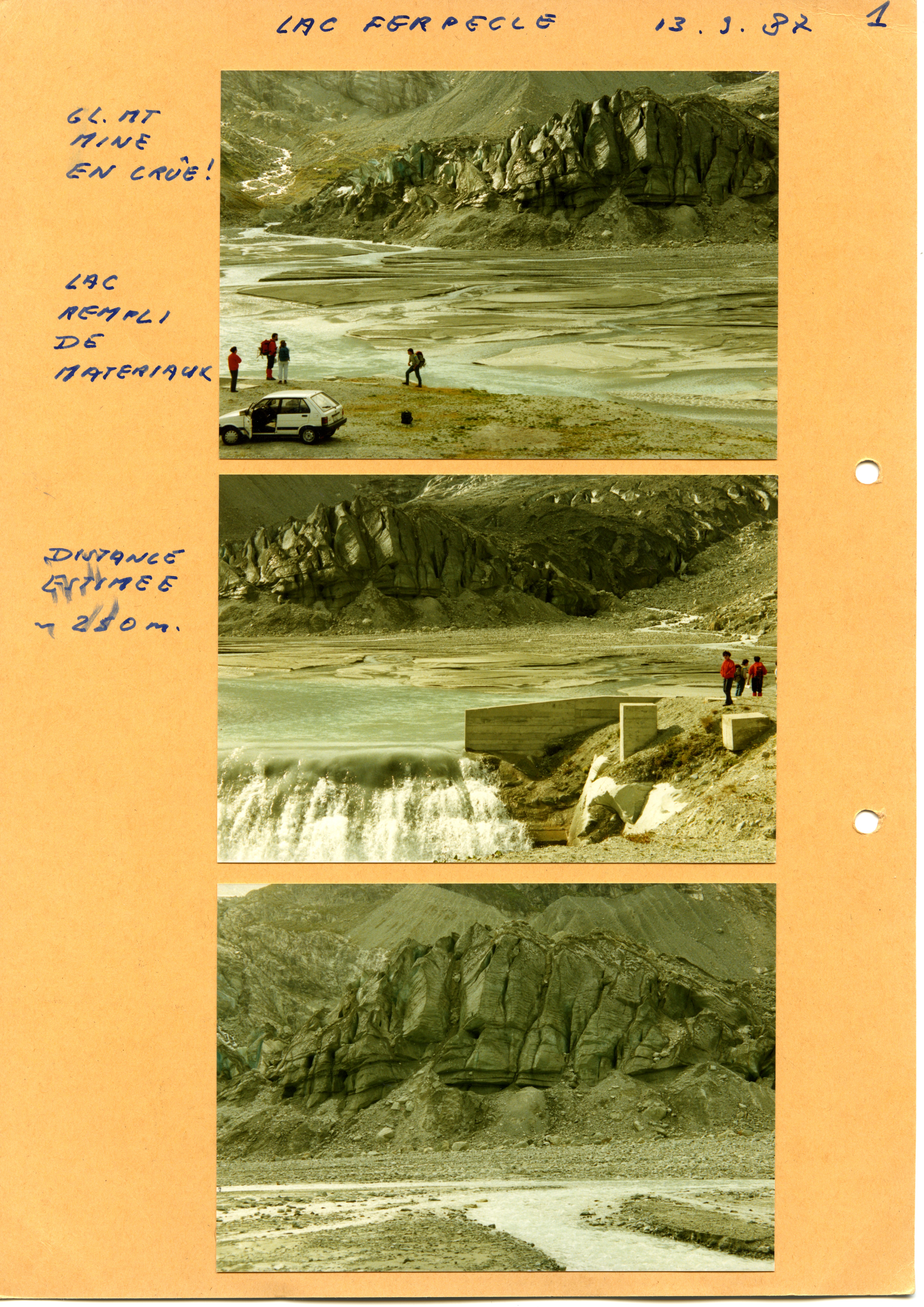 Show on map |
|
|
Grande Dixence SA (1987)
Limite supérieur des neiges (selon photos aériennes) Show on map |
|
|
No authors (1986)
Bas Glacier, 1986 Show on map |
|
|
A. Bezinge (1986)
Front of the Mont Miné Glacier and Ferpècle Glacier, June 1986  Show on map |
|
|
A. Bezinge (1986)
Ferpècle and Mont Miné Glaciers, may 1986 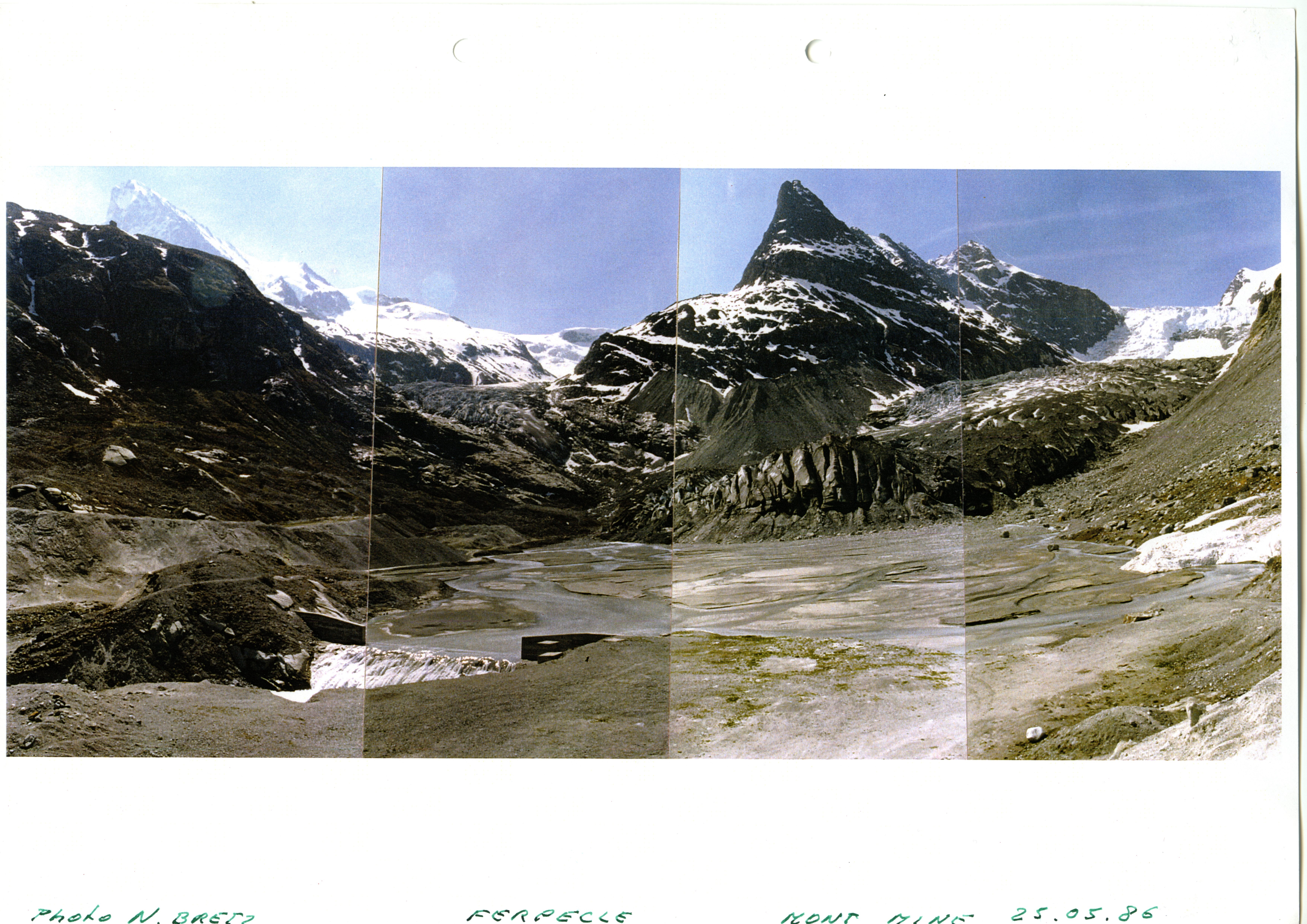 Show on map |
|
|
A. Bezinge (1986)
Glacier du bas d'Arolla ou glacier du Mont Collon. Show on map |
|
|
A. Bezinge (1986)
Glacier de Tsidjiore-nouve Show on map |
|
|
A. Bezinge (1985)
Part of the Tsijiore-Nouve and Petit Mont Rouge, August 1985  Show on map |
|
|
A. Bezinge (1985)
Haut Glacier d'Arolla, august 1985  Show on map |
|
|
A. Bezinge (1985)
Glacier du Mont Collon and haut Glacier d'Arolla water intake - August 1985  Show on map |
|
|
A. Bezinge (1985)
Arolla pumping station and Torrent de Pièce, August 1985  Show on map |
|
|
A. Bezinge (1985)
Front of the Haut Glacier d'Arolla in August 1985  Show on map |
|
|
A. Bezinge (1985)
Bas Glacier d'Arolla from the western side - August 1985  Show on map |
|
|
Albert Bezinge (1985)
Extrusion Glacier de Pièce 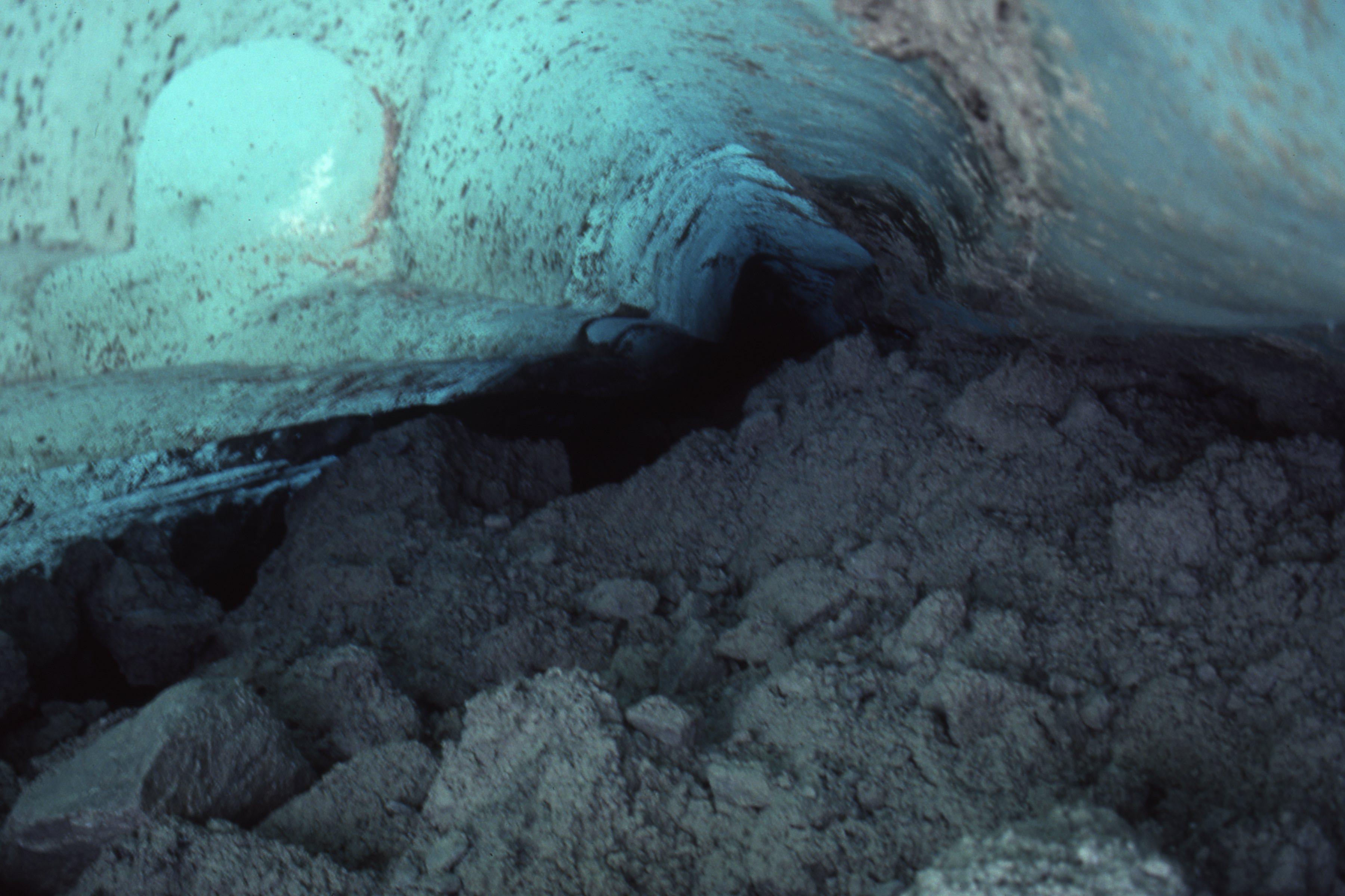 Show on map |
|
|
Albert Bezinge (1985)
Ferpècle and Glacier de Ferpècle, june 1985  Show on map |
|
|
Fenn, C.R. and Gurnell, A.M. and Beecroft, I.R. (1985)
An evaluation of the use of suspended sediment rating curves for the prediction of suspended sediment concentration in a proglacial stream Show on map |
|
|
Gomez, B. and Small, R. J. (1985)
Medial moraines of the Haut Glacier d'Arolla, Valais, Switzerland: debris supply and implications for moraine formation Show on map |
|
|
Gurnell, A. M. and Fenn, C. R. (1985)
Spatial and temporal variations in electrical-conductivity in a pro-glacial stream system Show on map |
|
|
A. Bezinge (1984)
Aerial picture of Ferpècle valley with Ferpècle Glacier, August 1984  Show on map |
|
|
A. Bezinge (1984)
Aerial picture of the Tsijiore-Nouve in July 1984  Show on map |
|
|
A. Bezinge (1984)
Tsijiore-Nouve - Front in july 1984  Show on map |
|
|
A. Bezinge (1984)
Glacier du Mont Miné, october 1984  Show on map |
|
|
A. Bezinge (1984)
Glacier de Ferpècle and Glacier du Mont Miné, july 1984 Show on map |
|
|
A. Bezinge (1984)
Glacier de Ferpècle, october 1984  Show on map |
|
|
A. Bezinge (1984)
Glacier du Mont Miné (front) and glacier de Ferpècle, june 1984  Show on map |
|
|
Gurnell, A.M. and Fenn, C.R. (1984)
Box-Jenkins Transfer Function Models Applied to Suspended Sediment Concentration-Discharge Relationships in a Proglacial Stream Show on map |
|
|
Small, R. J. and Beecroft, I. R. Stirling, D. M. (1984)
Rates of deposition on lateral-moraine embankments, Glacier de Tsidijore-Nouve, Valais, Switzerland Show on map |
|
|
A. Bezinge (1983)
Totalizer rain gauge, Bricola - may 1983  Show on map |
|
|
A. Bezinge (1983)
Totalizer rain gauge, Bricola - may 1983  Show on map |
|
|
A. Bezinge (1983)
Glacier du Mont Miné and lake, june 1983  Show on map |
|
|
A. Bezinge (1983)
Totalizer rain gauge, Glacier du Mont Miné - may 1983  Show on map |
|
|
A. Bezinge (1983)
Chenaux de Nye - Ferpècle, 1983  Show on map |
|
|
A. Bezinge (1983)
Glacier du Mont Miné, june 1983  Show on map |
|
|
A. Bezinge (1983)
Totalizer rain gauge, Bréona - may 1983  Show on map |
|
|
A. Bezinge (1983)
Glaciers de Ferpècle, july 1983  Show on map |
|
|
A. Bezinge (1983)
La Forclaz, July 1983  Show on map |
|
|
Fenn, C. R. (1983)
Analyzing proglacial streamflows series - some problems Show on map |
|
|
Gomez, B. (1983)
Temporal variations in the particle size distribution of surficial bed material: the effect of progressive bed armouring Show on map |
|
|
Gurnell, A.M. (1983)
Downstream Channel Adjustments in Response to Water Abstraction for Hydro-Electric Power Generation from Alpine Glacial Melt-Water Streams Show on map |
|
|
Small, R. J. (1983)
Lateral moraines of Glacier de Tsidjiore Nouve - form, development, and implications Show on map |
|
|
A. Bezinge (1982)
Glacier de Ferpècle and Glacier du Mont Miné, july 1982  Show on map |
|
|
A. Bezinge (1982)
Manzettes water intake, july 1982  Show on map |
|
|
A. Bezinge (1982)
Glacier du Mont Miné (front) and lake, june 1982  Show on map |
|
|
A. Bezinge (1982)
Aerial picture of Ferpècle dam and power station, july 1982  Show on map |
|
|
A. Bezinge (1982)
Removing sediments from Ferpècle lake, october 1982  Show on map |
|
|
A. Bezinge (1982)
Ferpècle - lake and proglacial margin, july 1982  Show on map |
|
|
A. Bezinge (1982)
Glacier du Mont Miné, july 1982  Show on map |
|
|
Albert Bezinge (1982)
Glacier du Mont Miné, july 1982  Show on map |
|
|
Gurnell, A.M. (1982)
The dynamics of suspended sediment concentration in an Alpine pro-glacial stream network Show on map |
|
|
Small, R. J. (1982)
Glaciers - do they really erode Show on map |
|
|
Y. Rey (1982)
Fluctuations des glaciers, rythme d'alimentation Show on map |
|
|
No authors (1981)
Variations de longueurs des glaciers suisses en 1979-1980 et 1980-1981 Show on map |
|
|
A. Bezinge (1981)
Tsijiore-Nouve - Front in july 1981  Show on map |
|
|
A. Bezinge (1981)
Glacier de Ferpècle and Glacier du Mont Miné, september 1981  Show on map |
|
|
A. Bezinge (1981)
Aerial picture of the Tsijiore-Nouve in August 1981  Show on map |
|
|
A. Bezinge (1981)
Bas Glacier d'Arolla - Front - June 1981  Show on map |
|
|
A. Bezinge (1981)
Ferpècle valley from above, august 1981 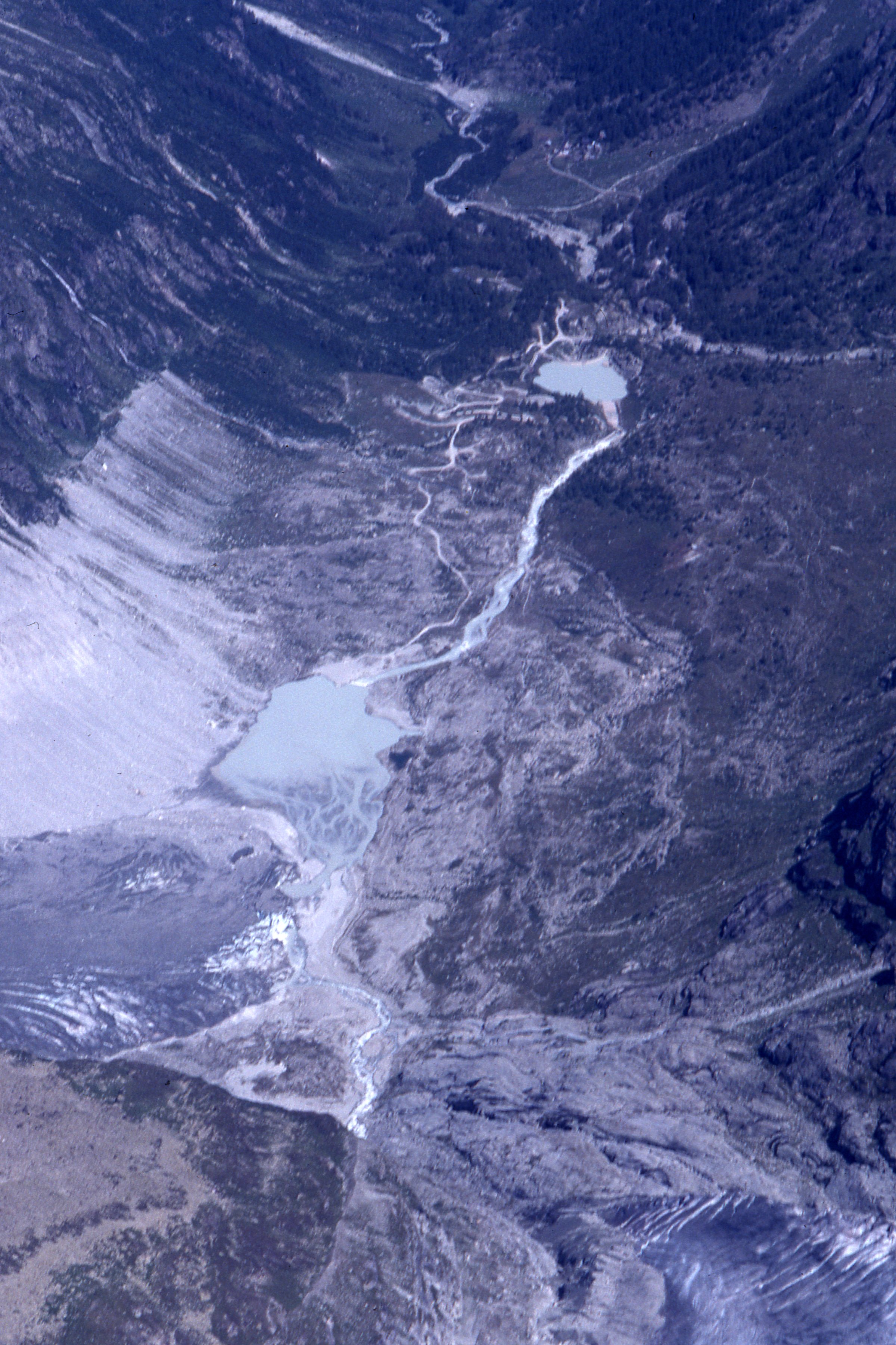 Show on map |
|
|
A. Bezinge (1981)
La suisse et ses glaciers Show on map |
|
|
A. Bezinge (1981)
Glacier du Mont Miné (front) and lake, august 1981 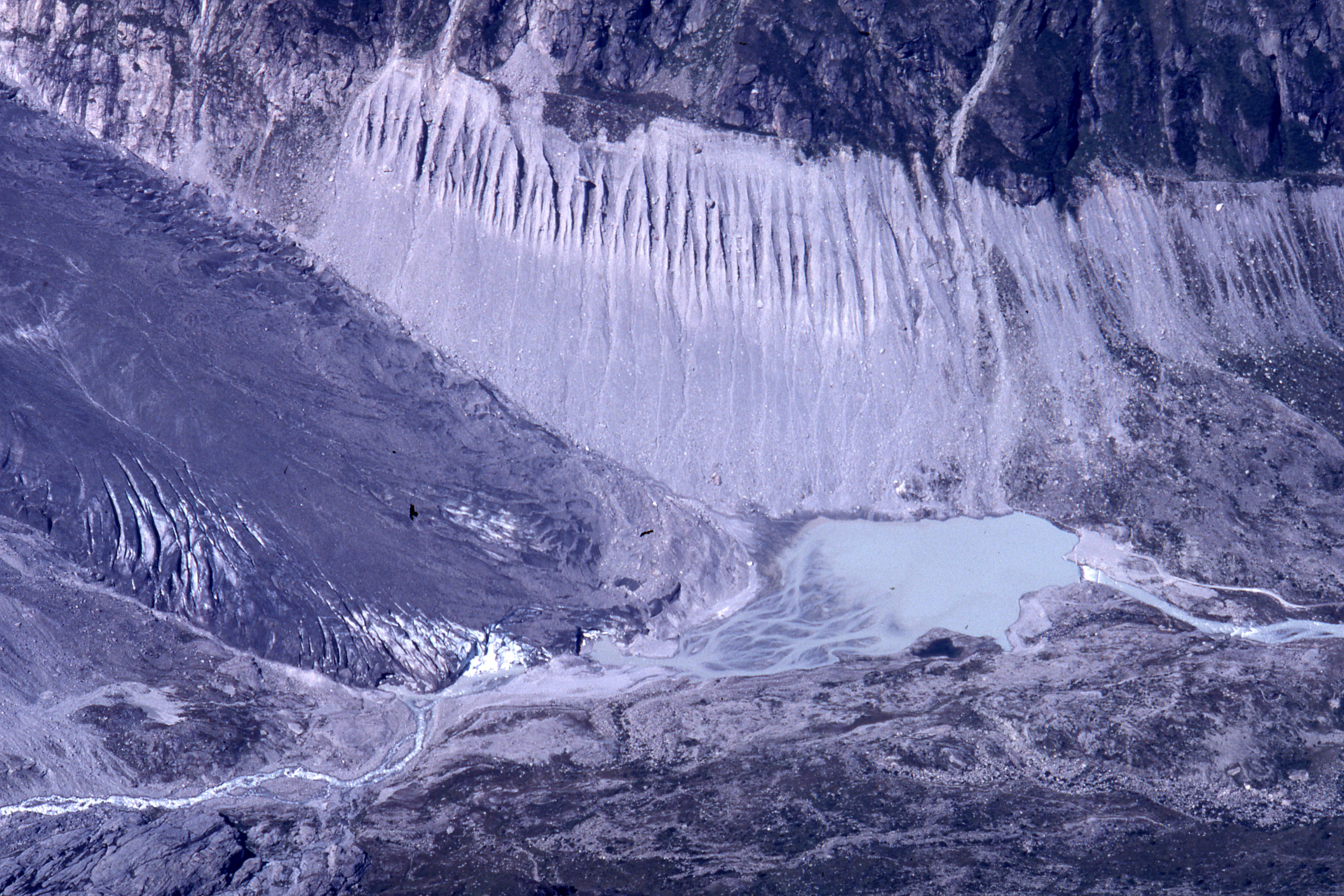 Show on map |
|
|
A. Bezinge (1981)
Tsijiore-Nouve - Front in july 1981  Show on map |
|
|
A. Bezinge (1981)
Glacier de Vouasson, 1981 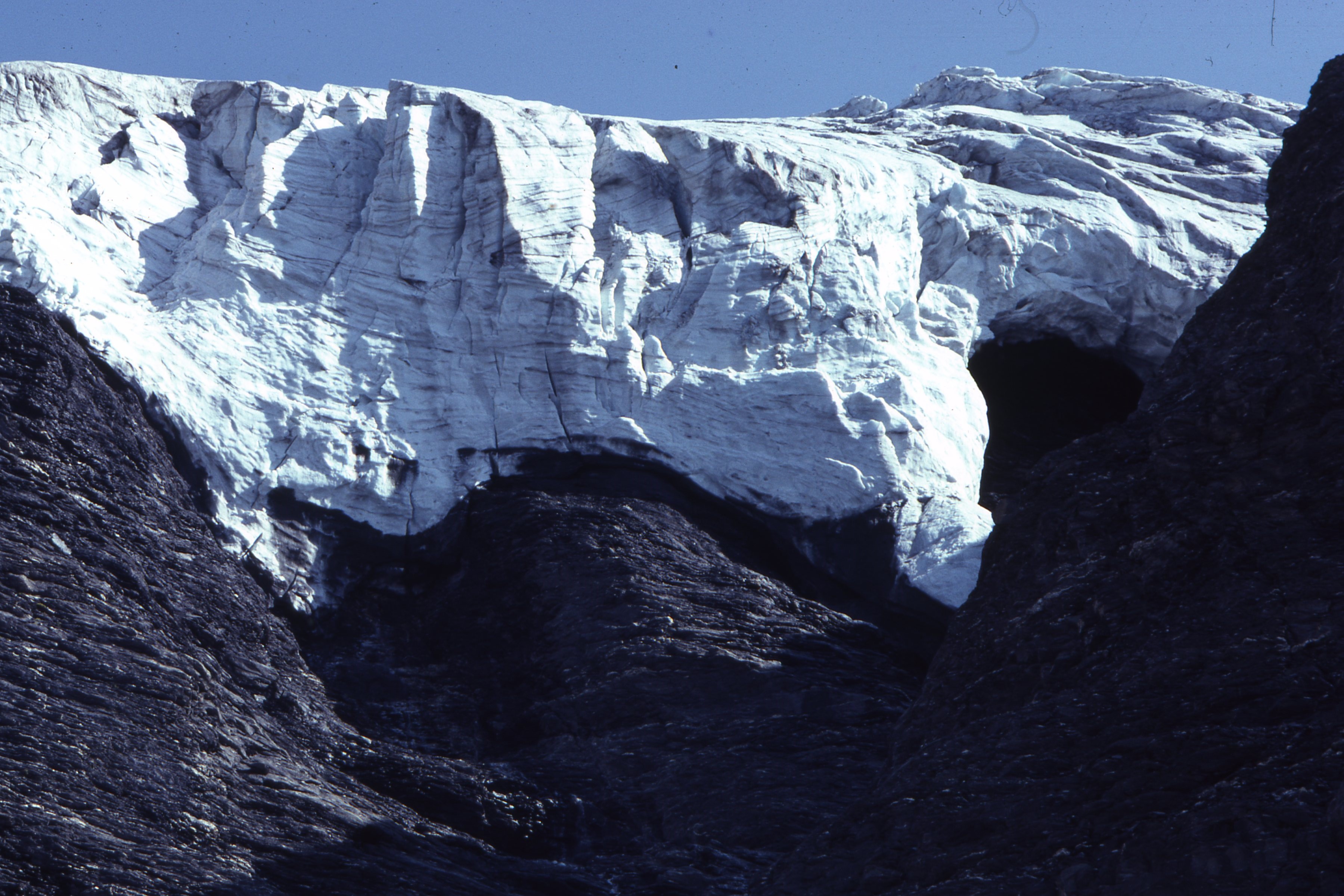 Show on map |
|
|
Albert Bezinge (1981)
Petit Mont Collon, august 1981 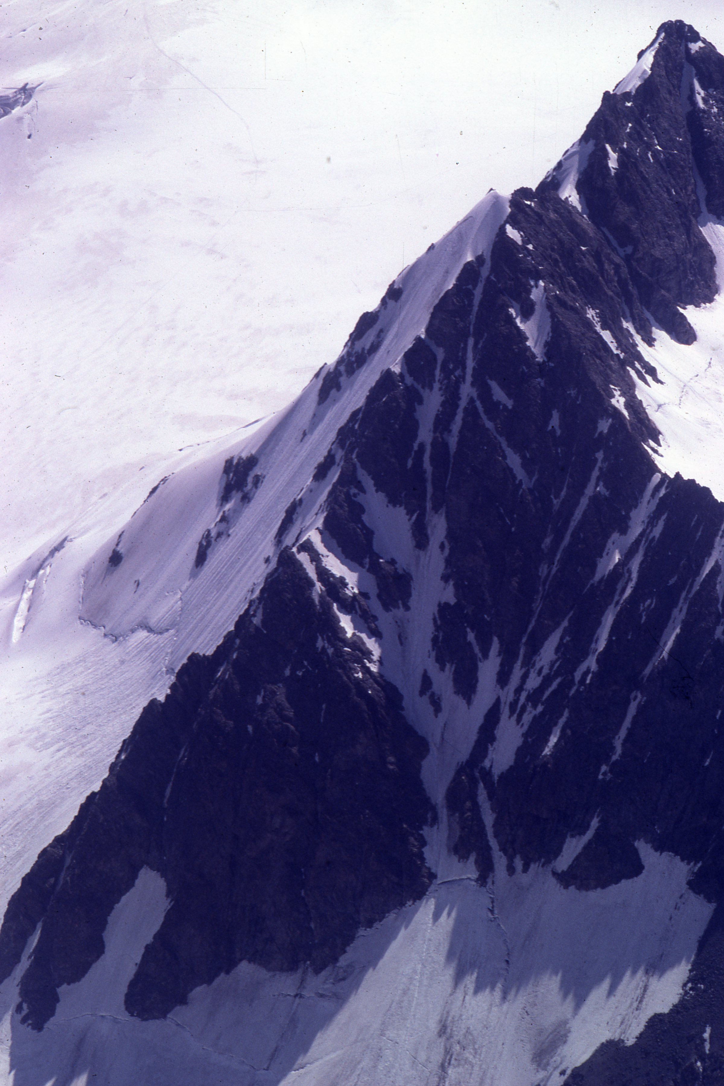 Show on map |
|
|
Albert Bezinge (1981)
Glacier de Vouasson, september 1981 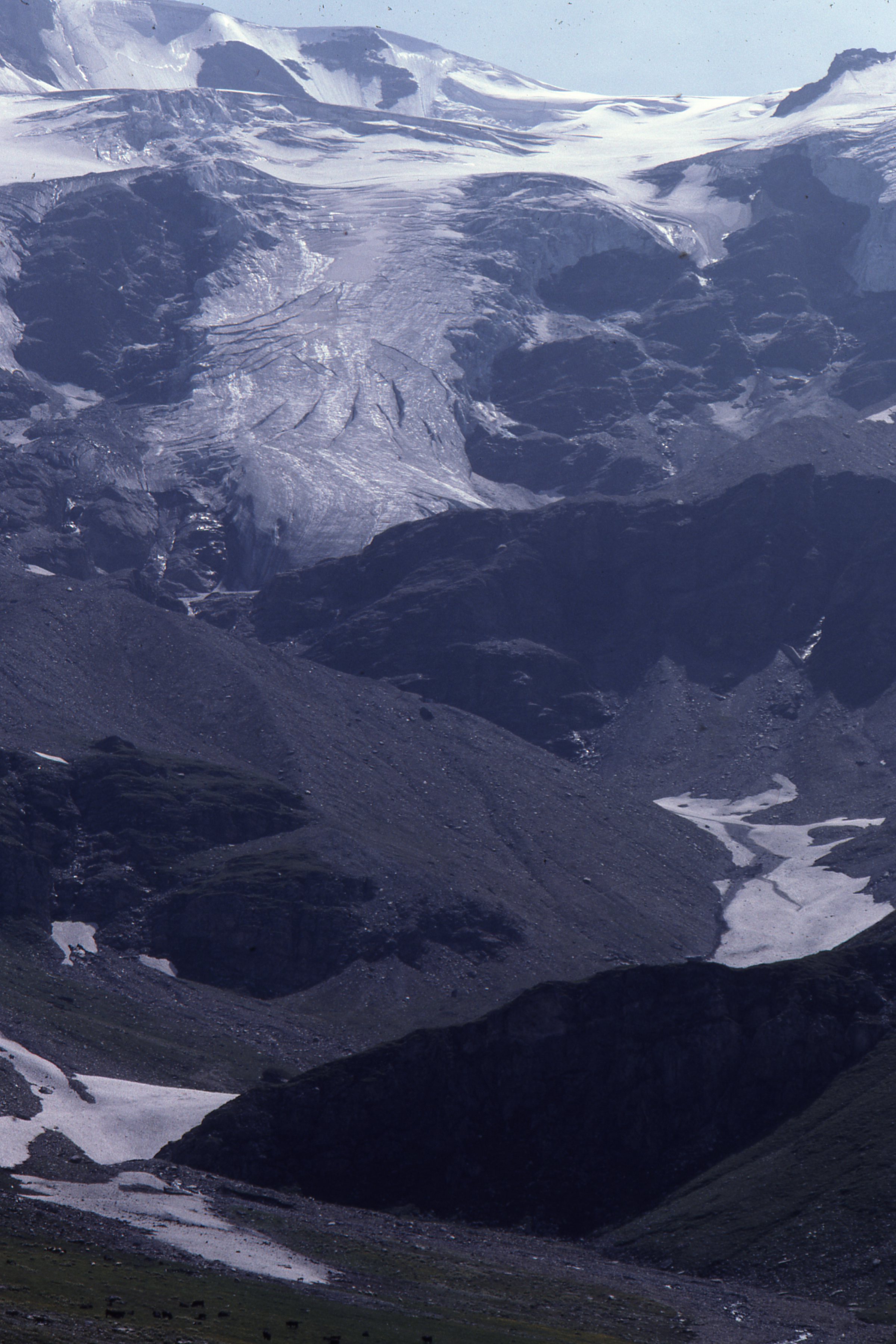 Show on map |
|
|
Albert Bezinge (1981)
Glacier du Mont Miné, serac fall, september 1981 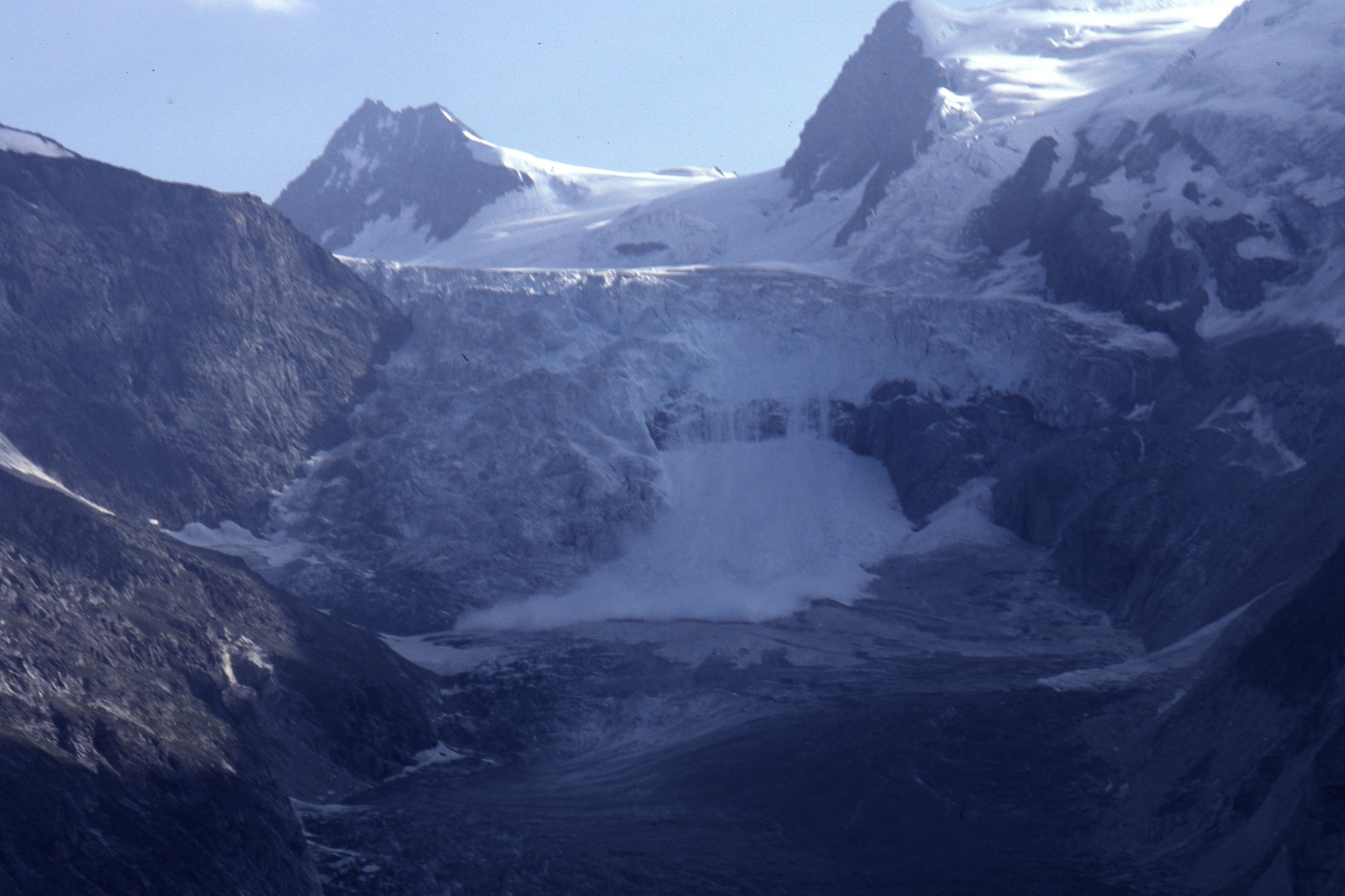 Show on map |
|
|
Albert Bezinge (1981)
Forbes bands Bas Glacier d'Arolla, august 1981 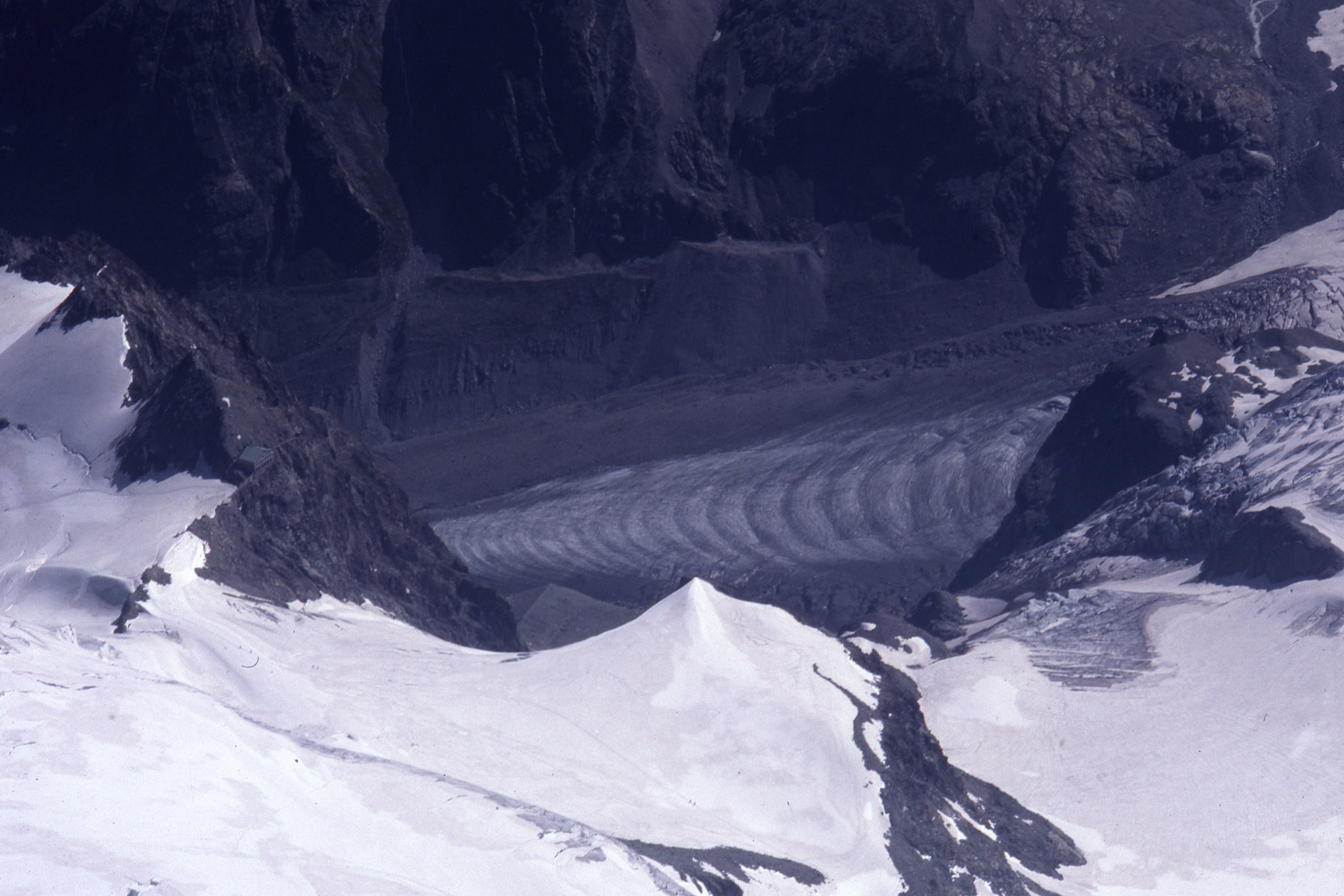 Show on map |
|
|
H. Röthlisberger (1981)
Ice: Recent work in switzerland Show on map |
|
|
Small, R. J. and Gomez, B. (1981)
The nature and origin of debris layers within Glacier de Tsidjiore Nouve, Valais, Switzerland Show on map |
|
|
A. Bezinge (1980)
Dent Blanche, Glacier de la Dent Blanche and Glacier de Bricola - September 1980 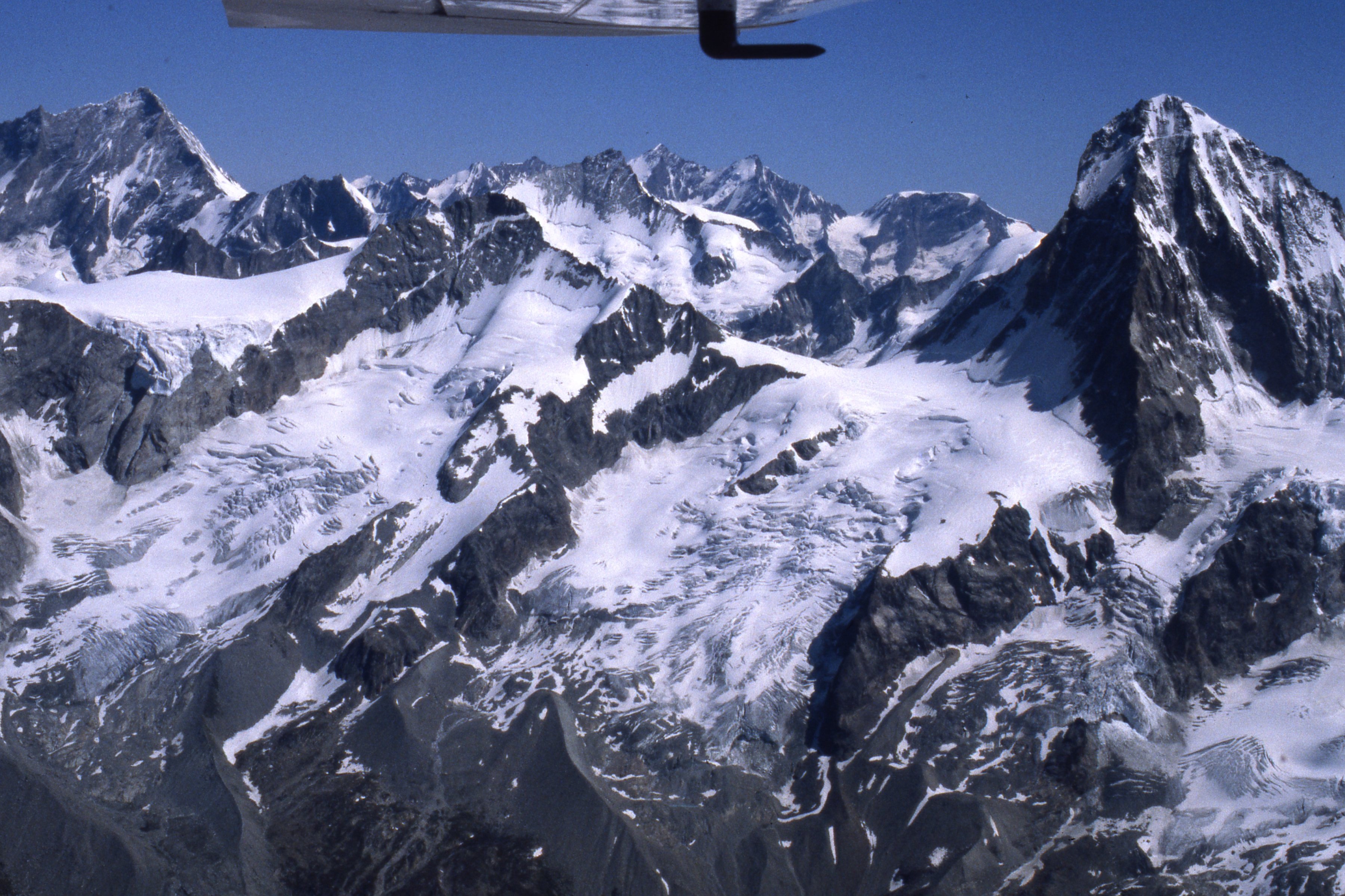 Show on map |
|
|
A. Bezinge (1980)
Glacier de Ferpècle and Glacier du Mont Miné, September 1980 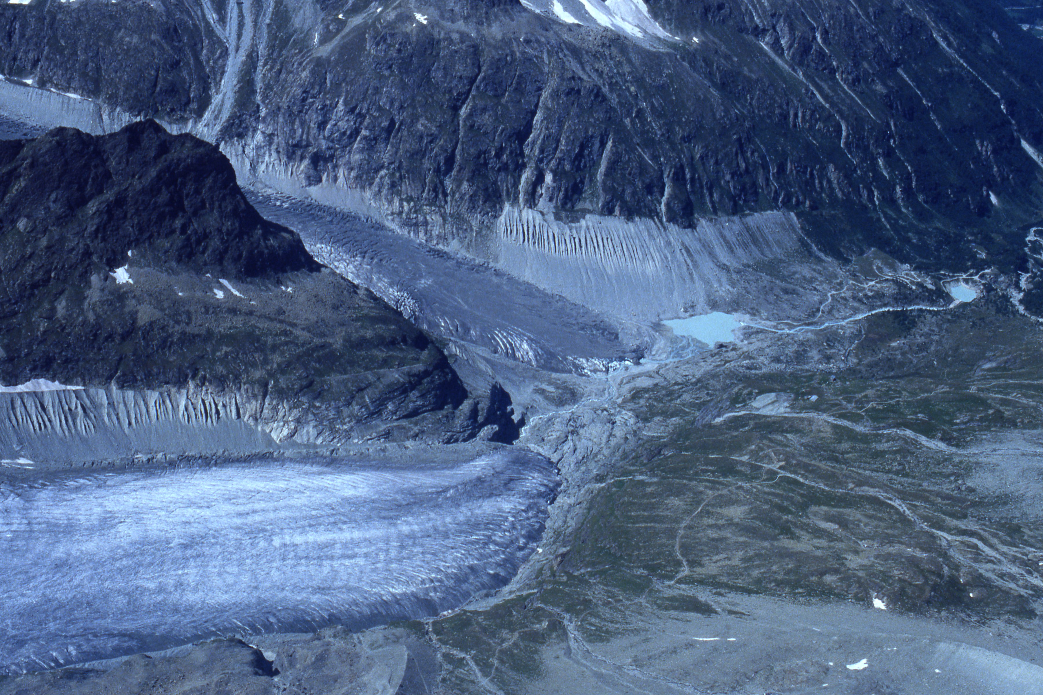 Show on map |
|
|
A. Bezinge (1980)
Glacier de Ferpècle and Glacier du Mont Miné, september 1980 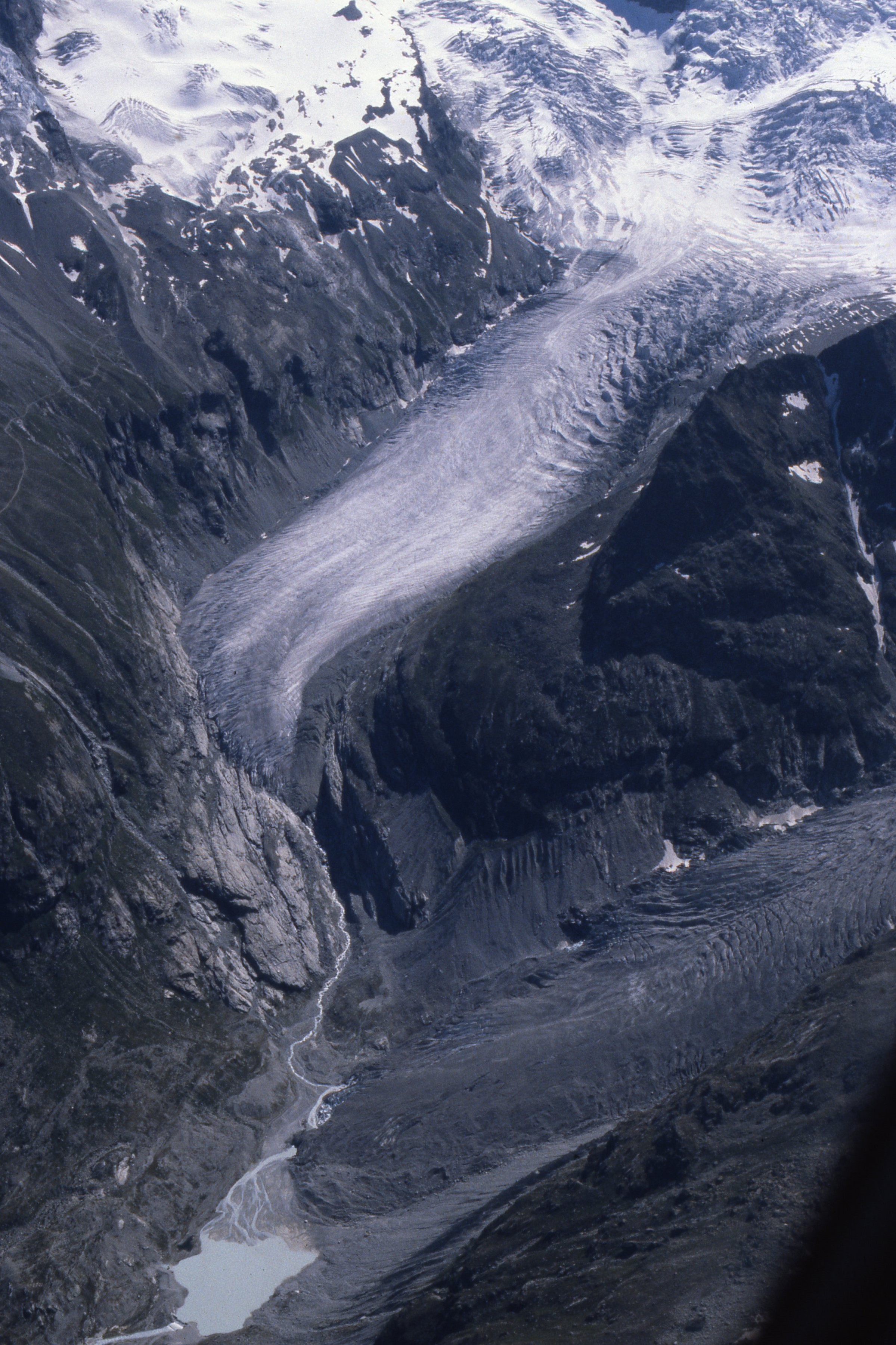 Show on map |
|
|
Unknown author (1980)
Picture of the Bas Glacier d'Arolla and Bertol inférieur water intake around 1980 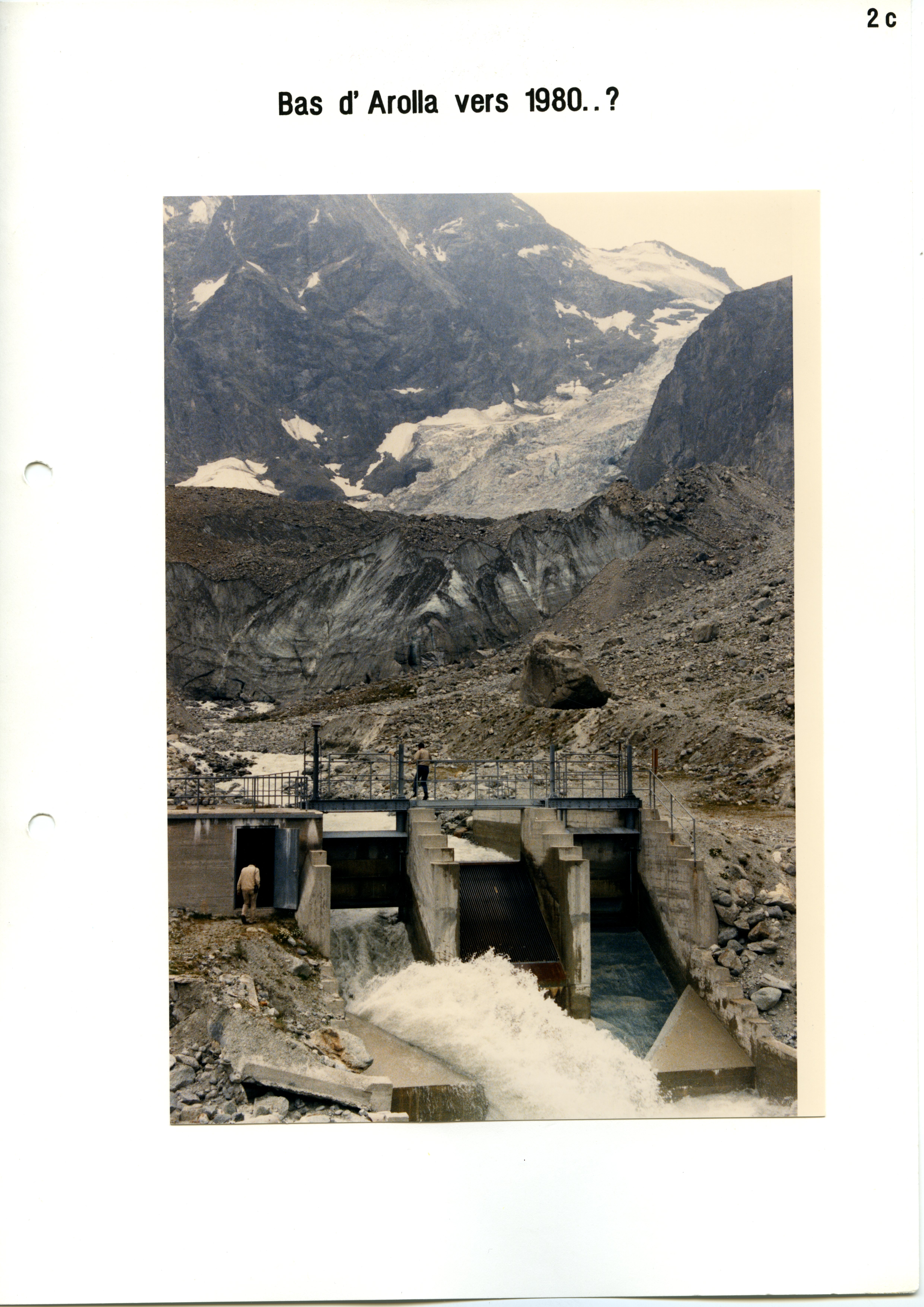 Show on map |
|
|
A. Bezinge (1979)
Totalizer rain gauge, Glacier de Ferpècle - october 1979 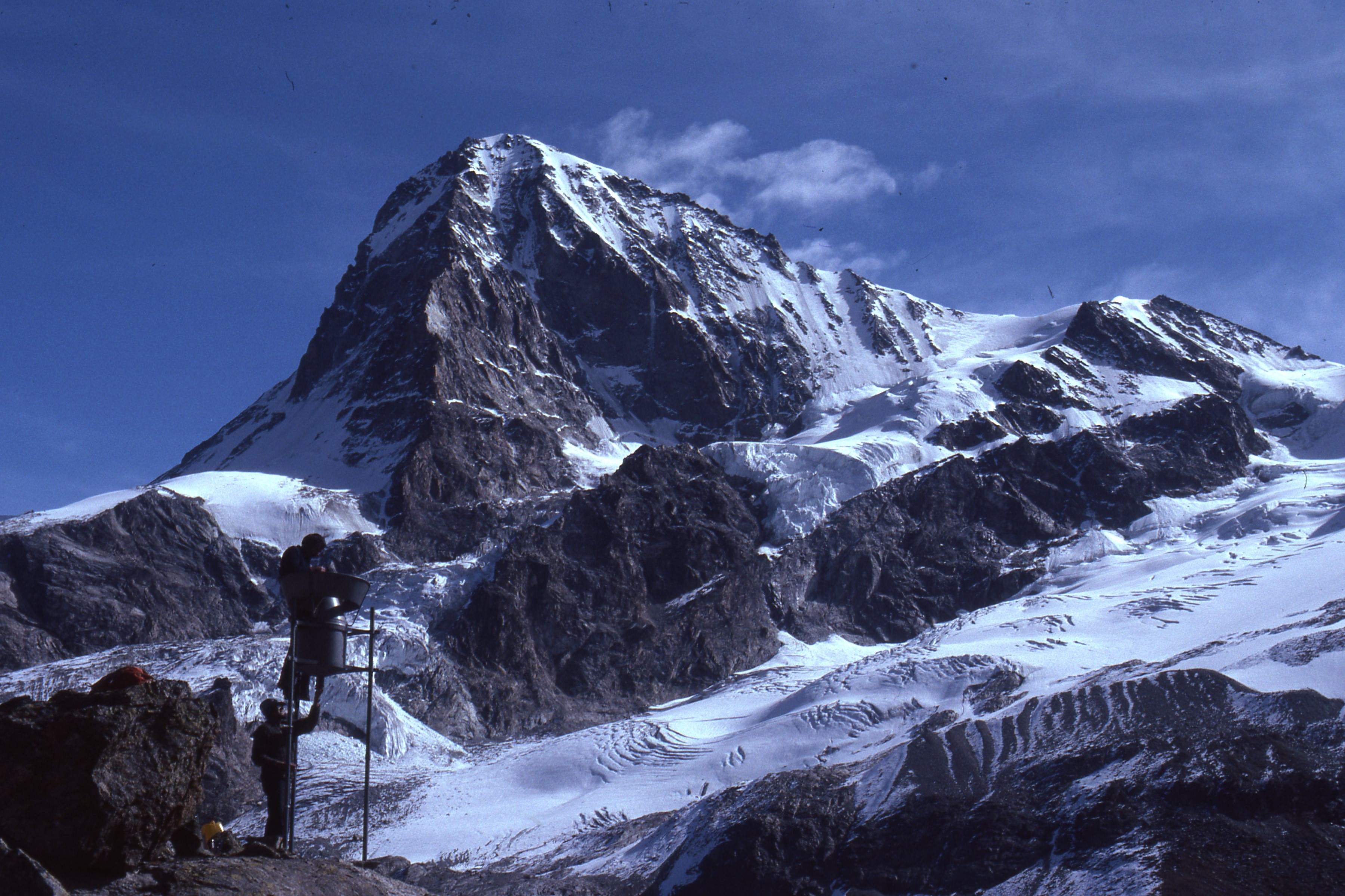 Show on map |
|
|
A. Bezinge (1979)
La collecte de données hydrologiques de base en Suisse Show on map |
|
|
A. Bezinge (1979)
Glacier du Mont Miné, June 1979 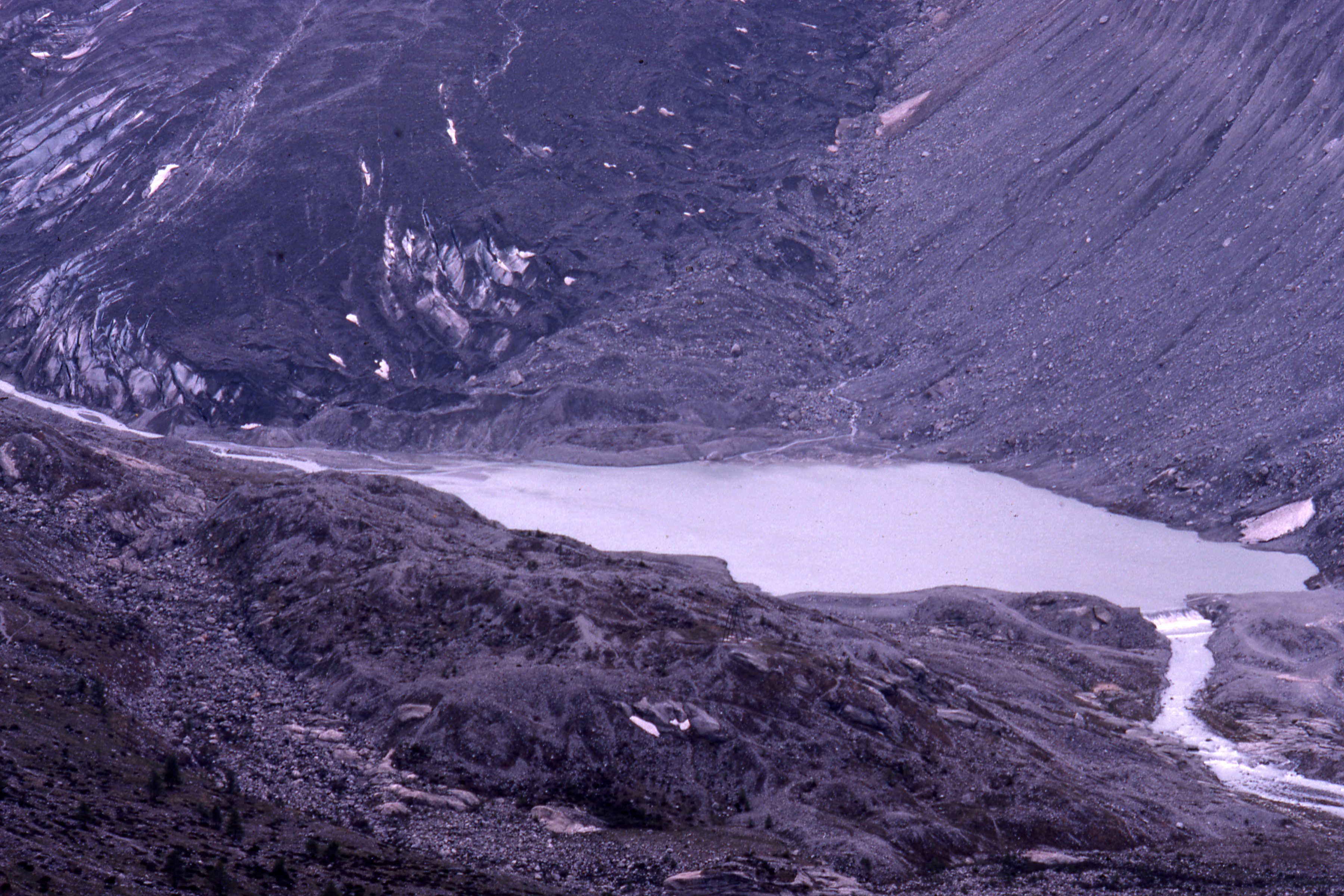 Show on map |
|
|
A. Bezinge (1979)
Totalizer rain gauge, Riedmatten - october 1979 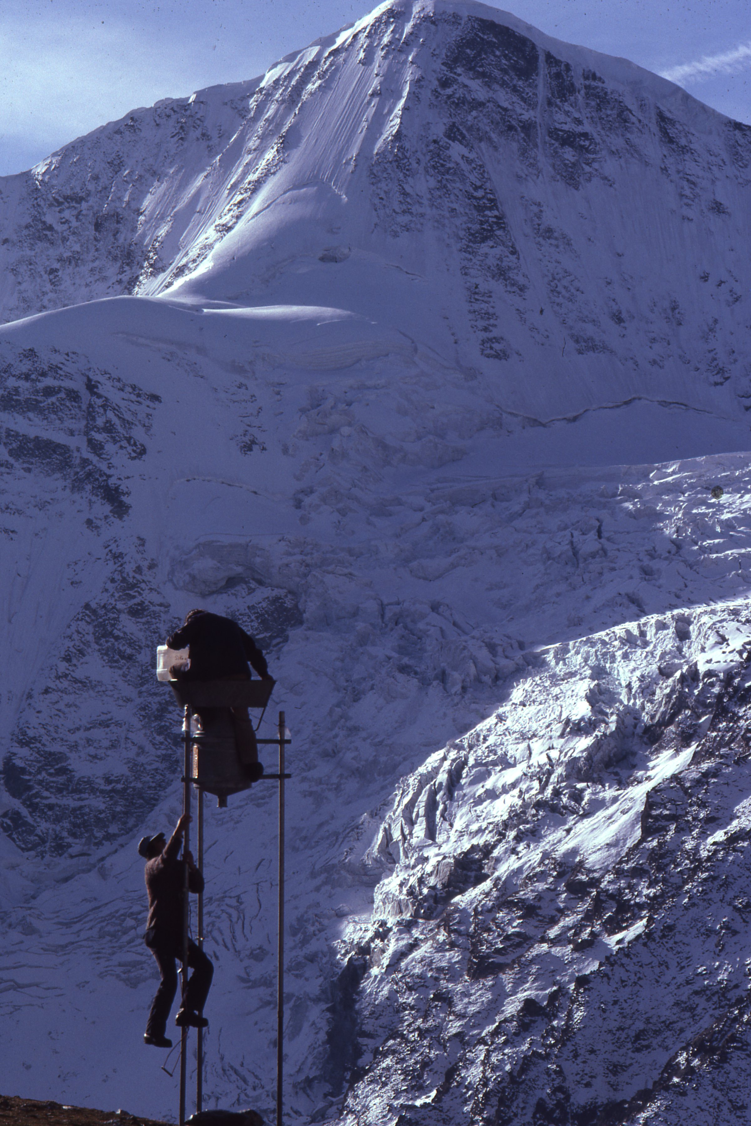 Show on map |
|
|
A. Bezinge (1979)
Bas Glacier d'Arolla, Mont Collon and pumping station, june 1979 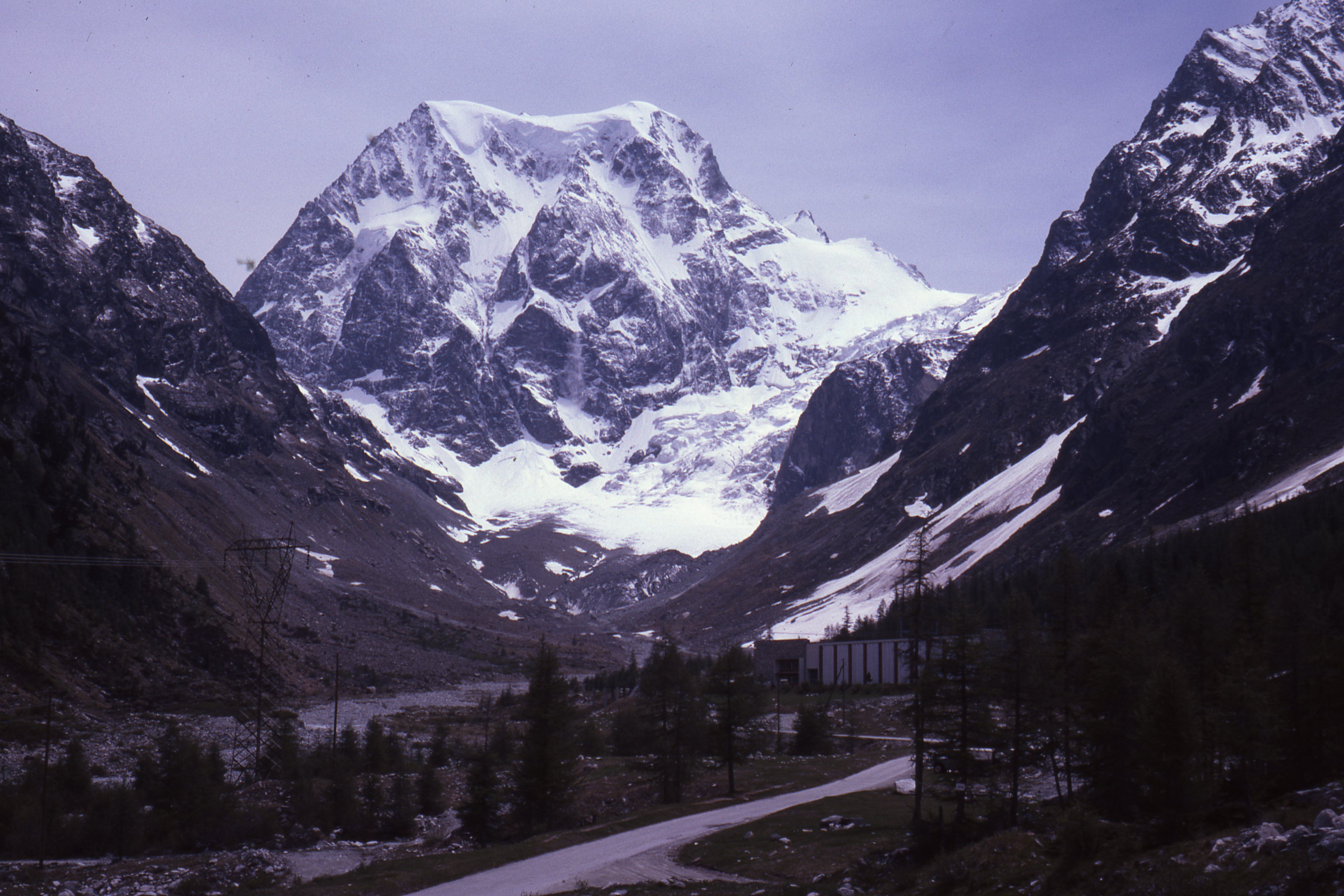 Show on map |
|
|
A. Bezinge (1979)
Glacier de Bricola and Glacier de la Dent Blanche - october 1976 Show on map |
|
|
A. Bezinge (1978)
Glacier du Mont Miné, September 1978  Show on map |
|
|
A. Bezinge (1978)
Aiguilles Rouges d'Arolla from western side, september 1978  Show on map |
|
|
A. Bezinge (1978)
Glacier de Vouasson - September 1978  Show on map |
|
|
A. Bezinge (1978)
Glacier du Mont Miné, september 1978  Show on map |
|
|
A. Bezinge (1978)
Front of the Glacier du Mont Miné, October 1978 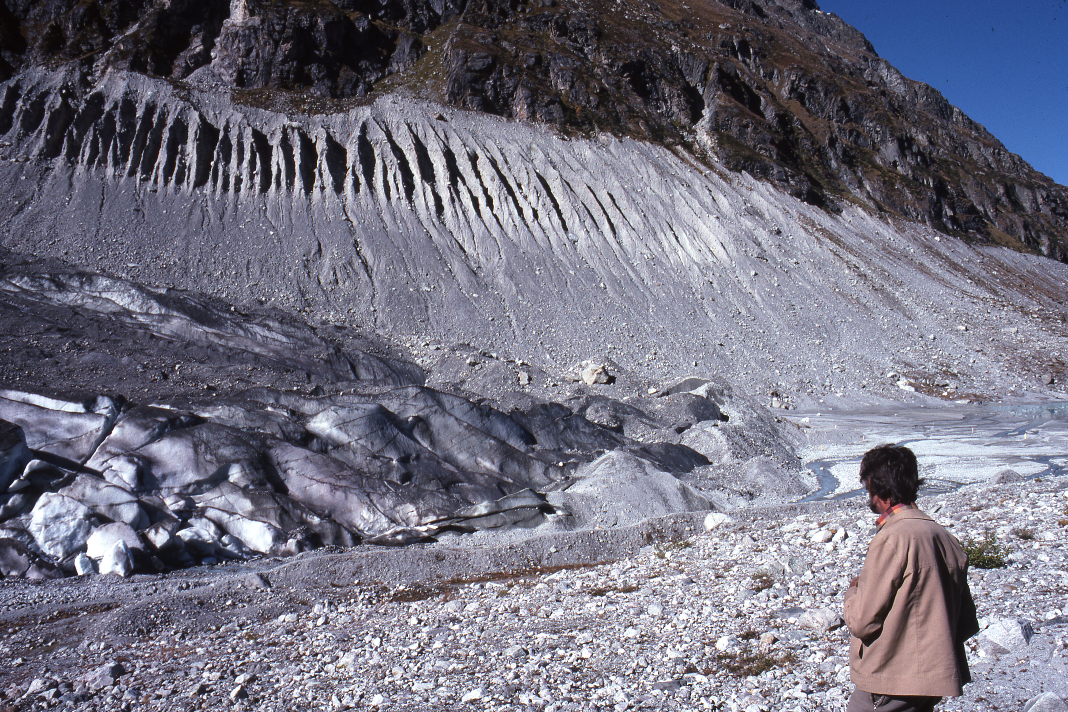 Show on map |
|
|
Albert Bezinge (1978)
Aerial picture of Evolène, Ferpècle and Dent Blanche  Show on map |
|
|
A. Bezinge (1977)
A picture of the Glacier du Mont Collon and water intake (Haut Glacier d'Arolla intake) - july 1977  Show on map |
|
|
A. Bezinge (1977)
Tsijiore-Nouve in 1977  Show on map |
|
|
A. Bezinge (1976)
Douves Blanches water intake, 1976 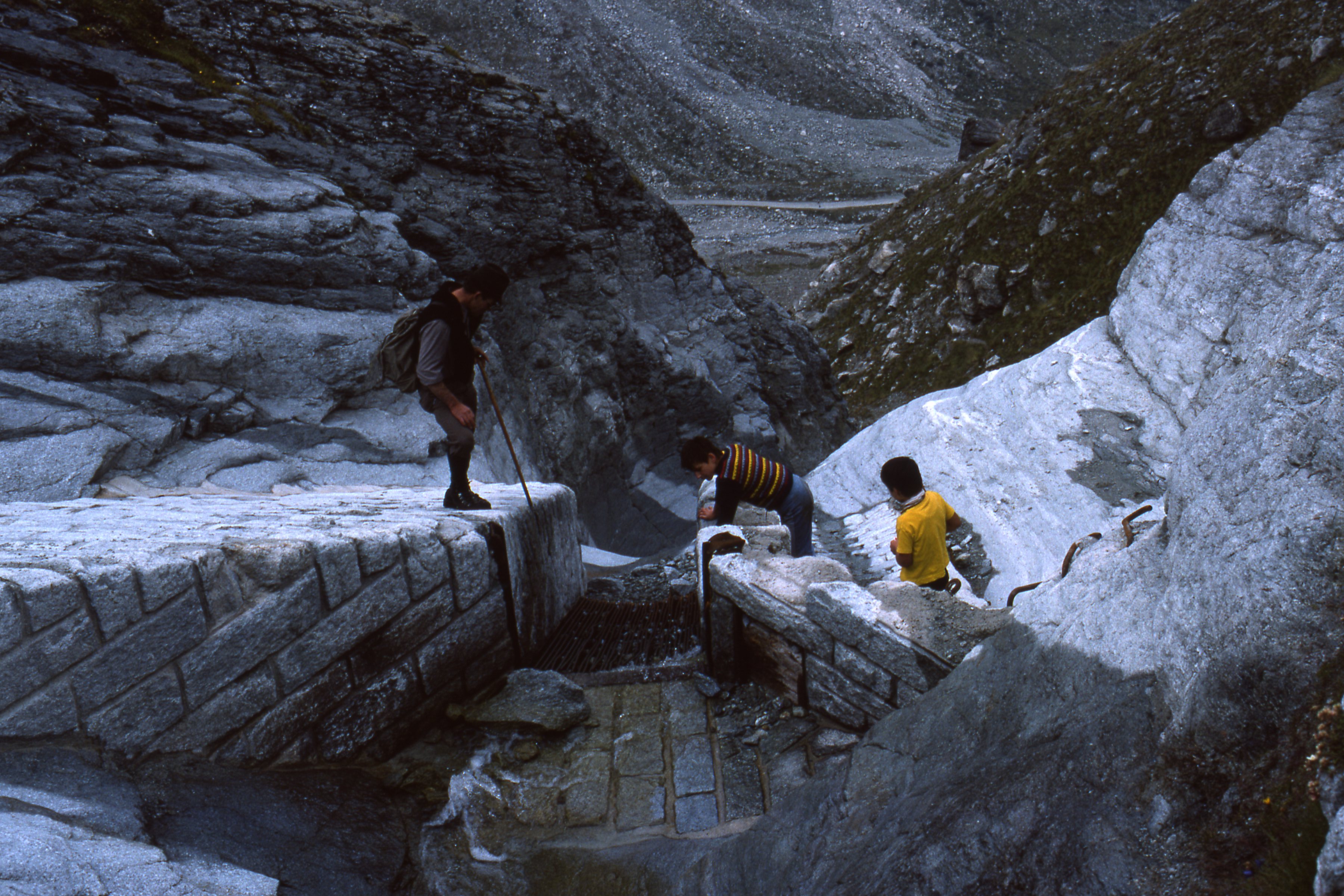 Show on map |
|
|
A. Bezinge (1976)
Glacier des Aiguilles Rouges d'Arolla - September 1976 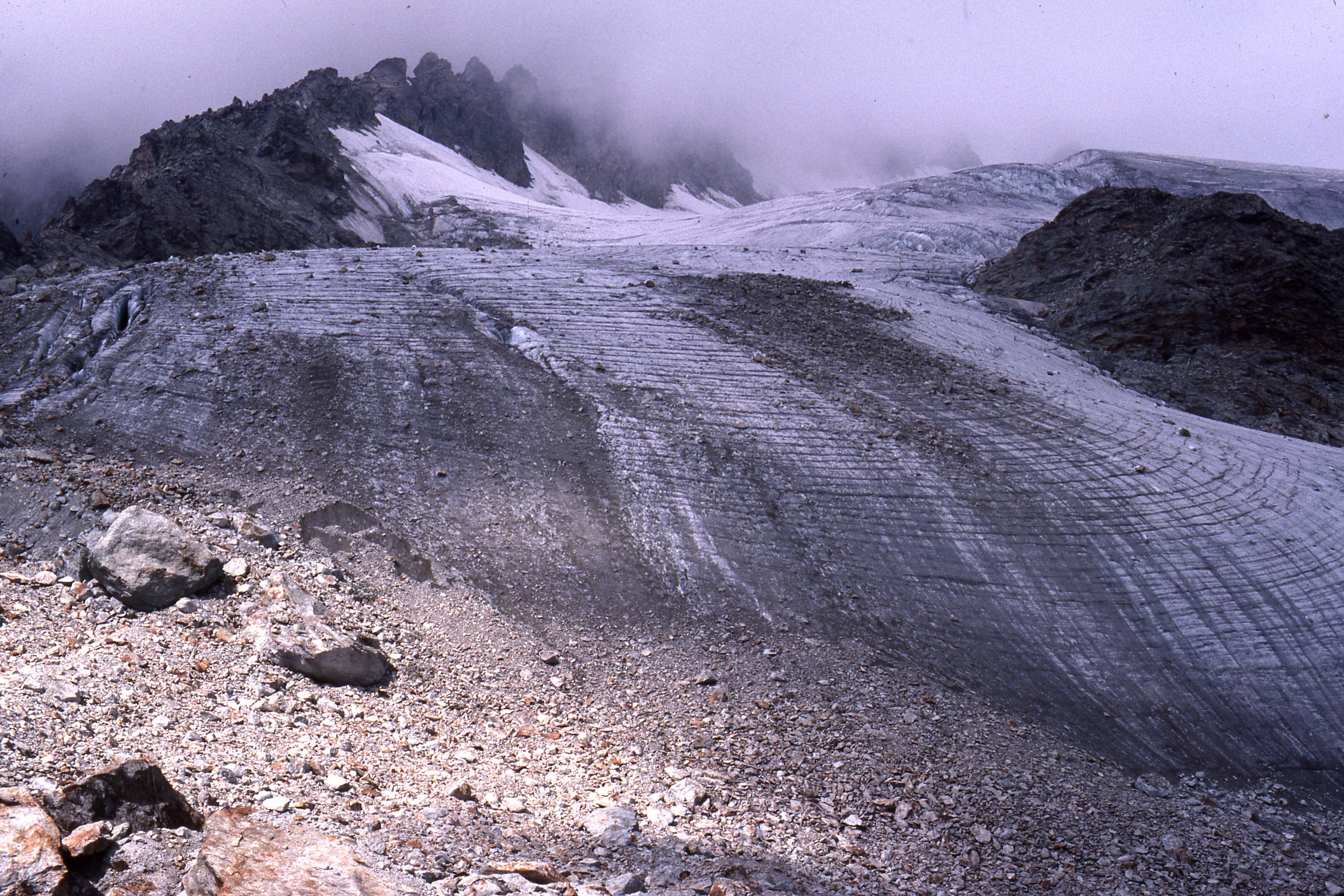 Show on map |
|
|
A. Bezinge (1976)
Dent Blanche and Glacier de la Dent Blanche - August 1976 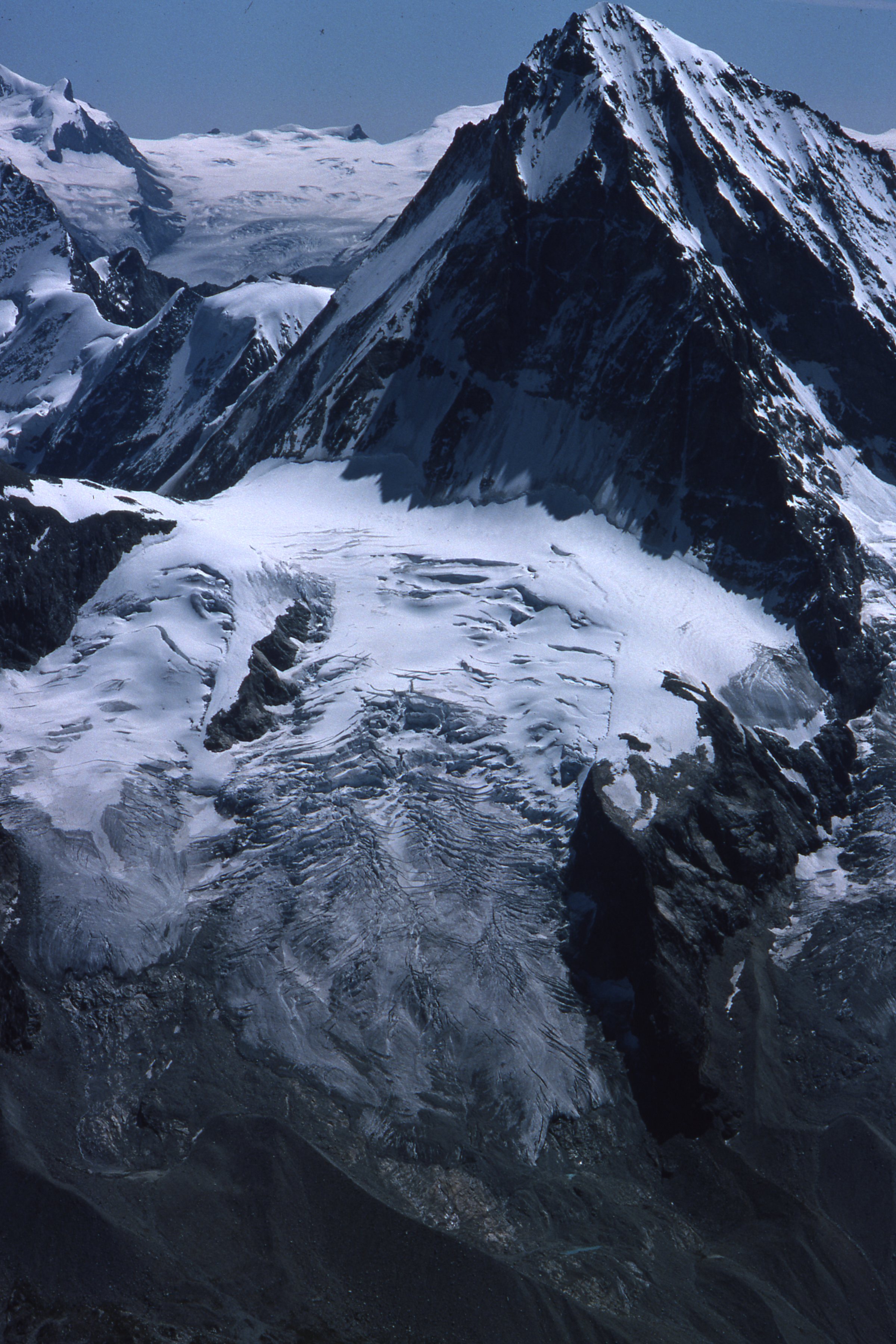 Show on map |
|
|
A. Bezinge (1976)
Aerial picture of Ferpècle valley with front of Mont Miné Glacier and Ferpècle Glacier, August 1976 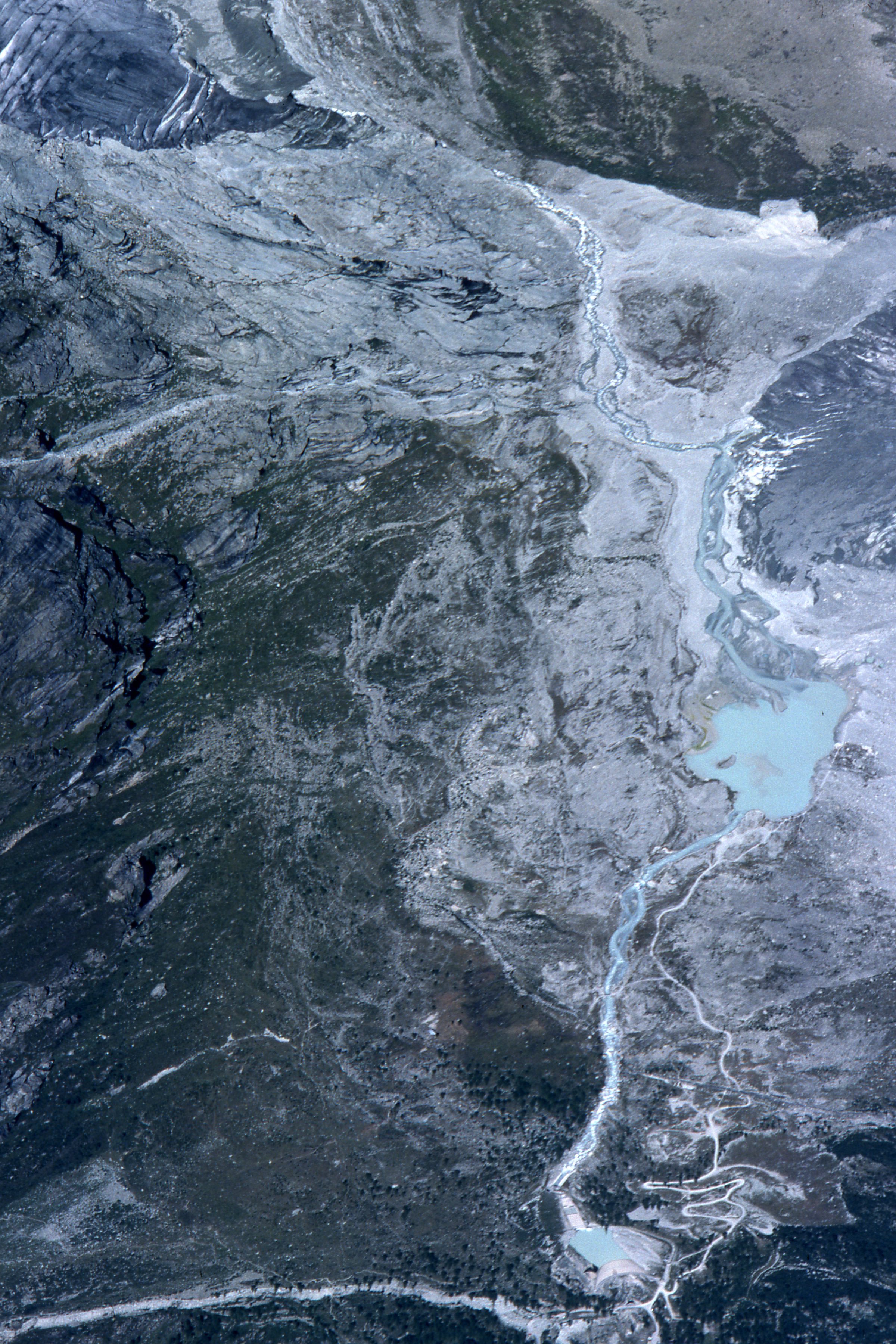 Show on map |
|
|
A. Bezinge (1976)
Aerial picture of the Tsijiore-Nouve in August 1976  Show on map |
|
|
A. Bezinge (1976)
Tsijiore-Nouve - Front in 1976  Show on map |
|
|
A. Bezinge (1976)
Front of the Tsijiore-Nouve, 1976  Show on map |
|
|
A. Bezinge (1976)
Aerial picture of Glacier du Mont Miné (picture from upglacier), August 1976  Show on map |
|
|
A. Bezinge (1976)
Glacier de Vouasson, august 1976 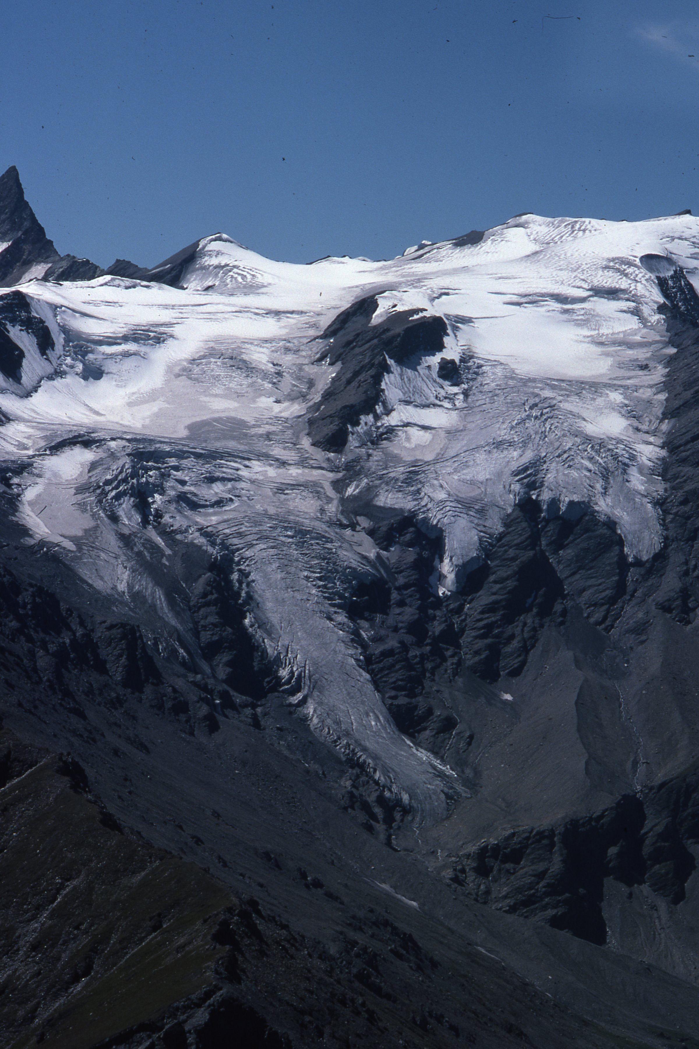 Show on map |
|
|
A. Bezinge (1976)
Aerial picture of Glacier de Bricola, August 1976 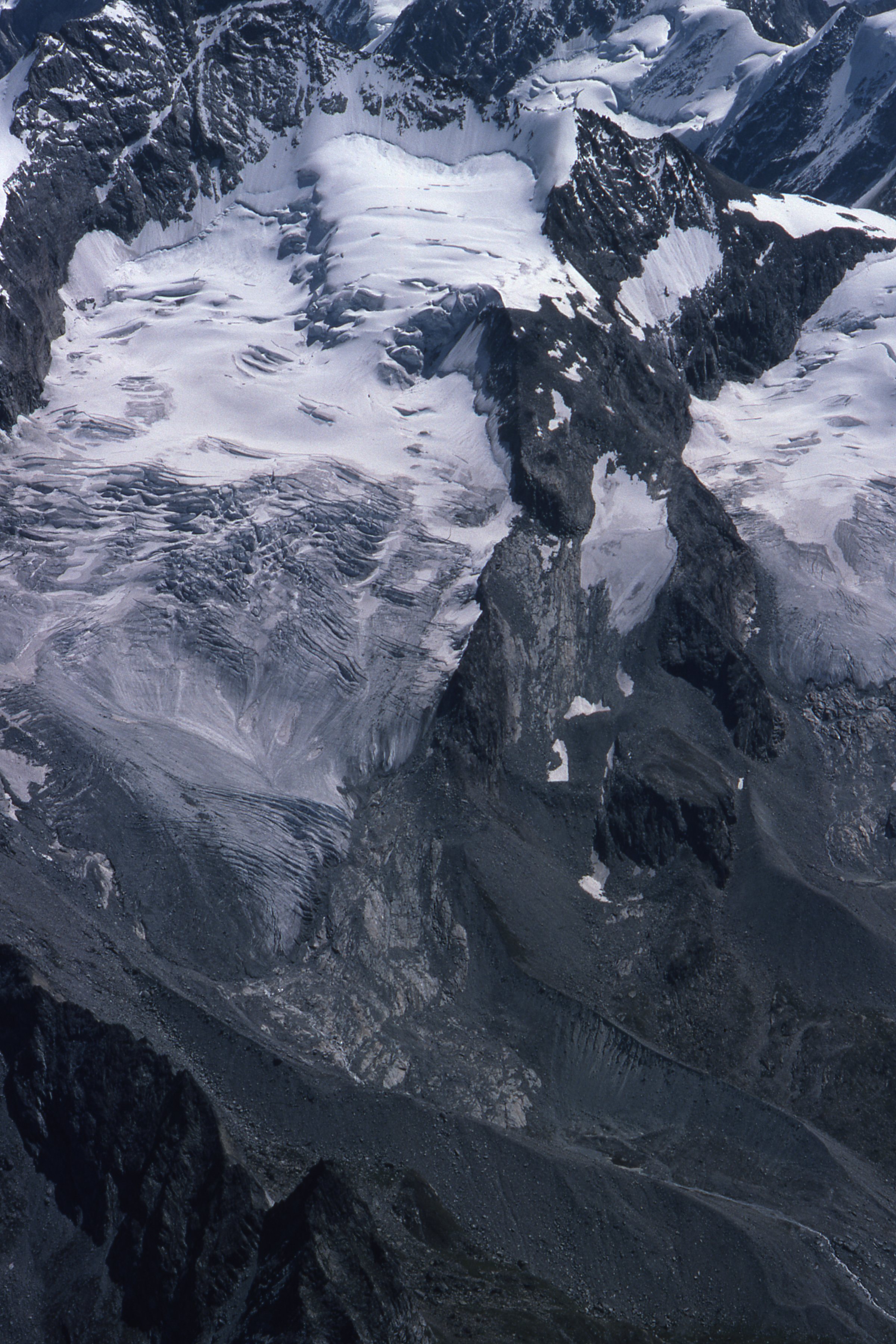 Show on map |
|
|
A. Bezinge et R. Vivian (1976)
Bilan de la Section de Glaciologie de la Société Hydrotechnique de France: Sites sous-glaciaires et climat de la période holocène en Europe Show on map |
|
|
Grande Dixence SA (1976)
Glacier du Bas d'Arolla, Contrôle du mouvement du glacier. Show on map |
|
|
Grande Dixence SA (1976)
Glacier du bas d'Arolla, pose de perches et profile en long Show on map |
|
|
A. Bezinge (1975)
Glacier du Mont Miné, August 1975  Show on map |
|
|
A. Bezinge (1975)
Val d'Hérens et Grande Dixence Show on map |
|
|
A. Bezinge (1974)
Bas Glacier d'Arolla, Forbes Bands - July 1974  Show on map |
|
|
A. Bezinge (1974)
Refuge Haut Glacier d'Arolla and Glacier du Mont Collon - july 1974 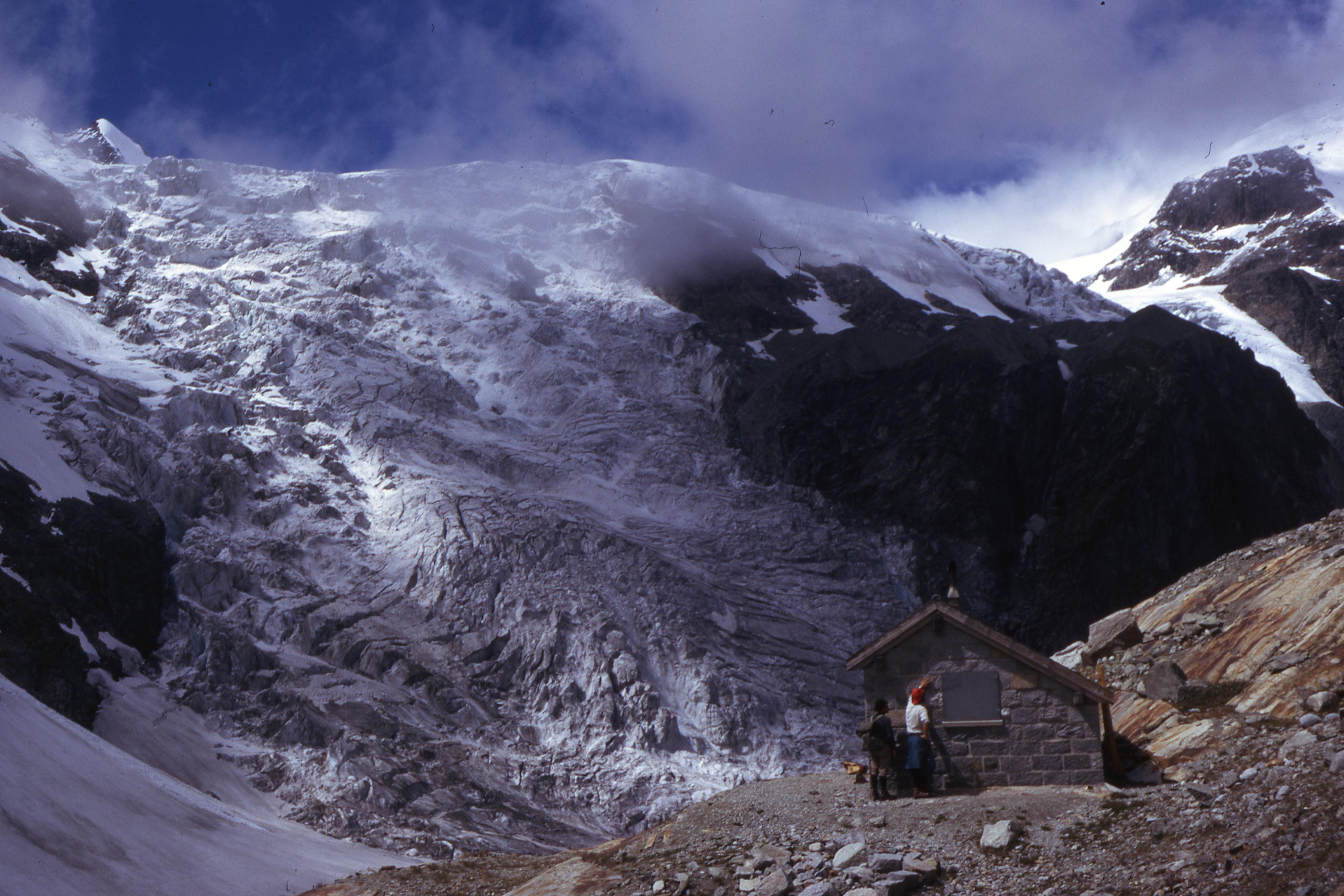 Show on map |
|
|
Friedrich Röthlisberger (1974)
Etude des variations climatiques d'après l'histoire des cols glaciaires. Le Col d'Hérens (Valais, Suisse) Show on map |
|
|
A. Bezinge (1973)
Bas Glacier d'Arolla - August 1973 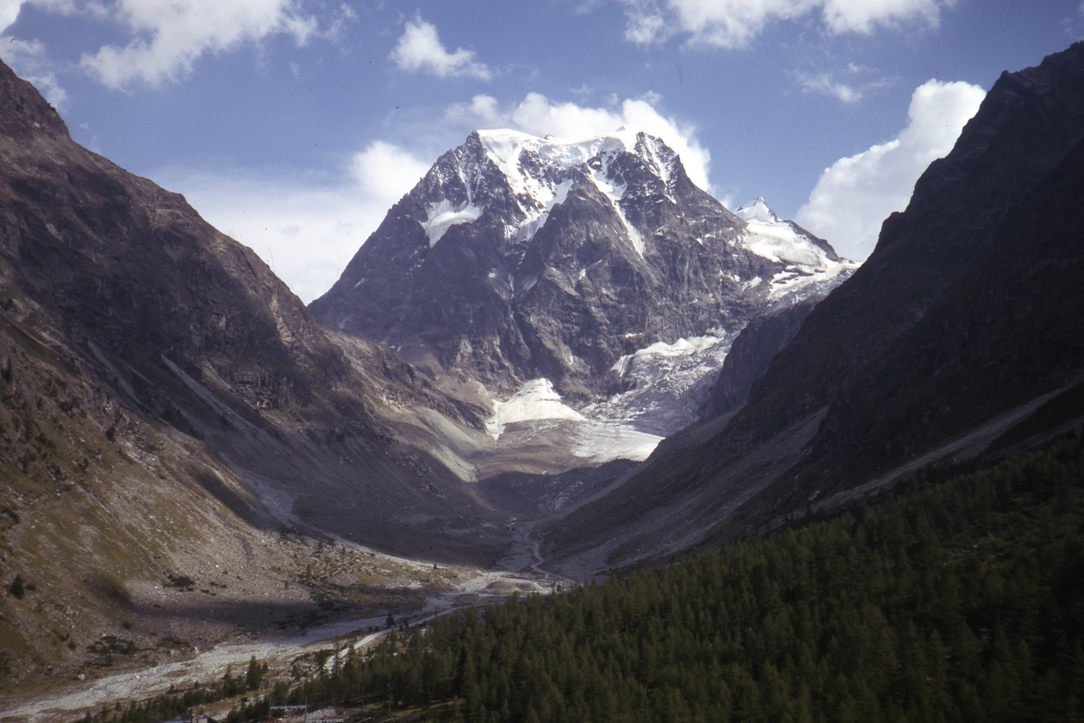 Show on map |
|
|
A. Bezinge (1973)
Glacier du Mont Miné and lake, October 1973 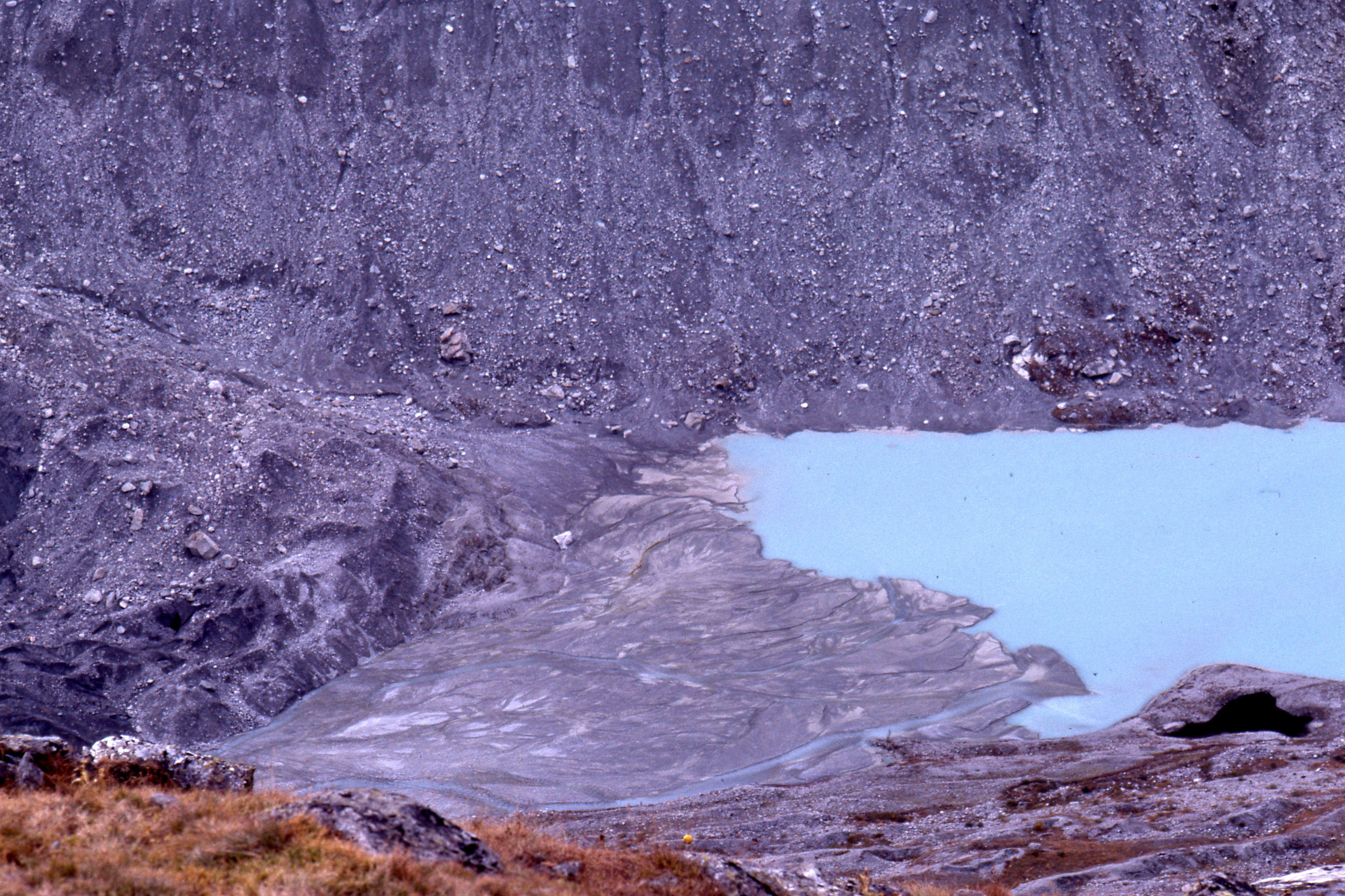 Show on map |
|
|
A. Bezinge (1973)
Mont Collon, Bas Glacier d'Arolla and Haut Glacier d'Arolla - 1973? 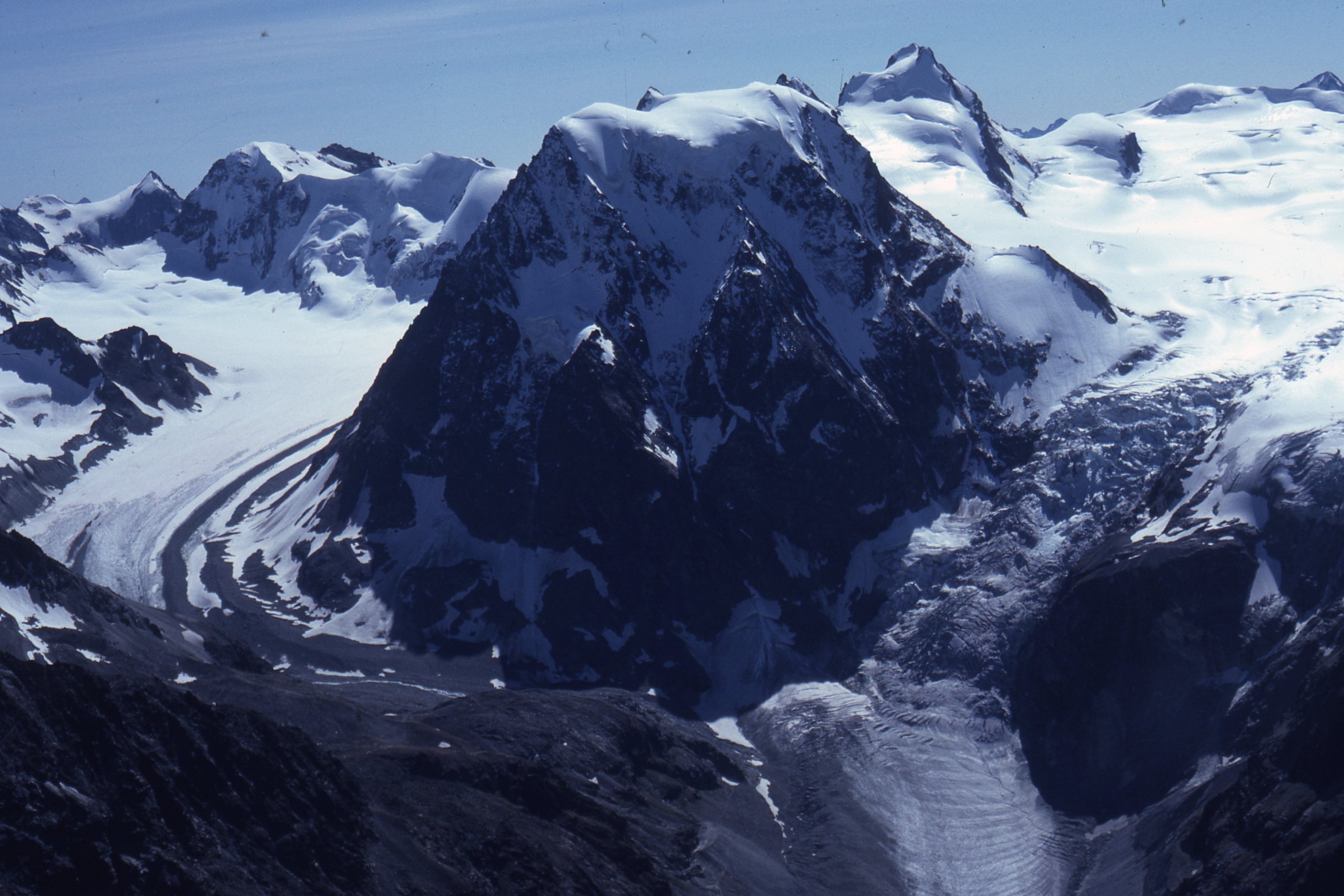 Show on map |
|
|
A. Bezinge (1973)
Les lacs artificiels sont-ils responsables du brouillard? Show on map |
|
|
A. Bezinge (1973)
Front of the Tsijiore Nouve in 1973  Show on map |
|
|
A. Bezinge (1973)
Pigne d'Arolla and Mont Collon - September 1973 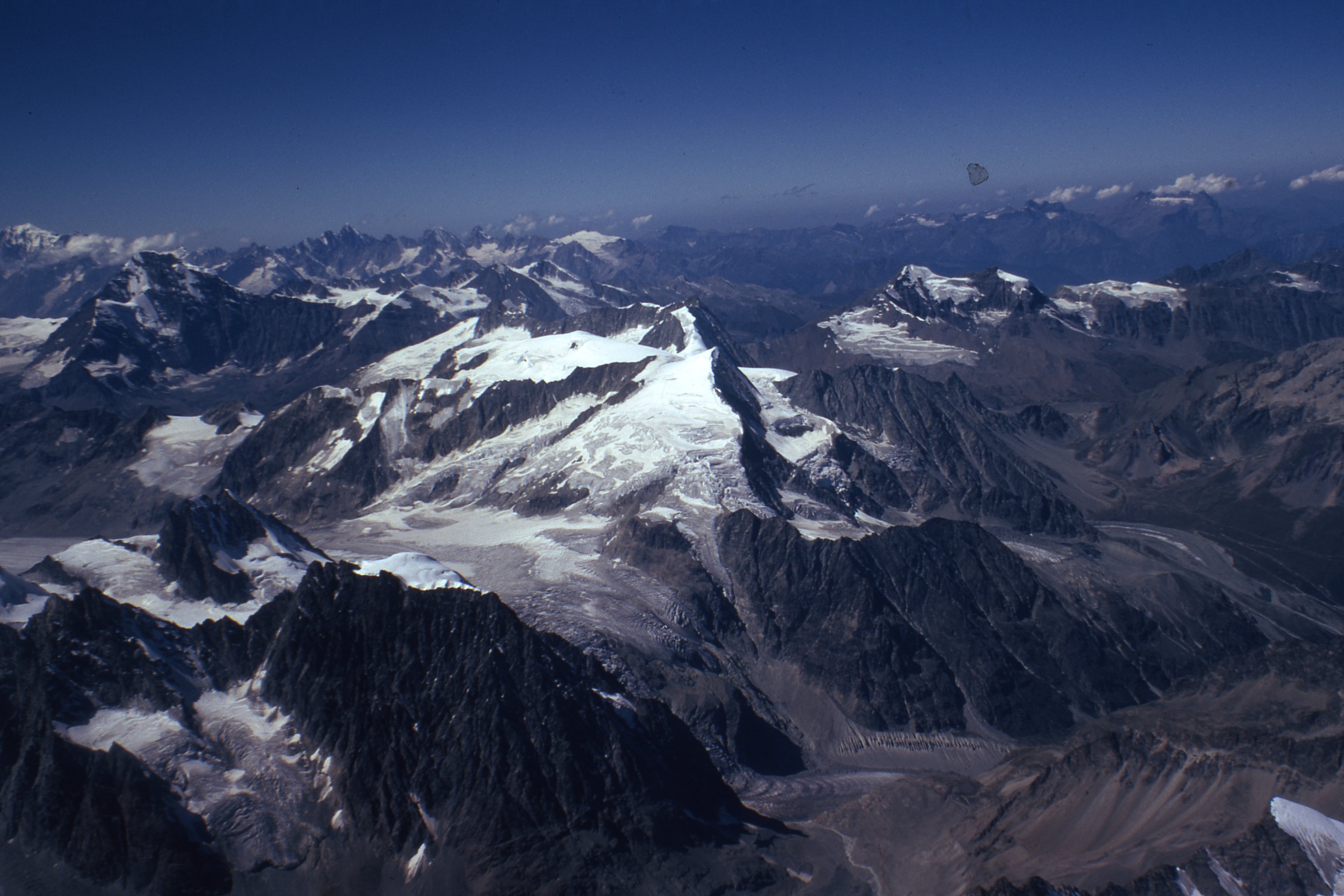 Show on map |
|
|
A. Bezinge (1973)
Tsijiore-Nouve - Front in september 1973  Show on map |
|
|
A. Bezinge (1973)
Effets des bassins artificiels sur l'équilibre naturel Show on map |
|
|
A. Bezinge (1973)
Tsijiore-Nouve in August 1973  Show on map |
|
|
A. Bezinge et G. Bonvin (1973)
Image du climat sur les Alpes Show on map |
|
|
Albert Bezinge (1973)
Aerial picture of Glacier de Ferpècle and Ferpècle valley, september 1973 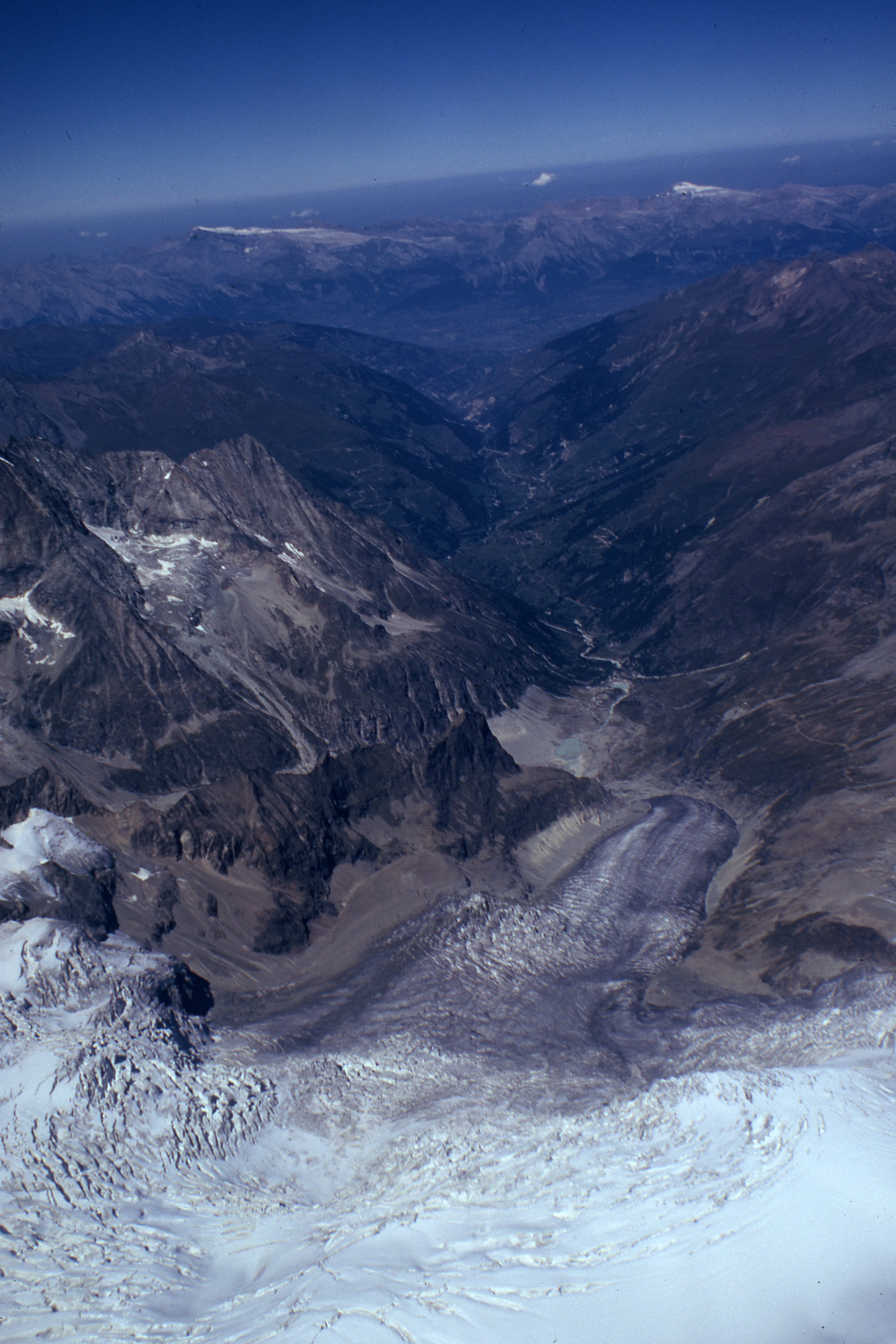 Show on map |
|
|
Albert Bezinge (1973)
Aerial picture of Arolla 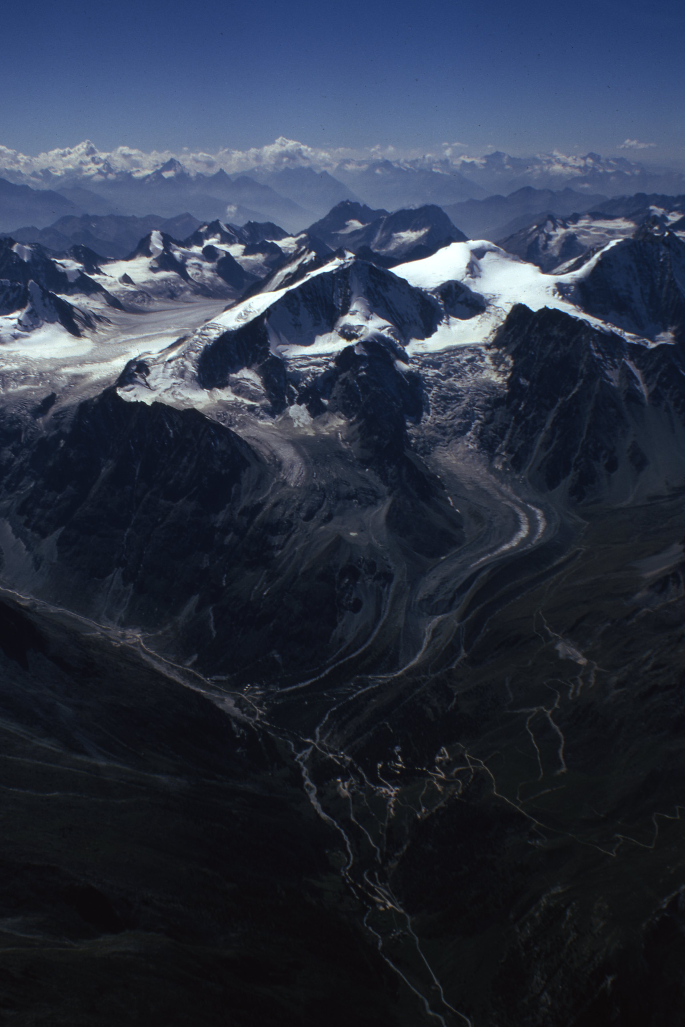 Show on map |
|
|
Barnèdès (1973)
Ferpècle lake and Mont Miné Glacier, Fall 1973 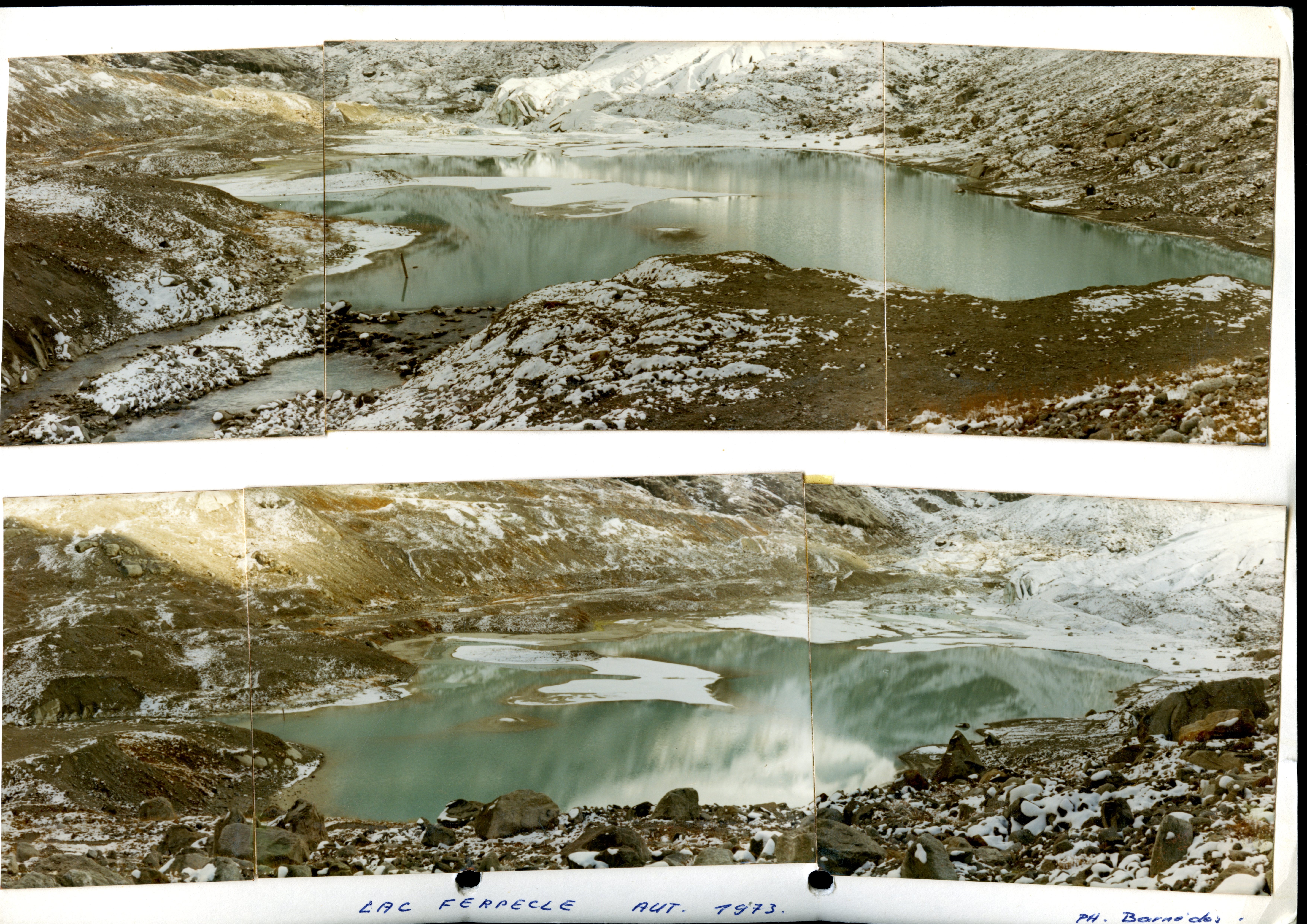 Show on map |
|
|
A. Bezinge (1972)
Constatations et remarques au sujet de prises ou visites sous-glaciaires Show on map |
|
|
A. Bezinge et J.-P. Perreten (1972)
Sites sous-glaciaires des Alpes dans glaces tempérées Show on map |
|
|
No authors (1971)
Bas Glacier, 1971 Show on map |
|
|
A. Bezinge (1971)
Déglaciation dans les vals de Zermatt et d'Hérens de 1930 à 1970 Show on map |
|
|
A. Bezinge (1971)
Variations des altitudes des fronts glaciaires Vallée d'Arolla Show on map |
|
|
A. Bezinge (1971)
Glaciation des bassins de Zermatt, Hérens, Dix et Cleuson Show on map |
|
|
A. Bezinge (1970)
Pigne d'Arolla and Tsijiore Nouve - around 1970-1980  Show on map |
|
|
Joan Pralong and Stuart Lane (1970)
Haut Glacier d'Arolla mid 1970 vs now  Show on map |
|
|
A. Bezinge (1969)
Glacier de Cheilon, september 1969  Show on map |
|
|
A. Bezinge (1969)
Mont Miné Glacier, lake and moraines, August 1969  Show on map |
|
|
Albert Bezinge (1969)
Aerial picture of Tsijiore-nouve and Bas Glacier d'Arolla  Show on map |
|
|
Albert Bezinge (1969)
Glacier du Mont Miné, August 1969  Show on map |
|
|
P. Kasser (1968)
Gletscherbeobachtunggen in der Schweiz Show on map |
|
|
Chrystelle Gabbud (1967)
A DEM of Haut Glacier d'Arolla. 1m resolution. Show on map |
|
|
A. Bezinge (1966)
Grande Dixence et les problèmes météorologiques qui lui sont liés Show on map |
|
|
No authors (1965)
Progressions et régression des fronts de quelques glaciers de 1892 à 1965 Show on map |
|
|
Grande Dixence SA (1965)
Glacier du Haut d'Arolla. Superficie de la glace et superficie totale Show on map |
|
|
Unknown author (1960)
Dent de Perroc and Aiguille de La Tsa 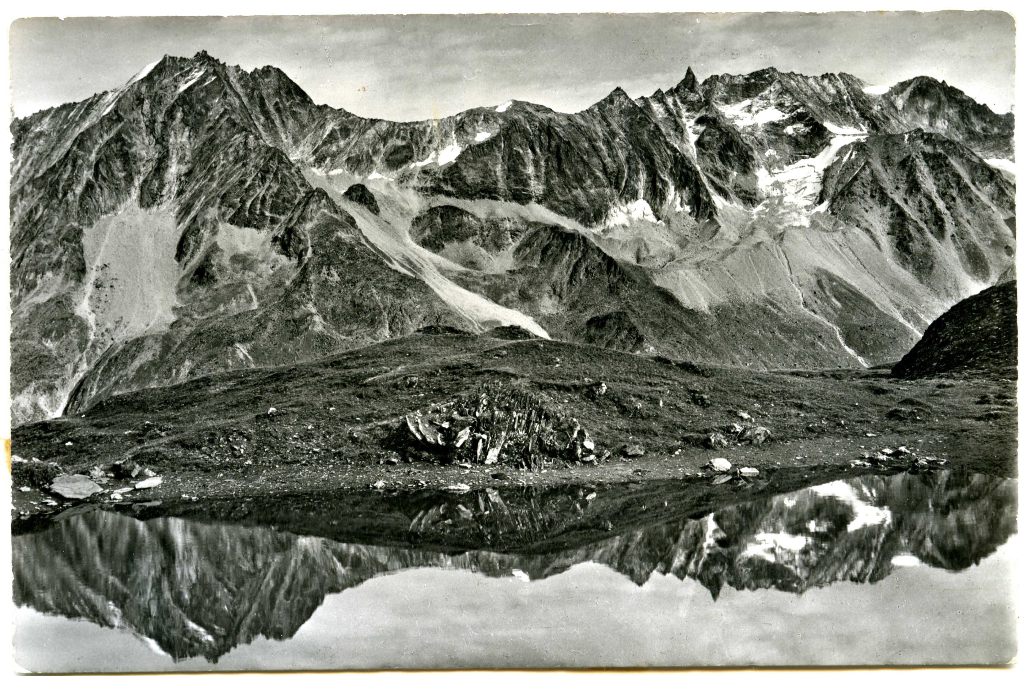 Show on map |
|
|
No authors (1959)
Untitled  Show on map |
|
|
No authors (1959)
Borgne d'Arolla  Show on map |
|
|
No authors (1959)
Untitled  Show on map |
|
|
Peter Eckardt (1959)
Prises d'eau et stations de pompage Show on map |
|
|
Jacques Martin-Chavannes (1953)
Les débâcles au vallon de Ferpècle Show on map |
|
|
Grande Dixence SA (1952)
Glacier du Mont Collon et de bas d'Arolla, profile en long et déplacements horizontaux superficiels Show on map |
|
|
Grande Dixence SA et Haefeli (1952)
Glacier du Mont-Collon. Galerie sous-glaciaire et Stress Trajectories Show on map |
|
|
M.E. Walser (1952)
La crue de la Borgne le 4 août 1952 Show on map |
|
|
Grande Dixence SA (1950)
Glacier de Bas d'Arolla. Profile en travers 300m en aval du front du glacier Show on map |
|
|
Grande Dixence SA (1949)
Arolla Glacier du Mont Collon, balises pour mesures d'ablation et écoulement. Situation au 23.6.1949 Show on map |
|
|
Süsstrunk (1949)
Seismische Messungen auf dem Glacier du Mont Collon 1949 Show on map |
|
|
Grande Dixence SA (1948)
Glacier du Mont-Collon. Galerie de prospection. Coupe en long schématique Show on map |
|
|
Toni Hagen (1944)
Der Gletscherausbruch von Ferpècle Show on map |
|
|
Unknown author (1940)
Galerie de prospection Bas Glacier d'Arolla, 1940-1950's ? 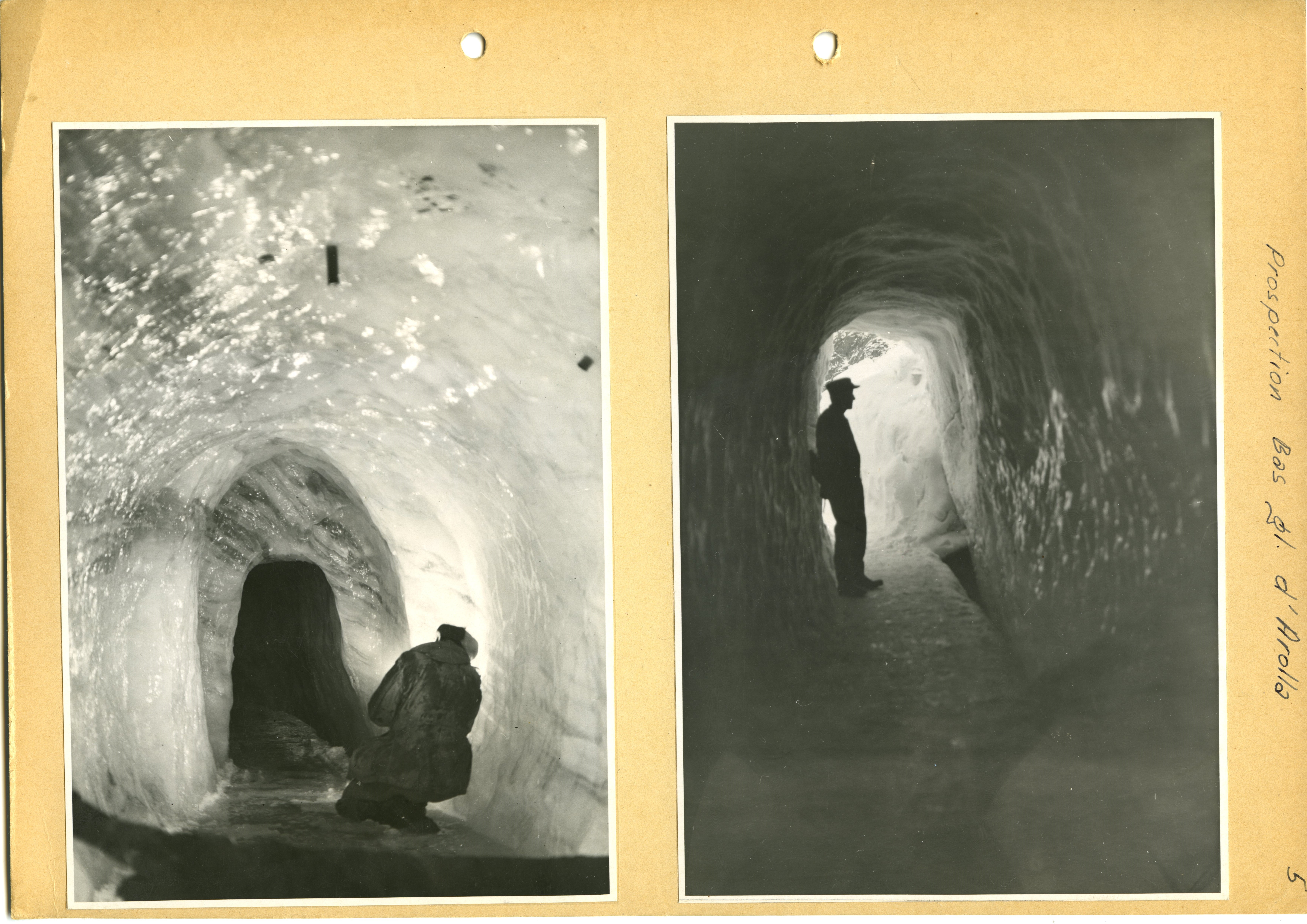 Show on map |
|
|
No authors (1939)
Bas Glacier, 1939 Show on map |
|
|
No authors (1935)
Bas Glacier, 1955 Show on map |
|
|
Stuart Lane (1930)
Photograph above Remointse d'Arolla, showing the Tsijiore Nouve Glacier and its moraines Show on map |
|
|
No authors (1920)
Dent de Perroc and Aiguille de la Tsa from La Gouille, 1920 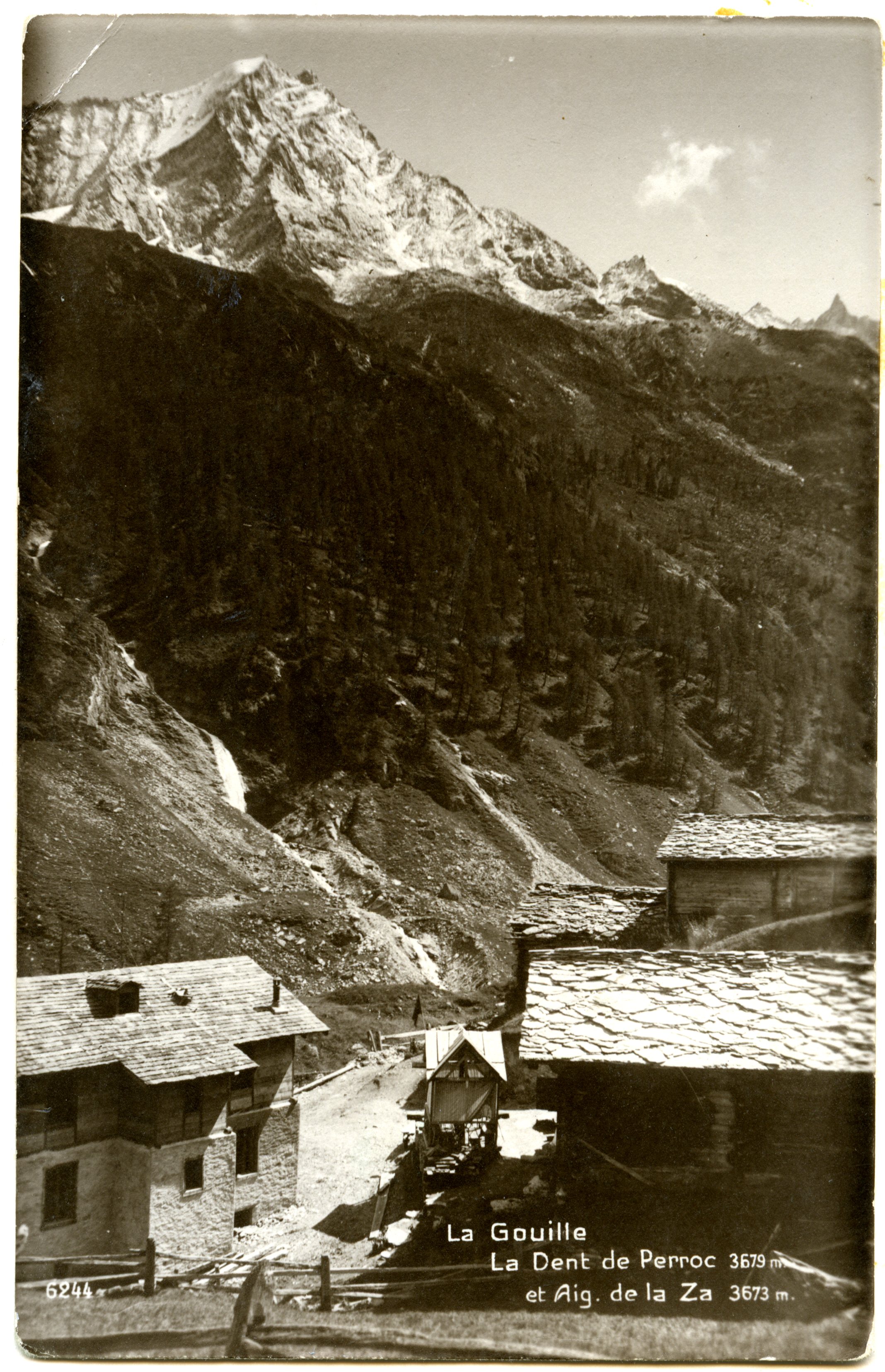 Show on map |
|
|
No authors (1917)
Sion 1917 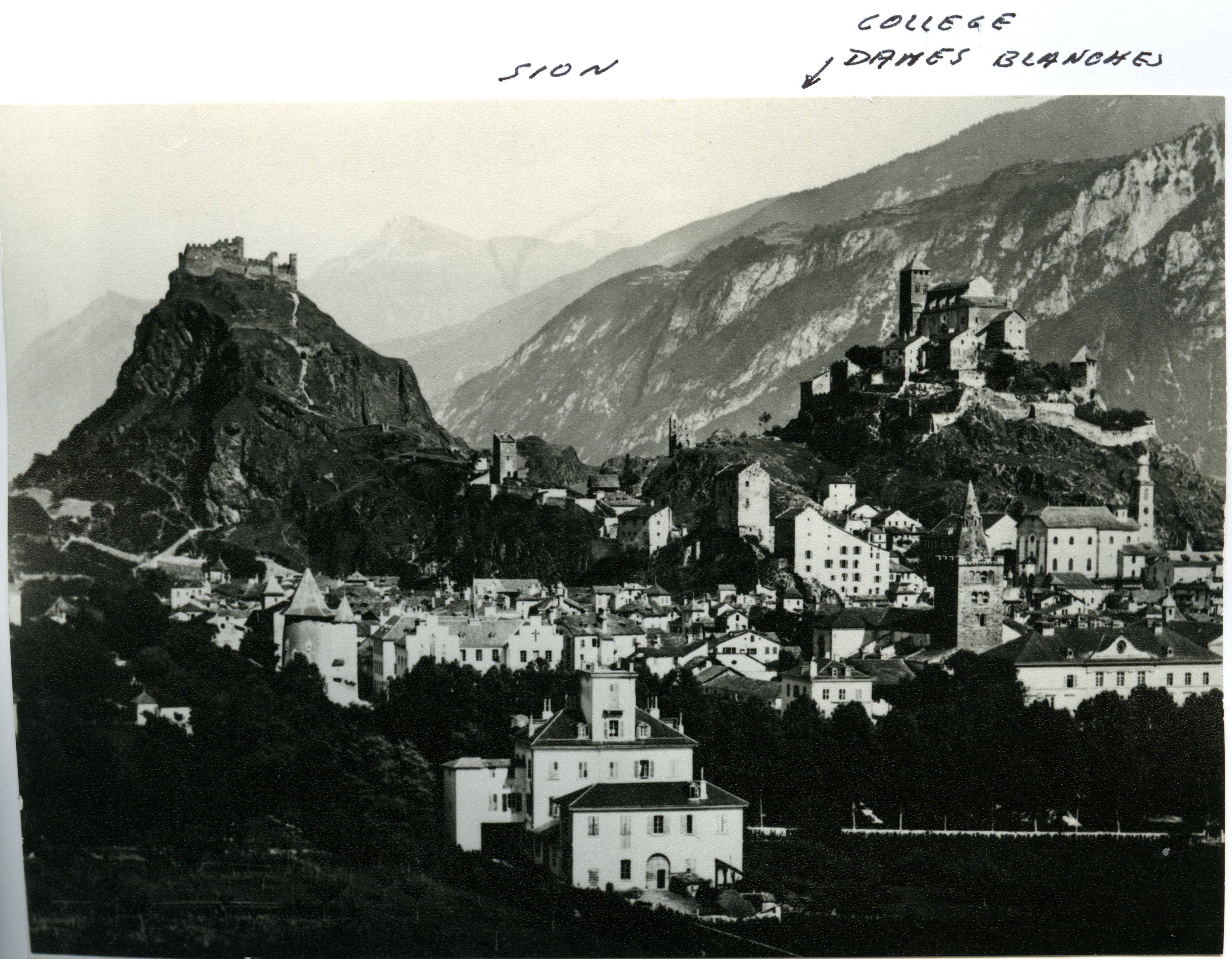 Show on map |
|
|
Unknown author (1917)
Bas Glacier d'Arolla and Mont Collon 1917  Show on map |
|
|
Unknown author (1917)
Tsijiore-Nouve - 1917 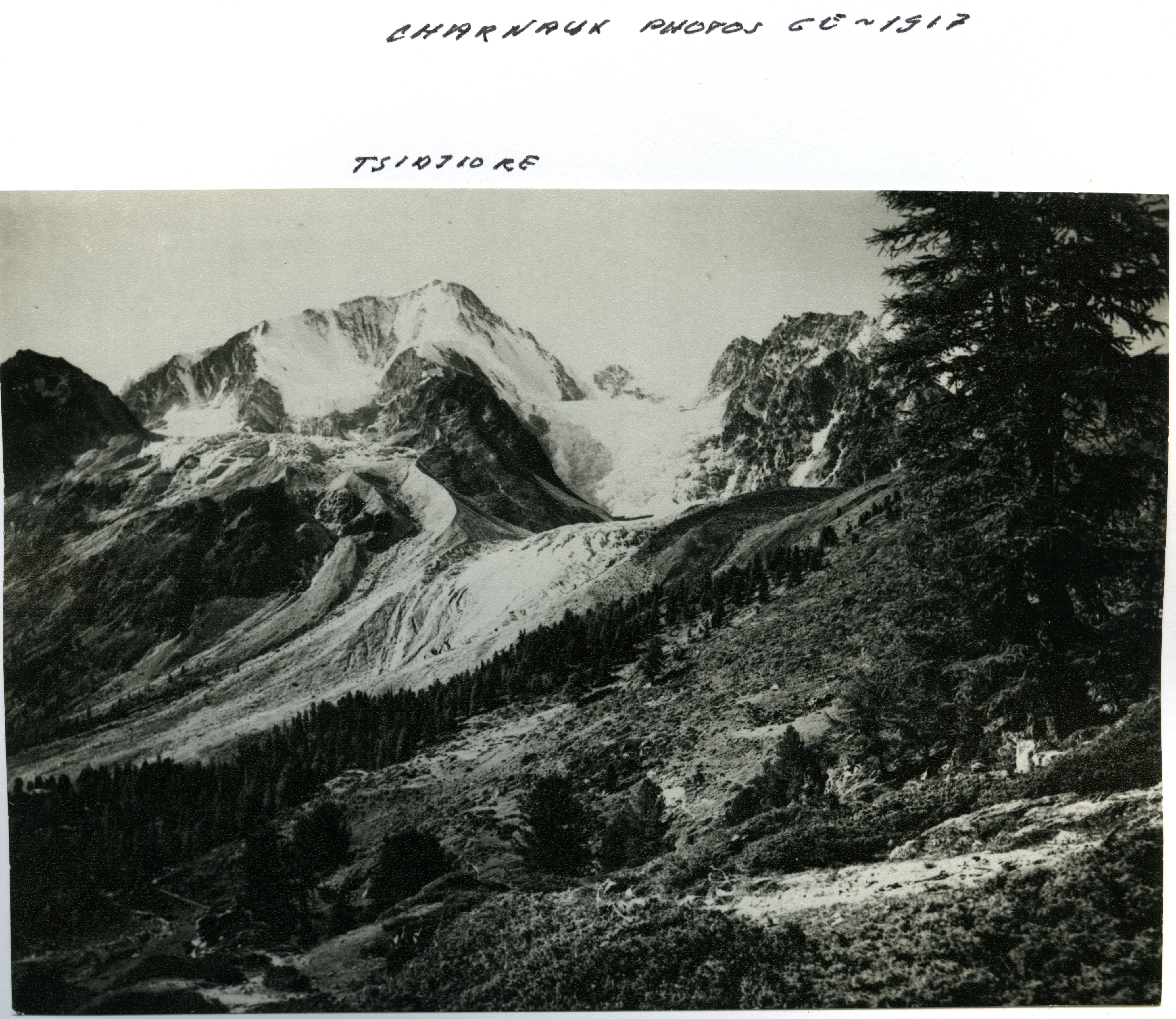 Show on map |
|
|
Unknown author (1917)
Salay 1917 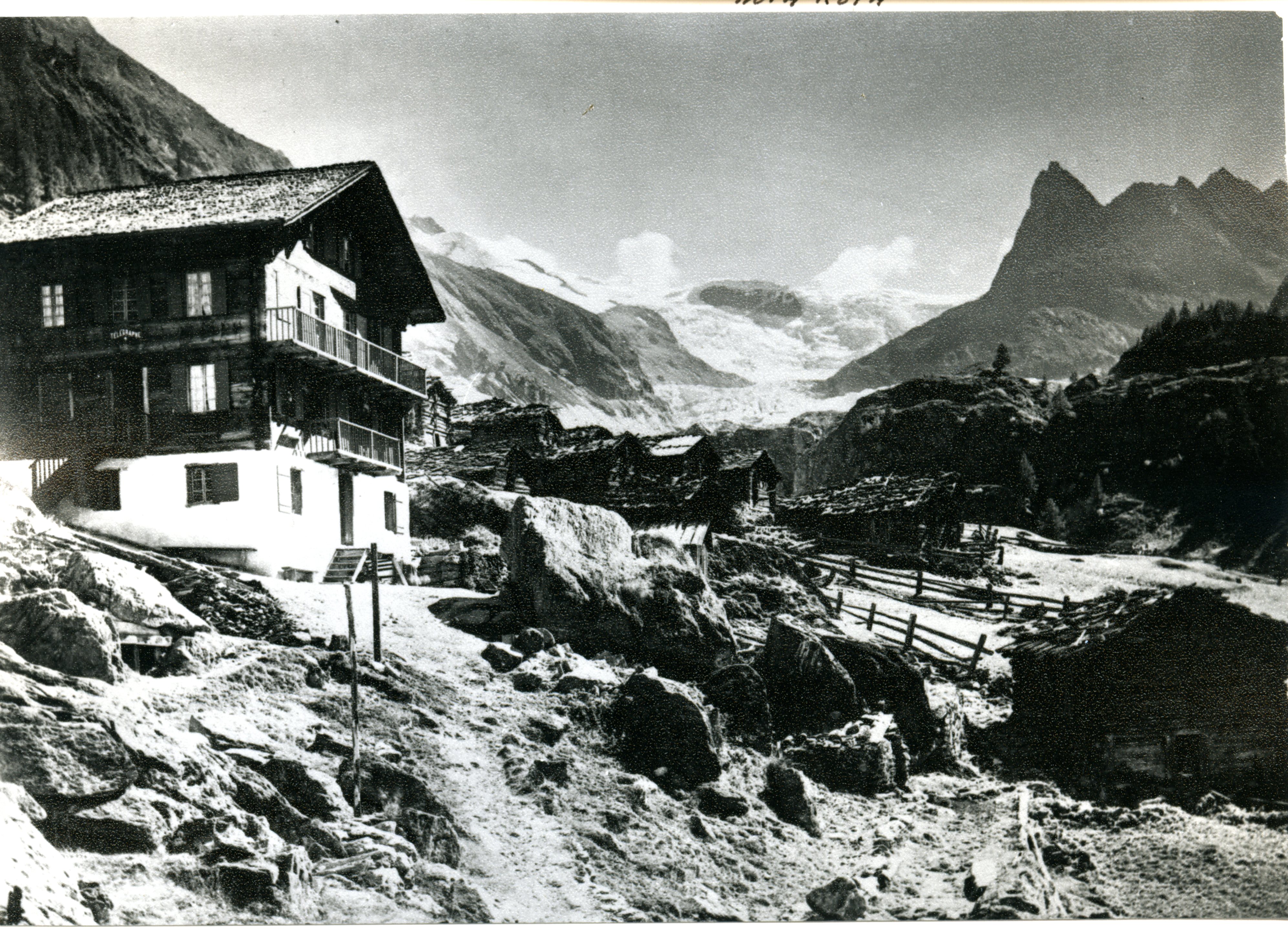 Show on map |
|
|
Unknown author (1917)
Bas Glacier d'Arolla and Mont Collon 1917  Show on map |
|
|
Unknown author (1917)
Bas Glacier d'Arolla, Mont Collon and Tsijiore Nouve 1917 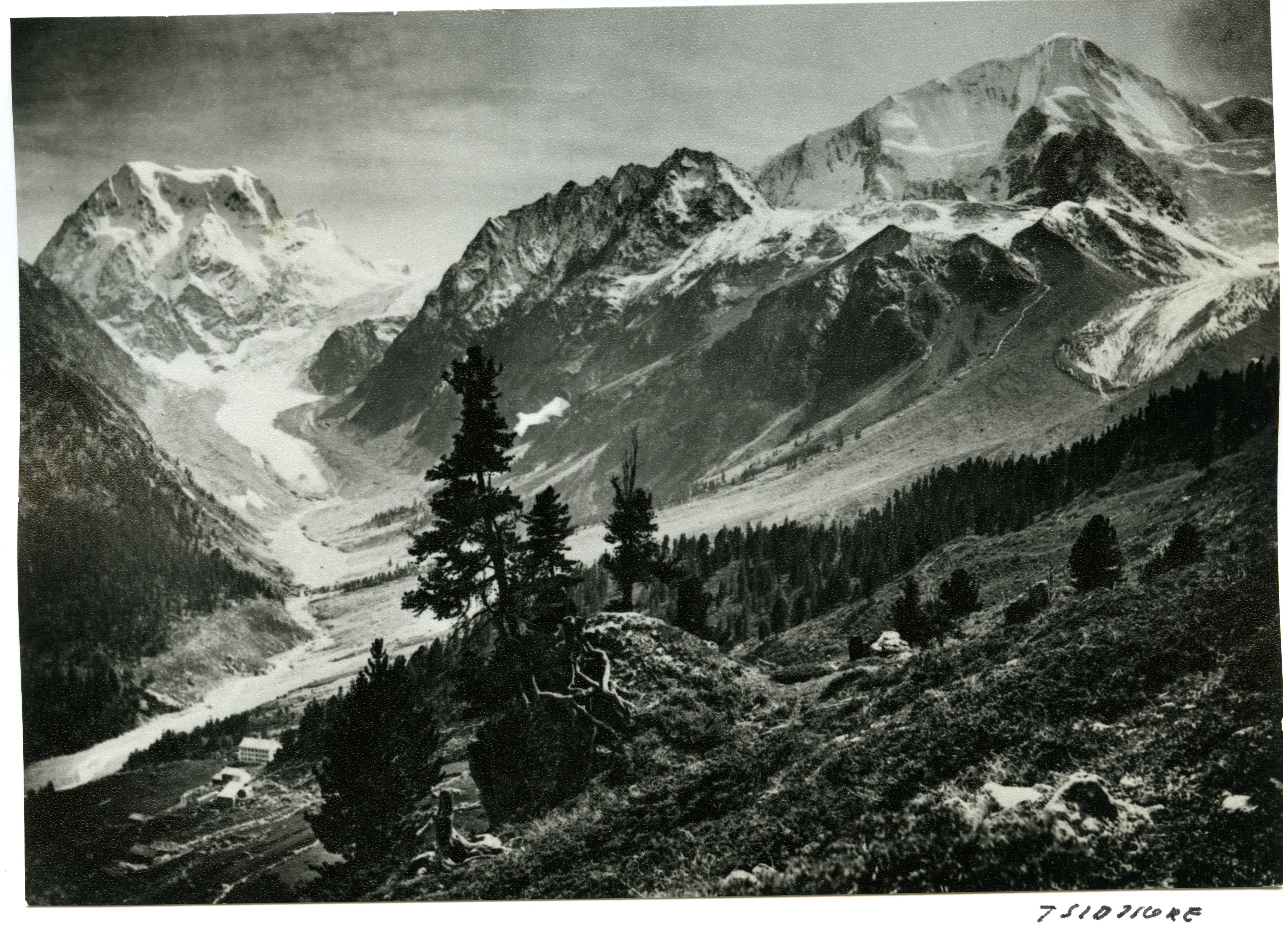 Show on map |
|
|
Unknown author (1917)
Mont Collon hotel and Tsijiore-nouve - 1917 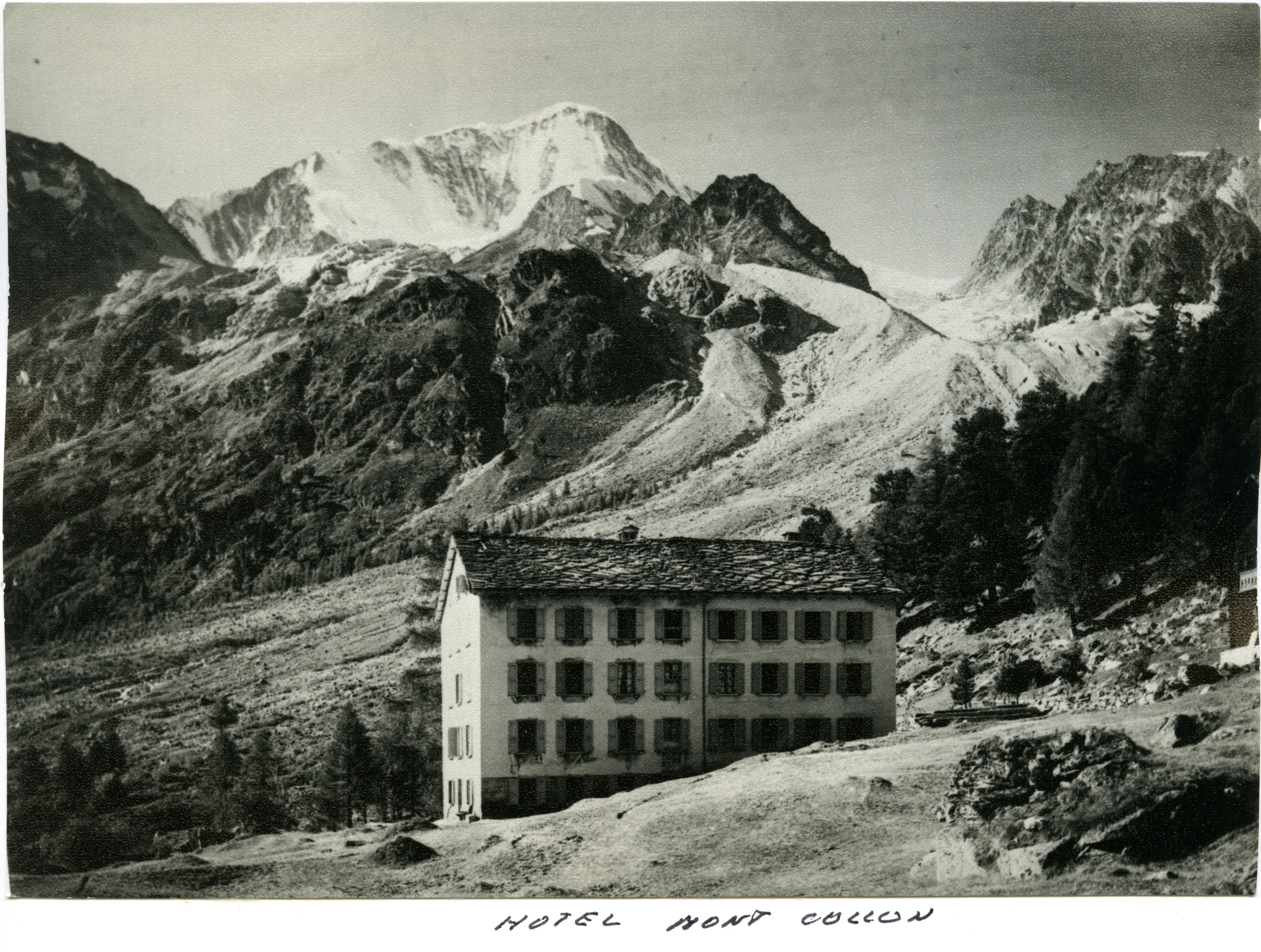 Show on map |
|
|
Unknown author (1917)
Arolla - La Tsa 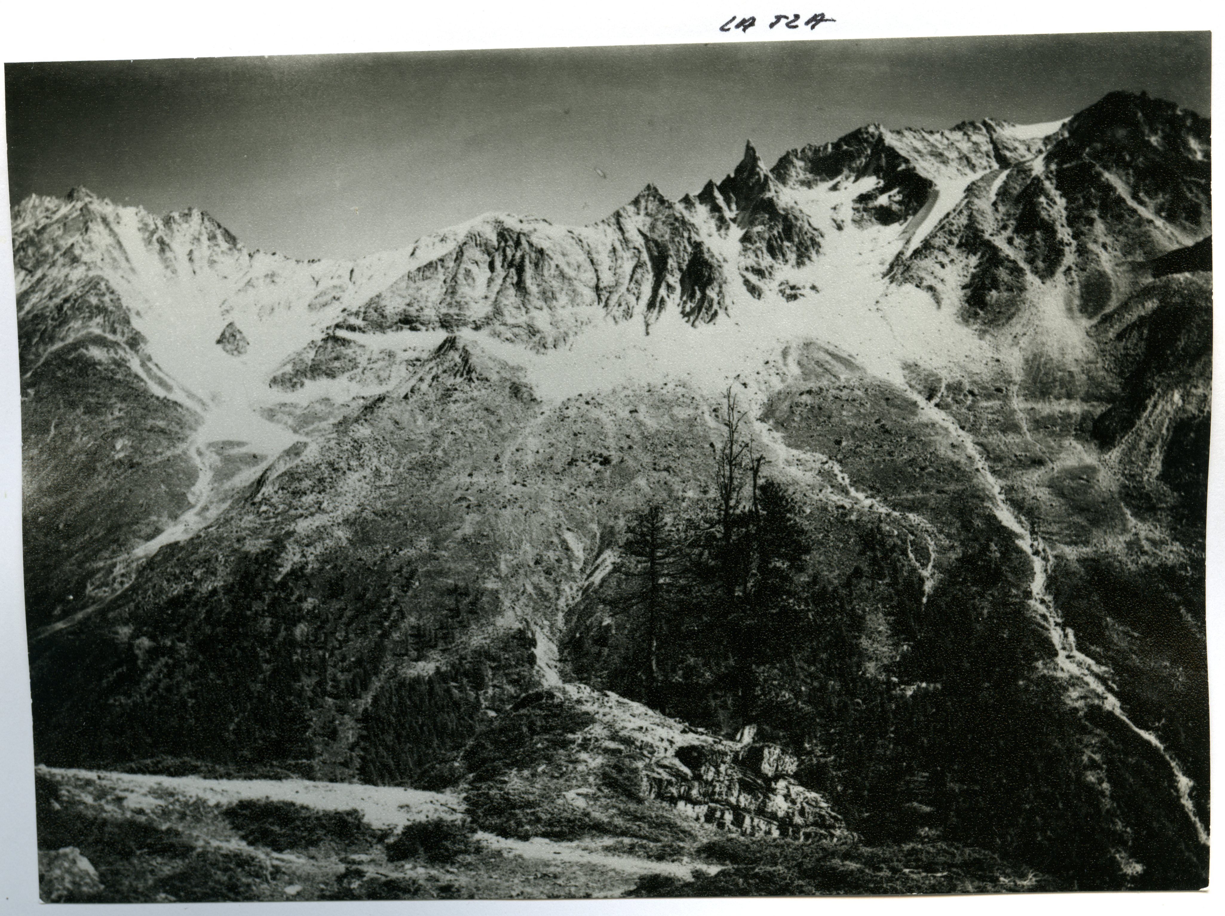 Show on map |
|
|
Unknown author (1917)
Ferpècle Glacier 1917 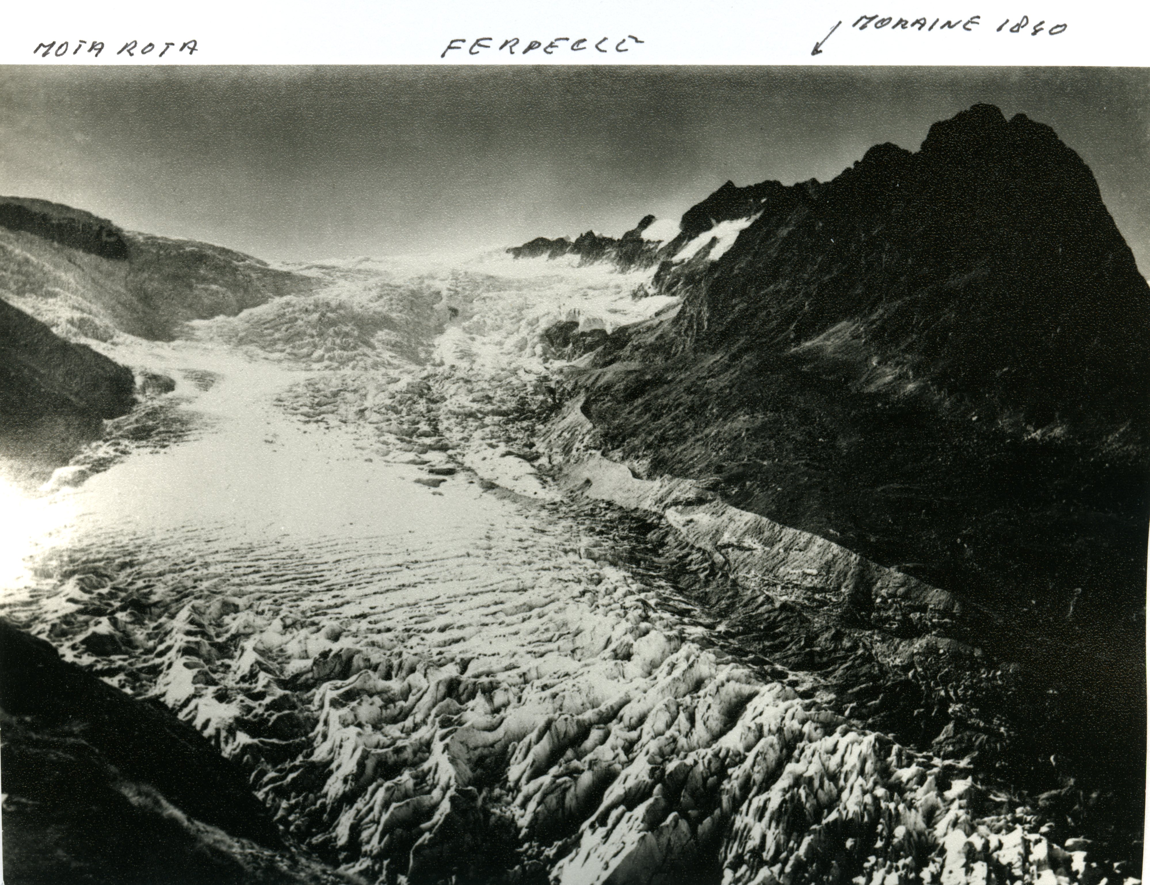 Show on map |
|
|
No authors (1916)
Bas Glacier, 1916 Show on map |
|
|
No authors (1909)
Ferpècle 1909 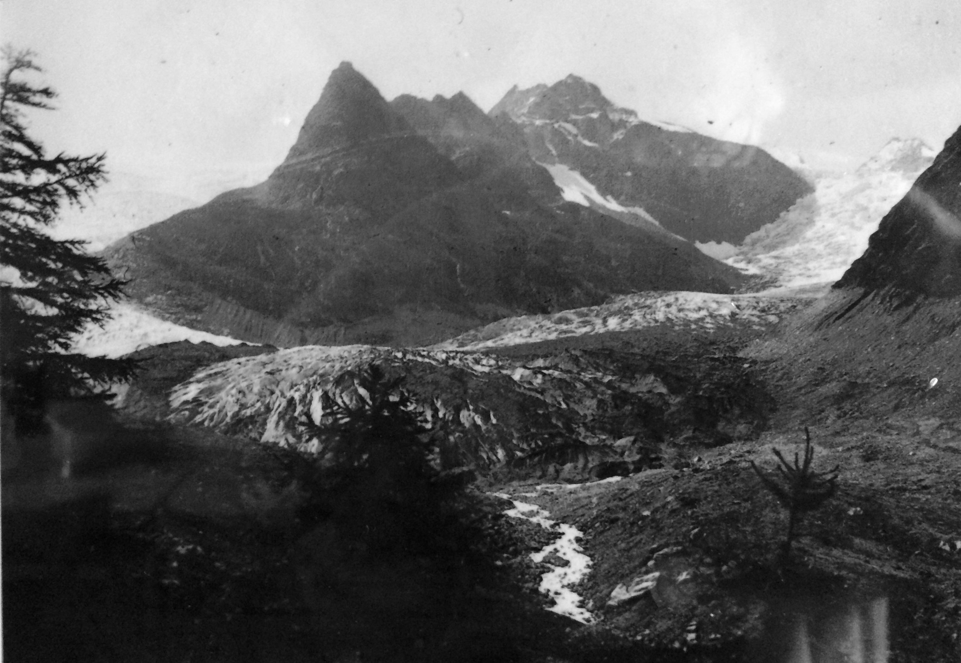 Show on map |
|
|
No authors (1908)
Bas Glacier, 1908 Show on map |
|
|
Reid, Harry Fielding (1902)
Bas Glacier d'Arolla, 1902 Show on map |
|
|
No authors (1901)
Bas Glacier, 1901 Show on map |
|
|
Stuart Lane (1894)
Photograph from the Valais médiatèque collection showing Arolla in c. 1890-1894 Show on map |
|
|
No authors (1886)
Bas glacier, 1886 Show on map |
|
|
Siegfried Map (1867)
Siegfried Map of Arolla 1:25'000 - year 1867 - georeferenced Show on map |
|
|
Siegfried Map (1867)
Siegfried Map of Arolla 1:50'000 - year 1867 - georeferenced Show on map |
|
|
Siegfried Map (1867)
Siegfried Map of Sion 1:50'000 - year 1867 - georeferenced Show on map |
|
|
Unknown author (1862)
Arolla-1862 Bas Glacier d'Arolla and Mont Collon 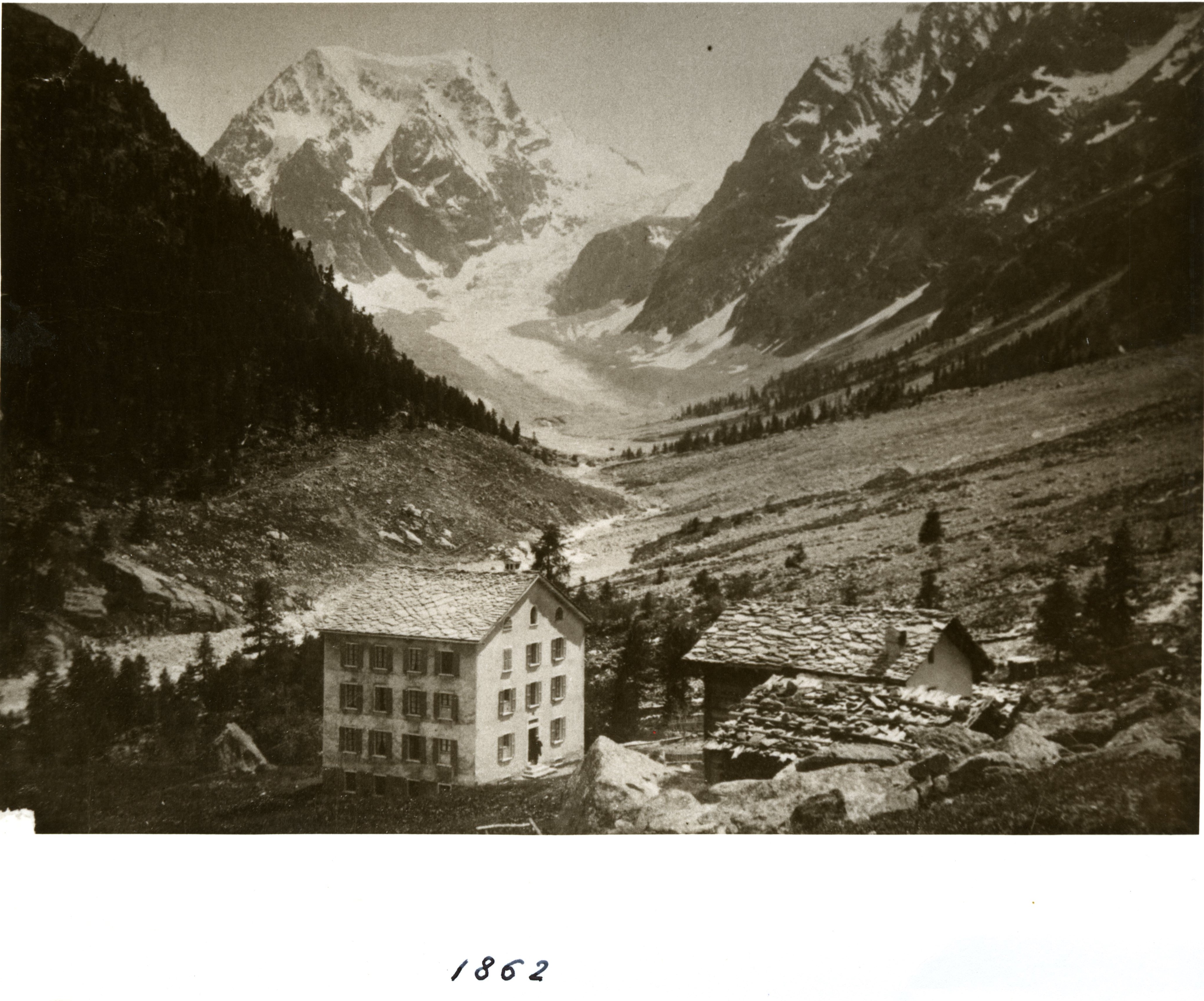 Show on map |
|
|
No authors (1856)
Bas Glacier, 1856 Show on map |
|
|
Bühlman (1835)
Ferpècle 1835 Show on map |